Tag Archives: goose bay

Sunday 27th September 2015 – I’M LOOKING FORWARD TO THIS.

Tonight, I’ll be sleeping in a real bed, in a real room, with full central heating too.

And what’s more, I’ve just stood for half an hour under a nice hot shower and I’ve changed my clothes and had a shave too. I even look human now, and you know how difficult that can be.

So how did all of this arise? The answer is that it’s a very long story.

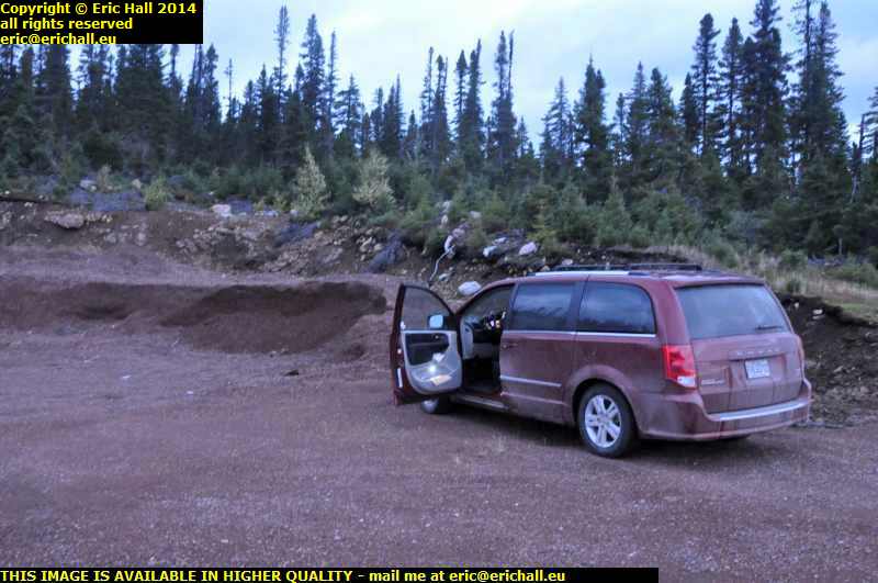
overnight camping place eagle plateau labrador coastal drive canadaThis morning, I awoke to a torrential downpour of rain and the black sacks with the insulation in were sopping wet (although the insulation itself was dry).

And we had a small amount of condensation inside the truck cap, but considering how wet it was outside and the fact that I’d been cooking inside last night, I’m not surprised by this. The small amount of condensation was quite acceptable.
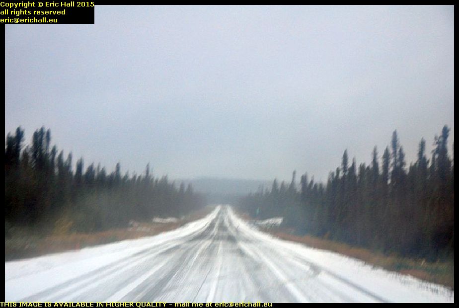
snowstorm eagle plateau labrador coastal drive canadaI hadn’t gone 5 kilometres when the metalled road ended. And while I was on the dirt road, the heavens opened and we were drenched in snow. It had been warmer in my little bolt-hole, but it wasn’t like that just here. This looked quite ominous for the rest of the journey. I wasn’t very optimistic.

Anyway, the dirt road only lasted for 15 kms or so and then we were back on the metalled road again. And I do have to say that in the dirt bit, there were men and machines, including an asphalt layer, all lined up. It looked as if today’s task (had the weather been better) would be to finish the gap.

And hats off to Strider too. I’ve been moaning about his excessive fuel consumption too (and to be fair, it is excessive) and I’d loaded up with 40 litres of extra fuel just in case I needed it. But we pulled in to the Ultramar petrol station in Happy Valley with the gauge just going into the final quarter. Not even the orange warning light, never mind having to refuel.

But I do have to say that the benefits of the new road are readily apparent. Whereas in 2010 when I was here, the difference between a litre of fuel here and a litre of fuel in a more-populated area was $0:34. Today, the difference is just $0:06. That says a lot.

old car happy valley goose bay labrador canadaAfter a coffee and an internet session at Tim Horton’s, I went for a good wander around.

First stop was to see what was happening with my old car – the one that I saw last year. It’s still here, looking definitely the worse for wear and it doesn’t look as if it is going to last for too long if no-one gives it any attention.

It really is sad

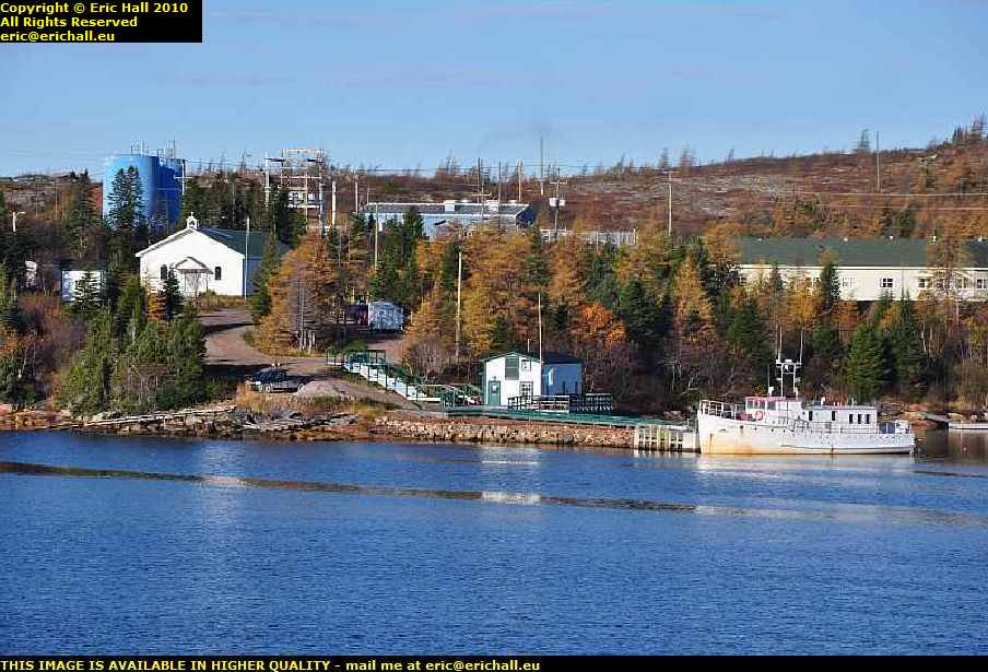
happy valley goose bay labrador canadaI went as far eastward as it was possible to go by road, and then went off for a wander into the bush to see what I could see in there.

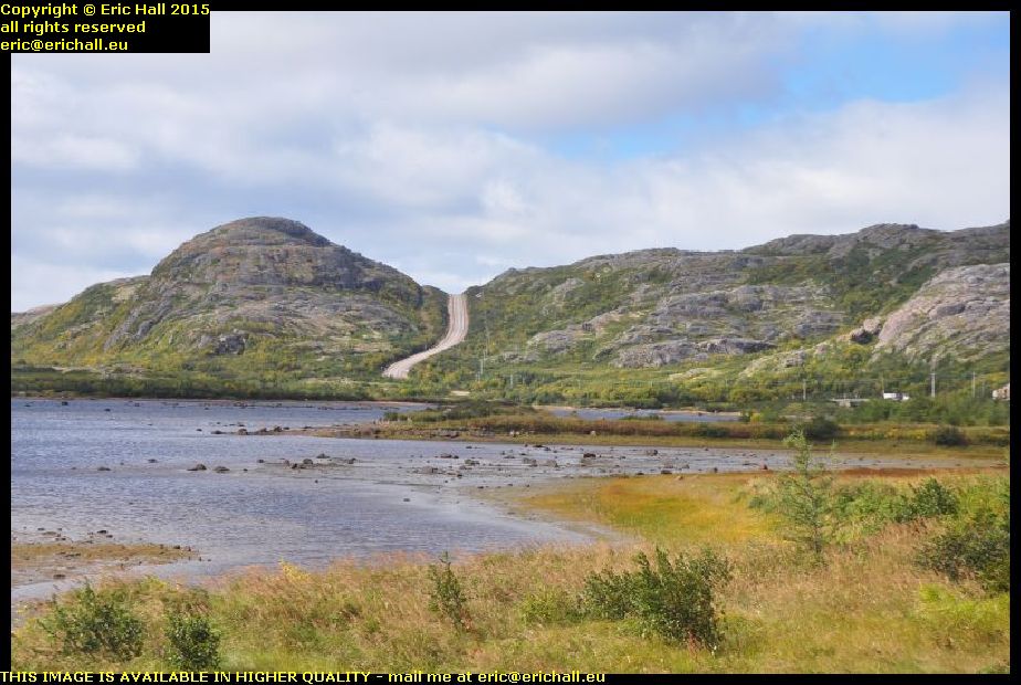
This is the bay of Goose Bay, at the head of the Hamilton Inlet, and there’s a lovely sand bar just here in the bay. The beaches really are nice in Labrador. And in the background are the mountains over which I’ve driven this last couple of days.
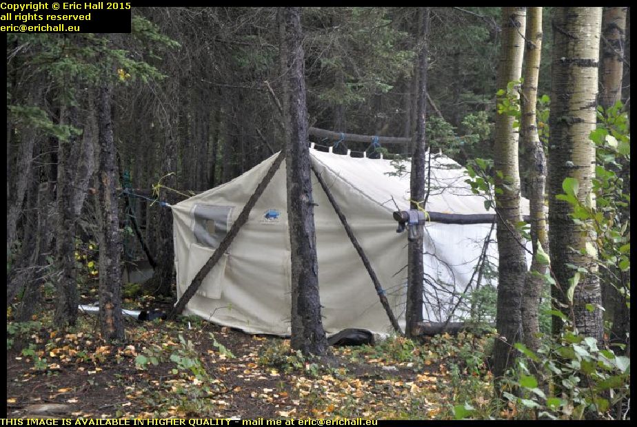
first nation encampment happy valley goose bay labrador canadaThis wasn’t all that there was to see either. There’s also a tent here in the woods.

There’s a really big Innu community around here and there are casual encampments all over the place. Although the First Nation people have adopted more modern building materials (I saw a hut made of OSB draped with a tarpaulin) the traditional itinerant lifestyle is quite important – and quite right too.

There was nothing doing at the quayside at Goose Bay and so I went on to North West River for a good look around. North West River is the farthest north town in Labrador that is possible to reach by road.

I was here late one evening last year and so this time I intended to have a better look around, even though the weather was dreadful.

And this is where our story begins.

I found a museum – the Labrador Interpretation Centre – and much to my surprise, it was open. That doesn’t happen very often.

I spent hours there chatting to the very friendly woman in charge, and we talked quite a lot about the interaction between the First Nation people and the Europeans.

“It’s a shame that the other museum in the town has closed for the season” she said. That has everything that you would like to see, including all of the papers from Mina and Leonidas Hubbard” … "he set out from here to explore the interior of Labrador 100 years ago and died of starvation – his wife set out 2 years later and completed his work" – ed
“I’d love to see that” I said. “What a tragedy that it’s closed”.
And so after another long chat, I wandered off to look at the museum, and she came hurrying after me “I’ve spoken to the curator on the phone. If you can be there at 09:00 he’ll let you in for a private showing”.
Well, badger me!
“I don’t suppose that you know anywhere where I can stay for the night?” I said rather optimistically. My last night around here had cost me a King’s ransom, and that was 5 years ago.
She wandered off and came back again 5 minutes later.
“The B&B is full unfortunately, you won’t want to pay $115 at the motel here, but there’s a room free, with communal facilities including washing machine, in the old Grenfell Building. That’s $45 a night”.
Do bears have picnics in the wood?
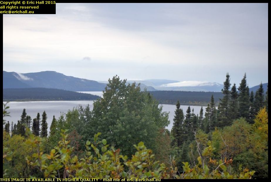
north west river hamilton inlet sunday hill north west river labrador canadaShe said that the best views around here were from the top of Sunday Hill, and so Strider and I went off-roading up the mountain.

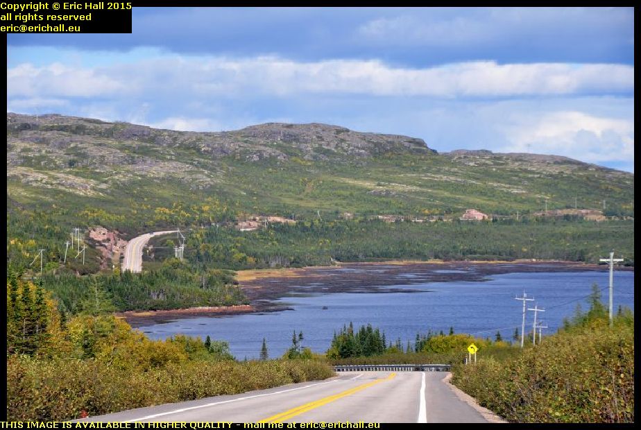
It was worth the effort because the view from here was stunning as you can see. And it would have been even better had the weather been kinder to me. It was a really excellent place to eat my butties.

And hats off once more to Strider because he made short work of our little excursion up the mountain, even in just 2-wheel drive. If only I could seriously improve his fuel consumption!

So here I am. In Wood Cottage, or Woods Cottage as I’ve seen it sometimes described. Built in the 1920s, it was first the boarding house for schoolkids at the High School who had come from the outlying settlements, and was later an Old People’s Home. I’m warm and comfortable, I’ve had a hot shower, a nice mug of coffee and all of my washing is now in the tumble drier. I’m going to make some food in a minute and then I’ll be off to a nice comfortable bed.

You just watch the house burn down!

IMPORTANT NOTE: From 1 September 2026 this blog has a live blog feature for the latest news. Click any post title with "LIVE" in it to see live updates. Comments are welcome from logged-in users and must be approved before they appear.

Saturday 26th September 2015 – BRRRRR – THAT WAS COLD!

interior labrador coastal drive sleeping in strider early morning canadaHere I am at 06:30, just before dawn. The alarm went off at 06:00 and again at 06:15 and it was so cold that I wasn’t going to hang about.You can see the ice all over the truck cap and the pile of snow that is on the side of the road that fell off the insulation when I moved it. I froze in the 5 minutes that I was outside.

Mind you, inside the truck cap there was no condensation or ice on the roof, and only a little on the sides. That insulation and the sun visor seem to have done their job and I’m pleased with that.

In fact, I had a good night’s sleep all in all and the lorry that pulled up alongside me at 03:00 didn’t really disturb me too much at all.

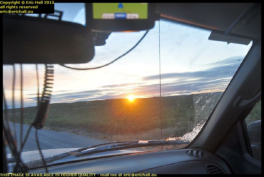
sunrise labrador coastal drive canadaNow I can see why it is that ancient man worshipped the sun. I’d been on the road for half an hour in the freezing cold when suddenly the sun put in an appearance over the horizon.

This sunrise was one of the most magnificent sights that I have ever seen and you’ve no idea how warm this made me feel and just how welcome it was. It made me feel so much better.

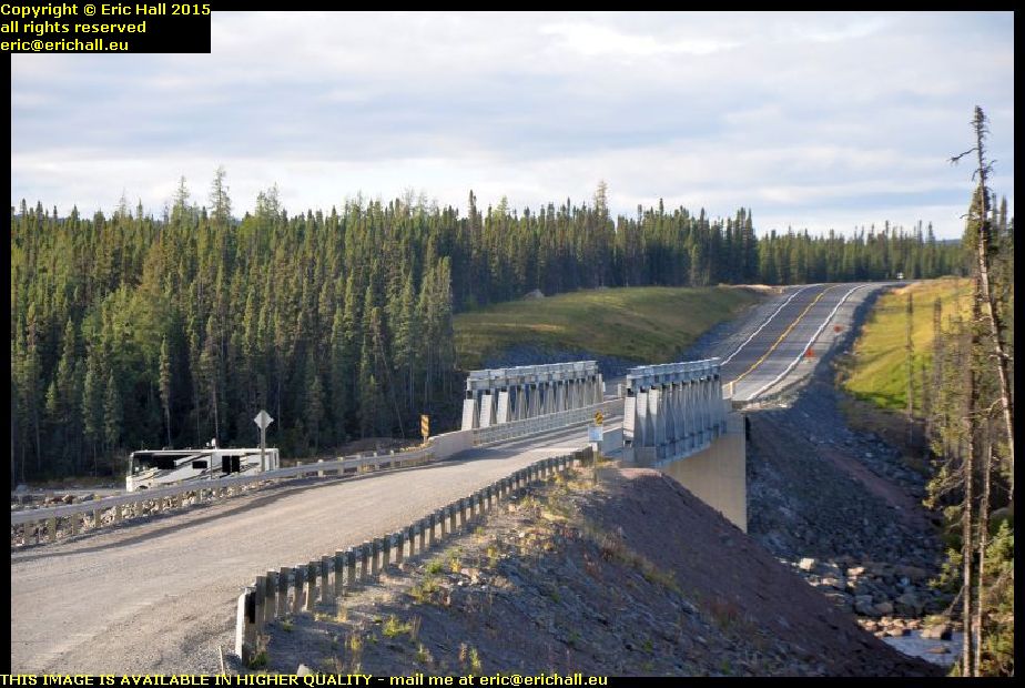
major highway improvements labrador coastal drive canadaAnd so we pushed on – or, rather, pushed off – through old familiar territory that you have seen many times before and so I’m not going to bore you with photos.

Nevertheless, I will show you some which might be of significance here, such as the amount of roadworks going on up here. If you read my earlier notes, you’ll recall me saying how bad the road was back in those days. Now, while it’s not quite a black-top highway,it soon will be, given all of this work.

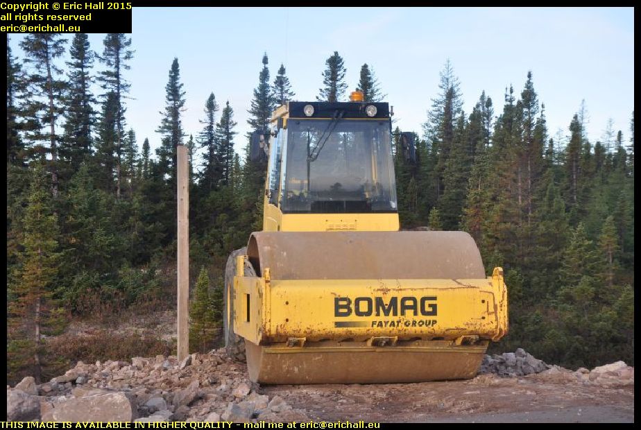
compactor major highway improvements labrador coastal drive canadaThis view is reinforced by the amount of construction equipment up here.

In 2010 we drove 1800kms of some of the worst roads in the world and I counted just a handful of compactors. Here, in this two-mile length of roadworks, there were two of them. You can see that they really mean business out here.

And while that’s bad news for me and any other adventurer, it has to be good news for the inhabitants.

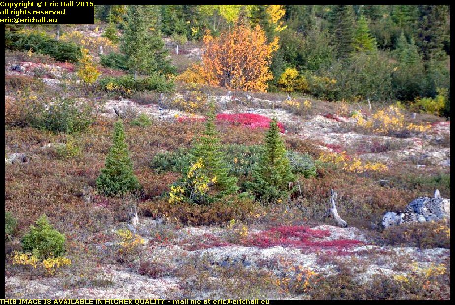
sub-arctic vegetation labrador coastal drive canadaAnd while I once famously said that the only time that you would ever see a photo of a flower on my pages would be if there were to be an old car parked upon it, I couldn’t resist a photo of these plants.

I don’t know what they are – add the names into the comments if you do know the answer – but they are very symbolic of the sub-arctic vegetation that you encounter up here because this is really a part of the tundra out here.

strider ford ranger labrador 813 kilometres coastal drive canadaWe always stop and take a photo at this spot whenever we are in the area. It’s far from being the most isolated spot along the trail, but it’s quite symbolic as being the first place where Labrador City appears on the road signs.

Before 2010, the road turned right just behind me and went down to Cartwright (well, it still does of course) but this road that we are taking didn’t exist. If you wanted to go west from here, you would have to go east down to Cartwright and wait for one of the weekly coastal boats that went up to Goose Bay, and then drive from there over to Labrador City.

abandoned car labrador coastal drive canadaThis is one of the things against which you have to guard yourself along the trail.

You can see that he has a flat tyre and by the look of things, he’s driven quite a way on it, because the tyre is off the rim. Why he hasn’t put the spare on, I really don’t know (and it’s none of my business anyway) but if you do have to abandon your vehicle to go and seek help, you should take your tyre with you. It won’t be fixed while it’s still on the vehicle.

And about 100kms further on, I found a loaded trailer with the same issues

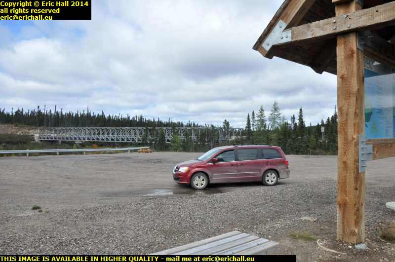
lunch stop labrador coastal drive canadaThere’s a photo of me and a Dodge Grand Caravan stopped here for lunch last year in brilliant sunshine and I remember saying how I would love to stay here and settle down.

Today, though, we have lunch in a snowstorm, although you can’t see the snow very clearly. It’s not looking too good out there along the Eagle Plateau but at least this year I have the right kind of vehicle to make the trip.

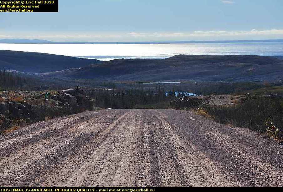
gravel road labrador coastal drive canadaFurthermore, further along the Labrador Coastal Drive they are gravelling the road – and doing it seriously too. There’s tons of stuff being spread out here.

With the compactors that I’ve seen, I wonder if they are preparing this for tarmac? They were building an asphalt plant when I was here last year and it wouldn’t surprise me in the least if we are going to end up with a black-top highway.

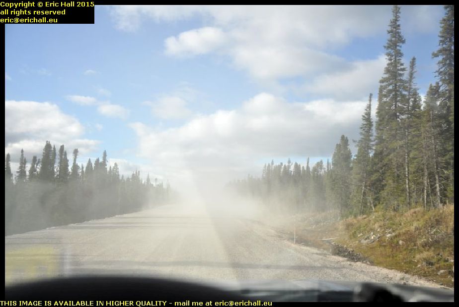
gravel road labrador coastal drive canadaBut this gravel is impossible. everywhere there are clouds of dust and stones being thrown up and Strider’s windscreen has taken a few heavy knocks.

And not only that, Strider is rear-wheel drive when he’s not in 4×4 mode, and the rear end is quite light. I don’t have much grip on the gravel and when I try to swerve to avoid a pot-hole, Strider goes everywhere across the road and we’ll be doing pirouettes soon.

But Strider is definitely the right vehicle to do this trip. Even in rear-wheel drive, his high ground clearance, larger non-standard wheels and heavy off-road tyres has meant that I’ve done all of this road with the cruise control set at 70kph and we haven’t missed a beat. Whenever the road has been rough, Strider has taken it all in his … errr … Stride.

Contrast that with the Dodge Grand Caravan and its rubbish tyres, and Casey, the PT Cruiser with his town tyres and low ground clearance. We really struggled on parts of this road.

I just wish that Strider had a tank that was 20 litres bigger, or that I could do something about his miserable fuel consumption.

paved highway rest area labrador coastal drive canadaYes, and here we are, folks.

I’m listening to Counting Crows and “Pave Paradise, Put Up A Parking Lot” – and right at that very moment, look what we have here. The highway is paved at this point and there is a parking lot by the side.

How depressing is that? The end of my adventures along this road are in site and in about 5 years time, the whole of the route will be just another black-top highway.

But anyway, this is where I’m stopping for the night. It’s not as cold as last night anyway and I do have to say that it’s a comfortable spec. I even cook a meal inside Strider’s truck cap and the condensation is minimal with the insulation on the roof, even though the windows aren’t open that much.

But it’s cramped in here and this truck cap is not going to work in the long term – that I have realised.

I really do have to think of a Plan B.

IMPORTANT NOTE: From 1 September 2026 this blog has a live blog feature for the latest news. Click any post title with "LIVE" in it to see live updates. Comments are welcome from logged-in users and must be approved before they appear.

Friday 25th September 2015 – WHAT A GOOD NIGHT’S SLEEP!

Having done everything that I needed to do last night, I crawled into my sleeping back and settled down to watch a film. But it wasn’t for long. After about 15 minutes, I switched off the laptop and that was the last thing that I remembered.

I must have had a good nine hours when I didn’t feel a thing. And when I awoke, it was reasonably warm inside the truck cap, there was no condensation at all on the roof and only a few minimal traces on the walls. It seems that this idea of putting the insulation on top of the roof of the truck cap is doing its job. I’m well-impressed with this. But I’ll need some more tape though. If the plastic sacks become torn or damaged, I have plenty to replace them but I’ve run out of tape to hold everything together.

I didn’t stop for breakfast though. There’s a sailing across to Labrador at 10:30 and I want to be on it if possible and so I hit the road.

sleeping in strider ford ranger newfoundland canadaBut I did take a minute or two out to take a photo of my spec for last night and Strider with his exterior insulation. You can see just what a good spec this is.

And now, a weird idea is running through my mind that if I could find a plastic sheet that is 6 feet by 4 feet, I could fit that over the top, hold it down with ratchet straps and that would make a very permanent arrangement while I’m on my travels. Something like a corrugated roofing sheet would be ideal for this.

An hour on the road found me at St Barbe and there was an enormous queue waiting for tickets to sail. I was given ticket 16 – which meant that I would be the 16th casual voyager to be added after the reserved places are loaded. And to my surprise, with the senior discount to which I’m now entitled, a 90-minute crossing with Strider costs me all of just $18:58 – eat your hearts out, you European ferry travellers!

mv apollo st barbe newfoundland blanc sablon quebec labrador ferry canadaHaving fuelled up Strider (I keep telling you that out here you need to fuel up when you can) I lined up on the quayside watching the antics of the artics loading up the trailers, and then I was squeezed on board into a little corner of the ship.

And poor Apollo. As she steamed in, I couldn’t help noticing that she’s looking every day now of her almost 50 years and she can’t be long for this world now. The inside is pretty rough too, and I’d have taken a photo of what I meant, except that Bane of Britain here seems to have forgotten to bring his camera with him up into the lounge.

But now, after a heary breakfast of coffee, four rounds of toast and a plate of hash browns, I’m ready for anything. Including a couple of chats that I had had, one with a German guy in an ancient New-Brunswick-registered Dodge Caravan from Woodstock (the Caravan, not the German) with a spare wheel strapped to the top, and another older guy heading out to Goose Bay.

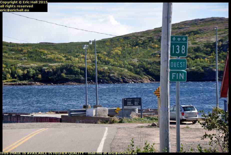
highway 138 lower north shore quebec canadaIn May 2012 I’d done a tour of Quebec Highway 138 from Montreal all the way to the end at Natashquan where the road comes to a shuddering halt in the middle of nowhere.

It’s not actually the end of Highway 138, theoretically at least, because there’s part of the Quebec coast accessible from Blanc Sablon,and the road along there is also called Highway 138. I’d driven down here last year but there was that much fog and rain that we hardly saw a thing

highway 138 lower north shore quebec canadaNo such complaints today though. I was really lucky with the weather and couldn’t have wished for better. I’ve managed to retake all of the photographs that I took last year.

And you can see just how beautiful the road is. It doesn’t quite have the grandeur that the Trans Labrador Highway has, of course … "nothing can quite manage that" – ed … but it was a journey that I wanted to make, just to complete my Highway 138 adenture

end of highway 138 old fort bay vieux fort lower north shore quebec canadaAnd so we arrive at Vieux Fort, known to the locals as Old Fort Bay because this is an Anglophone area, as I discovered a few years ago.

The Highway terminates at the harbour and here, right in front of us is an old quay. It’s closed off and marked “danger” so it’s clearly unused, but in view of its substantial construction, I wonder if the coastal boat that plies along the Lower North Shore used to call in here before the road through to here was opened.

old fort bay vieux fort lower north shore quebec canadaIt’s not quite the end of the Highway though. If the Highway ever is extended, which won’t be in the lifetime of anyone reading this rubbish, it’ll come round the head of the bay and head west.

At the moment there’s a dirt highway that takes that road, and this eventually brings you down to this beautiful sheltered bay just here. When I arrive, a couple of fishermen … "fisherPERSONS" – ed … were launching a boat and setting off. This really IS the end of the road as far as I can tell, and it was a convenient place for me to stop for lunch.

middle bay lower north shore quebec canadaThere are a few of the villages along the highway too and I took hundreds of photos of them. This is just one of them, Middle Bay.

This is said to be the site of a Basque whaling station back in the 16th Century. There were a couple of dozen along here and the most well-known example, Red Bay in Labrador has been excavated and there’s a museum there. However, I don’t know what, if anything, has been discovered here from that period

strider ford ranger labrador canadaFrom here, I retraced my steps to Blanc Sablon and beyond towards L’Anse Aux Loups in Labrador.

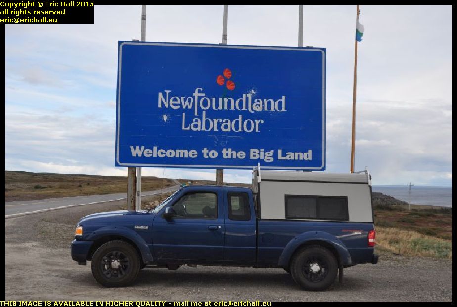
We had to stop though, in order to take a photograph at the border just to prove that Strider was here. This is the border today, of course, but it might not be in the future because the mayor of Blanc Sablon has said that he would like to apply to the Canadian Government to secede from the Province of Quebec and join up with Labrador. Whether the Province of Quebec will agree to releasing some of its prisoners however remains to be seen.

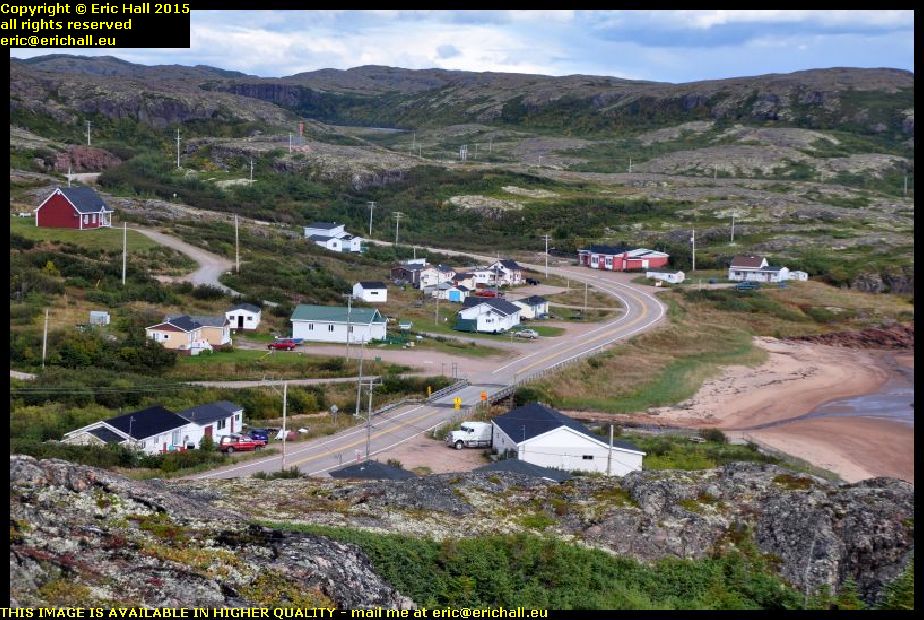
jersey trail anse aux loups labrador canadaThere are many French names just here. Some of them relate to the exploration of Jacques Cartier, others to the French fishing boats that came along here in the 18th Century, but many others relate to inhabitants of the Channel Islands who colonised this area.

The old road along the coast prior to the construction of the new highway is called the Jersey Trail today, and there are all kinds of remnants and relics of the previous inhabitants along here. Excavations have taken place and many artefacts have been uncovered.

anse aux loups labrador canadaThere are a dozen or so villages along here too. I missed out photographing them in 2010 because I was rushing for the ferry (I hadn’t realised that it ran on Newfoundland time, which is 90 minutes ahead of Quebec) and in 2014 I had the weather against me.

But never mind. Today, even though it was now going dark quite rapidly, I still had time to take all of the photos that I wanted to take.

labrador coastal drive deviation county cat pond canadaWhen I was here in 2010, the Labrador Coastal Drive followed the narrow valley of the Pinware River, but I did notice a considerable amount of roadworks in the area round by the County Cat Pond.

This is what they have been doing. The old road goes off to the right, but there’s a new road now going up the hill just there.

I can’t think why they have done it, though. The route along the Pinware River is beautiful, but this new route is all straight up and straight down. In 2014 I watched a huge lorry struggle up the hill in the rain and I bet he wasn’t amused.

I had planned to stop at a Guest House in Red Bay for a wash and a change of clothes, but there was no-one there when I called, and so I’ll be spending another couple of nights sleeping along the road. I found a very basic rest area and even though it was early, it was freezing cold and so I went to bed. But not before putting the big insulated sunshield across the rear window of the truck cap and wrapping the rest around the head of my bed. I’ve a feeling that I’m going to need it tonight.

IMPORTANT NOTE: From 1 September 2026 this blog has a live blog feature for the latest news. Click any post title with "LIVE" in it to see live updates. Comments are welcome from logged-in users and must be approved before they appear.
Thursday 24th September 2015 – I MUST BE GETTING OLD

It used to be the case that I could sleep anywhere at any time. At one time I was even found asleep leaning up against a wall in a garage. But just recently, as you know, I’ve been having some sleeping issues, but none such as I had last night on the ship out to Newfoundland.

With some of the nicest reclining seats that I’ve ever sat on, I just couldn’t drop off to sleep. And when I did, I was awake 10 minutes later with aches and pains everywhere. And this went on throughout the night until we docked at Channel Port Aux Basques.

We had a very long wait there too before we could unload. I did mention that we were parked right in the bowels of the ship, and so we had to wait until everyone else was out and gone before we could be liberated.

I went for a coffee and some biscuits at Tim Horton’s so that I could use their internet without any pangs of conscience, and then went over the road to Canadian Tire for a big roll of waterproof duck tape, the reason for which I shall mention in a moment.

channel port aux basques newfoundland canadaYou’ve seen plenty of photos of the ship and of the town – Channel Port aux Basques – in the past, but I bet that you have never seen it from this angle before.

I’m a mile or two outside the town here at the Newfoundland and Labrador Tourist Information Office where I stopped to search Strider for the charger for the mobile phone, and there’s a good view of the town across the bay from here. I couldn’t resist taking a photo to add to the archives.

typical southern newfoundland scenery canada. In the past, whenever I’ve driven out of – or into – Channel Port Aux Basques, I’ve always followed the coast. But today, I’ve driven due north along the Trans Canada Highway and seen parts of the island that I haven’t seen before.

The eastern part of the island has all of the accessible coastline, but the western part has the mountains and the lakes and here, only a handful of miles outside the town, we start entering some really beautiful country. This photo is just typical of the scenery on the southwestern side of the island.

newfoundland railway bridge coopers brook canadaNewfoundland once had a very important railway network – one of the longest narrow-gauge systems in the world. But it struggled along, suffering from chronic under-investment and lack of modernisation despite having one of the most beautiful routes of any railway network ever.

However, as I’ve told you before, it was yet another victim of the ruthless decimation of Canada’s railway network and while very little of the equipment remains, the railway line itself is almost complete and you will see loads of bridges such as this one on your travels.

trans canada highway climbing up into newfoundland mountainsIt’s not long before we start to climb into the mountains of Newfoundland, and the Trans-Canada Highway makes some stunning ascents and descents as we continue northwards.

Here’s one of the most exciting climbs as you can see, a few miles south of the turning for Stephenville. The flattest route is indeed via Stephenville but that puts dozens of miles onto the route and so we take the short cut.

At Deer Lake I stop for fuel again. I fuelled up at Channel Port aux Basques but that’s not enough to reach the Labrador ferry at St Barbe (the short range of Strider is depressing me) and so the Big Irvings at Deer Lake comes up with more fuel and also enables me to fill up one of my big containers. There’s 20 litres in that and once I’m across in Labrador I’ll put 20 litres into the other container. I hope that that will be enough to enable me to do this 418 kms between Port Hope Simpson and Goose Bay.

gros morne national park newfoundland canadaDeer Lake is the entrance to the Gros Morne National Park and if you think that the road has been beautiful to here, then you ain’t seen nuffink yet. Gros Morne really is spectacular.

This is one of the lakes here, nestling into the foot of what looks like a glaciated valley, and once more, this is just one of a thousand photos that I could have taken of the area. I’ve been here a few times now and I never tire of it. One day I’ll come here and stay for a week, and maybe I will, seeing as I now have transport of my own.

st pauls newfoundland canadaAs I was walking by St Pauls, I was seized by this beautiful view. I had to turn off the highway to see it and found myself on a little dockside.

There’s a big inlet here and the harbour is on the inside of the inlet, sheltered from the wind by the embankment for the beautiful metal girder bridge that spans the inlet. This is a typical Newfoundand photograph, isn’t it? The water, the fishing boats, the little harbour and the mountains away in the background.

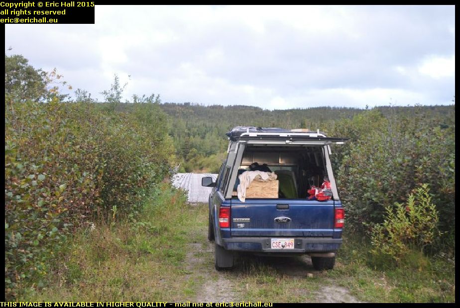
18:00 is my usual time to start to look for a suitable place to stay (unless something astonishing presents itself beforehand) and tonight, at about 18:30, I’ve found an abandoned cut-off that leads down to a dismantled bridge. The house here seems to be abandoned so the hedges are all overgrown and as it’s a downhill slope to the bridge I’m pretty sheltered. Of the six sheets of insulation, I’ve put two each into a huge bin liner, fitted another bin liner over the open end and sealed them up with the duck tape.

The three packets that I’ve made, I’ve put them on the roof weighted down with the wood.

We’ll see what that is like through the night as far as the condensation issue goes, but the roof does feel much warmer than the sides of the truck cap already.

IMPORTANT NOTE: From 1 September 2026 this blog has a live blog feature for the latest news. Click any post title with "LIVE" in it to see live updates. Comments are welcome from logged-in users and must be approved before they appear.
Wednesday 24th September 2014 – THE GREAT DECEPTION

Yes, I’m going to be talking rubbish … "well, there’s a novelty!" – ed … in a minute.

harbour goose bay labrador canada september 2014But before I do that, let me show you my nice and comfy little spec on the harbour at Goose Bay this morning.

Last night, I finished off my notes, made a good tea and then went to bed. Thoroughly painless until the alarm went off at about 06:50. I didn’t feel a thing.

And even though the temperature had dropped to zero by the time I awoke, with ice on the puddles outside and ice even on the inside of the windscreen, that didn’t inconvenience me for a minute. It was the sleep of the dead last night.

By 07:04 I’m on the road. I need to warm up the car, defrost the ice and charge up the laptop so I’m not going to hang about until all of that has been done. I’ve fuelled up half from the fuel can too, saving half of it for later. It has to be emptied before it can go back into storage anyway and it has served its purpose, easing my mind around these enormously long stretches of fuel-less highways. For the next few sections of the highway, it’s a more-realistic 300 kilometres.

old car happy valley labrador canada september 2014While the car is warming and the laptop is charging, I go for a drive around Happy Valley to see what there is to see.

We find a grass lawn – yes, real grass growing here. It’s not quite the High Arctic here. And we also find an old early-1950s car. However have they managed to protect this from the elements?

The queue for Tim Horton’s is enormous. The longest one yet. I upset everyone by driving in through the out door as Idon’t want the drive-in services, and the queue inside is just as long. I have a little smile thinking to myself about what might happen if I were to imitate Charles Hawtrey in Carry on Cowboy and shout “Gold Strike at Bear Creek”. But not only would the customers immediately shoot off like lightning, so would the personnel and so I would be no better off. Old Frontier traditions die hard in Labrador.

and coffee at Tim Horton’s was first money (apart from fuel) that I have spent since Deer Lake and how many years ago was that?

But how times have changed here over the last four years.It’s like the M6 down here too this morning. There are 5 or 6 vehicles in front of meand one or two behind. And we are in the flaming sub-arctic. This place isn’t anything like what it was four years ago at all. In those days you were lucky to see one car per hour.

log cabin trans labrador highway canada september 2014Now, this is how I always pictured Labrador to be. Log cabins by the side of rapids in fast-flowing rivers, and I’m glad to see that at least there is some of it left.

No dog sleds though. I’m told that the last working dog team in the region was retired in 1994. Everyone has snowmobiles these days, but where do you find fuel for them in the wilderness? And you can’t eat them if your supplies run out.

innu tribal gathering gull island Tshiashkueish trans labrador highway canada september 2014This is Gull Island, or as it is known by the local First Nation Innu community, Tshiashkueish. And I can’t even pronounce that with my own teeth in.

I’ve arrived during the Innu celebration gathering, which is taking place from 22-26 September and once more I’m disappointed by everyone arriving in 4×4 pickups rather than dogsleds. Whatever happened to native traditions? But still, it shouldn’t be overlooked that it’s these tribal gatherings are what is keeping the Nation together and I’m glad about that. These days, it seems that the emphasis is on supressing minority customs and traditions.

trans labrador highway canada september 2014But I’m having a huge disappointment on this road. When I came by here in 2010 I struggled for hours and hours over some of the worst roads in the world. Not today, though. With the exception of 30 kms in the middle, the entire highway has been re-aligned and surfaced with asphalt as you can see. There’s a bit of the old road over which I desperately struggled, and you can see what it looks like today.

A length that took me five hours to drive, I’ve just done it in 50 minutes at … well, 80kph is the official speed limit here but the road is so much better than that.

Of course, I’m the first to realise that I don’t have to live here and drive it every day, so who am I to complain? But the solitude for which I’m craving has gone for ever here. Now, it’s like any black-top highway anywhere else in the world and the adventure has gone.

Anther advantage of the road is that prices have now normalised. Fuel at Goose Bay was just 140.1 per litre – only 6 or 7 cents higher than in the urbanised areas of Canada. That’s something for the locals to cheer.

bird's nest trans labrador highway canada september 2014This is the current ohm of some local type of sub-arctic bird. It’s done well to build its nest up there.

But it needs to be careful. It would be shocking if it were to fall out of its nest – quite revolting in fact.

And this is the only hint of wildlife that I saw. I was chatting to a couple of maintenance men here and they were telling me that the new road and all of the traffic has driven away everything that I saw when I came over here.

solar panel air 403 wind turbine trans labrador highway canada september 2014But this is good to see. About 70 kms from Labrador City I come across someone with a similar lifestyle to mine.

Here we have an Air 403 wind turbine going round like I wish that mine would, and solar panels. And he’s had to shin up a ladder to clear the snow away from them.

So bully to him. I’m glad to see that he’s doing it and making it work. We need more people like this.

wabush trans labrador highway canada september 2014THis is the town of Wabush in Labrador. And this could be mistaken for any suburb in any town that you might care to mention. Not a dog sled in sight

But make the most of this photo because in 5 years time it will be nothing like this. It’s a mining town and talking to the local security guards there, they tell me that the mine is exhausted and a new mining project in the vicinity has been cancelled.

People are being laid off and many have already left the community to seek work elsewhere. If nothing is done about the new mining project, then this place will be a ghost town.

And on that depressing note, I went to find somewhere to lay my weary head. I’ve driven 520 kilometres and not even broken sweat. Ohh, how times have changed.

IMPORTANT NOTE: From 1 September 2026 this blog has a live blog feature for the latest news. Click any post title with "LIVE" in it to see live updates. Comments are welcome from logged-in users and must be approved before they appear.

Tuesday 23rd September 2014 – I SPENT LAST NIGHT …

esker lodge bay labrador coastal drive canada september 2014… sleeping in an esker.

I mean, I don’t mean sleeping IN an esker like that arctic explorer and fellow former Nantwich-dweller Jack Hornby and his companion James Critchell Bullock back 90-odd years ago.

They actually burrowed in like rabbits and built themselves a cave. I actually spent the night sleeping in an old quarry that has been formed where a load of sand had been removed from an esker.

And an esker? It’s like a sandbank but has been deposited by a glacier rather than a river or a sea and the whole of northern Labrador is covered in them. This one is about 10 miles north of Lodge Bay.

And I was up even as dawn was breaking, and on my way. It was quite cold and damp and so I needed to warm up the Dodge before I could do much. A good drive for half an hour would sort that out

A sign of the times is how the raffic is on the roads around here. Back in 2010 you could drive for hours and not see another vehicle. Here on Iceberg Alley at the moment, at just 07:20 it’s like the M6. There’s a car coming towards me and there’s a car coming behind me too

st lewis iceberg alley labrador coastal drive canada september 2014At the end of Iceberg Alley is a small town called St Lewis and as I have said before
it’s one of the most beautiful places on earth, and this is where I’ve come for breakfast.

But they were quite right about the storm worsening today. I’ve tried to open the door to go out and take a photo but I physically can’t open the door against the wind. I had to turn the Dodge around. And the coffee that I made went down well too. I needed that.

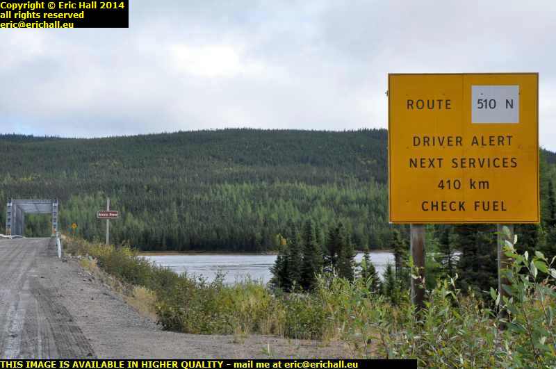
sign next fuel 408 kilometres port hope simpson labrador coastal drive canada september 2014Fuel is also 152.9 cents per litre at Port Hope Simpson so I fuel up again. Not that I desperately need it but as I have said before, you should never pass up a reasonable opportunity to fill up your tank when you are out here

The reason is that it this sign that you are up against in areas like this. And if I’m going to look at Paradise River, something that I overlooked to do in 2010, then I’ll need an extra 100 kms of fuel at least for all of that

paradise river metis trail labrador coastal drive canada september 2014So this is Paradise River. It’s another place that could qualify for one of the most beautiful places on earth.

I can see how it got its name but as for the village itself, there’s no focal point or hint of any urban node – It’s a linear village and just stretches along the road on the shore of the river with a house here, a house there.

It was once a very much larger village but 1918 flu epidemic swept away a good proportion of the inhabitants and others have slowly drifted away. That’s quite evident by empty lots and abandoned property and state of one or two of the houses. Then again, people living in Paradise River would have an 80km round trip to the shops and to get fuel. How isolated is that for a village?

rest area labrador coastal drive canada september 2014There’s an area right by the junction where the road to Cartwright leaves the Labrador Coastal Drive that I’ve had my eye on ever since 2010. It would make a perfect motel, shop, cafe and fuel station.

However, it’s been usurped by the Newfoundland and Labrador Tourist Board as the principal tourist rest area for the trail. It weems that people have indeed been reading my notes but lack the capital to invest in the plot.

Now I’m heading right into the mountains. And the weather is fluctuating like no-one’s business. We’re having bright sunlight, then clouds, then torrential rain, and then back in the sunlight and it’s changing faster than it ever does in the Auvergne.

motorcyclists labrador coastal drive canada september 2014And if you want to kno the meaning of “intrepid”, have a look at this photo. These are two motorcyclists and they’ve come all the way round from Goose Bay, and probably from further round too.

A motorcycle doesn’t have the range to do this leg of the trail and these motorcyclists are stopping to fuel up their bikes out of cans. This is certainly adventurous.

rough road labrador coastal drive canada september 2014This is sample shot of the road where I stopped on one occasion and look how much this road has deteriorated compared to how it was in 2010. And this is far from being the worst part of it either.

It was never ever like this 4 years ago and I’ve no idea what might be in their heads letting the road deteriorate like this in just 4 years. It doesn’t say much for the long-term future of the road if it’s ended up like this.

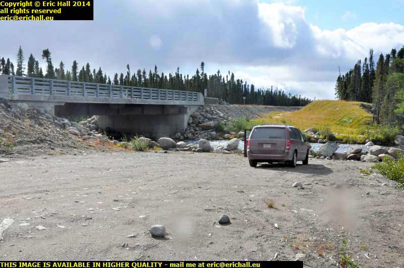
lunch stop labrador coastal drive canada september 2014This is my lunch stop for this afternoon and isn’t it beautiful? The river doesn’t seem to be carrying a nameplate so I don’t know what it is, but the bridge is dated 2008 if that’s of any use. I could quite happily settle down here in this spot.

And just look at the poor Dodge. It’s looking as if it could do with a really good wash but it isn’t going to have one for a while yet.

labrador coastal drive canada september 2014This is the Valard Construction camp and there are enough mobile homes here to house a thousand people.

It seems that the Muskrat Falls at Goose Bay are to have a hydro-electric dam. The power is going to come this way on pylons and there will be side roads built to service the pylons. The power is togo all the way through to Forteau and then under the sea to Newfoundland and then under the sea again to Cape Breton and then Maine.

Its primary purpose is to provide electricity to the Province, earn revenue by exporting the surplus to Nova Scotia and the USA, and freeing themselves from Quebec Hydro’s oppressive grip.

And there’s talk of asphalting the whole length of this highway – in fact an asphalt plant has already been built.

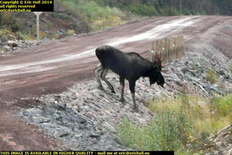
labrador coastal drive canada september 2014Standing in the middle of the road, acting as if he owned it, which he probably did, is our old friend Mr Moose.

He stood there as if challenging me to a contest but he was no match for Strawberry Moose and so he slowly lumbered out of the way to leave me with a clear path to drive all of the way down to Goose Bay. That was very good of him

north west river labrador coastal drive canada september 2014I didn’t stop in Goose Bay but went right through to North West River, the farthest northern point of the Province that it is feasible to reach by road.

This is a beautiful place to visit, especially in the setting sun. And it really did look this good too.

So now that I’ve accomplished this task, another one that I didn’t do in 2010, I retraced my steps to the docks at Goose Bay and I’ll settle down here for the night. This will do me

IMPORTANT NOTE: From 1 September 2026 this blog has a live blog feature for the latest news. Click any post title with "LIVE" in it to see live updates. Comments are welcome from logged-in users and must be approved before they appear.

Saturday 28th January 2012 – IT JUST GOES TO SHOW …

HEAVY SNOW FALL 2012 les guis virlet puy de dome france… that those people in football clamouring for a winter break mid-season quite simply don’t have a clue about whatever it is that they are trying to say.

Here we are in the Puy-de-Dôme, having had our 6-week winter break in the mildest winter in the area since records began, and the football season restarts this evening.

And today we have had the heaviest snowfall of the winter and so all the matches are postponed.

So much for the winter break

But not that I am complaining too much. I spent the morning and some of the afternoon working on my presentation of The Trans-Labrador Highway for the local village social evening in a month’s time. and I’ve managed to reach the outskirts of Goose Bay – i.e. well over halfway.

It’s an ill wind that doesn’t blow anyone any good.

But at about 13:30 the snow stopped and we had a little thaw. That was the cue for me to race off to St Eloy and so some shopping.

And I was back by 15:00 with the usual stuff, but also two Harry Potter films, the director’s cut versions, for €9:99 the pair. I’ll have to see what Herry Potter is up to – so far I’ve managed to avoid those films (except for one that I caught a glimpse of – in French – with Marianne over Christmas).

This afternoon I’ve turned my room around again. I’ve done a lot more sorting out, repositioned the furniture and by the time you read this I will have the bed back where it used to be. Only this time, with a proper array of chests of drawers behind it for the clothes.

What inspired this was the fact that the new large set that I bought in IKEA in the spring, and the medium sized set that I acquired at a brocante 18 months ago fit together nicely and are exactly the right size to fill one of the alcoves.

But I’m surprised at all of the bedding and stuff that I seem to have acquired since I emptied out Expo. I can see me having a really good sorting out one of these days.

I’ve left Caliburn on the road at the top of the lane in case the weather continues to turn nasty. From there I can drive him out.

Because tomorrow afternoon, Terjat, who I saw last Sunday in a basement Allier 3rd Division clash, are at home again. If I can move around, I’ll go for a nosey to see if they really are as bad as they looked last week.

IMPORTANT NOTE: From 1 September 2026 this blog has a live blog feature for the latest news. Click any post title with "LIVE" in it to see live updates. Comments are welcome from logged-in users and must be approved before they appear.

Friday 15th October 2010 – THIS ALL STARTED AS AN ARGUMENT, YOU KNOW.

strait of belle isle newfoundland labrador canadaSomeone had said something about the first white child born in North America being Virginia Dare in 1587. I replied that that was nonsense as there is evidence in the Norse Sagas to show that at least one child was born to the Viking settlers in Vinland.

The counter argument to that was that Newfoundland is an island – to which led the next and most logical question “and Roanoke Island is what?”.

So then we degenerated into some other discussion that terminated with “well, you can’t see the mainland from Newfoundland”.

The distance across the Straits of Belle Isle is only 18 miles at its narrowest part – less than the English Channel between the UK and France – and so that statement sounded like absolute nonsense and so I was determined to go along and see for myself, and this is how all of this started. I’ve spent 5 years planning for this

mv bernier strait of belle isle labrador newfoundland canada And so here I am at sea level in Red Bay on the southern shore of Labrador and in the distance are the hills of Newfoundland way across the Strait of Belle Isle.

And if you don’t believe me, just click on the image and see for yourself.

The … errrr … ship on the right of the image is the MV Bernier, a collier delivering coal to the bay in 1966 that slipped from its moorings in a November gale and ran aground on the rocks.

basque whaler recovered from water red bay labrador canadaBut I had a most amazing stroke of good fortune at Red Bay.

Red Bay was the site of a Basque whaling station in the 16th Century (and there is strong evidence to suggest that it was operational long before then – maybe even before Columbus sailed the Atlantic). Not only are there the ruins of a whale-oil distillery, but 4 sunken galleons and several small whalers, one of which has been recovered and put on display

wreck mv bernier cemetery basque whaler graves red bay labrador canadaThey also rediscovered a cemetery containing the graves of basque whalers who had lost their lives jn the 16th Century, and this can be seen to the left of the Bernier.

Of course it is all closed up at this time of year but the Canadian Government has submitted it as a potential UNESCO World Heritage site and today there were some visitors from this being shown around. Of course, Yours Truly blagged his way onto the guided tour and was given the full VIP treatment.

It was truly remarkable

mary's harbour labrador canadaI forgot to take a photo of my hotel last night but this is the town in which is is situated – Mary’s Harbour.

This is a “new” town, being officially founded in the 1930s. Prior to that, everyone lived on an island called Battle Harbour but the settlement burnt down in 1930, so it was decided to create a new community for the inhabitants here on the mainland.

From here, it was to my startling discoveries at Red Bay.

point amour lighthouse strait of belle isle labrador newfoundland canadaAnd that wasn’t all either. Down the road at Point Amour is Canada’s second highest lighthouse.

It was of course closed when I got there but a lady was loading up her car and so she took some time out to explain things to me. She even told me where to go to see the remains of two ships stranded on the coast just down here.

shipwreck hms raleigh point amour strait of belle isle lighthouse labrador canadaSo off I went for a wander along the coast to see for myself.

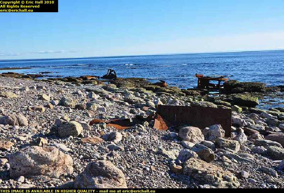
These are probably bits of HMS Raleigh, a British light cruiser that ran aground here in 1922, having swerved to avoid an iceberg in the Strait of Belle Isle. It was so well aground that it was impossible to move it and so they decided to dynamite it.

shipwreck hms raleigh point amour strait of belle isle lighthouse labrador canadaThey calculated precisely the amount of explosive that they needed to split the ship into manageable portions, but totally forgot to take into account the quantity of ammunition that remained on board.

Consequently, huge portions of the ship were hurled many hundreds of yards inland where they remain to this day.

But some of the remains that you see relate to HMS Lily, a British man-o-war that had gone aground 50 years earlier. However the remains are so mixed up due to the explosion that it’s hard to tell which is which.

mv apollo newfoundland labrador ferry strait of belle isle blanc sablon st barbe canadaSo that was my day really – and what a day it was.

And coming into Blanc Sablon there was a ferry moored in the harbour with steam up. Further enquiries revealed that it was the MV Apollo – the Newfoundland ferry, and it was leaving in half an hour so I had to get a move on if I wanted to catch it.

And so here I am in St Anthony, Newfoundland just 20 minutes away from L’Anse au Meadows and the Viking remains. Yes, I had a quick thrash through the dark right the way up Newfoundland to get here.

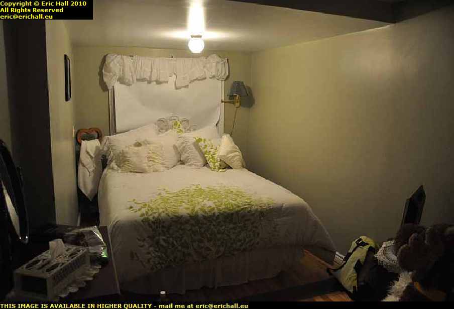
bed and breakfast st anthony newfoundland canadaBut what a cheesy place this B&B is – it’s furnished in the worst possible taste – all chintz and lace and nothing practical and all gone to ridiculous extremes.

It’s like something out of a bad 1920s novel and I can’t think what must have gone through the minds of the people who fitted this out. There are 7 pillows on the bed, for heaven’s sake, all laid out with military precision. One look at this place and the phrase “obsessive behaviour” sprang straight away to mind.

Still I’ll be gone tomorrow, I hope.

But that’s not definitive. There are some ominous rumblings in the distance. It seems that the ferry to Sydney, Cape Breton, may well have broken down. And the only other way off the island is back the way I came, and then to retrace my steps all the way over the Trans-Labrador Highway. And the weather has broken!

The road from Blanc-Sablon to some weirdly-named town beginning with N … "Natashquan" – ed … has not yet been built so I can’t get round to Sept Iles and then Baie-Comeau that way.

One other possibility is to have Casey shipped in a container by sea freight to wherever it is that Highway 138 begins – and when they told me how much that might cost (STARTING AT $400 – heaven alone knows what price it will finish at) I nearly fell through the floor.

But on reflection, if you think about it – the hotel at Labrador City, the one at Goose Bay, the one at Cartwright and the one at Mary’s Harbour came to almost twice that – and then there was the fuel and so on.

I shall have to look carefully into this. There’s a freighter leaving for there from Blanc Sablon next Friday.  

IMPORTANT NOTE: From 1 September 2026 this blog has a live blog feature for the latest news. Click any post title with "LIVE" in it to see live updates. Comments are welcome from logged-in users and must be approved before they appear.

Wednesday 13th October 2010 – I’VE SEEN A BEAR!

eagle plateau black bear trans labrador highway canadaYes, I really have!

Rupert sauntered across the road about 150 metres in front of me and then stopped by the side of the road waiting for me to ensure his immortality by recording his features in the camera.

But I’m ever so impressed by all of this, I really am. I think that all of the wildlife have been briefed to expect the arrival of the legendary Strawberry Moose and they are lying in wait.

united states air base happy valley goose bay labrador canadaSo this morning having left my extortionate and over-priced motel (but then again everything is extortionate and over-priced out here and when you work out the logistics of bringing the stuff up here it’s hardly any surprise – you just need to be prepared for the shock) I had a wander around to see the air base at Goose Bay

its well-known airfield from World War II when it was one of the wayside stations in the Atlantic Ferry but there wasn’t anything significant to observe. It’s all seen much better days and is pretty much derelict now.

labrador coastal drive canadaAnd so I headed off for part III of the route – the Labrador Coastal Drive.

This part of the road here towards L’Anse au Loup was finally opened earlier this year and it is this that has made my journey feasible. Prior to this, one had to go to the docks, stick one’s car into a container and wait for a ship for Cartwright.

labrador coastal drive canadaThe road was surprisingly good and I could keep up a good speed along it for the most part although there were a few bits that were thin.

But I did have a problem. Casey is doing about 9.5 litres to the 100 kms on good roads and much more on the rough stuff and so when I took it to be fuelled up, the guy put about 24 litres in, to account for the 300 from Churchill Falls yesterday.

I reckoned that the fuel consumption over that last bit must have been exceptional despite the roads and I was expecting Casey to need much more fuel than that.

But halfway round the route today I noticed that the gauge had dropped alarmingly. It seems that the guy didn’t fill it all the way to the top and it was about 8 litres (the length of the neck) short of fuel.

if ever I come this way again, which I really hope that I shall, I’ll have a 20-litre fuel can with me, and I’ll make sure that it’s full

casey chrysler pt cruiser labrador coastal drive canadaAnd Casey is now thoroughly filthy … "and as if you aren’t" – ed … as the weather conditions were pretty awful with the torrential rain that we were having every now and again.

And with another 750 kms to travel, despite what it says on the sign (and how the towns are spelt – clearly someone in the signwriting service around here has a sense of humour) his condition was not going to improve.

eagle plateau labrador coastal drive canadaBut I wouldn’t have missed this journey for the world, even if I didn’t have much luck with the weather. In good weather this journey would have been stunning and even in weather conditions that I was having, it was quite spectacular.

Anyway, these are only a selection of photos and a short resumé of the journey. To see more, you need to go to this page, start at the beginning, and read on until the end

Eventually, I arrived in Cartwright (after seeing my bear) on fumes, and also with a semi-flat tyre, not that this is any surprise. I’m surprised that it’s the only problem that I have had up to date, given what I’ve gone through this last few days. But now, another one has presented itself.

metis trail cartwright labrador canadaThere are two hotels in the town, and one of them is fully booked and the other one is closed for the season.

However, the owner of the fully-booked one rang up a friend of the owner of the second one and she came out from home to unlock a room for me, and gave me the key to the kitchen to help myself for cooking and for breakfast. It’s a good job that I had bought a few tins of beans and packets of spaghetti for emergencies such as this. I knew that they would.

But there’s about a year’s supply of beer in the kitchen – all kinds of things and I could have a field day in there if I were of that type.

metis trail cartwright labrador canadaHere at Cartwright, an old fishing port dating back to the 18th Century and one of these stops for the coastal ferry trade up the Labrador coast, the road is a new arrival.

Isolated and Remote Canada seems to have these really old and traditional kind of values, as the affair of the motel has provd and I shall always be grateful to them.

Tomorrow when I’ve fixed the tyre and fuelled up I’m going to look at the Norse Wunderstrand then drive back the 82 kms to the highway and go to the site of a historic early Pioneer village, Canada’s second-highest lighthouse, an early Basque whaling station and the Basque fishing boats from the 16th Century that have been salvaged.

Finally, it will be Blanc-Sablon where I may well spend the night ready to take the ferry to Newfoundland the next morning.

But the bear. I can’t get over that. What with the beaver … "it was a porcupine" – ed … on the first day, the moose on the second, the bear on the third – I’m going for the Loch Ness Monster tomorrow!

IMPORTANT NOTE: From 1 September 2026 this blog has a live blog feature for the latest news. Click any post title with "LIVE" in it to see live updates. Comments are welcome from logged-in users and must be approved before they appear.
Tuesday 12th October 2010 – I’M IN GOOSE BAY THIS EVENING …

… the town, that is, not the bay itself, and I’m goosed.

This morning got off to a rather bad start. I was walking down a street somewhere in small-town America in a howling gale. I don’t remember who I was with, and we were watching this 8-storey brick-built rooming house which was swaying alarmingly in the wind. Suddenly the top four storeys were blown right off the building and crashed to the street with an almighty bang. The two of us dashed over to start to rescue the survivors and suddenly in the middle of all of this I sat bolt upright in my bed.

It’s been ages since I’ve had such a realistic dream as this.

So this morning I was up long before dawn and took piles of photos of Labrador City, only to find that I had the ISO on the wrong setting after last night’s photos, and I had forgotten to change it back. Hence, not a one came out, and was I upset?

motel labrador city canadaWell, not quite. It wasn’t quite light when I took the photo of my motel this morning so I managed to salvage that.

And I’m not going to say anything about the motel at all – I’ll wait for another occasion after I’ve recovered. I was expecting the prices out here to be different than in most other places – 500 kms of dirt road to bring stuff out here will be responsible for that – but I wasn’t prepared for this.

wabush iron ore mine quebec north shore labrador railway line canadaIf it wasn’t for the huge iron-ore mines out here, there wouldn’t be anything at all. But what we do have is, apart from the mine of course, a huge railway network for hauling away the output and that was one of the things that I had wanted to see.

Having grown up on The Land God Gave to Cain and similar books, to come out to Labrador to see the iron ore mines, the railway lines and the dams has been my main lifetime ambition ever since my childhood.

But back to the story of my drive over the trail. Today I drove about as far as yesterday, but the roads were a different thing altogether. Leaving Labrador City we had a paved road for all of about 50 kms and then that was about that.

trans labrador highway canadaSeeing an enormous snowplough coming towards me with its front all thoroughly plastered with snow gave me a little inkling of what the weather was likely to be, and as we climbed up onto the Labrador Plateau it started to snow.

The more the road deteriorated, the more snow we had and it started to become quite an adventure. The higher I climbed brought me up into the clouds and it became a question of not even being able to see what the weather was doing, and that was probably the best idea.

But Casey, Strawberry and I pressed on relentlessly along the worst road that I have ever driven, deep into the wilderness.

male moose trans labrador highway canadaAnd Strawberry was well-rewarded because at a certain moment right up on top of the plateau with the wind whistling around from everywhere, one of his Canadian cousins slowly ambled across the road as if he owned it, which he probably did.

Strawberry was ever so excited as you can imagine and it brought me to a standstill for a good few minutes as the two of them exchanged pleasantries. Eventually cousin managed to manoeuvre himself into a good spot between a couple of trees where I could get a really good shot of him, and once he was sure that he had made his entry onto these pages, he made his excuses and left

road to fuel station churchill falls trans labrador highway canadaWe arrived at Churchill Falls and had a good hunt around to find the petrol station – it wasn’t easy to spot.

Churchill Falls is not on the main Trans Labrador Highway – it’s way off to one side and you need to drive down this road in order to find it. Fuel was $1.15 at Fermont but here it was $1.22 and that’s quite acceptable for where we are – after all there is no train hauling it up into the mountains just here and from the railhead it’s quite a way.

churchill falls trans labrador highway canadaThe falls though were a little disappointing, and for two reasons too. Firstly, at this time of the year it’s probably all frozen up high up in the mountains.

Secondly, the river has had part of its course diverted to feed the huge hydro-electric power station on the other side of town. But there isn’t too much to see – everything is inside a hollowed-out mountain, rather like Doctor Evil’s lair.

trans labrador highwy canadaAfter Churchill Falls as we climbed back out of the river valley onto the plateau the little bit of paved road immediately petered out and from then on I can safely say that I was on the worst road that I have ever driven in my life as you can tell from the photo.

One stretch of 122 kms took over 4 hours to drive, and I don’t hang about as you know

major road works trans labrador highway canadaAt another point we were held up by a construction team (there were about 20 teams working up here and they could have done with 200 I reckon) for 10 minutes while they dynamited a huge rock.

And then we were held up for another hour or so while they shovelled it up from off the road as they had miscalculated the amount of dynamite to use. It certainly was spectacular watching lumps of rock the size of giant pumpkins flying down the road just a hundred yards from where I was parked.

And by the time they had finished, quite a little queue had built up

trans labrador highway canadaBut the road really was awful – at times it was just like a sea of mud in places and I didn’t dare stop because I would never have started again.

After 3 hours of driving from Churchill Falls with just 87 kms on the clock it all became a little depressing. But eventually, after 122 kms we passed onto an area where the construction crews had finished and we could roll along at a much more relaxed 60 kph – even though the roads were nothing like anything that you would get anywhere else. Ruts and potholes, lakes of water, huge stones, these were all commonplace

former trace trans labrador highway canada.But that being the case, every so often you would catch a glimpse of the old road – the one that they used before they had the idea to make the Highway about 10 years ago.

Just imagine driving on that surface -you wouldn’t even manage 60 kilometres in a week on that. There just aren’t any words in the dictionary to describe that road

deciduous forest river valley trans labrador highway canadaBut all of a sudden, at exactly 191 kms from Churchill Falls there was a huge steep climb up over the mountains and Casey struggled up that, I can tell you, and as we dropped down the other side we found ourselves in a deciduous forest.

Yes, the deliniation of the climatic zone was as dramatic as that – you could draw a line to represent it. And as we drove through a steep-sided valley it was curious to note that in the valley floor and the north-facing slopes there were conifer trees, mosses and lichens yet on the south-facing slopes there were deciduous trees and grass. This kind of area is a real marginal climatic zone that’s for sure.

But who is this “we” that I’ve been talking about?

Ford F150 pontiac 7 seater MPV minivan trans labrador highway canadaWell, in fact long before Churchill Falls when I had stopped to take a photo of something I was passed by a Ford F150 pickup followed by a Pontiac 7-seater MPV. Half an hour later I caught up with them again, and then lost them as I stopped again to take another pic or so.

And we continued like this all the way over the Labrador Plateau and right until we hit the paved road a few miles from Goose Bay, when they piddled off into the sunset. It really was quite strange continually catching them up at roadworks and so on. We must have made quite a strange convoy along that road.

Now if last night’s hotel was the most expensive in which I have ever stayed, today’s is the second. And not by much either. I reckon that I could have stayed for a night with a lady of ill-repute in each of these places and still been ahead of the game. I shall be looking into this.

Anyway, these are only a selection of photos and a short resumé of the journey. To see more, you need to go to this page, start at the beginning, and read on until the end.

IMPORTANT NOTE: From 1 September 2026 this blog has a live blog feature for the latest news. Click any post title with "LIVE" in it to see live updates. Comments are welcome from logged-in users and must be approved before they appear.