Tag Archives: newfoundland and labrador tourist information

Thursday 24th September 2015 – I MUST BE GETTING OLD

It used to be the case that I could sleep anywhere at any time. At one time I was even found asleep leaning up against a wall in a garage. But just recently, as you know, I’ve been having some sleeping issues, but none such as I had last night on the ship out to Newfoundland.

With some of the nicest reclining seats that I’ve ever sat on, I just couldn’t drop off to sleep. And when I did, I was awake 10 minutes later with aches and pains everywhere. And this went on throughout the night until we docked at Channel Port Aux Basques.

We had a very long wait there too before we could unload. I did mention that we were parked right in the bowels of the ship, and so we had to wait until everyone else was out and gone before we could be liberated.

I went for a coffee and some biscuits at Tim Horton’s so that I could use their internet without any pangs of conscience, and then went over the road to Canadian Tire for a big roll of waterproof duck tape, the reason for which I shall mention in a moment.

channel port aux basques newfoundland canada
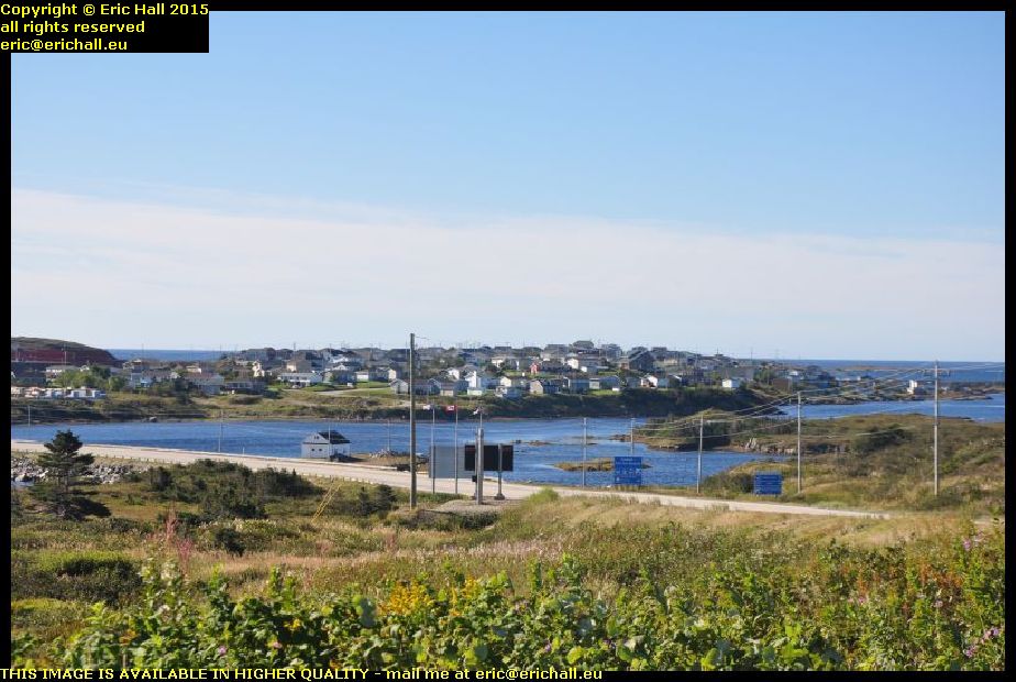
You’ve seen plenty of photos of the ship and of the town – Channel Port aux Basques – in the past, but I bet that you have never seen it from this angle before.

I’m a mile or two outside the town here at the Newfoundland and Labrador Tourist Information Office where I stopped to search Strider for the charger for the mobile phone, and there’s a good view of the town across the bay from here. I couldn’t resist taking a photo to add to the archives.

typical southern newfoundland scenery canada. In the past, whenever I’ve driven out of – or into – Channel Port Aux Basques, I’ve always followed the coast. But today, I’ve driven due north along the Trans Canada Highway and seen parts of the island that I haven’t seen before.

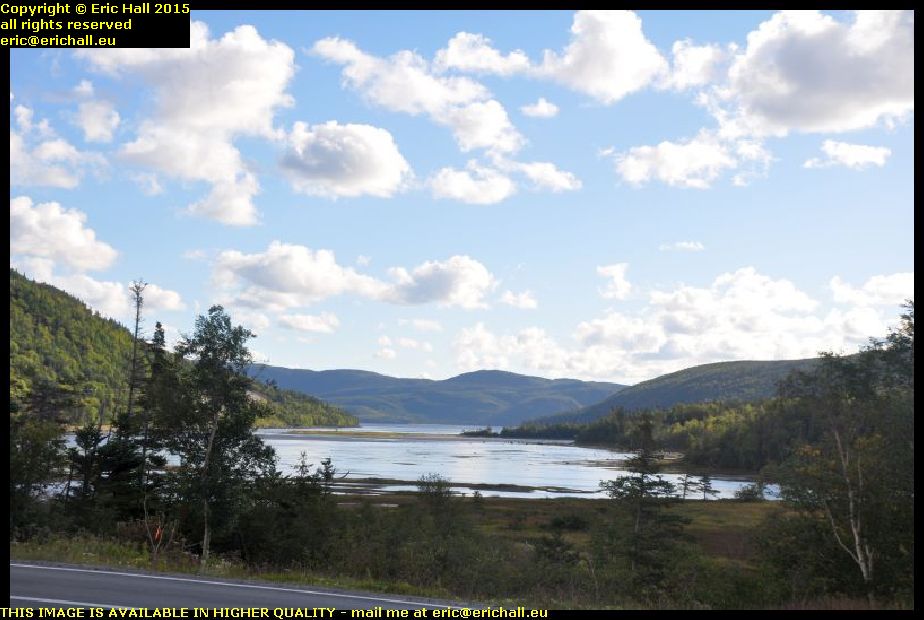
The eastern part of the island has all of the accessible coastline, but the western part has the mountains and the lakes and here, only a handful of miles outside the town, we start entering some really beautiful country. This photo is just typical of the scenery on the southwestern side of the island.

newfoundland railway bridge coopers brook canada
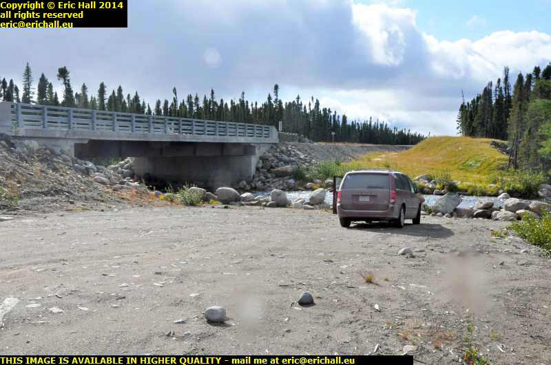
Newfoundland once had a very important railway network – one of the longest narrow-gauge systems in the world. But it struggled along, suffering from chronic under-investment and lack of modernisation despite having one of the most beautiful routes of any railway network ever.

However, as I’ve told you before, it was yet another victim of the ruthless decimation of Canada’s railway network and while very little of the equipment remains, the railway line itself is almost complete and you will see loads of bridges such as this one on your travels.

trans canada highway climbing up into newfoundland mountainsIt’s not long before we start to climb into the mountains of Newfoundland, and the Trans-Canada Highway makes some stunning ascents and descents as we continue northwards.

Here’s one of the most exciting climbs as you can see, a few miles south of the turning for Stephenville. The flattest route is indeed via Stephenville but that puts dozens of miles onto the route and so we take the short cut.

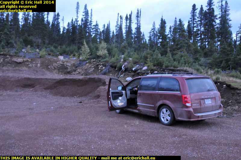
At Deer Lake I stop for fuel again. I fuelled up at Channel Port aux Basques but that’s not enough to reach the Labrador ferry at St Barbe (the short range of Strider is depressing me) and so the Big Irvings at Deer Lake comes up with more fuel and also enables me to fill up one of my big containers. There’s 20 litres in that and once I’m across in Labrador I’ll put 20 litres into the other container. I hope that that will be enough to enable me to do this 418 kms between Port Hope Simpson and Goose Bay.

gros morne national park newfoundland canadaDeer Lake is the entrance to the Gros Morne National Park and if you think that the road has been beautiful to here, then you ain’t seen nuffink yet. Gros Morne really is spectacular.

This is one of the lakes here, nestling into the foot of what looks like a glaciated valley, and once more, this is just one of a thousand photos that I could have taken of the area. I’ve been here a few times now and I never tire of it. One day I’ll come here and stay for a week, and maybe I will, seeing as I now have transport of my own.

st pauls newfoundland canadaAs I was walking by St Pauls, I was seized by this beautiful view. I had to turn off the highway to see it and found myself on a little dockside.

There’s a big inlet here and the harbour is on the inside of the inlet, sheltered from the wind by the embankment for the beautiful metal girder bridge that spans the inlet. This is a typical Newfoundand photograph, isn’t it? The water, the fishing boats, the little harbour and the mountains away in the background.

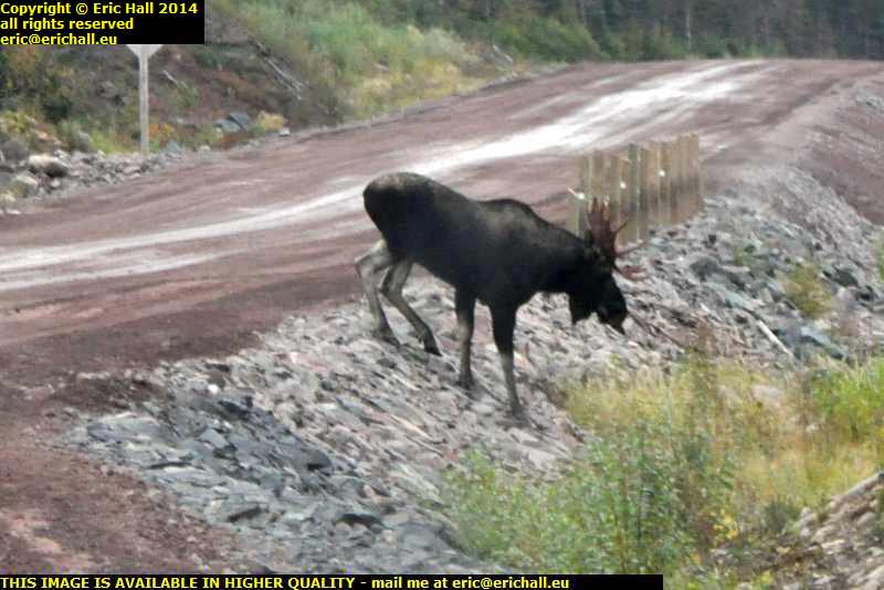
18:00 is my usual time to start to look for a suitable place to stay (unless something astonishing presents itself beforehand) and tonight, at about 18:30, I’ve found an abandoned cut-off that leads down to a dismantled bridge. The house here seems to be abandoned so the hedges are all overgrown and as it’s a downhill slope to the bridge I’m pretty sheltered. Of the six sheets of insulation, I’ve put two each into a huge bin liner, fitted another bin liner over the open end and sealed them up with the duck tape.

The three packets that I’ve made, I’ve put them on the roof weighted down with the wood.

We’ll see what that is like through the night as far as the condensation issue goes, but the roof does feel much warmer than the sides of the truck cap already.

Sunday 16th August 2015 – PLEASANT COMPANY EXPECTED

If you thought that last night’s two drivers were unusually friendly and helpful, then the encounters today have topped all of that off in spades, I’ll tell you that.

I was up at the crack of dawn this morning (lucky dawn!) and after a good shower I set to work. First thing to do was to try to remember my nocturnal ramblings. I was in van somewhere in England (yes, England, not the UK) and I was on a photography expedition going somewhere but every time that I tried to take a photograph my camera fell apart and thos kept on happening with monotonous regularity. There was one place that I particularly remembered – a tiny village in a low valley where the road took a sharp right-hand bend right by the village green where there was a telephone box.

But anyway, enough of that for now.

The breakfast room at the hotel was crowded and we ran out of coffee and jam – and I remembered to make something of a little note about this – but while I was looking for the breakfast attendant I came across a second breakfast room which had apparently been missed by everyone else because it was quite empty.

aeroplanes taking off from pierre trudeau airport dorval montreal quebec canadaWith it being Sunday, the buses didn’t start running until late so it gave me an opportunity to have a good session on the computer and catch up on a few things. I had a good look out of the window too, and I do have to say that the view from here is one of the best that I can hope to have.

It’s not as noisy as you might think with the new generation of jets, and it’s a shame that the big KLM jumbo jet takes off in the dark.

And then it was off to the town.

First stop was to buy some water where the girl at the cash desk gave a big sigh as I was counting out the cash. What a way to start the day, so I gave her a little “piece of advice”, as they say in the Police Farce.

I went onwards to the Tourist Information office for a map (I’d left mine behind) and there I fell in with a woman who was on her was from Vancouver to Newfoundland. She was travelling via the Trans-Canada Highway and so we had a spritied discussion about going via the Trans-Labrador Highway and across from Blanc Sablon.

musi students sunday brunch performance place jacques cartier montreal quebec canadaIn the Place Jacques Cartier just around the corner we were treated to some street musicians.

In fact every Saturday and Sunday during July and August various little groups of musicians entertain the crowds, and these five people are from one of the many music academies around the city. I do have to say that while their selection of music was not my type, I quite enjoyed the atmosphere – which is one of the best reasons to be here.

quai de l'horloge st lawrence river montreal quebec canadaI had a wander off down to the Quai de l’Horloge to sit in the sun, lap up the atmosphere, watch the river and (most importantly) to eat my butties as it was now my kind of lunchtime.

There was plenty going on on the river – lots of marine traffic and the like, but nothing over about 15 tonnes which for me, at any rate, was something of a disappointment. Where’s the 150,000 tonne tanker when you need it?

And, if the truth was known, I had a little doze in the sunshine too. It’s been a long time since I’ve done that, and I find that the water is quite relaxing.

algonova quayside st lawrence river montreal quebec canadaWith nothing here worth photographing, I wandered off down to the Point by the clock tower to see what was in the docks and I was lucky in that the Algonova was there. She had been there for a while too, having come from Corner Brook in Newfoundland.

She might not look it, but she’s quite a modern ship, dating from as recently as 2007, and cost about $43,000,000, which is a lot of money to have sitting idle, tied up at the quayside.

So having mused on that for quite a while, I was all ready to move off when a couple of teenage girls squeezed in next to me. One of them was discreetly trying to look at my map so I let her have it.

We started off a conversation – ohhh yes, I can still chat up the females, even though, at my age, I can’t remember why- and of course, my plans to leave were completely abandoned.

Their parents joined in the chat too. They are from Winnipeg and visiting Montreal for a holiday. The chat quickly led to a much wider field and of course, Labrador came up in the chat. The Labrador Tourist Board ought to be paying me a commission.

Once everyone had cleared off, I went to have a look at my favourite building – the Gare Viger. They’ve knocked down a few more internal walls but that’s about all. Nothing much else is being done.

But here I had another one of those legendary encounters. Some woman van driver needed to do to an address in a street behind me, but it had all been cut off by roadworks and she wondered how she was going to get there. As soon asI openedmy mouth, she said “sorry, I didn’t realise that you weren’t local” – but as it happened, I did know the area where we were and I knew how to get to the address concerned.

And then she drove off with my rucksack and I had to run after her.

water skiing riviere des prairies laval quebec canadaOn the underground, I went to the Cartier metro station at Laval, to see the riviere des Praries. From the Pont Viau there were some lovely views with all kinds of things to see, including a car trying to drive up the cycle path.

There was a lot of maritime activity here too, including some water-skiing. And that I found quite astonishing. If the river has that much of a slope on it, how come Quebec Hydro hasn’t put a dam across it and fitted a few hydro turbos?

montmorency metro montreal laval quebec canadaThe end of the orange line at Montmorency is actually the big University campus at the back of Laval. Leaving the station, I went for a wander around but I didn’t stay too long. There wasn’t anything interesting (from my point of view) to see.

But there was a guy of my age pacing up and down outside.
"You look as if you are waiting for someone" I said
"Yes, my daughter" he replied
"Well, I’d forget about her and take someone else. I’ve seen a few girls that I wouldn’t mind taking home instead of my daughter."

parking spaces montmorency metro station laval montreal quebec canadaParking featured quite a lot on these pages at one time, and here’s a good example of street parking in North America.

Not so much of how the cars are parked but the size of the parking places. Anyone from Europe could park a lorry in spaces as big as this, never mind a compact car. It did remind me of the time that I reversed into a car parking space somewhere in the USA, watched by quite a crowd.

And someone asked me why I’d reversed in, to which I replied “because I can. I’m from Europe”.

There was an incident on the metro and traffic was “perturbed”. But eventually I arrived at Cote-des-Neiges and my plate of falafel, salad and chips. There was a football match on the TV, a Major League Soccer match. And I have to say that I wasn’t impressed. A couple of stars of European football having one last pay-day and a few local players, and it was all about Third or Fourth Division standard

In the Metro supermarket was a note – “due to Quebec Employment legislation, we are only allowed to employ a maximim of four people after 21:00, on Sundays and Public Holidays”. No-one in the supermarket thought that strange. But I can’t imagine any other Government, anywhere else in the western world, putting maximum limits on how many people are allowed to be employed in an enterprise in the middle of an employment crisis.

Another friendly, chatty bus driver on the way back and even though it was only 21.45 I crashed out yet again.

And what a nice day too. I’ve met loads of helpful, friendly people and had a few interesting chats with some very pleasant company.

Tuesday 23rd September 2014 – I SPENT LAST NIGHT …

esker lodge bay labrador coastal drive canada september 2014… sleeping in an esker.

I mean, I don’t mean sleeping IN an esker like that arctic explorer and fellow former Nantwich-dweller Jack Hornby and his companion James Critchell Bullock back 90-odd years ago.

They actually burrowed in like rabbits and built themselves a cave. I actually spent the night sleeping in an old quarry that has been formed where a load of sand had been removed from an esker.

And an esker? It’s like a sandbank but has been deposited by a glacier rather than a river or a sea and the whole of northern Labrador is covered in them. This one is about 10 miles north of Lodge Bay.

And I was up even as dawn was breaking, and on my way. It was quite cold and damp and so I needed to warm up the Dodge before I could do much. A good drive for half an hour would sort that out

A sign of the times is how the raffic is on the roads around here. Back in 2010 you could drive for hours and not see another vehicle. Here on Iceberg Alley at the moment, at just 07:20 it’s like the M6. There’s a car coming towards me and there’s a car coming behind me too

st lewis iceberg alley labrador coastal drive canada september 2014At the end of Iceberg Alley is a small town called St Lewis and as I have said before
it’s one of the most beautiful places on earth, and this is where I’ve come for breakfast.

But they were quite right about the storm worsening today. I’ve tried to open the door to go out and take a photo but I physically can’t open the door against the wind. I had to turn the Dodge around. And the coffee that I made went down well too. I needed that.

sign next fuel 408 kilometres port hope simpson labrador coastal drive canada september 2014Fuel is also 152.9 cents per litre at Port Hope Simpson so I fuel up again. Not that I desperately need it but as I have said before, you should never pass up a reasonable opportunity to fill up your tank when you are out here

The reason is that it this sign that you are up against in areas like this. And if I’m going to look at Paradise River, something that I overlooked to do in 2010, then I’ll need an extra 100 kms of fuel at least for all of that

paradise river metis trail labrador coastal drive canada september 2014So this is Paradise River. It’s another place that could qualify for one of the most beautiful places on earth.

I can see how it got its name but as for the village itself, there’s no focal point or hint of any urban node – It’s a linear village and just stretches along the road on the shore of the river with a house here, a house there.

It was once a very much larger village but 1918 flu epidemic swept away a good proportion of the inhabitants and others have slowly drifted away. That’s quite evident by empty lots and abandoned property and state of one or two of the houses. Then again, people living in Paradise River would have an 80km round trip to the shops and to get fuel. How isolated is that for a village?

rest area labrador coastal drive canada september 2014There’s an area right by the junction where the road to Cartwright leaves the Labrador Coastal Drive that I’ve had my eye on ever since 2010. It would make a perfect motel, shop, cafe and fuel station.

However, it’s been usurped by the Newfoundland and Labrador Tourist Board as the principal tourist rest area for the trail. It weems that people have indeed been reading my notes but lack the capital to invest in the plot.

Now I’m heading right into the mountains. And the weather is fluctuating like no-one’s business. We’re having bright sunlight, then clouds, then torrential rain, and then back in the sunlight and it’s changing faster than it ever does in the Auvergne.

motorcyclists labrador coastal drive canada september 2014And if you want to kno the meaning of “intrepid”, have a look at this photo. These are two motorcyclists and they’ve come all the way round from Goose Bay, and probably from further round too.

A motorcycle doesn’t have the range to do this leg of the trail and these motorcyclists are stopping to fuel up their bikes out of cans. This is certainly adventurous.

rough road labrador coastal drive canada september 2014This is sample shot of the road where I stopped on one occasion and look how much this road has deteriorated compared to how it was in 2010. And this is far from being the worst part of it either.

It was never ever like this 4 years ago and I’ve no idea what might be in their heads letting the road deteriorate like this in just 4 years. It doesn’t say much for the long-term future of the road if it’s ended up like this.

lunch stop labrador coastal drive canada september 2014This is my lunch stop for this afternoon and isn’t it beautiful? The river doesn’t seem to be carrying a nameplate so I don’t know what it is, but the bridge is dated 2008 if that’s of any use. I could quite happily settle down here in this spot.

And just look at the poor Dodge. It’s looking as if it could do with a really good wash but it isn’t going to have one for a while yet.

labrador coastal drive canada september 2014This is the Valard Construction camp and there are enough mobile homes here to house a thousand people.

It seems that the Muskrat Falls at Goose Bay are to have a hydro-electric dam. The power is going to come this way on pylons and there will be side roads built to service the pylons. The power is togo all the way through to Forteau and then under the sea to Newfoundland and then under the sea again to Cape Breton and then Maine.

Its primary purpose is to provide electricity to the Province, earn revenue by exporting the surplus to Nova Scotia and the USA, and freeing themselves from Quebec Hydro’s oppressive grip.

And there’s talk of asphalting the whole length of this highway – in fact an asphalt plant has already been built.

labrador coastal drive canada september 2014Standing in the middle of the road, acting as if he owned it, which he probably did, is our old friend Mr Moose.

He stood there as if challenging me to a contest but he was no match for Strawberry Moose and so he slowly lumbered out of the way to leave me with a clear path to drive all of the way down to Goose Bay. That was very good of him

north west river labrador coastal drive canada september 2014I didn’t stop in Goose Bay but went right through to North West River, the farthest northern point of the Province that it is feasible to reach by road.

This is a beautiful place to visit, especially in the setting sun. And it really did look this good too.

So now that I’ve accomplished this task, another one that I didn’t do in 2010, I retraced my steps to the docks at Goose Bay and I’ll settle down here for the night. This will do me