… the town, that is, not the bay itself, and I’m goosed.
This morning got off to a rather bad start. I was walking down a street somewhere in small-town America in a howling gale. I don’t remember who I was with, and we were watching this 8-storey brick-built rooming house which was swaying alarmingly in the wind. Suddenly the top four storeys were blown right off the building and crashed to the street with an almighty bang. The two of us dashed over to start to rescue the survivors and suddenly in the middle of all of this I sat bolt upright in my bed.
It’s been ages since I’ve had such a realistic dream as this.
So this morning I was up long before dawn and took piles of photos of Labrador City, only to find that I had the ISO on the wrong setting after last night’s photos, and I had forgotten to change it back. Hence, not a one came out, and was I upset?
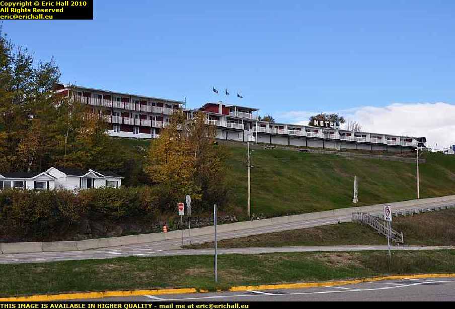
 Well, not quite. It wasn’t quite light when I took the photo of my motel this morning so I managed to salvage that.
And I’m not going to say anything about the motel at all – I’ll wait for another occasion after I’ve recovered. I was expecting the prices out here to be different than in most other places – 500 kms of dirt road to bring stuff out here will be responsible for that – but I wasn’t prepared for this.
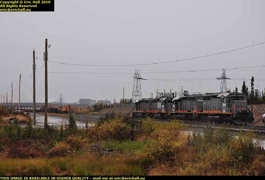 If it wasn’t for the huge iron-ore mines out here, there wouldn’t be anything at all. But what we do have is, apart from the mine of course, a huge railway network for hauling away the output and that was one of the things that I had wanted to see.
Having grown up on The Land God Gave to Cain
But back to the story of my drive over the trail. Today I drove about as far as yesterday, but the roads were a different thing altogether. Leaving Labrador City we had a paved road for all of about 50 kms and then that was about that.
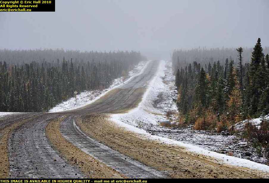 Seeing an enormous snowplough coming towards me with its front all thoroughly plastered with snow gave me a little inkling of what the weather was likely to be, and as we climbed up onto the Labrador Plateau it started to snow.
The more the road deteriorated, the more snow we had and it started to become quite an adventure. The higher I climbed brought me up into the clouds and it became a question of not even being able to see what the weather was doing, and that was probably the best idea.
But Casey, Strawberry and I pressed on relentlessly along the worst road that I have ever driven, deep into the wilderness.
 And Strawberry was well-rewarded because at a certain moment right up on top of the plateau with the wind whistling around from everywhere, one of his Canadian cousins slowly ambled across the road as if he owned it, which he probably did.
Strawberry was ever so excited as you can imagine and it brought me to a standstill for a good few minutes as the two of them exchanged pleasantries. Eventually cousin managed to manoeuvre himself into a good spot between a couple of trees where I could get a really good shot of him, and once he was sure that he had made his entry onto these pages, he made his excuses and left
 We arrived at Churchill Falls and had a good hunt around to find the petrol station – it wasn’t easy to spot.
Churchill Falls is not on the main Trans Labrador Highway – it’s way off to one side and you need to drive down this road in order to find it. Fuel was $1.15 at Fermont but here it was $1.22 and that’s quite acceptable for where we are – after all there is no train hauling it up into the mountains just here and from the railhead it’s quite a way.
 The falls though were a little disappointing, and for two reasons too. Firstly, at this time of the year it’s probably all frozen up high up in the mountains.
Secondly, the river has had part of its course diverted to feed the huge hydro-electric power station on the other side of town. But there isn’t too much to see – everything is inside a hollowed-out mountain, rather like Doctor Evil’s lair
 After Churchill Falls as we climbed back out of the river valley onto the plateau the little bit of paved road immediately petered out and from then on I can safely say that I was on the worst road that I have ever driven in my life as you can tell from the photo.
One stretch of 122 kms took over 4 hours to drive, and I don’t hang about as you know
 At another point we were held up by a construction team (there were about 20 teams working up here and they could have done with 200 I reckon) for 10 minutes while they dynamited a huge rock.
And then we were held up for another hour or so while they shovelled it up from off the road as they had miscalculated the amount of dynamite to use. It certainly was spectacular watching lumps of rock the size of giant pumpkins flying down the road just a hundred yards from where I was parked.
And by the time they had finished, quite a little queue had built up
 But the road really was awful – at times it was just like a sea of mud in places and I didn’t dare stop because I would never have started again.
After 3 hours of driving from Churchill Falls with just 87 kms on the clock it all became a little depressing. But eventually, after 122 kms we passed onto an area where the construction crews had finished and we could roll along at a much more relaxed 60 kph – even though the roads were nothing like anything that you would get anywhere else. Ruts and potholes, lakes of water, huge stones, these were all commonplace
 .But that being the case, every so often you would catch a glimpse of the old road – the one that they used before they had the idea to make the Highway about 10 years ago.
Just imagine driving on that surface -you wouldn’t even manage 60 kilometres in a week on that. There just aren’t any words in the dictionary to describe that road
 But all of a sudden, at exactly 191 kms from Churchill Falls there was a huge steep climb up over the mountains and Casey struggled up that, I can tell you, and as we dropped down the other side we found ourselves in a deciduous forest.
Yes, the deliniation of the climatic zone was as dramatic as that – you could draw a line to represent it. And as we drove through a steep-sided valley it was curious to note that in the valley floor and the north-facing slopes there were conifer trees, mosses and lichens yet on the south-facing slopes there were deciduous trees and grass. This kind of area is a real marginal climatic zone that’s for sure.
But who is this “we” that I’ve been talking about?
 Well, in fact long before Churchill Falls when I had stopped to take a photo of something I was passed by a Ford F150 pickup followed by a Pontiac 7-seater MPV. Half an hour later I caught up with them again, and then lost them as I stopped again to take another pic or so.
And we continued like this all the way over the Labrador Plateau and right until we hit the paved road a few miles from Goose Bay, when they piddled off into the sunset. It really was quite strange continually catching them up at roadworks and so on. We must have made quite a strange convoy along that road.
Now if last night’s hotel was the most expensive in which I have ever stayed, today’s is the second. And not by much either. I reckon that I could have stayed for a night with a lady of ill-repute in each of these places and still been ahead of the game. I shall be looking into this.
Anyway, these are only a selection of photos and a short resumé of the journey. To see more, you need to go to this page, start at the beginning, and read on until the end.