Tag Archives: waterfall

Tuesday 11th August 2020 – I’VE BEEN SPENDING …

… my money yet again.
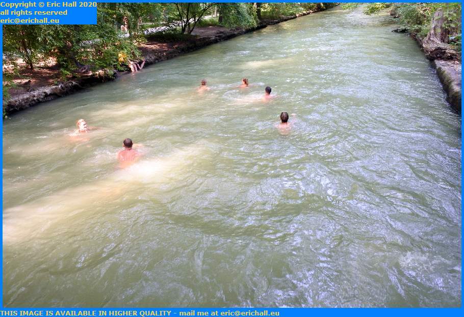
swimmers in the schwabinger bach english garden munich germany eric hallWhile you lot admire some photos of people having fun in the water in the Englischer Tur, regular readers of this rubbish will recall that I have been on the lookout for a new acoustic guitar.

My current one was a £25:00 special of no quality or finish or anything, and rather disappointing all round, and so one of my reasons for being in Germany was to visit the large music shops to see whether there was anything that was more suitable.

Thomann’s had been very disappointing so I was hoping for better luk back in Munich. That was the plan for today.

surfers schwabinger bach english garden munich germany eric hallAnyway, this morning I was wide-awake quite early (Hans’s sofa really is comfortable) and attacked the paperwork.

Heidinnguaq, my Greenland Inuit friend appeared on one of my voyages last night and we’d met as she was doing something as a kind of student so I’d recruited her for my travel company as receptionist, called Heidi, we changed her name to Heidi and she was working there. No matter how I tried I couldn’t make our work relationship into a personal relationship unfortunately. On one occasion we were walking towards the canteen to go and have a meal and she said “I’ll see you back at the office at 13:30 (it was now 12:50)”. I said “yes OK, or you can come and have lunch with me”. “Oh no” she said “you can go and have your lunch in here” she said, pointing to one of the dining rooms. “It’s a smoking one and you can make a mess if you like”, something like that to do with smoking and so on. Definitely doing everything she could to keep me at arms’ length, and I can’t say that I blame her. I would keep a good distance away from myself if only I could.
surfers schwabinger bach english garden munich germany eric hallLater on there was a murder case involving some Chinese people. All of the papers and all of the evidence had been stuffed in an old blue minibus. People had broken into this minibus and started to search through the contents. This was clearly not right and I was wondering why they hadn’t sent the boxes to something like Iron Mountain, something like that. I was wandering around back at my office, getting in arrears again at work and doing some stuff that I didn’t really like. Someone was doing a survey on food and found that we only had something like 81% of food that we needed to survive. I was trying to think of ways to cut down on different things and how to make the food go further which involved taking more care about it but every time I mentioned cheese there was some cheese about someone would say “well so-and-so hasn’t had his cheese yet. Do you want some cheese?” Of course that wasn’t my plan at all because I didn’t want to give it away gratuitously like that. I wanted to keep it. There was some pie left over and I thought that I’d put it in a safe in the spare room but when I went to pick it up this guy there said “oh so-and-so hasn’t had any pie yet” and started to ask around who wanted more pie, whereas I was going to put it in a room and serve it up at tea later that night. I was thinking that there will have to be some really drastic economies of food if we were all going to survive. We can’t afford to waste it all and give it away like this.

Hans appeared at some point and made coffee, and we had a good chat.

Later, we headed out across the road to the cafe where they do very reasonable breakfasts. I had a couple of delicious German bread rolls with jam.

deutsche bahn class 423 743 4 electric multiple unit eching eric hallOff into town now. Caliburn took us to the main-line railway station in town and to catch a train for Munich.

The train that pulled up to take us was one of the lightweight Class 423 units buolt by a consortium including ABB, Adtranz, Alstom and Bombardier specifically for the suburban networks of many German cities during the early years of this century, the first ones actually entering service in 1998.

Clean, tidy, comfortable and quiet, it whizzed us into the city and at the rather appropriately-named Moosach station we alighted and took the Metro down to the Olympic Park. At the big shopping complex near there is A place called Just Music, one of the largest music shops in Germany.

Here, they did EXACTLY what Thomann’s should have done the other week. A salesman listened to what I was telling him about my requirements, sorted out half a dozen guitars, put them in a little room with me, and then left me to it.

After about half an hour I’d whittled the choice down to two and following a lengthy discussion with Hans and the salesman I finally made my choice. So I paid up and left the guitar there for later collection.

We then headed off back to the underground for a train (and a bus) back to the city centre.
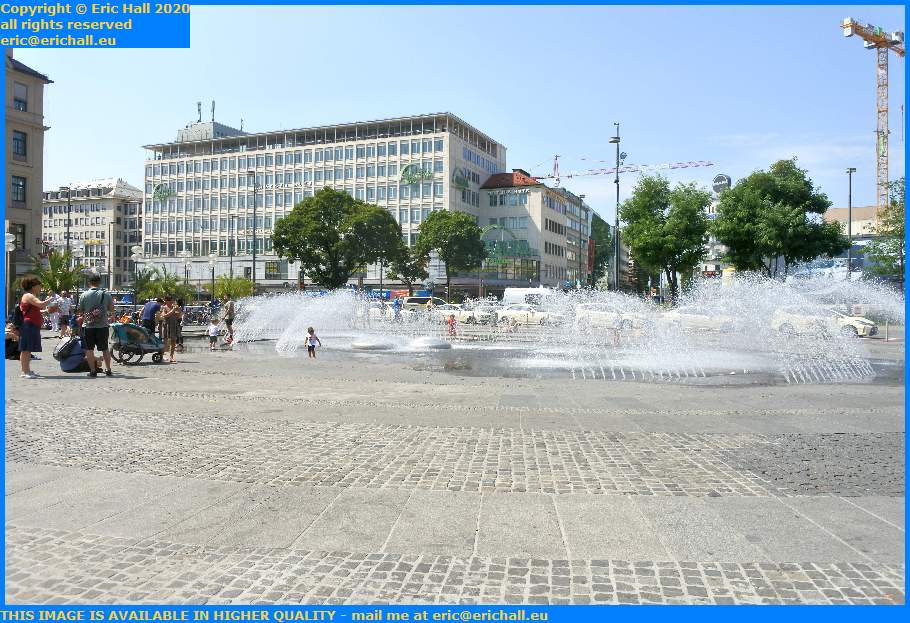
karlsplatz munich germany eric hallWe were planning for a mega-ramble around Munich today to see some of the sights and we started today at the Karlsplatz.

Mind you, it’s not everyone who knows it as the Karlsplatz, not even on some occasions the announces on the Underground system. Charles Theodore, the Elector of Bavaria after whom it was named was not very popular with the locals and the story goes that when he died in 1799, the locals held a party that went on for several days.

The locals call it the Stachus, which apparently was the name of a bar that once stood on ths site.

In winter, by the way, the fountain is switched off and it becomes a skating rink.
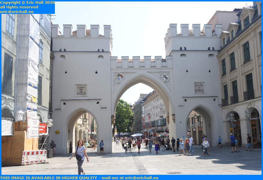
karlstor munich germany eric hallProbably the most impressive building in the Square and one of the most impressive throughout the city is the Karlstor, or Charles’s Gate.

It goes without saying that being an important city in medieval times, there were fortifications here that included a city wall – or maybe I should say “walls” because like most cities back in those days, rapid growth led to several concentric rings of walls to protect the expanding town.

The Karlstor, originally known as the Neuhauser Tor, is one of the very few surviving structures from the sesond generation of city walls erected in the latter part of the 13th Century and was certainly in existence in 1302.

But what we see today isn’t the original. The original was used as a munitions store and in 1857 the munitions exploded, destroying the gate. In the 1860s the gate was built and it’s quite different now from how it used to be.
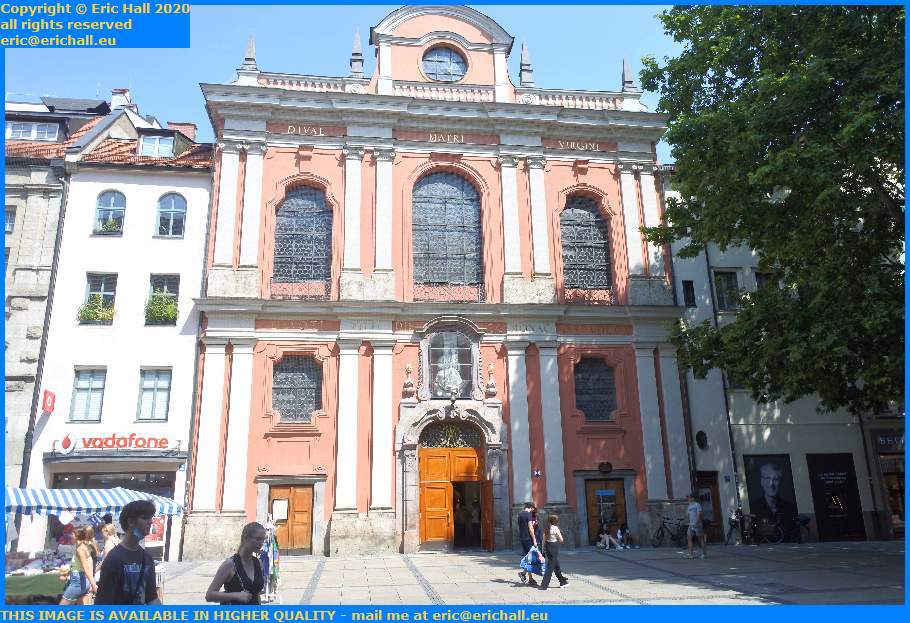
Bürgersaalkirche Marianische Männerkongregation Mariä Verkündigung am Bürgersaal zu München Kapellenstrasse Munich eric hallWe walked on into town down the Neuhauserstrasse, stopping for a cold drink on a terrace where we could admire the Burgersaalkirche on the corner of the Kapellenstrasse.

To give it its full name, which is a bit of a mouthful, it’s the Bürgersaalkirche Marianische Männerkongregation Mariä Verkündigung am Bürgersaal, or “Citizens’ Hall Church of the Men’s Congregation of the Annunciation of Mary at the Citizens’ Hall. It’s a Catholic Church then, which is quite evident as Southern Germany and Bavaria in particular is a Catholic region.

It seems to have been at first a Civic Hall when it was built round about 1710 and became a church in 1778. Within it is the grave of Father Rupert Mayer, a Jesuit priest who was a firm and outspoken opponent of the Nazi regime but was spared execution by virtue of his popularity and also by the fact that he had won the iron Cross for bravery as a regimental chaplain in World War I during which he lost a leg while administering the last rites to soldiers in the Front Line in December 1916.

Isartor munich germany eric hallA little earlier we were at the karlstor at the west end of the city. We have now walked all the way through the centre and are now at the Isartor, the gate near the River Isar.

When the second circle of city walls was built between 1285 and 1337, this gate was added to control entrance to the city. The tower was built first and the two flanking towers later when the moat was created.

Unlike the Karlstor, the Isartor is pretty much as it would have been when completed. It is said that the restoration taken place in the 1830s followed the original plans, as were the repairs after the end of World War II during which it was heavily damaged.
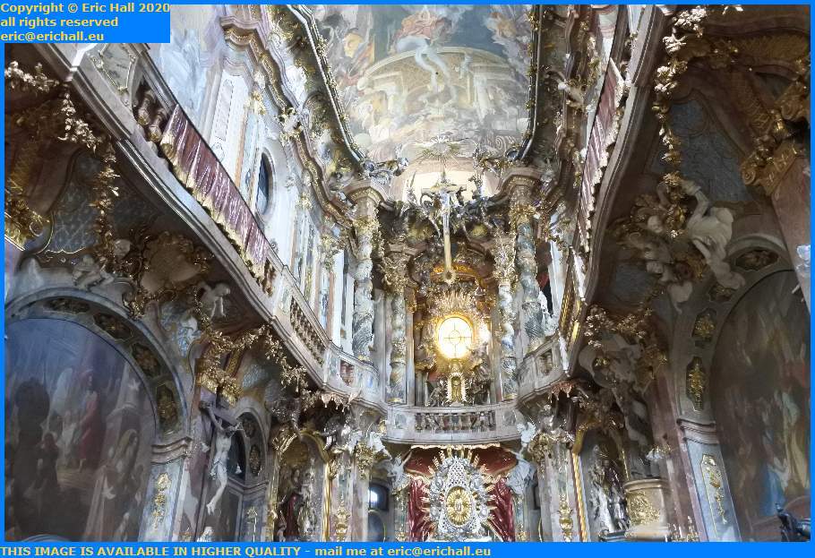
interior Asamkirche church sedlingerstrasse munich germany eric hall
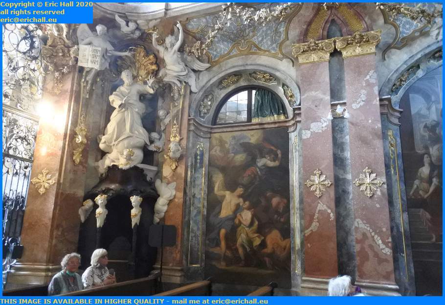
Hans had saved the best until last. It took quite a lot of finding but in the end Hans led me to the Asamkirche.

For this we have to turn the clock back once more to our favourite period of Munich Architecture and head for the years 1733-1746 and the Baroque period.

A couple of brothers, a sculptor named Egim Asam and his painter brother Cosmas wanted their own private church and so they bought four houses in the Sendlingerstrasse. Having done that, they set to work to create a veritable masterpiece to showcase their individual talents.
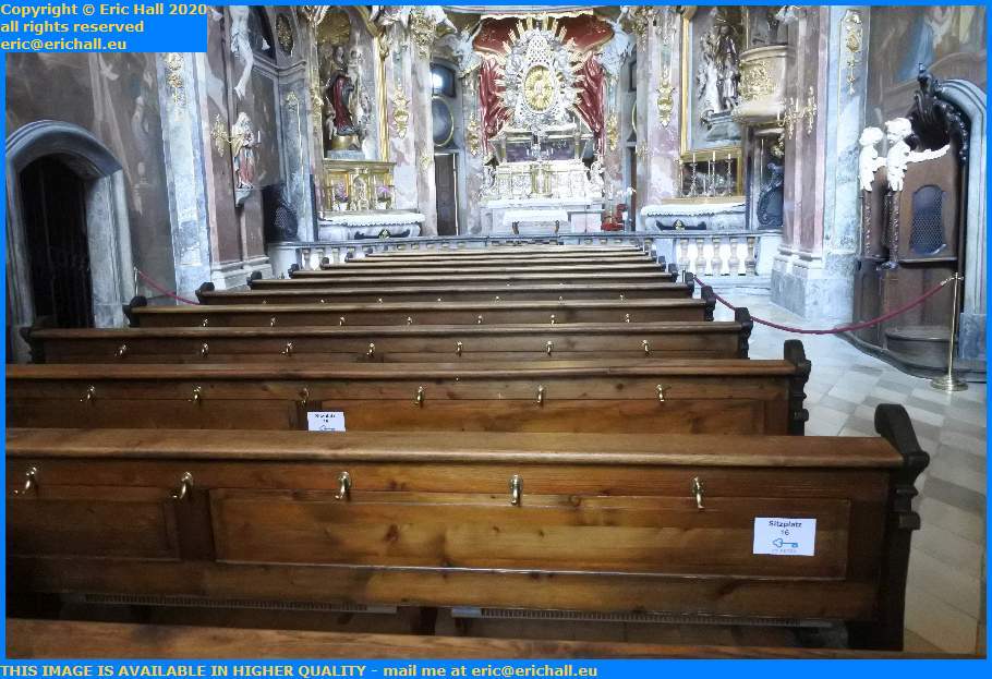
interior Asamkirche church sedlingerstrasse munich germany eric hallAlthough it’s known by the locals as the Asam Church, Its official title is the Church of St Johann Nepumuk.

Because it’s a private church, they didn’t have to conform to any established design and so could pretty much as they pleased. And for that it has some delightful little quirks. You’ll notice (or maybe you won’t) that the altar in the church is to the west, not to the east and Jerusalem which is traditional.

It’s said (and I have to say that I didn’t check) that the altar was so positioned that Egim could see it through the window of his house.
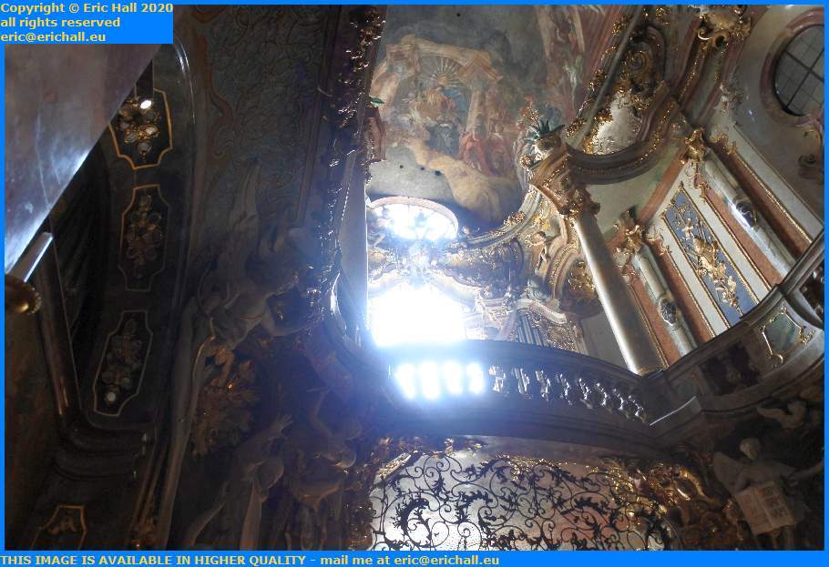
interior Asamkirche church sedlingerstrasse munich germany eric hallAnother little quirk is that it’s symbolically on three levels.

The lower third is for the congegation and is dark and sombre to represent the suffering of the world. The second section is in blue and white and is reserved for the Royal Family of Bavaria and whoever might be the Holy Roman Emperor.

The third part, right up in the roof with all of the wonderful illuminated paintings is reserved specifically for God. The fresco up there is called “the Life of Saint Nepomuk” and is said to be an example of the apogee of the talent of Cosmas Asam.
interior Asamkirche church sedlingerstrasse munich germany eric hallThe story goes that despite it being a private church and built to please the Brothers Asam rather than the church authorities, the neighbours were not very co-operative and insisted that it become a public place of worship and it’s for that reason that we are allowed in today.

And we are lucky to see it too because although damaged during the blitz of Munich in 1944, it survived without suffering very serious damage. Imagine a group of modern-day artists and sculptors trying to reproduce all of this?

In conclusion, I have seen some very opulent churches in my time – many that hardly correspond to the idea of “give all thou hast to the poor”, but this one outdoes them all

Munich Stadtmuseum Sankt-Jakobs-Platz München, Germany eric hallWhile we’d ben on our walk to find the Asam Kirche, we’d seen and interesting building away in the distance so we went to see what it was.

It turns out that it’s the Munich City Museum, in the Sankt Jakobs Platz. Ordinarily we would have gone for a wander around inside but with it being so hot, we’d sat for 15 minutes or so by the fountain just outside to cool down, and by the time we realised what time it was, we had to clear off.

Also in the square was a hideous concrete Brutalist structure that I didn’t photograph, considering that it was of no architectural merit whatever. I found out later that it was the Bavarian Jewish Museum.

Anyway we hurried across town to the Munchener Freiheit where we had arranged to meet Ulli on the way and stopping for a drink and a chat. I like Ulli.
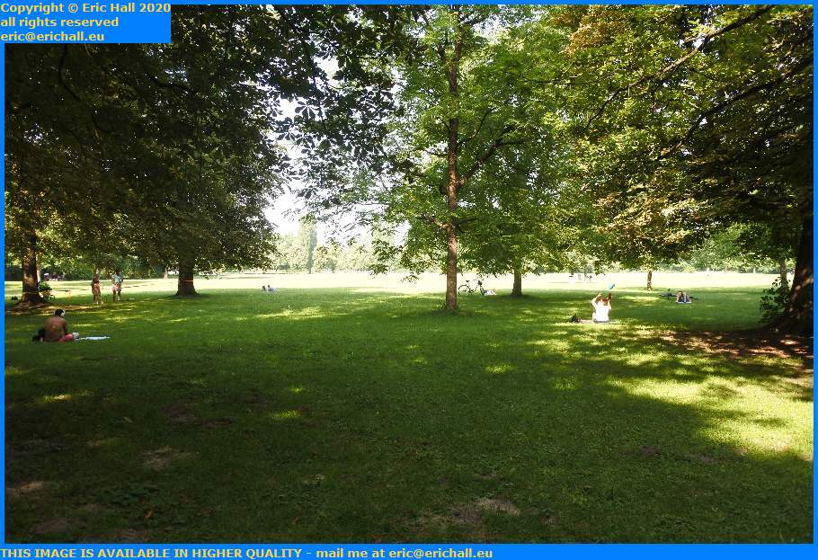
English garden munich germany eric hallHaving done the socialising bit (after all the time that it took to find Ulli too) Hans and I threaded our way through the back streets to the English garden to see the swimmer and the surfers (and I am not making this up, as you have already seen).

We’re back in the days of the unpopular Elector Charles Theodore again. In an attempt to win back some popularity amongst the people after his failed attempt to sell them and their lands to the Emperor of Austria, he decided upon a series of civic imrorvements.

In 1784 he engaged the services of Sir Benjamin Thompson, a Loyalist American who had fled after the American Revolution, to undertake a modernisation of his army, and one of Thompson’s suggestions was a garden.

Although one of the aims was to make a public open space, its real purpose was to train the military in agricultural practices so that they could be loaned out to perform civilian work during times when the Army wasn’t fighting

monopteros english garden munich germany eric hallGradually, the military importance faded and the civilian leisure use of the park increased and under the direction of Friedrich Ludwig von Sckell who assumed responsibility of the Gardens in 1804, the Gardens adopted their current form

This building here is the Monopteros, built on top of an artificial hill that was created using leftover rubble from the renovations of the Royal Palace. There had been a wooden temple nearby but this had weathered away and so in 1836 they erected the hill and this stone temple of 10 columns, designed by Leo von Klenze.

The dome is actually made of copper, although you wouldn’t think so from here.
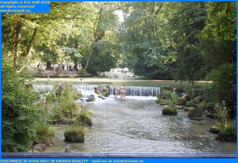
beauties in the schwabinger bach english garden munich germany eric hallIt’s not just the mound that’s artificial in the park. The river that runs through here and the waterfall are too.

The river is called the Eisbach, which means “Ice Stream and runs for about 2 kilometres through the Gardens, and the waterfall was created here in 1815. It’s an ideal spot to come and soak up the shade on a stifling hot day and to admire many of the wonderful sights that nature can create.

Hans and I remained here for quite a while resting out of the sun and contemplating the scenery.
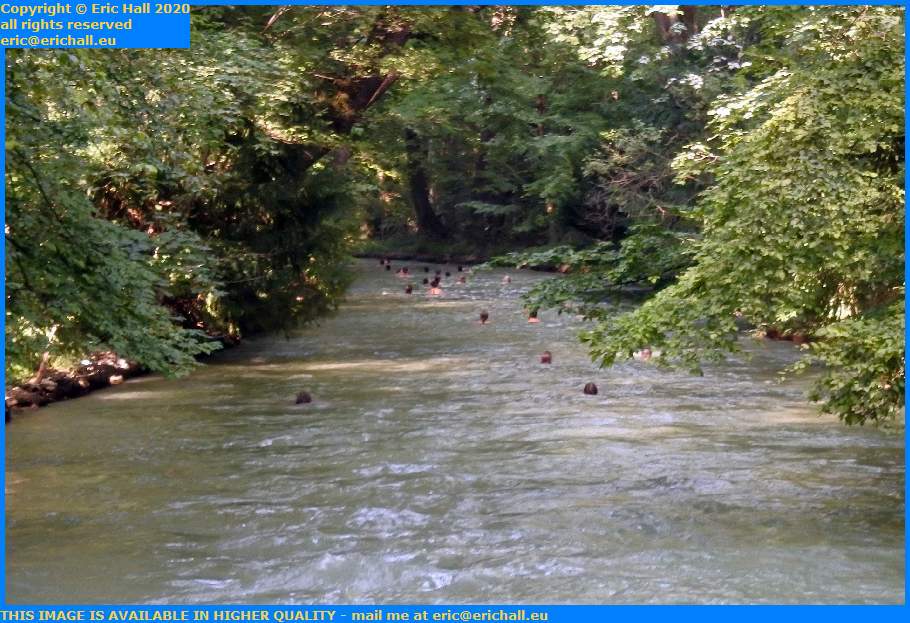
swimmers in the schwabinger bach english garden munich germany eric hallThe Eisbach lives up to its name because it really is cold. I’m told that the temperature doesn’t exceed 15°C although of course I have no intention of finding out for myself.

Officially, swimming isn’t allowed but as the river is about the fastest that I’ve ever witnessed and the police would stand no chance whatever of catching the people who are flouting the law. They might just fish out a few of the bodies because there have been a number off atalities in there, people succumbing to the cold or to the speed of the river.

It’s not for me, of course. If the water isn’t at 37°C I’m not interested at all in it.
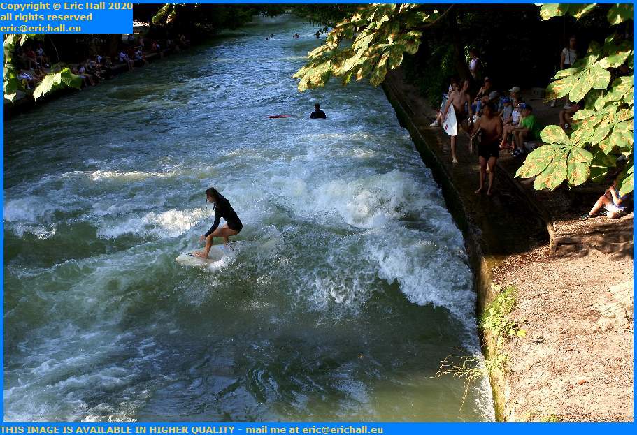
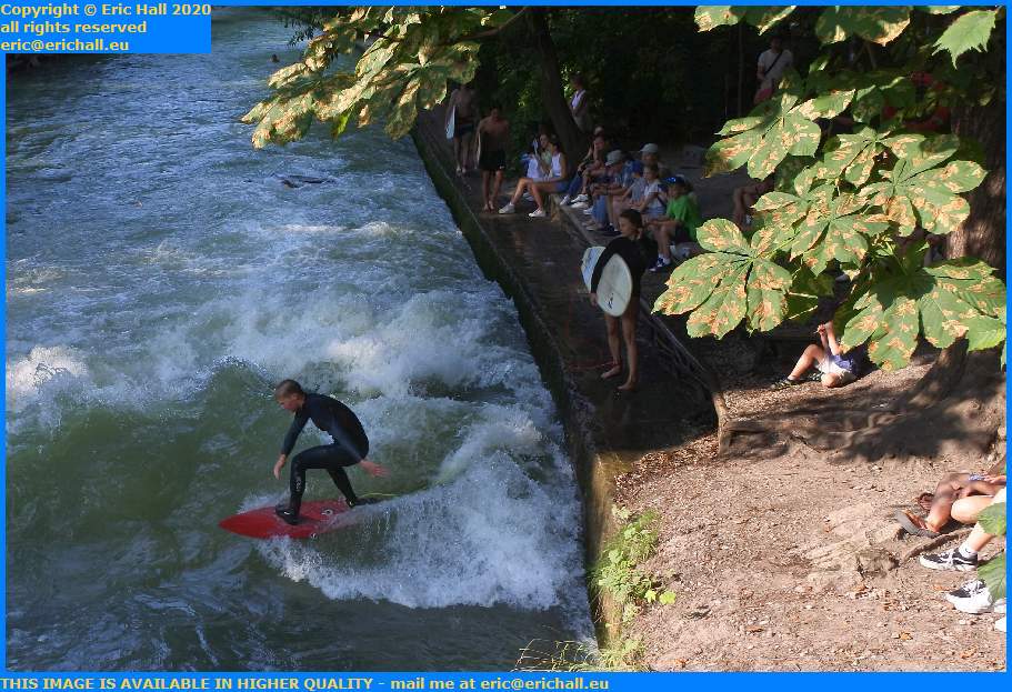
surfers schwabinger bach english garden munich germany eric hallSo we went off to watch the surfers, who you saw earlier.

Surfing first started here in the early 1970s, much to the dismay of the local authorities who tried to stop it. However, various forms of action by interested parties succeeded in reversing the Council’s decision and in 2010 it was afficially permitted and since then, surfers have enhanced the waves by using artificial devices.

We watched them for a while and noticed that they didn’t seem particularly proficient in what they were doing. I suppose that you can’t expect too much in an inland site like this.

Kayakers sometimes have a go at the waves too although they are not made welcome by the surfers and there have been confrontations between the two groups.

Later on, we went back to the music shop to pick up the guitar, and our walk concluded with a trip to the Munchener Freiheit and the Indian café there where I had another bowl of their delicious curry. And then it was time to come home. And hardly surprising – I’d walked 14kms today in the heat.

The guitar is beautiful. It’s an Ibanez softwood acoustic with a beautiful tone and sound, a nice deep bass and a good low action. I’m really pleased with this one. We had a play on it for an hour or so and then one of Hans’s friends phoned us up. Our evening concluded with a session in the beer garden.

Tonight is another night on the really comfortable sofa. And I’m going to make the most of it because there are apparently some Celtic remains in the vicinity that have recently been discovered. Tomorrow’s plan includes a little visit of the site to see what we can see.

And with my interest in that kind of thing, it should be good. My career has been in ruins for quite some considerable time.

Saturday 28th September 2019 – IT’S REALLY EASY …

… to see what’s going on when you have a lead-light, the correct facilities and the correct tools.

We managed to move Strider this morning by climbing underneath with a light and a spanner and manually putting him in neutral. Then I started him up and Darren (who is braver than I ever imagined) climbed back underneath while my foot was on the brake of course, and with the spanner knocked him back into second gear.

Like that, I could drive him into the workshop and straight over the inspection pit where we had a closer look from a much more comfortable position with a proper inspection light.

And sure enough, everything seems to work exactly fine as it should, except that we could see that the plastic clip that (in theory) holds the cable onto the pivot is no longer there.

In principle, we could quite simply wedge the cable in place with some kind of Heath-Robinson invention, but there’s nothing as permanent as a temporary solution, I’ll forget about it, and it will let go when I’m somewhere in the depths of darkest Labrador 300 miles from any kind of help, in the middle of a snowstorm.

May as well do the job properly first as last, and I’m not so desperate for transport right now, so there will be a new gearchange cable and clip coming on Monday.

Last night despite an evening rather later than I had hoped, I had a decent night’s sleep. But still tons of stuff has mysteriously found its way onto the dictaphone during the night. So I wonder what that’s all about.

I didn’t have much time to lounge about though because I had to hitch a lift up to the tyre depot with Rachel who starts work at 08:00.

Just settling down with my morning coffee and my bagel for breakfast when Rosemary rang me up. She’s in the UK right now watching the chaos as the UK sinks beneath the waves. It seems to be quite exciting there right now, but I’m not in a hurry to find out.

We were quite busy today and it wasn’t until about 11:45, 15 minutes to closing time, that we could deal with Strider.

For a change I came home with Darren in the big Chevy lorry, bringing my bass with me. High time I had another run up and down the scales.

The girls all left to go shopping so I made myself some sandwiches and then knuckled down to work.

What I’ve been doing today is to start to add into the blog the missing entries from when I was on board The Good Ship Ve … errr … Ocean Endeavour. I had hoped to wait until I was back home when I could deal with the photos as well, but my fans are clamouring to know what I got up to while I was away and I can no longer resist the pressure.

At the moment I’ve just come back from visiting the Dynjandi waterfall in Iceland and by the skin of my teeth I’ve managed so far to avoid too many faux-pas like treading on the bombe surprise, whistling on board ship or knocking someone base over apex out of a zodiac.

But it’s early days yet and there is plenty of time for me to get into mischief. If you start here and work your way forward, you’ll see how far I’ve come to date.

Another thing that I’ve done is to book my flight in the general direction of homeward. And, sad as it is to say it, my regular hotel in Brussels is booked up so I’m having to go to another disreputable cat-house somewhere.

God help me!

Tea tonight should have been a flatbread pizza but could I ‘eck as like find them. That is, until I was halfway through cooking something else when I put my hand straight on them. They will have to do for another time now.

So now it’s late. Darren is asleep, Hannah is back but the others are still gallivanting about somewhere. And why not? Tomorrow is Sunday, a Day of Rest with the wonderful Taylor Breakfast Brunch that brings visitors from miles around.

High time we had a few luxuries around here.

Monday 26th August 2019 – I DID MY FIRST …

… presentation today on an Adventure Canada ship and I was really pleased.

The subject of maps came up in the discussion and in particular Croker Bay where we were. it’s a huge, long fjord that branches off into two at the head. And so the question was raised. Why isn’t it shown on old maps?

The answer to that is simple.

The fact is that when this area was first surveyed in the mid 19th Century there was a glacier down it, as my Admiralty Charts tell me, and for that reason it was never possible to sail into it and explore it.

But when you see the fjord today, how long, wide and deep it is, it’s astonishing how much ice has actually melted away. Anyone who denies the existence of climate change needs to come here and have a look for themselves.

Last night I had a horrible night. Although I went asleep quite early on, I was awoken by I don’t know what at about 01:30 and that was my lot for the night.

Despite that, I still managed to beat the third alarm and was soon up on deck in the fog and mist. But a little later, we were in luck. We saw a polar bear asleep on a rock just on shore, right by where we were planning to land for Dundas Harbour. It was as if he was waiting for us.

It put the kybosh on the landing of course, but at least we had a good hour’s entertainment before he loped off to the other side, to our alternative landing point. So after a while waiting for him to move off, which he didn’t of course, we found another landing site in the vicinity. But not before a family of seals came along to join in the fun.

We had a cruise in the zodiacs around the bay so that we could at least look at the old Inuit settlement at Morin Point and the mast at Inglefield Hill, and then sailed across the strait to shore.

This new landing place is nothing like as historic or as interesting, but beautiful nevertheless. Probably one of the most beautiful places that I have ever visited. I surprised myself by climbing almost all the way to the top, which was quite an effort. Coming down alongside the waterfall was just as exciting. No-one was more pleased than me to have made it up there.

And the weather was perfect too. When I was here last year we were caught in a blizzaed.

After lunch we went for a cruise in Croker Bay (now that we can these days of course) and saw another polar bear, some walrus, more seals and some arctic geese. We certainly had our money’s worth this afternoon.

Tea was a disaster though yet again. Another one that took hours to come. And then they forgot my dessert. All in all I was waiting for two hours for my meal. I’ve no idea what was going on in the kitchen tonight.

This evening I helped the two young girls on board do a jigsaw and then came down here. Tons of photos to edit right now after today’s effotrts but even though we gain an hour tonight, after last night’s shenanigans I’m too tired to do anything.

So I’m off to bed. See you in the morning.

Wednesday 21st August 2019 – WE GAIN …

… an hour tonight.

Well, we don’t actually. We really gain two hours tomorrow night but seeing as we are not going near any community tomorrow during the day we will put our clocks back one hour tonight and we’ll do the other hour tomorrow night.

And I can’t say that I’m sorry, because I’m exhausted. And for once I had a decent night’s sleep too. Took me a while to drop off but once I was gone I was gone and I remember nothing at all until the alarms went off. I only just beat the third alarm – and by a matter of seconds – too.

It was a late breakfast but I didn’t take advantage because we are now in another fjord hard by Disko Island with the Eqip Sermia glacier at the end of it. Only a small glacier but a very lively one – one of the fastest glaciers in the world apparently.

Too fast in fact, for just as we were unloading the ship a large piece of ice broke away and calved, causing a tidal wave that crashed one of the kayaks against the rocks and damaged it before the crew had time to secure it..

The resultant chaos took ages to sort out and a 09:00 departure was more like 10:30.

We had a good sail around the face of the glacier watching some calving while they prepared a decent landing for us and eventually they were ready for us at the landing site.

An easy landing, and a beautiful environment but due to the earlier mishap not enough time to visit it properly. By the time that I’d had a geology lesson from Marc and a lengthy history chat with Rachel I was struggling to reach the waterfall.

But when I did – drat and double-drat! I’m not sure how many waterfalls I have visited just recently but I don’t recall visiting even one that didn’t have the sun shining directly over the top spoiling the photos. And this one was no different.

For the money that we are paying for this voyage, you would think that the company would have turned the earth around 90 degrees to give us all a sporting chance.

Back on board The Good Ship Ve … errr … Ocean Endeavour we had a barbecue and then I had a shower and washed my expedition clothes. They’ll dry quite quickly. And I … errr … closed my eyes for a second or two (or maybe more.

We had some more lectures (during one of which I fell asleep) and then tea time. I sat with Jerry Kobalenko the explorer and we had a good chat too about all kinds of things, especially diet in the High Arctic.

Another good day for photo editing though. I’m now on 19080785 and just leaving South Pass on my way back to Montana and Winnipeg. So it’s not going as quickly as I would like it. But I’ll get there somehow some day.

Although I’ve a feeling, comparing my screen with a known photo that I took a while ago, that I might have to do all of this editing lark again when I get to a decent screen, whenever that might be.

Only time will tell.

Monday 22nd July 2019 – IT WAS SOMETHING …

… of an easier day for me today, although you might not think so.

Being awake at 03:05 this time (just for a change) and then again a short while before the alarms went off, I did finally manage to fall out of bed and totter straight down into breakfast for 06:30.

Once breakfast was over we had to dash back to our rooms to don our winter clothing because we were off for a very long zodiac trip. And we needed our clothing too because it was to be a very long trip in the cold and wind.

We’ve anchored in Arsuk Fjord and almost at the head of it is a really impressive waterfall. It’s not the highest in Greenland (we have already seen that) and not by a long way either, but the volume of water that pours over it is phenomenal.

On the way there we kept a look-out for wildlife, although our first “sighting” was of a cabin on shore. It looked as if it had been abandoned for a considerable period of time and was in a poor state of repair, but it would make a very nice home for someone who craved solitude. Going to the shops would be an issue, though.

A little farther on, someone on our boat spotted an arctic fox. We all craned our necks and one or two people managed to catch a fleeting glimpse. I wasn’t so lucky unfortunately. But then, someone later explained that an arctic fox was only the same size as a domesticated cat so I don’t feel so bad about not seeing it.

Much more luck later on. Someone called from another zodiac that they had seen a musk-ox on shore, so we all headed that way. After a good deal of searching and scanning, I finally saw it. And it put on quite a performance for us too, gambolling about in a clearing amid the rocks.

But it was strange to see a musk-ox on its own. They are herd animals. And so the consensus thinking was that although it didn’t look much like it, it was possibly a male adolescent that had been ejected from the herd by the dominant male and had yet to establish its own harem

The waterfall was impressive. It was really powerful and the amount of water cascading down from it was enormous. It’s all melt-water off the Greenland ice-cap so it gives you some idea of what’s going on in the interior of Greenland and how badly climate change is affecting the place.

Some of the zodiacs went quite close to the fall, but our driver was somewhat nervous by the looks of things and wasn’t too keen to go too close.

On the way back we were waylaid by another zodiac. Our driver is apparently the expedition’s ornithologist and the others had seen some birds that needed to be identified.

Not that this kind of thing would interest me. As I have said before, there may be several interesting species of bird in a Greenland fjord but not a single one of any type that I would be interested in watching.

They had repositioned The Good Ship Ve … errr Ocean Endeavour while we had been away and so it was a long – and I do mean long – ride back to where we were supposed to go. In fact all the way up to the end of the fjord, past the Danish navy’s naval base at Kangilinnguit and then along another arm, following the only road in Greenland that connects two communities together.

The reason for the naval base is that not too far away (although it seems like miles when you are in a cold and wet zodiac in a freezing fog) was the world’s only cryolite quarry, in the abandoned town of Ivittuut.

While looking for silver (which they found, but not in sufficient quantities to make it worthwhile) at the end of the 18th Century they stumbled across an outcrop of cryolite. At first is was used as an additive to salt (the Pennsylvania Salt Company was the chief purchaser) and pottery but later they discovered that added to bauxite, it reduced considerably the energy needed to smelt aluminium.

The Danes worked it for a while and then the Americans took over, but when Denmark was occupied by the Nazis there was a fear that the mine would fall into their hands. Thus a Canadian and later an American detachment of troops was sent in to protect it. The naval base was built to repel any possibility of a German raider or invasion party.

The mine was exhausted and abandoned in 1984, and cryolite became the first of the earth’s minerals to be commercially exhausted. But by then scientists had succeeded in making it in a laboratory.

The whole place looks as if it’s abandoned now and it’s really sad, with all of the equipment lying around. Even a half-dismantled Bedford lorry, a 6-cylinder diesel of the 1970s is just lying there.

I had a good explore around and found the cemetery, full of graves of workmen who must have died in mining accidents (this must have been a dangerous place to work) as well as the graves of a couple of young children. There were also several plaques relating to people lost in shipwrecks in the vicinity.

We did find several examples of habitation though. Two or three houses looked as if they were still occupied, there was a garden growing potatoes and lettuce and there was an array of solar panels. These seemed to be powering the equipment in a Seismology reading station carved into the side of one of the rocks.

By the way, as a matter of interest, this is not the first time that the town had been abandoned. Although it is very well-known that the Norse had an Eastern Settlement (Brattahlid and its environs) and a Western Settlement (near Nuuk) here in Greenland, there was also a much less well-known Middle Settlement too, of about 20 homesteads. Some excavations on the site of Ivittuut have revealed Norse ruins that would correspond with what is known about part of the site of the Middle Settlement.

Back on board ship it was lunchtime and I was good and ready for it. And much to our surprise there was free time – the first of the trip – afterwards. I went down to my cabin intending to do all sorts of things but ended up under the covers for well over two hours. And I wasn’t sorry either.

Later there was an exhibition of Admiralty charts of the High Arctic and, even better, the guy presenting the exhibition had them in *.pdf format and offered to copy them to anyone who wanted them. Ever since then, I’ve been armed with a memory stick for the next time that I bump into him.

Tea tonight was in the company of several other people. I always enjoy people-watching and there was plenty to see tonight that caught my interest.

But now I might go for an early night. There’s a lie in (of sorts) tomorrow so there’s no urgency but it will still be nice to take advantage of whatever is available to help me catch up with my sleep.

Thursday 18th July 2019 – I REALLY DO WONDER …

… when I’m actually going to have a really good night’s sleep because last night was yet another depressing night as far as I’m concerned. Once more I was awake at some kind of silly time and had to go to the bathroom. Round about 04:00 I suppose.

After that, I managed to go back to sleep again for an hour and a half or so but that was my lot. Mind you, I wasn’t able to pull myself out of bed at any reasonable time, beating the third alarm call by a mere matter of minutes.

We were entering Prins Christians Sund at the foot of Greenland (which means that we won’t be going round Cape Farewell) so I watched the manoeuvres. It’s nature’s answer to the Corinth Canal and it is magnificent. In places no more than 500 metres wide and bordered by cliffs that could be as much as 2200 feet.

After breakfast every one of us was up on deck in the magnificent weather watching the spectacular scenery. And we didn’t know where to look because everywhere was so wonderful. And when you did see something that you would describe as “the most beautiful view that I have ever seen. I won’t ever see anything this beautiful for as long as I live” then 5 minutes later, you would see something even more so.

We had cliffs, rocks, glaciers, icebergs, waterfalls, a seal, a tiny village and a few men in speedboats checking fishing traps. A kayaker and a yacht too made it quite a day. I even picked up a wi-fi signal so I had to put my phone onto aeroplane mode before I started to rack up a large bill.

But just my luck. There were two tutorials that I wanted to attend – a Greenlandic language class and the photography group. And as fate would have it as usual, they were both at the same time. I ended up with the photographers and we all had a really good time.

Our expedition leader eventually found a place for us to go ashore, but not without help from a local. And it was the fifth one that he had tried.

All the others were completely unsuitable for one reason or other, and as Jane in a zodiac was pondering what to do and where to go, a very vocal local yokel in a fishing boat came by to see what was the problem.

He listened to Jane for a couple of minutes and then pointed over to a rocky shelf in the distance. “Why don’t you go over there?”.

Landing on this rocky ledge was something of a challenge and then there was a hell of a climb up to anywhere that had a pretence of being level.

But it was well worth the effort in the end. Strawberry MooseStrawberry Moose came with me and he enjoyed himself, being photographed in several places. And we had wild flowers, tiny trees and a waterfall.

The waterfall was spectacular. Definitely the highlight of the walk as far as I was concerned. It fell all the way down in a gentle gradient from a hanging valley over various steps. At one point it had carved a deep channel into the granite bedrock but a flood had brought along a huge boulder that had dammed the channel so the water was cascading around it.

By the time that I returned to the ship I was exhausted. So a hot shower and a clothes wash, followed by a mug of tea and a good relax soon warmed me up.

At the evening meal they were looking for volunteers for a Francophone table so Rosemary and I joined up. Poor Rosemary – it’s the first time she’s really heard a Québecois accent and did not find it easy to come to terms with the vocabulary and sentence construction.

This evening I was out on deck for a while and I’ve now made it 152 photos for the day – a new record I reckon. But it was well worth the effort.

We have now left the shelter of the fjord and are now in the open sea on the west coast of Greenland, and the ship is swaying about rather more than somewhat in the waves and wind. So I’m off to bed and I hope that I can finally have a decent night’s sleep.

I need it.

Thursday 11th July 2019 – WE’VE HAD …

… a really busy day today. And I do mean busy.

Last night I had a very mixed night – I went to bed early, fell asleep watching a film, managed to awaken in time to switch everything off and go back to sleep.

Nevertheless i was awake enough at about 04:00 and again at 05:50 but hardly in any mood to leave the bed except for the usual reasons that any man of my age will know.

Once the alarms all went off (I found my phone last night under a couple of pieces of paper as I was tidying up) I had a struggle to leave my stinking pit, but once on deck I found that we were pulling in to the port of Seydisfjordur.

And we weren’t alone either, for there was a big car ferry, the MS Norrona, moored alongside. This is the ferry that goes to the Faroe Islands and Denmark and how I would have liked to have gone for a ride on that in order to come across the North Sea.

Mind you, I would have had a few logistics problems as it’s a once-a-week only sailing. And then I would have to get to Reykjavik. But there were hordes of cars of all kinds of European countries lined up ready to board, and streams of ditto disembarking all over the place. There were even several British vehicles.

After Breakfast I came back to my room where I … errr … had a little rest and almost missed my call at 08:40.

Jessie led us on a photography hike to the waterfall where we climbed up to the top of the path and took a pile of photos. The day had started off cold but by the time that I was on top I had divested myself of almost everything.

Back into town afterwards, where on the way I stumbled across an ancient Scandinavian vehicle. No idea what it is so I shall have to do some research. But while I was doing that, the ferry loaded up and sailed out. “Gone and never called me mother” as they might have said in “East Lynne”.

We photographed the Rainbow Walk and a few other places in the town centre and then off to the church.

On the way back to the ship I came across the local scrapyard where I spent a very pleasant half hour poking around the ruins and relics. Nothing all that exciting or old unfortunately. But while I was continuing on to the ship, another cruise ship pulled in and tied up to where the ferry had been.

One mug of tea later we were back on shore. Rosemary had missed the church so I took her there, only to find that it had closed for lunch. So we went for a walk and a visit to a couple of arty places. But by now the wind had increased and it was going bitterly cold. A hanging cloud was rolling up the fjord making things worse.

Back yet again at the ship and I fetched my packed lunch as we were off on the bus.

First stop was at an archaeological site at Thorunnarstadir where an old Norse church had been discovered. We had a good look around it. They had come across and excavated a graveyard there, of which half of the bodies had been interred in the foetal position indicating a pagan burial, but others in the more usual Christian style. Iceland was Christianised at 1000AD so the church and the Christian burials would date from some time round about then.

But it’s interesting to speculate about what might have been on the site prior to the church that led to it being chosen as a site for pagan burials. There was a Norse village here that has yet to be properly investigated, and interestingly, a modern village had sprung up in the immediate vicinity but had been abandoned comparatively recently, in the last 50 or so years.

While they were excavating the church they unearthed some relics and these are now in the museum at Rejkjavik.

On we went to the Skalanes nature reserve at the edge of the fjord. We were given a discussion on lupins, how they were planted to anchor and fertilise the soil but how they have gone on the rampage and found to be most pervasive – the country is covered in them. There were plenty of rhubarb and angelica growing here in the neighbourhood.

Dodging the terns, we went to a cliff site to see the nesting birds but I was more interested in the geological formations. And a gyrfalcon put in an appearance but unfortunately I wasn’t quick enough with the camera.

There was a pile of feathers lying around and it was explained to us that a short while ago a Skua had caught a fulmar, drowned it to kill it, and then dragged the carcass onshore for a feast. This had all taken place in front of a crowd of onlookers.

The road out there was narrow and treacherous and involved driving through several rough, rocky fords where there were several impressive waterfalls. It was a good job that we had a 4 wheel drive bus.

Tea was a barbecue and I almost missed it, having a shower and a clothes wash, followed by yet another relax.

We had a chat afterwards, including a young American boy, and now I’m off for an early night. I need it too. There won’t be any photography tonight because we are now encased in an overwhelmingly thick fog.

Saturday 6th July 2019 – HAVING SAID …

… last night that it was bound to rain before long, I can say that it didn’t at all today, which is always very nice.

And for a change, I was up and about early yet again. Straight after the second alarm went off. That gave me a good 45 minutes to bash away at what I wanted to do before breakfast, which is something that I like to do otherwise tend up falling behind.

After breakfast, we had to get ready as we were going off on a zodiac cruise to shore and a town called Rif. There’s a strange guy there who runs a theatre and hostel, and he was to entertain us for half an hour.

The ride in was good, not too rough so we weren’t soaked. And just for a change, we were first off out of the blocks. That doesn’t happen every time.

The guy there gave us a talk and a few songs, and I talked to one of the residents, a girl called Sonia.

But it was the wrong time of year to be visiting Rif as the centre of the village is well-known for its colony of nesting terns and right now, the eggs have only just hatched so the birds were quite aggressive. Several of us were dive-bombed and received little gifts from the heavens, but one or two of the people where physically attacked by the birds and injuries were suffered.

There was a church in the vicinity that I had wanted to see but the aggressive birds put quite a few areas out of bounds. For the same reason it wasn’t recommended to walk to the town of Hellisandur either.

A waterfall , the Svodufoss, 4kms away was a very good substitute so some of us went there instead. But I don’t know by what route they calculated the 4kms but my fitbit made the round trip 12.1 kms – a bit of a difference and I could certainly feel it.

And it’s as well that I hadn’t had much to drink. After all, you can’t go behind a bush in Iceland because there are no bushes to go behind.

Of course I was not alone out there .Strawberry Moose came with me and took full advantage of the situation, being photographed in several exciting places.

Back on the zodiac and it was lunchtime. I was good and ready for it too, having walked all of that way in just a morning.

After lunch I went and had a shower and washed my clothes. It’s been a couple of days and I bet that they could pick me up on the ship’s radar. And then we had a series of lectures on different subjects.

One of our lectures, on the geology of Iceland, was interrupted. A blue whale had been observed off the port bow so we abandoned the lecture – another “Gold Strike at Bear Creek” moment as in Carry On Cowboy. We were in luck too because there were two of them and they gave us quite a performance.

After tea we sailed past a series of very high cliffs at a place called Latrabjarg. And very impressive they were too. We weren’t the only ones to think so either because right at the point of land (it’s the extreme western edge of Iceland) there was a scenic viewpoint with quite a few cars and people admiring the view.

There was a rep from Nikon there too offering us a trial of various equipment. She had a very high quality 28-300mm lens amongst her hire equipment so I have borrowed that for a few days. I’m interested to see how that shapes up, so I’ll let you know in due course.

Now I have a few things to tidy off and then I might go to have an early night. The sunset might be a good one again but I really need to catch up with my sleep.

Tuesday 29th September 2015 – THAT WAS A NICE …

… night too. despite the rainstorm that we had, and despite having to leave my stinking pit twice due to reasons that any man of my age will know, and despite me having a neighbour arrive at some point, I was really comfortable in my little bed. So much so that I was awake and out of the bed long before the alarm went off.

And it was warm (well, comparatively warm), to such an extent that I stood outside Strider, lowered down the tailgate and made myself a coffee in the open air. And it was here that I engaged my neighbour in conversation.

He and his wife were from Newfoundland and had a 1999 Chevy pick-up with a camper back. They’d come round from Baie Comeau and were telling me about the road. We discussed fuel consumption too, and he dismayed me by saying that he could do from Goose Bay to Blanc Sablon on just one tank of fuel. Mind you, it cheered me up to a certain degree when he said that he had a 135-litre tank. That compares to Strider’s 70 litres or something. And how I wish I had that size of fuel tank. But of course I will settle for an improved fuel consumption.

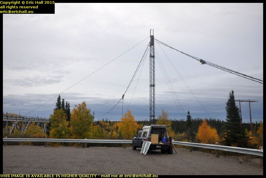
strider cable car remains churchill falls rest area trans labrador highway canadaHe knows the area here quite well and he drew my attention to the structure under which Strider was parked.

According to him, these are the remains of a cable car. Before the highway – and the bridge – were built, they still needed to pass stuff over the river to whatever settlement was over on the other side and to start the construction of the plant and cabins that formed the basis of the town of Churchill Falls.

if what he says is true, then it can’t be true about the cable car at North West River being the only one in Labrador. But we shall see what they mean by all of this.

churchill falls river gorge trans labrador highway canadaAnother thing that he knew was the footpath that led to the best view possible of the falls, although it’s not possible to see the falls in all their glory – the best views are just inaccessible.

It’s quite a hike, although not a difficult one, but it’s well-worth the effort. I was pleased to reach the end pf the path because there’s a splendid view of the gorge itself from there. I’ve never seen a view quite like this – the Grand Canyon excepted, of course Apparently, I’m 240 feet up just here, according to the Neighbour from Newfoundland.

waterfall churchill falls trans labrador highway canadaHe was right about the view of the falls not being spectacular. The falls themselves are spectacular, of course, but you just can’t reach the immediate vicinity of them, or found a spec directly opposite to take a good photo.

In any case, the falls themselves aren’t anything like as spectacular as they used to be. They really were impressive back years ago but the river was diverted to provided the drop for the hydro-electric power plant and so only a small fraction of the water falls over the waterfalls today.

crashed pick up trans labrador highway canadaMy neighbour also told me of a crashed vehicle that was lying on its roof further on down the road.

And so I kept my eyes peeled, and I found this one here. It’s not on its roof of course but it hasn’t half been knocked about. This gives you yet another clue about the state of the road around here. As for the yellow tape that’s around it, that’s Police marking tape. It shows that the Police have inspected the vehicle, and that it’s sealed off to warn people not to enter.

crazy quebec lorries overtaking me trans labrador highway canadaBut it’s not by any means the state of the road that’s responsible for may of the accidents – it’s the state of the drivers.

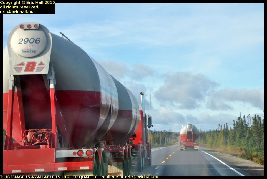
The speed limit along the Trans-Labrador Highway is 80 kph and I have the speed limiter on Strider set at just 80 kph. But everything on the Highway is going past me like I’m standing still, including these two lorries. And these aren’t just simple artics either, these are two of those road-trains pulling two trailers and these road trains are notoriously unstable at the best of times on the best of roads.

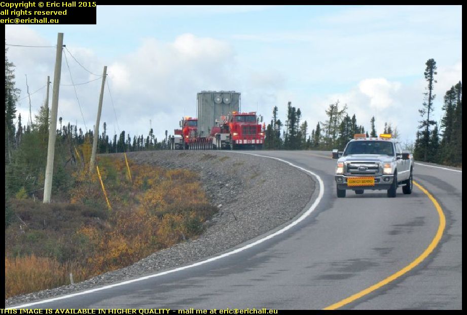
double load twin tractor units trans labrador highway canadaAnd talking of unusual loads on the road (although road trains aren’t by any means unusual) how about this one? We started off with a police car in front flagging down the traffic and telling us to move right off the edge of the road. And then this came along.

This is some kind of huge electrical unit, and it has two lorries in charge of it. There’s one pulling it, and the one behind it is pushing it along. The purpose of the pick-up in front is to clear the road because with the configuration that this unit has, it can’t even take a bend like this and keep on its own side of the road. It took up most of the road.

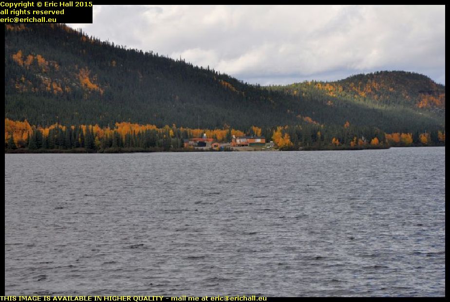
cottages near labrador city trans labrador highway canadaI’ve been noticing, as I’m sure that I have already told you, that there’s some kind of urbanisation taking place along the Trans-Labrador Highway. This is the lake that we’ve all seen before, about 40 kms out of Labrador City, when we came by here on previous occasions.

There was a cottage there previously, but now we seem to have a couple of other cottage down by the lakeshore. And this is the kind of place where I would like to live, with this really gorgeous backdrop and a really beaautiful view of the lake in front.

iron ore mine wabush trans labrador highway canadaLast year when we were in Wabush, we heard all kinds of sories about the iron ore mine closing down and how people were going to desert the town in droves.

I made a diversion into the town to see what was going on in here, and as you can see, the buildings of the iron ore mine are still there standing. And furthermore, I didn’t see anything that suggested to me that people were deserting in droves. There were no more houses up for sale or to let than you would expect to see anywhere else.

But of course, that’s not to say that things won’t be different in another year’s time.

I stopped off at Tim Horton’s for the internet and a coffee, and then I went on to Fermont, in Quebec, for fuel as it’s the last station before the Northern Quebec wilderness.

I also went to look in the “boomerang”. We saw a photo of it last year – it’s the big, high, long building that has a huge shopping gallery on the ground floor and a pile of apartments up above. I’ve never been in there before (except to sound out the hotel in 2010) and so I was curious to see what it was like.

It’s certainly a labyrinth on the ground floor, but what surprised me was that a good proportion – probably 30% or 40% – of the shops were closed down and empty. At least the Co-op food store was open, which is more than can be said for the one in Labrador City which seems to have closed down since last year.

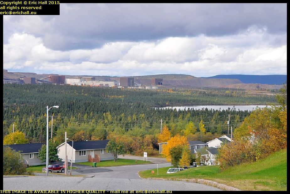
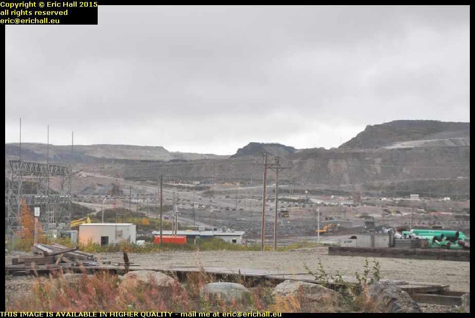
mont wright trans labrador highway 138 quebec canadaThe road out of Fermont into the Wilderness goes past Mont Wright and the Arcelor Mittal iron mine, what is said to be the largest iron ore mine in the world, and it’s the reason for the town of Fermont being built – to house the workers. Mont Wright was once a mountain, but so much iron ore has been extracted that it’s fast becoming a hole in the ground.

The mine tailings stretch for miles, and from here up on a ridge at the back you can see some of the workings. And I do mean “some” because they also stretch for miles. It’s really impressive from that point of view, but we saw last year what has happened at Gagnon, another huge iron ore mine. When that was exhausted, it was simply abandoned and is now an environmental disaster.

trans labrador highway 138 quebec canadaAnd now, from the beautiful morning that we had today, we have now descended into a dreadful and miserably wet evening up here.

We’re having wind, fog and squalls of rain and although you can’t see it, we are back on the dirt road. And a miserable wet and muddy dirt road it is too, with very little sign (if anything) of any improvement to match the major work that has taken place on the Labrador side of the border.

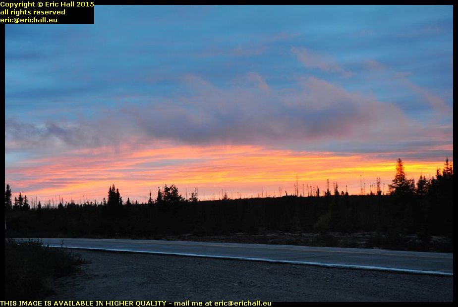
beautiful sunset red sky sub arctic tundra trans labrador highway 138 quebec canadaI’ve found a place to park for tonight. It’s in a lay-by and I’ve dug myself in in behind one of the emergency telephones, with a lorry to keep me company through the night – although he didn’t stay for long.

And the weather seems at last to be improving. There’s a beautiful red sky right now, and so that might promise well for the morning (at least I hope so) but it’s cold, so I’m going to snuggle myself down in my sleeping bag and keep warm like that.

Monday 12th September 2011 – THE FUNDY SHORE

After I pleasant day at Colleen’s, I was back on the road once more

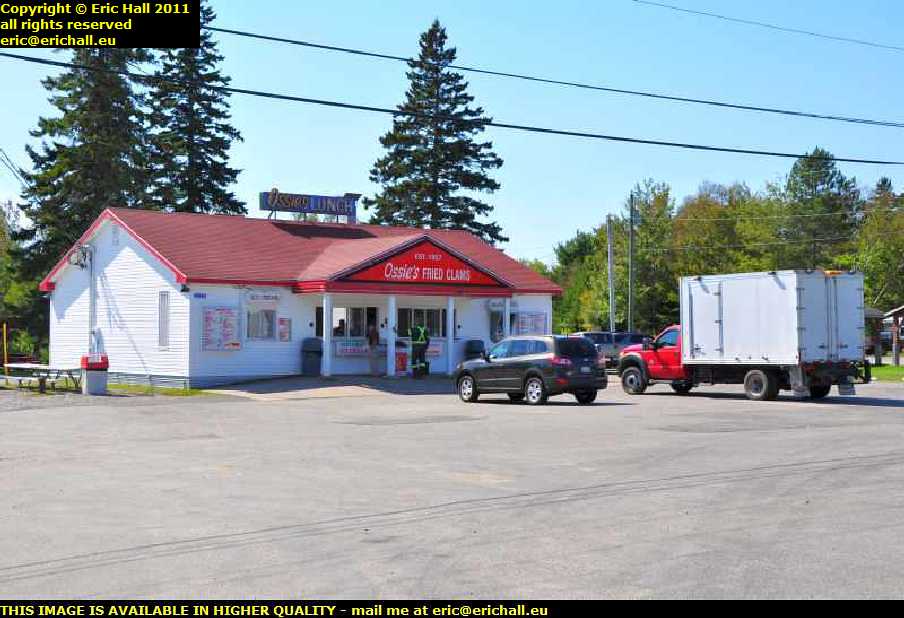
ossies fried clams southern new brunswick canadaBut I didn’t get far. It was lunchtime and I found a fish and chip shop.

And this place is noteworthy for two reasons

  1. it sold real chips. Nice proper lumps of potatoes, not these horrible matchstick things
  2. it was the first place that I have ever encountered in North America that had real malt vinegar on offer.

And they were delicious too. And it was really nice sitting outside in the sun.

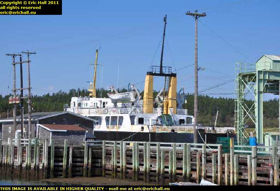
blacks harbour ferry terminal grand manan island southern new brunswick canadaFirst stop this afternoon was at Black’s Harbour where the ferry goes over to Grand Manan Island. And look what’s parked up over there. I’m sure that it’s the ferry that was under repair in Pictou last October when we there there.

And as a matter of fact, she is. It appears that there are two ships that ply across the waters, but only one in winter. And last winter she was laid up as her replacement was due in the spring. However the arrival of her replacement was rather late, and then the other one was involved in an accident back in May, so she was pressed back into service.

Her ultimate destination seems to be hauling gravel for a company in Quebec – the usual fate of many old ferries out here.

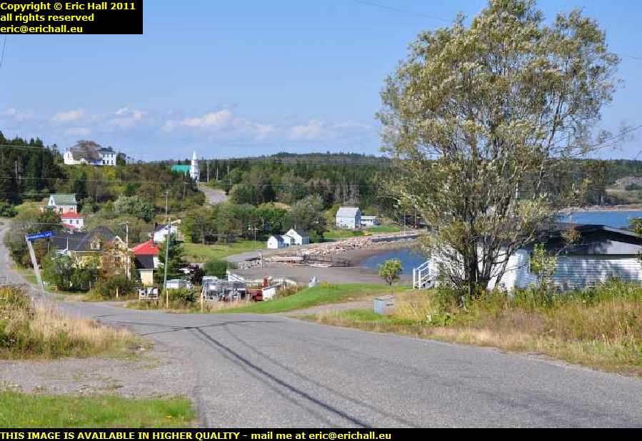
lighthouse road beaver harbour southern new brunswick canadaWhenever you see a road called “lighthouse road”, that’s a cue for a deviation – or, at least, it is in my case.

And I’m glad that I came down this road too because some of the scenery is magnificent. According to the church in the distance, this area here is called Beaver Harbour and if so, that’s an old Quaker settlement where a bunch of United Empire Loyalists came to settle.

And you can see why they came to settle here, cant you?

The road to the lighthouse was all closed off so I couldn’t go down there, but a thing like that isn’t likely to put me off.

drews head lighthouse beaver harbour southern new brunswick canadaWhere there’s a will there are relatives, and so here I am round on the next headland down with a telephoto lens.

It’s Drews Head lighthouse, so I’m told, there has been a lighthouse on here since as recently as January 1876 although this is not the original. It was replaced by a skeletal tower-type of construction in the late 1960s and the fibreglass skin that you can see dates from 1984.

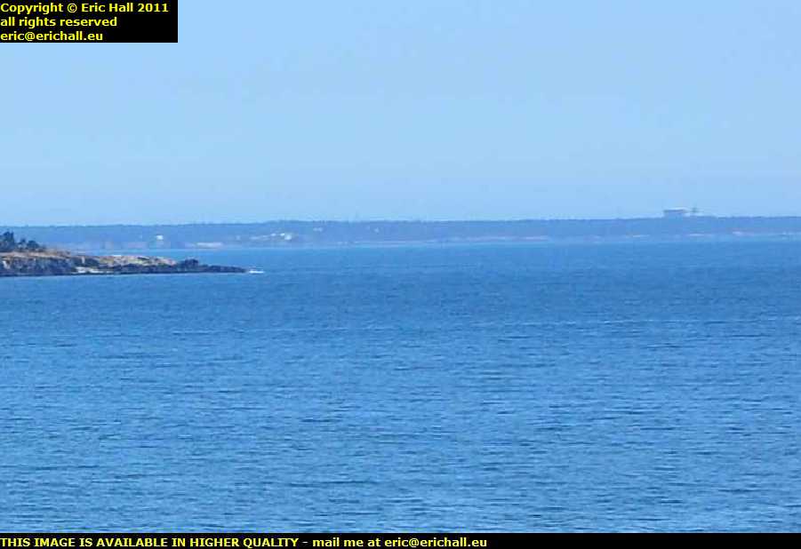
point lepreau nuclear power station southern new brunswick canadaWhat we see right out there is the nuclear power station situated out on Point Lepreau. It’s the only nuclear power station in Atlantic Canada and is something else that was quite controversial in New Brunswick.

After years of debate, the New Brunswick Prime Minister Richard Hatfield announced that it was going to be built, regardless of whatever conclusions an Environmental Assessment committee reached. It was built in the early 1980s and cost three times the estimated amount.

It’s suffered all kinds of problems caused by, amongst other things, poor maintenance and employee sabotage, and there has been a variety of work-related accidents and illnesses. An 18 month overhaul, started in March 2008, took four and a half years to complete.

I went out there for a drive around to see what I could see, but it’s hidden in a forest so you can’t see it from close up.

point lepreau river waterfall southern new brunswick canadaInstead, I went off to see if I could find the famous waterfall on the Lepreau River.

The river is only about 30 kms long but has quite a descent over that distance, culminating in a drop of about 6 metres over this granite ledge.

Below the falls is the tidal limit of the Bay of Fundy and on the incoming tide you’ll find salt water down there. In fact, you can’t see it in this photo but the tide is coming in as I’m standing here.

island view saint motel john new brunswick canadaWhen I was here ten years ago, I arrived after dark and left before light so I didn’t take a photo of my motel that night.

So here we are. This is the Island View motel where I stayed, on top of a hill to the south of the city of Saint John. I seem to remember that there wasn’t that much to write about this motel, but I don’t remember criticising the price either so it must have been a reasonable deal.

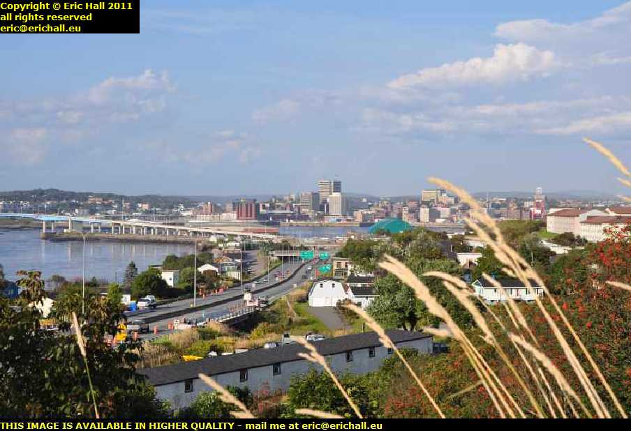
saint john new brunswick canadaThere’s a convenient hill just a little way around the corner and so I wandered off to see what I could see.

And sure enough, there’s a beautiful view down the river towards the city of Saint John (and you mustn’t forget to always write the name in full – that’s quite important).

You’ll notice all of the modern skyscrapers there. Saint John is the second-largest city in Atlantic Canada (after Halifax) and also one of the wealthiest

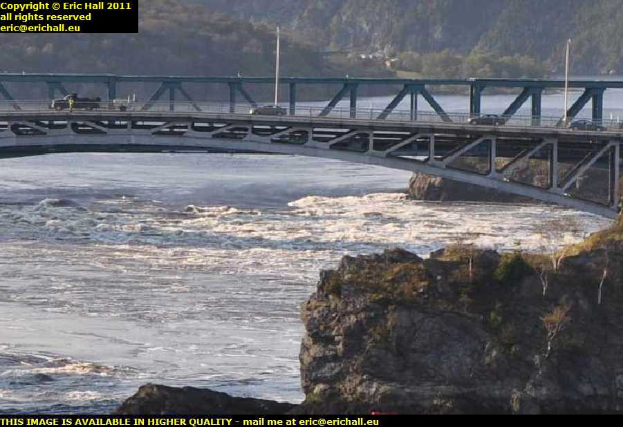
reversing falls saint john new brunswick canadaI can’t believe that I’ve managed to time my arrival so badly – when the tide is at mid-point.

Over there are the Reversing Falls – at low tide the level of the tide is about 4 metres below the level of the river and at high tide, it’s about 4 metres higher. Consequently, at either high or low tide, you have a spectacular spectacle right underneath the bridge.

business sector saint john new brunswick canadaI took thousands of photos here at Saint John, and one day I’ll post them all somewhere for you to see.

You’ll remember just now that I posted a photo of the city taken from distance, and showed you the tall modern buildings on the skyline. And so here, right in the centre of the city, we can have a view of them from closer up.

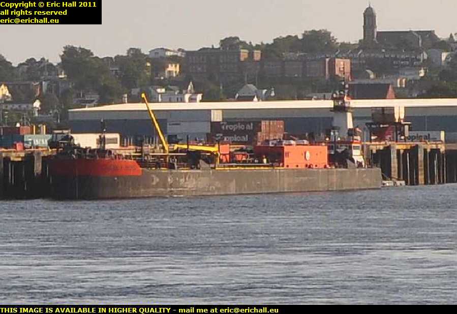
tropical containers saint john new brunswick canadaWith there being water around, there are bound to be ships. And I’m not disappointed either because this is a huge harbour and there are dozens about.

However, never mind the ship for the moment – take a look beyond it at those shipping containers with the word TROPICAL written on them? They are, would you believe, going to feature in our story in a few days’ time.

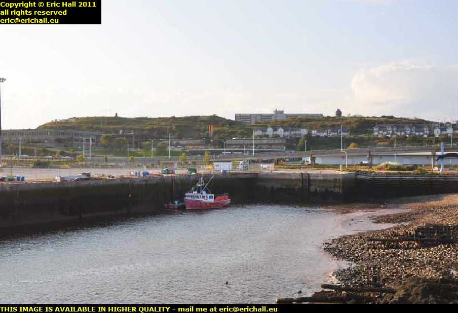
saint john new brunswick canadaBut I hope that you aren’t expecting to see anything really historic in the city because, beautiful as it might be from this perspective on the waterfront, there’s very little in the city dating from before 1877

In that year, there was, for the benefit of those of you who know very little about the history of Canada, a devastating fire raged through the city and destroyed 1612 properties and caused $28,000,000 of damages.

Not like the fire that raged through Bentilee in Stoke on Trent, destroying 1612 houses and causing £30 worth of improvements.

Saint John was in the front line during the disputes with the USA. In the early days, the border between Canada and the USA had not been resolved, and the USA was claiming as far up the coast as the mouth of the Saint John River.

fort howe saint john new brunswick canadaOf course, Britain was having none of that and the mouth of the river, especially on the shore, was quite heavily fortified.

This is Fort Howe, built during the War of American Independence following the Siege of Saint John in 1777, the “Howe” being the Commander of the British forces in North America at the time. It has the distinction of being the first site in Canada to be designated a National Historic Park.

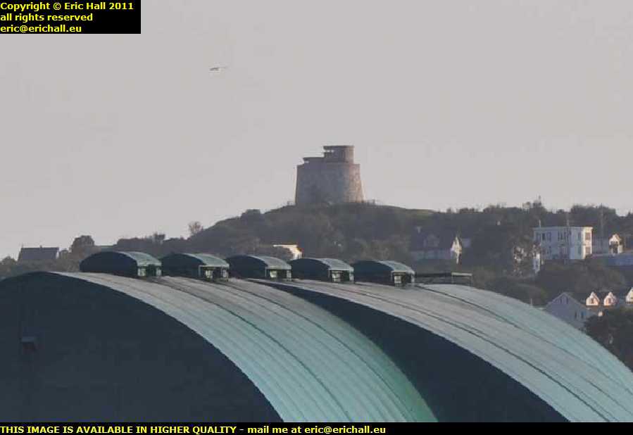
carleton martello tower saint john new brunswick canadaWay over there in the distance (thanks to the zoom lens) is the Carleton Martello tower, one of only 9 now remaining in Canada.

This dates back to the War of 1812 and was built to guard the entrance to the harbour. It was in use during World War II as an anti-aircraft gun tower (the Canadian Government had more faith in the Luftwaffe’s technical abilities than the Luftwaffe did) and observation post, and during World War I had been a prison for deserters from the Canadian Army.

old city market saint john new brunswick canadaI did say that Saint John was one of the wealthiest cities in Atlantic Canada, and you can tell that by looking at some of the buildings around here.

This is the old city market, situated on Charlotte Street. and dates from 1876. It’s the umpteenth Market Hall in the city, and regular readers of this rubbish don’t need to be told what happened to the others.

The building deteriorated considerably after World War II but underwent a major renovation between 1987 and 1990.

trinity anglican church saint john new brunswick canadaChurches are always a good indication of the wealth of any community, and no-one is going to be disappointed by this church. This is the Trinity Anglican Church in Germain Street and was founded by United Empire Loyalists who fled here in 1783.

This imposing pile dates from 1880, and you don’t REALLY need me to tell you what happened to its predecessor, do you?

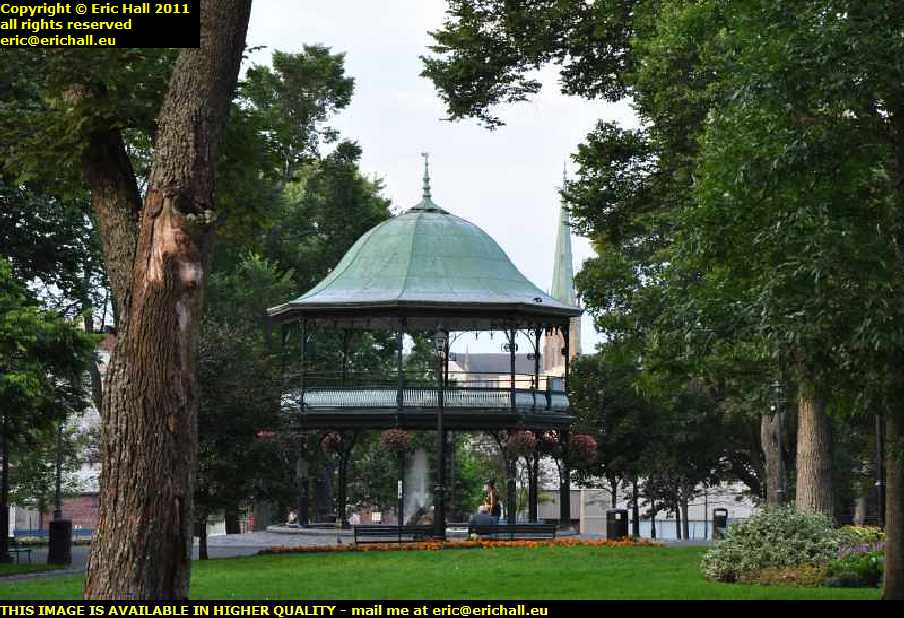
king edward 8 bandstand kings square saint john new brunswick canadaThere’s a beautiful park right in the centre of the city – King’s Square, it’s called. And right in the middle is a bandstand, the King Edward VIII bandstand, dating from 1908.

It’s not very well-known, (so I shall publicise the fact) that I once made a bandstand. That’s right. I set fire to all of their chairs.

I’ll get my coat.

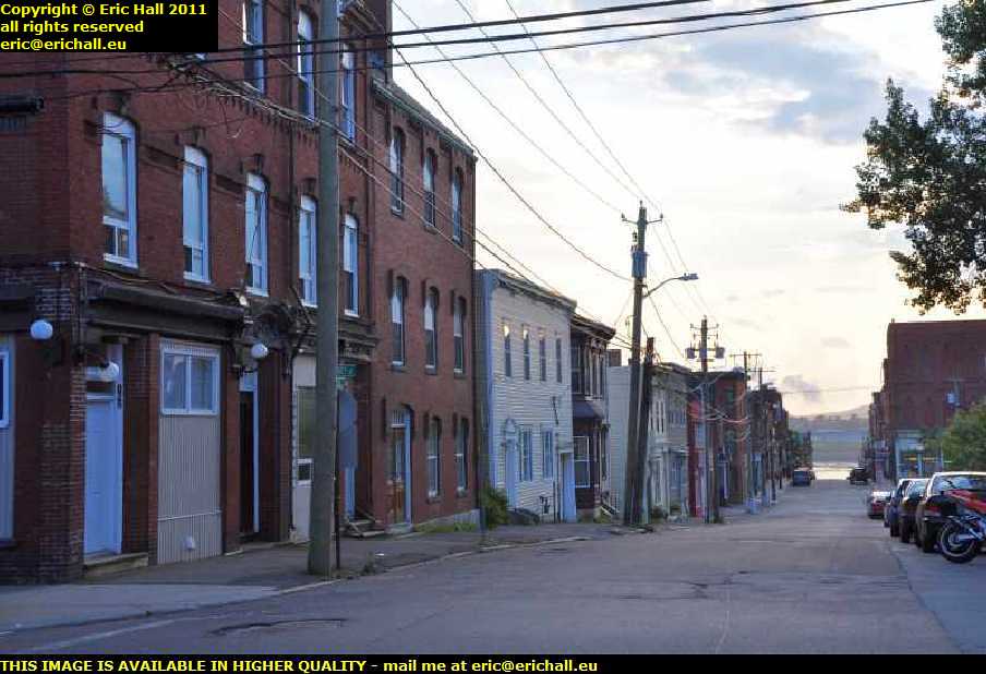
poorer areas of saint john new brunswick canadaI said that there was plenty of evidence of former wealth in Saint John. And there is also plenty of evidence of current poverty too. This street here would not be out of place in any industrial city in the north of England.

If that’s not all, I stumbled upon a bingo hall which had a game actually in progress. The hall was pretty full too. Just how sad is that? It really did remind me of Stoke on Trent on a bad day.

And some ageing hippy has just come up to me. He was having a good look at my telephoto lens and, pointing to it, said “hi – you must be one of those long-distance photographers”.
“I’m from the UK” I replied. “Is that long enough?”

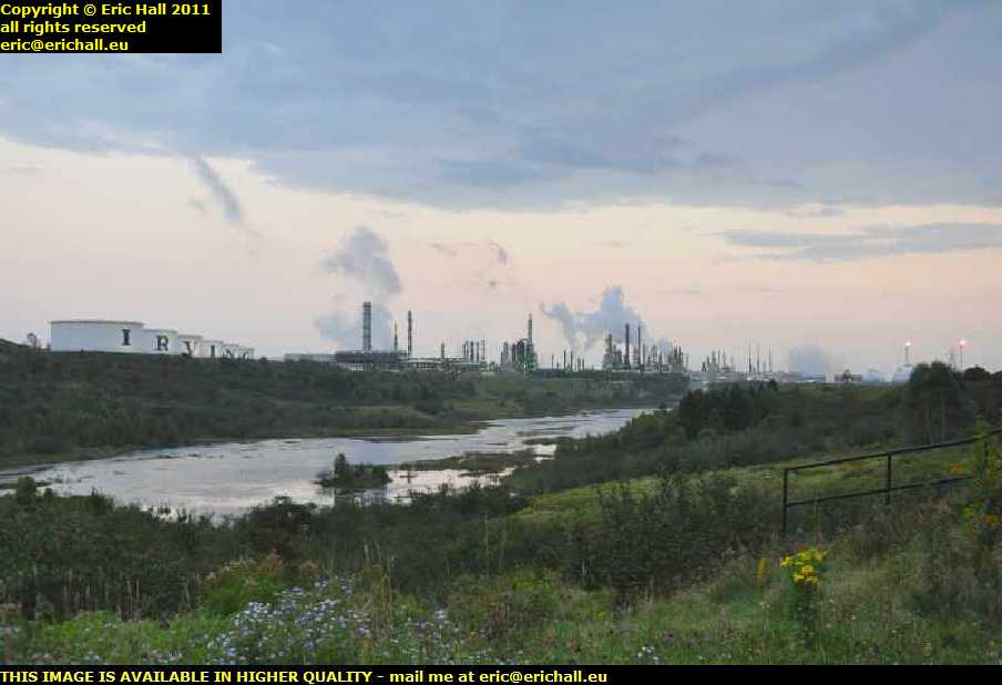
k c irving oil refinery LPG processing plant saint john new brunswick canadaBravely battling against the lack of light, I rejoin my vehicle and head out of the town, continuing my journey to the north-east and leaving behind me a load of photographs that I must deal with some time.

Just outside the town is the immense KC Irving oil refinery and LPG processing plant. It really does look like a desperate scar on the landscape, but as long as people want to drive around in cars, what do you expect?

A phrase involving omeletttes and eggs springs to mind.

And now it’s dark, I can’t see what I’m doing, but there’s a truck stop ahead. That’s going to be as good a place as any for me to lay down my weary head.

Saturday 10th October 2010 – RIGHT NOW…

baie comeau quebec canada… I’m sitting in a dingy motel room in Baie Comeau, a town that was built in the 1930s to handle the timber and subsequently the paper trade relating to all of the forests and so on around here.

At that time it was effectively the farthest north-eastern town (as opposed to “settlement”, of which there were plenty) in Quebec. They hadn’t yet discovered the iron ore and aluminium that led to the creation of Sept-Iles further up the coast.

railway line steam locomotive baie comeau quebec canada>What’s interesting is that they have a rail link from here to Quebec City, would you believe?

There’s just about 10 kilometres of track on this side of the river to handle all of the paper traffic from the mill and then a rail ferry takes it across to Matane on the south shore of the St Lawrence from where it’s shipped by rail to Quebec City.

There’s quite a bit of sea traffic too. There are two huge freighters, of which this is one, anchored in the bay waiting to get in while a third one, the Australiaborg, owned by a Dutch shipping company, is currently being loaded at the dockside.

And of course there is the ferry over the St Lawrence to Matane. I’ve made a note of that for the return.

motel baie comeau quebec canadaAnd don’t think that I’m complaining about my motel room either because I’m not. I’m on the economy budget plan as you know and a room here has only cost me $49 so I’m happy with that.

And not only that, it’s on the main road and nicely positioned for tomorrow when I head off into the interior. The Labrador Trail, Highway 389, starts just about 1km from my door and I’ll be on that tomorrow.

Talking of railways, sometime tomorrow I’ll be encountering the railway line that runs from Sept Iles up to Labrador City and all of the iron and aluminium lines in the interior. It might mean nothing to you at the moment but if you have ever read The Land God Gave to Cain by Hammond Egges, then this is the line that they were building all throughout the story, so it has some kind of literary interest.
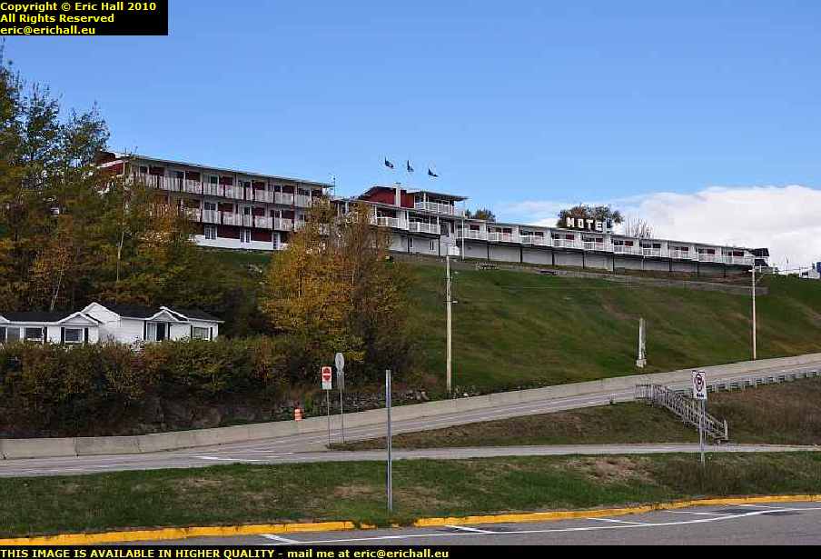
motel st simeon st lawrence river quebec canadaMy motel last night at St Simeon, despite being expensive, was quite comfortable and I was up and about quite early going for a little walk.

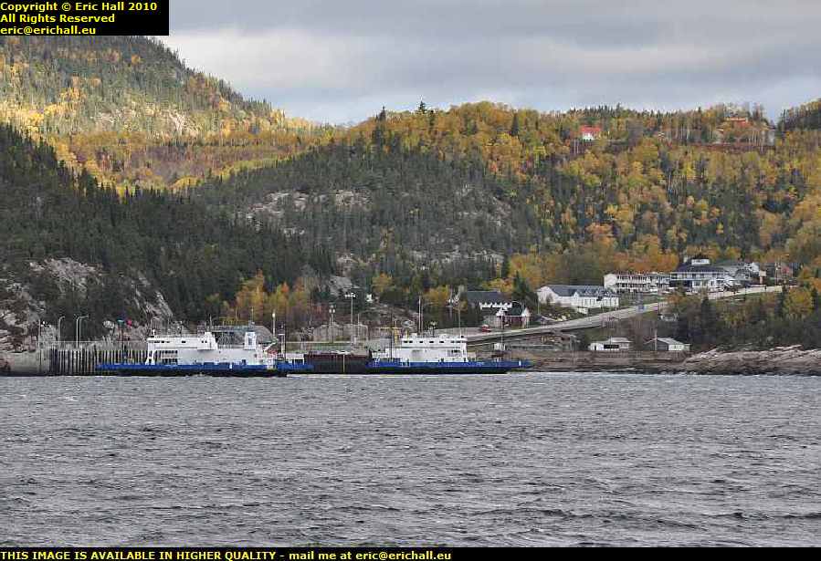
From here there’s a ferry across the St Lawrence that I sailed on in 2001, but I’m not going that way – I’m going much further along the river from here and then heading into the interior

felix antoine savard saguenay ferry st lawrence river quebec canadaBut I’m not to be denied my ferry trip.

Back in 2001 I passed over the Saguenay River on the ferry that crosses here and I took it again this year.

But when I arrived here in 2001 it was dark and in the morning it was freezing cold so I didn’t gat to hang around too much and photograph the scenery. One of the things I had always planned to do was to come back and photograph it properly in the daylight, and here I am today.

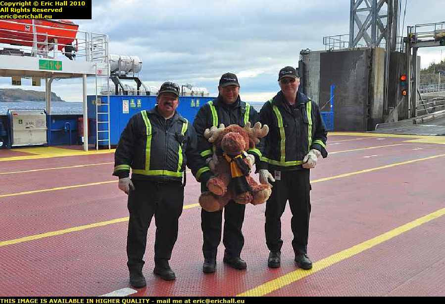
strawberry moose felix antoine savard saguenay ferry st lawrence river quebec canadaAnd Strawberry Moose had a good photo opportunity today. Master Bates, Seaman Staines and Roger the cabin Boy, the crew of the Felix-Antoine Savard, did the honours as His Nibs posed for the camera. Luckily the ferry was comparatively empty.

And as for the weather, it might be freezing but at least we have bright sunlight. It could quite easily be raining.

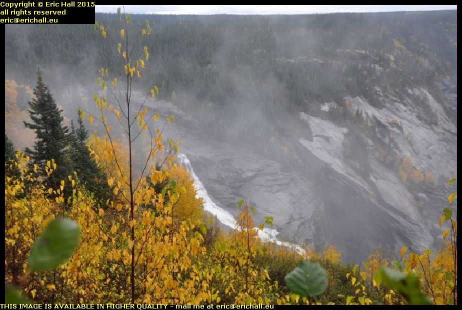
waterfall riviere sault aux moutons st lawrence river quebec canadaI’m really off the beaten track now though. As well as the St Lawrence River and the scenery, I’ve encountered my first serious waterfall.

I think that this is the Riviere Sault aux Moutons – the River Leap-Sheep ad if the sheep were leaping over that waterfall they must have been pretty good. We have a parking place and a sign, but that’s our lot. Had this been in civilisation, we would have had a fanfare and a marching band, together with coloured lights.

log flume forestville st lawrence river quebec canadaThere are several other ferries across the St Lawrence and I went to check them out. At Forestville, where there’s a ferry over to Rimouski, I was distracted by this.

Forestville was formerly an important logging town and to move the logs down to the river, they had a log flume. This was a wooden trough filled with water and they floated the logs down to the shore in it.

If you’ve ever been on the log flume ride at any adventure park, then you’ll be pleased to know that that attraction has been based upon this idea.

So here I am at Baie Comeau. I arrived at about 14:30 today so you are probably wondering why I didn’t press on. The fact is that the next motel once I hit the Labrador Highway is 213km away at Manic 5 and the route planner that I downloaded before I went says that it ought to take me all of 8 hours to do it.

It’s an unpaved dirt road with many bends apparently and with three long single-track bridges. I reckon that I ought to plan a full day to do that and if I do get ahead of myself I can drive on to Fermont, just another 250 or so kms further on.

There’s a few places to stop there as well.