Category Archives: churchill falls

Tuesday 29th September 2015 – THAT WAS A NICE …

… night too. despite the rainstorm that we had, and despite having to leave my stinking pit twice due to reasons that any man of my age will know, and despite me having a neighbour arrive at some point, I was really comfortable in my little bed. So much so that I was awake and out of the bed long before the alarm went off.

And it was warm (well, comparatively warm), to such an extent that I stood outside Strider, lowered down the tailgate and made myself a coffee in the open air. And it was here that I engaged my neighbour in conversation.

He and his wife were from Newfoundland and had a 1999 Chevy pick-up with a camper back. They’d come round from Baie Comeau and were telling me about the road. We discussed fuel consumption too, and he dismayed me by saying that he could do from Goose Bay to Blanc Sablon on just one tank of fuel. Mind you, it cheered me up to a certain degree when he said that he had a 135-litre tank. That compares to Strider’s 70 litres or something. And how I wish I had that size of fuel tank. But of course I will settle for an improved fuel consumption.

strider cable car remains churchill falls rest area trans labrador highway canada
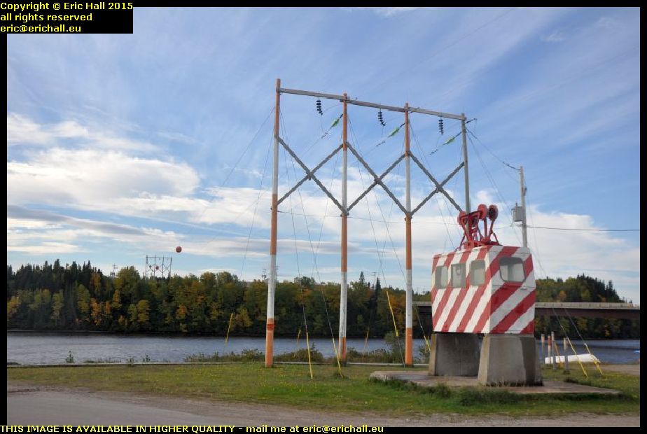
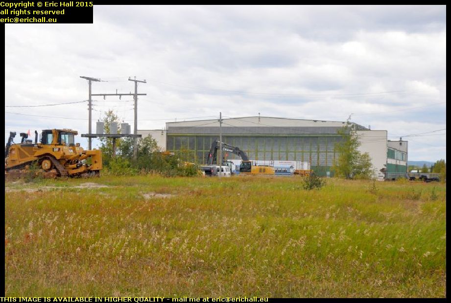
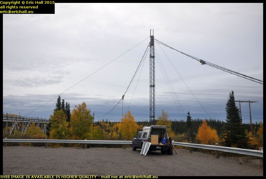
He knows the area here quite well and he drew my attention to the structure under which Strider was parked.

According to him, these are the remains of a cable car. Before the highway – and the bridge – were built, they still needed to pass stuff over the river to whatever settlement was over on the other side and to start the construction of the plant and cabins that formed the basis of the town of Churchill Falls.

if what he says is true, then it can’t be true about the cable car at North West River being the only one in Labrador. But we shall see what they mean by all of this.

churchill falls river gorge trans labrador highway canada
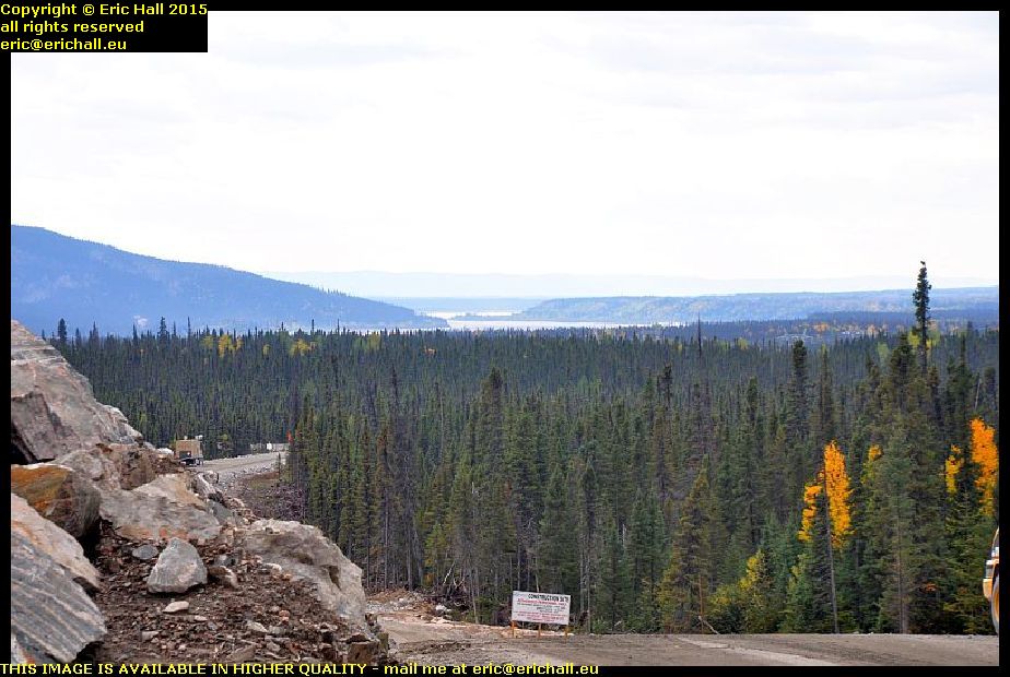
Another thing that he knew was the footpath that led to the best view possible of the falls, although it’s not possible to see the falls in all their glory – the best views are just inaccessible.

It’s quite a hike, although not a difficult one, but it’s well-worth the effort. I was pleased to reach the end pf the path because there’s a splendid view of the gorge itself from there. I’ve never seen a view quite like this – the Grand Canyon excepted, of course Apparently, I’m 240 feet up just here, according to the Neighbour from Newfoundland.

waterfall churchill falls trans labrador highway canada
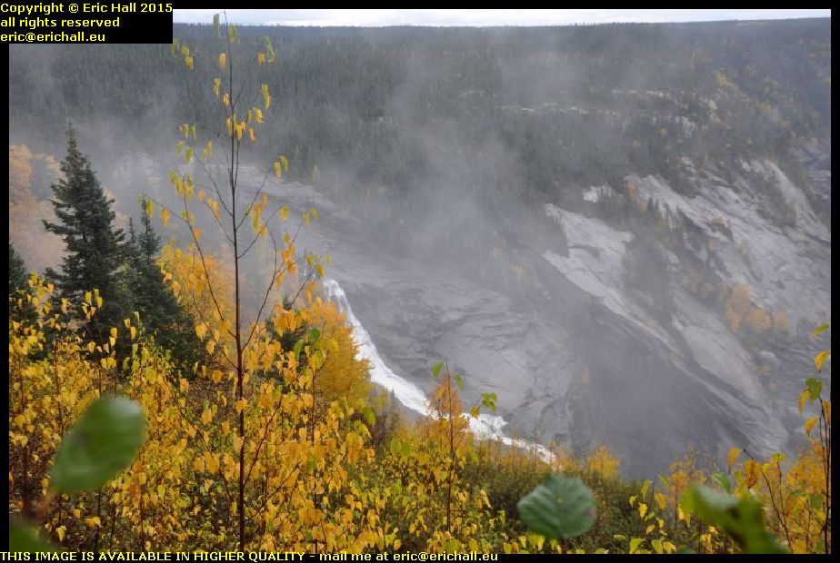
He was right about the view of the falls not being spectacular. The falls themselves are spectacular, of course, but you just can’t reach the immediate vicinity of them, or found a spec directly opposite to take a good photo.

In any case, the falls themselves aren’t anything like as spectacular as they used to be. They really were impressive back years ago but the river was diverted to provided the drop for the hydro-electric power plant and so only a small fraction of the water falls over the waterfalls today.

crashed pick up trans labrador highway canadaMy neighbour also told me of a crashed vehicle that was lying on its roof further on down the road.

And so I kept my eyes peeled, and I found this one here. It’s not on its roof of course but it hasn’t half been knocked about. This gives you yet another clue about the state of the road around here. As for the yellow tape that’s around it, that’s Police marking tape. It shows that the Police have inspected the vehicle, and that it’s sealed off to warn people not to enter.

crazy quebec lorries overtaking me trans labrador highway canadaBut it’s not by any means the state of the road that’s responsible for may of the accidents – it’s the state of the drivers.

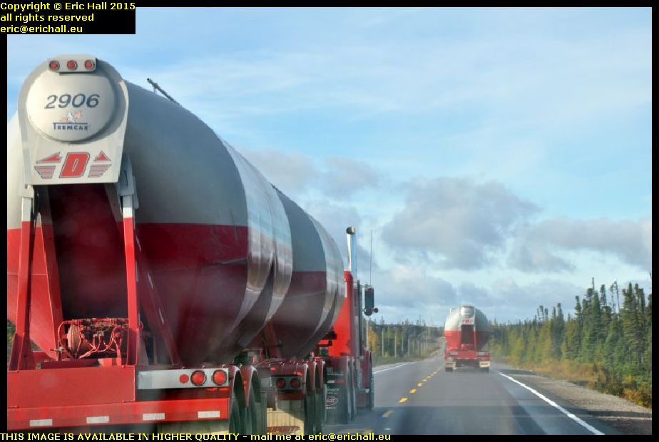
The speed limit along the Trans-Labrador Highway is 80 kph and I have the speed limiter on Strider set at just 80 kph. But everything on the Highway is going past me like I’m standing still, including these two lorries. And these aren’t just simple artics either, these are two of those road-trains pulling two trailers and these road trains are notoriously unstable at the best of times on the best of roads.

double load twin tractor units trans labrador highway canada
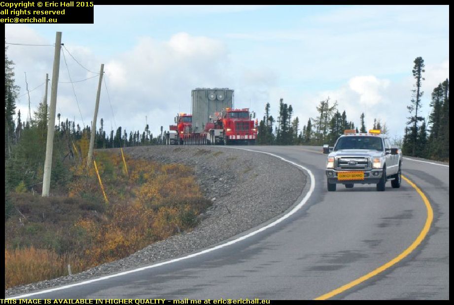
And talking of unusual loads on the road (although road trains aren’t by any means unusual) how about this one? We started off with a police car in front flagging down the traffic and telling us to move right off the edge of the road. And then this came along.

This is some kind of huge electrical unit, and it has two lorries in charge of it. There’s one pulling it, and the one behind it is pushing it along. The purpose of the pick-up in front is to clear the road because with the configuration that this unit has, it can’t even take a bend like this and keep on its own side of the road. It took up most of the road.

cottages near labrador city trans labrador highway canada
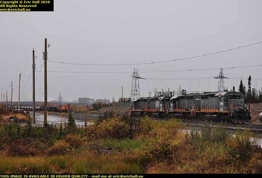
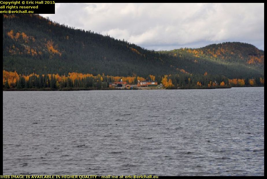
I’ve been noticing, as I’m sure that I have already told you, that there’s some kind of urbanisation taking place along the Trans-Labrador Highway. This is the lake that we’ve all seen before, about 40 kms out of Labrador City, when we came by here on previous occasions.

There was a cottage there previously, but now we seem to have a couple of other cottage down by the lakeshore. And this is the kind of place where I would like to live, with this really gorgeous backdrop and a really beaautiful view of the lake in front.

iron ore mine wabush trans labrador highway canada
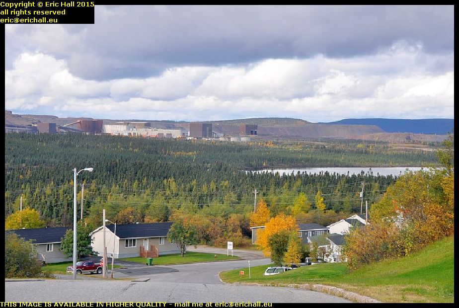
Last year when we were in Wabush, we heard all kinds of sories about the iron ore mine closing down and how people were going to desert the town in droves.

I made a diversion into the town to see what was going on in here, and as you can see, the buildings of the iron ore mine are still there standing. And furthermore, I didn’t see anything that suggested to me that people were deserting in droves. There were no more houses up for sale or to let than you would expect to see anywhere else.

But of course, that’s not to say that things won’t be different in another year’s time.

I stopped off at Tim Horton’s for the internet and a coffee, and then I went on to Fermont, in Quebec, for fuel as it’s the last station before the Northern Quebec wilderness.

I also went to look in the “boomerang”. We saw a photo of it last year – it’s the big, high, long building that has a huge shopping gallery on the ground floor and a pile of apartments up above. I’ve never been in there before (except to sound out the hotel in 2010) and so I was curious to see what it was like.

It’s certainly a labyrinth on the ground floor, but what surprised me was that a good proportion – probably 30% or 40% – of the shops were closed down and empty. At least the Co-op food store was open, which is more than can be said for the one in Labrador City which seems to have closed down since last year.

mont wright trans labrador highway 138 quebec canada
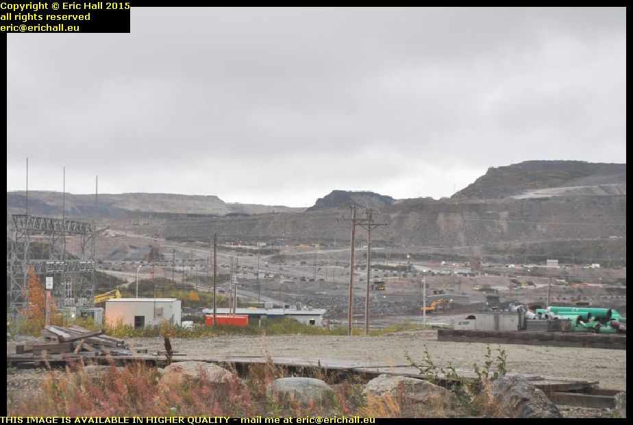
The road out of Fermont into the Wilderness goes past Mont Wright and the Arcelor Mittal iron mine, what is said to be the largest iron ore mine in the world, and it’s the reason for the town of Fermont being built – to house the workers. Mont Wright was once a mountain, but so much iron ore has been extracted that it’s fast becoming a hole in the ground.

The mine tailings stretch for miles, and from here up on a ridge at the back you can see some of the workings. And I do mean “some” because they also stretch for miles. It’s really impressive from that point of view, but we saw last year what has happened at Gagnon, another huge iron ore mine. When that was exhausted, it was simply abandoned and is now an environmental disaster.

trans labrador highway 138 quebec canadaAnd now, from the beautiful morning that we had today, we have now descended into a dreadful and miserably wet evening up here.

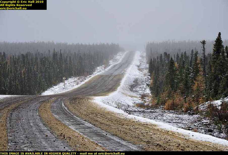
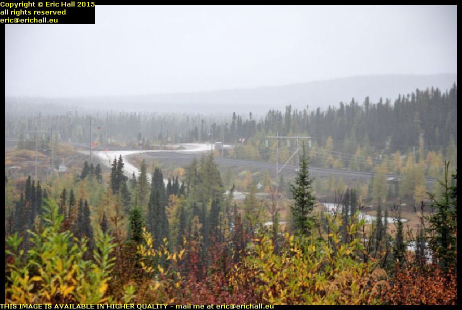
We’re having wind, fog and squalls of rain and although you can’t see it, we are back on the dirt road. And a miserable wet and muddy dirt road it is too, with very little sign (if anything) of any improvement to match the major work that has taken place on the Labrador side of the border.

beautiful sunset red sky sub arctic tundra trans labrador highway 138 quebec canadaI’ve found a place to park for tonight. It’s in a lay-by and I’ve dug myself in in behind one of the emergency telephones, with a lorry to keep me company through the night – although he didn’t stay for long.

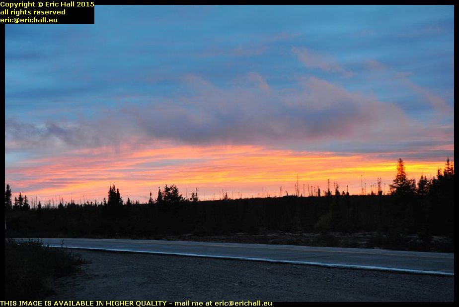
And the weather seems at last to be improving. There’s a beautiful red sky right now, and so that might promise well for the morning (at least I hope so) but it’s cold, so I’m going to snuggle myself down in my sleeping bag and keep warm like that.

Monday 28th September 2015 – WHAT A GOOD NIGHT …

wood cottage north west river labrador canada… that was last night in Wood Cottage. I had had a good shower and shave, done a machine-load of washing, had a nice tea (rice and vegetables seasoned with a packet of dried onion soup), spent some time on the internet, and then flat-out upstairs in a nice heated bedroom.

And you can tell how good a sleep I had had, for I was on my travels again. I’d been playing for a Welsh Premier League football team in a European competition and we were so unprepared that we had been playing for just 18 minutes and we were already 3-0 down. And then there was a call on the public address system for the stadium electrician, and so Terry had to leave the field to go to deal with the issue and so we were down to 10 men already.

But that did bring back memories of a match at Pionsat. We were in mid-game and the siren at the fire station sounded, so two of the players ran from the field (they were volunteer firemen) and went down to the station. And they came back later when the emergency was over and rejoined the game.

sheshatshiu north west river labrador canadaAnd while you admire the view of the Innu community’s settlement at Sheshatshiu across the river, let me tell you about the internet here at North West River.

North West River is a small settlement, the farthest north that it is possible to go by road in Labrador (and then only since about 1982), and across the river is a First Nation settlement. An outpost of civilisation it most certainly is, and yet the internet speed here is a good ten (and I do mean 10) times faster than the speed that I have at home.

I said that North West River has only been connected to the national highway system since about 1982 when the road bridge was built. Prior to that, we had the coastal boat that called here once a week.

old chairlift north west river labrador canadaBut North West River is actually on the north side of the river, and civilisation (in the name of Goose Bay and Happy Valley) is on the south. To cross the river to civilisation, you had your canoe in the summer and your ice-skates in winter but in the very early 1960s a cable-car from the UK was installed here and this was luxury!

When the bridge was opened, the chair lift became redundant. The town bought it for the symbolic dollar and it’s here on display on the site from which it used to operate.

north west river labrador canadaThe site is next-door to the Labrador Heritage Museum, and that’s my next port of call.

The museum is situated in the old Hudsons Bay Trading Post and part of the exhibition is a fully-restored store inside, complete with many period products. The museum is officially closed as it’s now out of season but I’ve managed to blag my way in for a private tour. It wasn’t the Trading Post that interested me (although it did) but there was quite an exhibition about the boats that plied the coast here but also a big exhibition of artefacts from the Leonidas Hubbard and Mina Hubbard expeditions, including photos that Dillon Wallace had taken on his travels with Leonidas.

And I was right about the Labrador flag. The blue is the sea, the green is the forest and the white is the snow.

former airstrip north west river labrador canadaI spent a good couple of hours in the museum and then I went off for another wander around the town.

I’d noticed on an old map that I had seen that by the side of the dirt track out to the north, there was an airstrip indicated. It’s no longer used since the town has a road connection with the airport at Goose Bay, but I still thought it might be an interesting thing to try to find.

And here we are. This is the airstrip – now built-on in places and with some light industry in what I imagine would have been the airstrip building

north west river labrador canadaThat wasn’t all the excitement out here either.

I’d seen some people way out in the distance looking as if they were working in a field, and so I walked right over there to talk to them. They are indeed working in the field, pulling up their crop of potatoes, and here’s the evidence. They reckon that this is a bad year for their spuds but I’d be happy with a crop like this.

They told me that carrots, cabbages, lettuce and a few other crops are grown here but people keep them near to their houses as they need quite a lot of tending. Potatoes don’t need much tending at all and so they can grow them out in what passes around here for fields. I reckon that it’s just sand but at least that will warm up quickly once the sun comes out, as anyone who has sat on a beach will tell you.

From here, I went for a drive around the Innu settlement at Sheshatshiu but I won’t be posting any photos of it here. In fact, I didn’t take any at all.

There’s a reason for that. Sheshatshiu is an artificial settlement built under the extremely controversial Government plan of regrouping all of the outlying Innu settlements into larger centres of population with a concentration of services. But unfortunately it’s destroyed the lifestyle of the Innu and given them nothing to replace it. Just like the settlement out at the Davis Inlet, Sheshatshiu is a hotbed of despair, destitution, alcoholism and drug abuse, and you can see the hopelessness everywhere.

This is something that I’ve seen in other First Nation and Native American settlements – the hopelessness.I would have thought that Europeans would have learnt to leave the native communities alone and let their way of life evolve at their own pace.

By Europeans, by the way, I mean people of European origin, whether or not they are 10th Generation Canadians.

northern ranger goose bay labrador canadaTalking of First Nation settlements, there is about half a dozen of them further up the northern Labrador coast (and that’s a lot less that there used to be before the Government’s controversial compulsory resettlement policy) and the only access that they have is by sea.

The Northern Ranger is the ship that carries out the service and calls at each of the settlements, making the tour once a week. And here she is, at the quayside in Goose Bay loading up for – I imagine – Cartwright and the enigmatically-named Black Tickle.

goose bay airport labrador canadaThere was a great deal of activity at the Goose Bay airport too. A couple of helicopters were taking off and landing, there was a whole stream of light aircraft coming in to land, and there was a cargo plane over there at the terminal.

It’s all go since Valard began all of the work on the hydro plant at the Muskrat Falls – it’s brought piles of changes to the area, but it’s still a far cry from the days when this was an important port-of-call on the Atlantic Ferry in World War II and subsequently a major NATO base during the Cold War.

goose bay airport hangar labrador canadaI came here in 2010 and the place really was derelict in those days but now it’s being tidied up a bit.

The hangars were in a desperate state in those days but now they seem to be in use for light industry. And talking of Valard and the construction works here, in one of the hangars is a company that specialises in buying, selling and repairing heavy plant and machinery. And I bet that there’s a great deal of that needing repair too, seeing the amount of work that they do and the conditions in which they are doing it.

churchill river muskrat falls trans labrador highway canadaI fuelled up Strider again (you need to fuel up at every opportunity out here) and set off for Labrador City after that.

And while you can no longer go to visit the Muskrat Falls due to all of the construction, the construction work has opened up some astonishing vistas that were no longer visible previously. This is one of them – you wouldn’t have seen this a few years ago. And it’s not the only one either. There are plenty of them and the whole scenery is changing.

cabin shack house trans labrador highway canadaIt’s not only the Muskrat Falls that is undergoing major construction work. I’ve been noticing dozens and dozens of new cabins and homes springing up all along the Trans Labrador Highway that were certainly not there previously.

Some of them are quite banal as you might expect, but one or two of them have been built by people with a sense of the unusual and the eccentric. This home has quite fascinated me and I could quite happily live in a house like this – especially the tower bit. I love that.

beautiful autumn scenery trans labrador highway canadaOne thing that I do like about Labrador at this time of the year is the beautiful autumn colours.

The northern side of the valley catches the sun and is quite sheltered from the wind and so there are plenty of deciduous trees that grow up there. And here, there’s a spectacular view of a deciduous forest and as the colours change for the autumn, they are magnificent. I could sit and look at these colours for ever.

old section of trans labrador highway canadaWhen I came by up here in 2010 the road was thoroughly dreadful and it took hours to cover just 150 kilometres. Today though, it’s all different and we have a really modern and quick black-top highway so that we can cover the ground as fast as we like (subject to the 80 kph speed limit of course).

Just here, you can see a sample of the old road along which we used to have to travel and you won’t be surprised that it took so long to cover the ground. However, I am glad that I did the route when it was still a challenge and a struggle. It’s nothing like that now of course.

By economising on the performance of Strider, I’m managing to stretch out the fuel consumption a little. And so I didn’t call at Churchill Falls to fuel up. Strider won’t do the 550 kilometres to Labrador City of course, but I still have 40 litres in cans in the back. And so I’m heading to the sheltered little rest area by the Churchill Falls to spend the night

churchill falls airport trans labrador highway canadaBut talking of Valard and construction and the like, this is Churchill Falls airport and it never ever looked like this.

There’s been a considerable amount of rebuilding and expansion that’s gone on here this last year or so, and you can see who are the major customers here, judging by the amount of Valard vehicles parked in the car park.

And Valard vehicles are everywhere – at one point a stream of 5 Valard pick-ups passed me in the opposite direction and at almost every track off into the forest there are one or two parked up.

Now, I’m on the rest area. I’ve put my 20 litres of fuel in and I’ve settled down in the back of Strider, listening to the pouring rain beating down upon the insulation on the roof. I’m going to crawl into my sleeping bag in a minute and watch a film. And if I fall asleep during the film, then ask me if I care.

Tuesday 12th October 2010 – I’M IN GOOSE BAY THIS EVENING …

… the town, that is, not the bay itself, and I’m goosed.

This morning got off to a rather bad start. I was walking down a street somewhere in small-town America in a howling gale. I don’t remember who I was with, and we were watching this 8-storey brick-built rooming house which was swaying alarmingly in the wind. Suddenly the top four storeys were blown right off the building and crashed to the street with an almighty bang. The two of us dashed over to start to rescue the survivors and suddenly in the middle of all of this I sat bolt upright in my bed.

It’s been ages since I’ve had such a realistic dream as this.

So this morning I was up long before dawn and took piles of photos of Labrador City, only to find that I had the ISO on the wrong setting after last night’s photos, and I had forgotten to change it back. Hence, not a one came out, and was I upset?

motel labrador city canadaWell, not quite. It wasn’t quite light when I took the photo of my motel this morning so I managed to salvage that.

And I’m not going to say anything about the motel at all – I’ll wait for another occasion after I’ve recovered. I was expecting the prices out here to be different than in most other places – 500 kms of dirt road to bring stuff out here will be responsible for that – but I wasn’t prepared for this.

wabush iron ore mine quebec north shore labrador railway line canadaIf it wasn’t for the huge iron-ore mines out here, there wouldn’t be anything at all. But what we do have is, apart from the mine of course, a huge railway network for hauling away the output and that was one of the things that I had wanted to see.

Having grown up on The Land God Gave to Cain and similar books, to come out to Labrador to see the iron ore mines, the railway lines and the dams has been my main lifetime ambition ever since my childhood.

But back to the story of my drive over the trail. Today I drove about as far as yesterday, but the roads were a different thing altogether. Leaving Labrador City we had a paved road for all of about 50 kms and then that was about that.

trans labrador highway canadaSeeing an enormous snowplough coming towards me with its front all thoroughly plastered with snow gave me a little inkling of what the weather was likely to be, and as we climbed up onto the Labrador Plateau it started to snow.

The more the road deteriorated, the more snow we had and it started to become quite an adventure. The higher I climbed brought me up into the clouds and it became a question of not even being able to see what the weather was doing, and that was probably the best idea.

But Casey, Strawberry and I pressed on relentlessly along the worst road that I have ever driven, deep into the wilderness.

male moose trans labrador highway canadaAnd Strawberry was well-rewarded because at a certain moment right up on top of the plateau with the wind whistling around from everywhere, one of his Canadian cousins slowly ambled across the road as if he owned it, which he probably did.

Strawberry was ever so excited as you can imagine and it brought me to a standstill for a good few minutes as the two of them exchanged pleasantries. Eventually cousin managed to manoeuvre himself into a good spot between a couple of trees where I could get a really good shot of him, and once he was sure that he had made his entry onto these pages, he made his excuses and left

road to fuel station churchill falls trans labrador highway canadaWe arrived at Churchill Falls and had a good hunt around to find the petrol station – it wasn’t easy to spot.

Churchill Falls is not on the main Trans Labrador Highway – it’s way off to one side and you need to drive down this road in order to find it. Fuel was $1.15 at Fermont but here it was $1.22 and that’s quite acceptable for where we are – after all there is no train hauling it up into the mountains just here and from the railhead it’s quite a way.

churchill falls trans labrador highway canadaThe falls though were a little disappointing, and for two reasons too. Firstly, at this time of the year it’s probably all frozen up high up in the mountains.

Secondly, the river has had part of its course diverted to feed the huge hydro-electric power station on the other side of town. But there isn’t too much to see – everything is inside a hollowed-out mountain, rather like Doctor Evil’s lair.

trans labrador highwy canadaAfter Churchill Falls as we climbed back out of the river valley onto the plateau the little bit of paved road immediately petered out and from then on I can safely say that I was on the worst road that I have ever driven in my life as you can tell from the photo.

One stretch of 122 kms took over 4 hours to drive, and I don’t hang about as you know

major road works trans labrador highway canadaAt another point we were held up by a construction team (there were about 20 teams working up here and they could have done with 200 I reckon) for 10 minutes while they dynamited a huge rock.

And then we were held up for another hour or so while they shovelled it up from off the road as they had miscalculated the amount of dynamite to use. It certainly was spectacular watching lumps of rock the size of giant pumpkins flying down the road just a hundred yards from where I was parked.

And by the time they had finished, quite a little queue had built up

trans labrador highway canadaBut the road really was awful – at times it was just like a sea of mud in places and I didn’t dare stop because I would never have started again.

After 3 hours of driving from Churchill Falls with just 87 kms on the clock it all became a little depressing. But eventually, after 122 kms we passed onto an area where the construction crews had finished and we could roll along at a much more relaxed 60 kph – even though the roads were nothing like anything that you would get anywhere else. Ruts and potholes, lakes of water, huge stones, these were all commonplace

former trace trans labrador highway canada.But that being the case, every so often you would catch a glimpse of the old road – the one that they used before they had the idea to make the Highway about 10 years ago.

Just imagine driving on that surface -you wouldn’t even manage 60 kilometres in a week on that. There just aren’t any words in the dictionary to describe that road

deciduous forest river valley trans labrador highway canadaBut all of a sudden, at exactly 191 kms from Churchill Falls there was a huge steep climb up over the mountains and Casey struggled up that, I can tell you, and as we dropped down the other side we found ourselves in a deciduous forest.

Yes, the deliniation of the climatic zone was as dramatic as that – you could draw a line to represent it. And as we drove through a steep-sided valley it was curious to note that in the valley floor and the north-facing slopes there were conifer trees, mosses and lichens yet on the south-facing slopes there were deciduous trees and grass. This kind of area is a real marginal climatic zone that’s for sure.

But who is this “we” that I’ve been talking about?

Ford F150 pontiac 7 seater MPV minivan trans labrador highway canadaWell, in fact long before Churchill Falls when I had stopped to take a photo of something I was passed by a Ford F150 pickup followed by a Pontiac 7-seater MPV. Half an hour later I caught up with them again, and then lost them as I stopped again to take another pic or so.

And we continued like this all the way over the Labrador Plateau and right until we hit the paved road a few miles from Goose Bay, when they piddled off into the sunset. It really was quite strange continually catching them up at roadworks and so on. We must have made quite a strange convoy along that road.

Now if last night’s hotel was the most expensive in which I have ever stayed, today’s is the second. And not by much either. I reckon that I could have stayed for a night with a lady of ill-repute in each of these places and still been ahead of the game. I shall be looking into this.

Anyway, these are only a selection of photos and a short resumé of the journey. To see more, you need to go to this page, start at the beginning, and read on until the end.