After I pleasant day at Colleen’s, I was back on the road once more
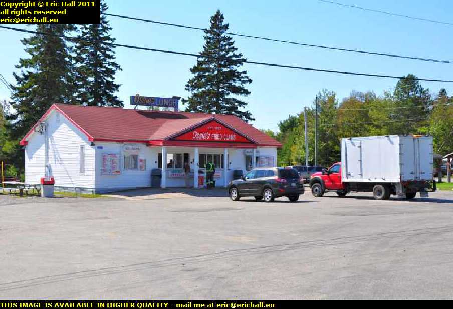 But I didn’t get far. It was lunchtime and I found a fish and chip shop.
And this place is noteworthy for two reasons
- it sold real chips. Nice proper lumps of potatoes, not these horrible matchstick things
- it was the first place that I have ever encountered in North America that had real malt vinegar on offer.
And they were delicious too. And it was really nice sitting outside in the sun.
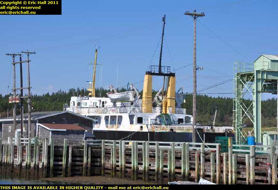 First stop this afternoon was at Black’s Harbour where the ferry goes over to Grand Manan Island. And look what’s parked up over there. I’m sure that it’s the ferry that was under repair in Pictou last October when we there there.
And as a matter of fact, she is. It appears that there are two ships that ply across the waters, but only one in winter. And last winter she was laid up as her replacement was due in the spring. However the arrival of her replacement was rather late, and then the other one was involved in an accident back in May, so she was pressed back into service.
Her ultimate destination seems to be hauling gravel for a company in Quebec – the usual fate of many old ferries out here.
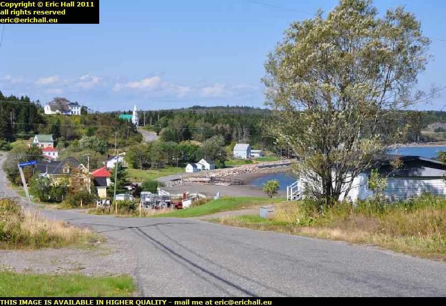 Whenever you see a road called “lighthouse road”, that’s a cue for a deviation – or, at least, it is in my case.
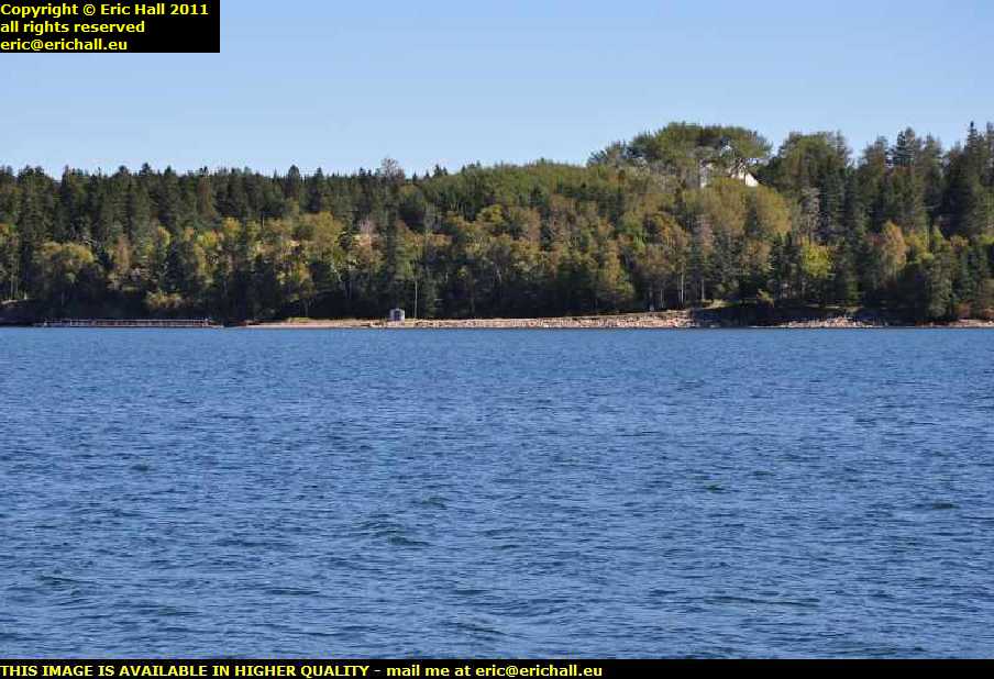
And I’m glad that I came down this road too because some of the scenery is magnificent. According to the church in the distance, this area here is called Beaver Harbour and if so, that’s an old Quaker settlement where a bunch of United Empire Loyalists came to settle.
And you can see why they came to settle here, cant you?
The road to the lighthouse was all closed off so I couldn’t go down there, but a thing like that isn’t likely to put me off.
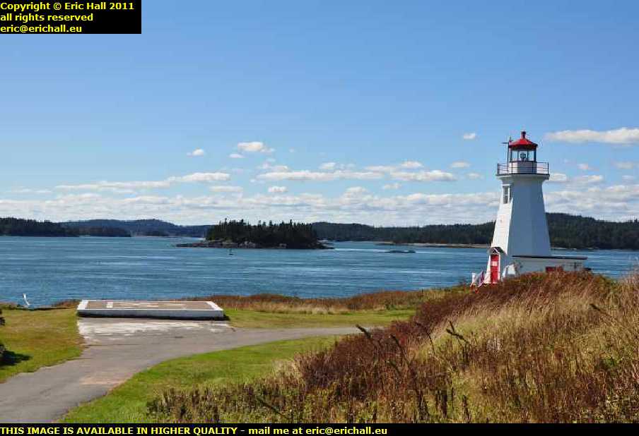
 Where there’s a will there are relatives, and so here I am round on the next headland down with a telephoto lens.
It’s Drews Head lighthouse, so I’m told, there has been a lighthouse on here since as recently as January 1876 although this is not the original. It was replaced by a skeletal tower-type of construction in the late 1960s and the fibreglass skin that you can see dates from 1984.
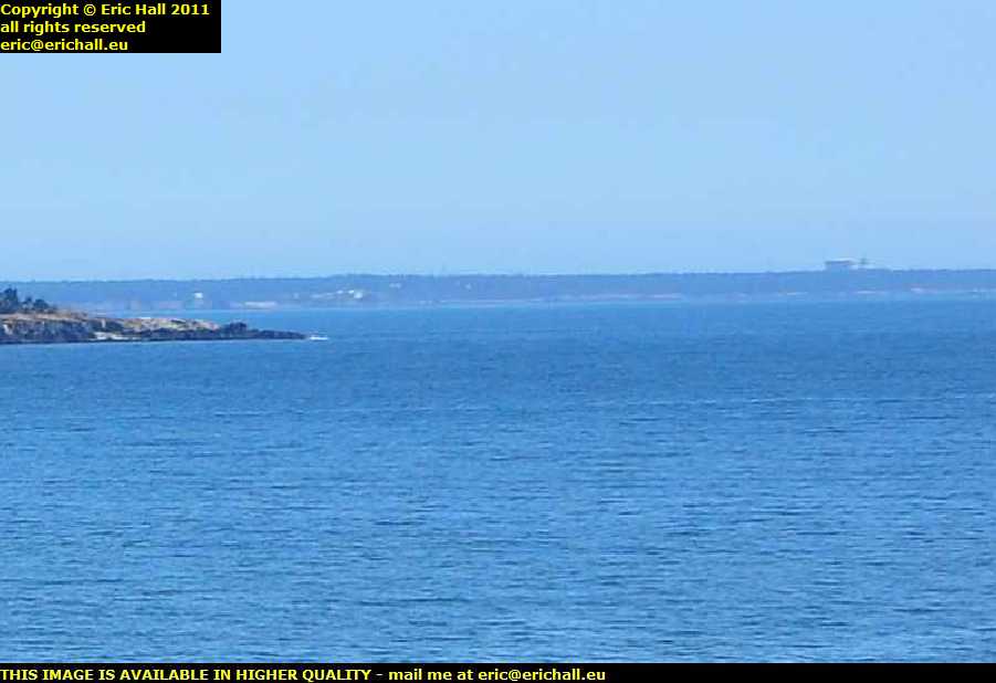 What we see right out there is the nuclear power station situated out on Point Lepreau. It’s the only nuclear power station in Atlantic Canada and is something else that was quite controversial in New Brunswick.
After years of debate, the New Brunswick Prime Minister Richard Hatfield announced that it was going to be built, regardless of whatever conclusions an Environmental Assessment committee reached. It was built in the early 1980s and cost three times the estimated amount.
It’s suffered all kinds of problems caused by, amongst other things, poor maintenance and employee sabotage, and there has been a variety of work-related accidents and illnesses. An 18 month overhaul, started in March 2008, took four and a half years to complete.
I went out there for a drive around to see what I could see, but it’s hidden in a forest so you can’t see it from close up.
 Instead, I went off to see if I could find the famous waterfall on the Lepreau River.
The river is only about 30 kms long but has quite a descent over that distance, culminating in a drop of about 6 metres over this granite ledge.
Below the falls is the tidal limit of the Bay of Fundy and on the incoming tide you’ll find salt water down there. In fact, you can’t see it in this photo but the tide is coming in as I’m standing here.
 When I was here ten years ago, I arrived after dark and left before light so I didn’t take a photo of my motel that night.
So here we are. This is the Island View motel where I stayed, on top of a hill to the south of the city of Saint John. I seem to remember that there wasn’t that much to write about this motel, but I don’t remember criticising the price either so it must have been a reasonable deal.
 There’s a convenient hill just a little way around the corner and so I wandered off to see what I could see.
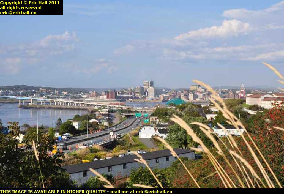
And sure enough, there’s a beautiful view down the river towards the city of Saint John (and you mustn’t forget to always write the name in full – that’s quite important).
You’ll notice all of the modern skyscrapers there. Saint John is the second-largest city in Atlantic Canada (after Halifax) and also one of the wealthiest
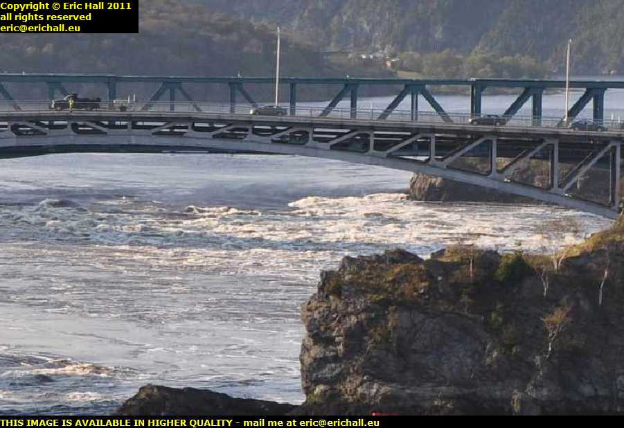 I can’t believe that I’ve managed to time my arrival so badly – when the tide is at mid-point.
Over there are the Reversing Falls – at low tide the level of the tide is about 4 metres below the level of the river and at high tide, it’s about 4 metres higher. Consequently, at either high or low tide, you have a spectacular spectacle right underneath the bridge.
 I took thousands of photos here at Saint John, and one day I’ll post them all somewhere for you to see.
You’ll remember just now that I posted a photo of the city taken from distance, and showed you the tall modern buildings on the skyline. And so here, right in the centre of the city, we can have a view of them from closer up.
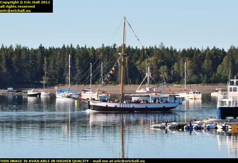
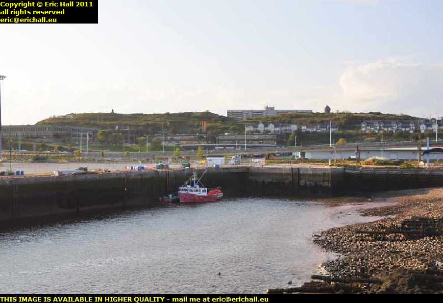
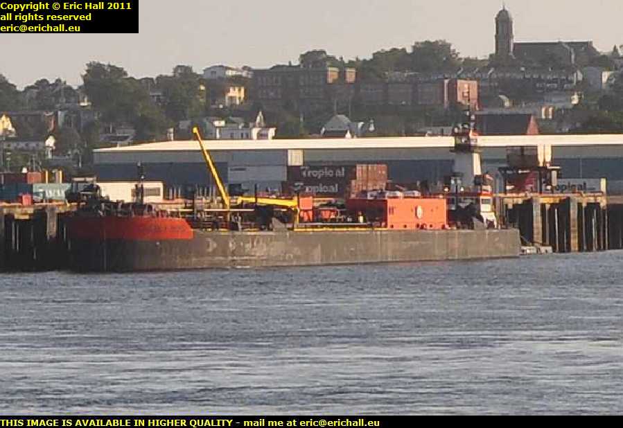 With there being water around, there are bound to be ships. And I’m not disappointed either because this is a huge harbour and there are dozens about.
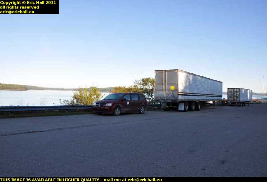
However, never mind the ship for the moment – take a look beyond it at those shipping containers with the word TROPICAL written on them? They are, would you believe, going to feature in our story in a few days’ time.
 But I hope that you aren’t expecting to see anything really historic in the city because, beautiful as it might be from this perspective on the waterfront, there’s very little in the city dating from before 1877
In that year, there was, for the benefit of those of you who know very little about the history of Canada, a devastating fire raged through the city and destroyed 1612 properties and caused $28,000,000 of damages.
Not like the fire that raged through Bentilee in Stoke on Trent, destroying 1612 houses and causing £30 worth of improvements.
Saint John was in the front line during the disputes with the USA. In the early days, the border between Canada and the USA had not been resolved, and the USA was claiming as far up the coast as the mouth of the Saint John River.
 Of course, Britain was having none of that and the mouth of the river, especially on the shore, was quite heavily fortified.
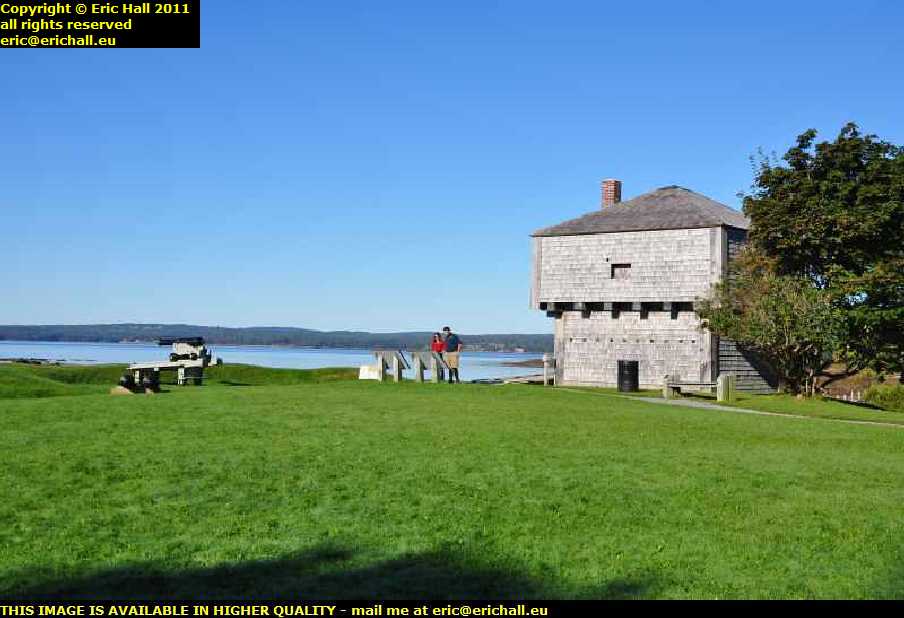
This is Fort Howe, built during the War of American Independence following the Siege of Saint John in 1777, the “Howe” being the Commander of the British forces in North America at the time. It has the distinction of being the first site in Canada to be designated a National Historic Park.
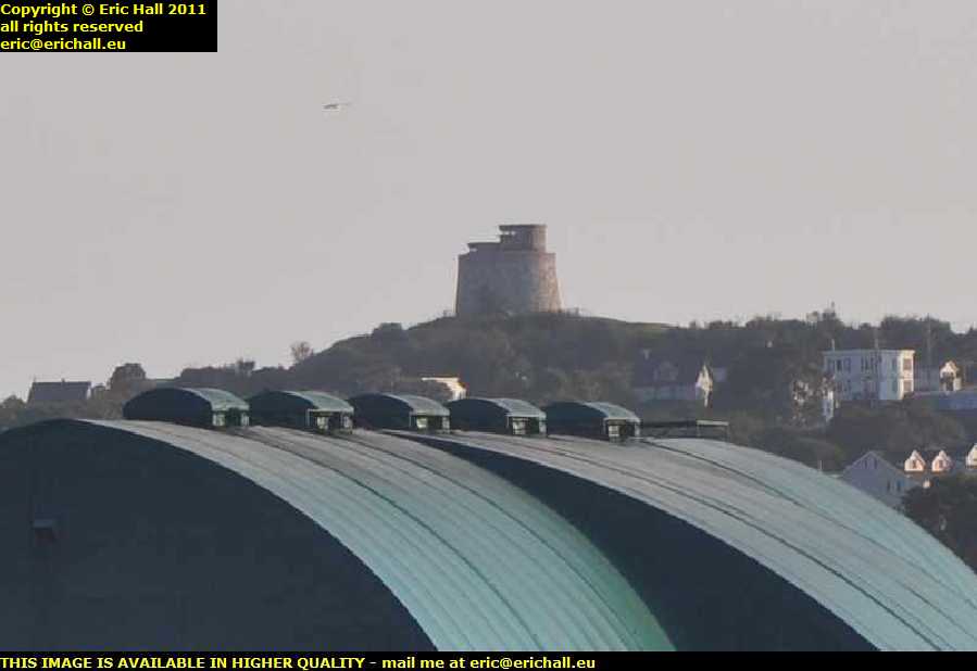 Way over there in the distance (thanks to the zoom lens) is the Carleton Martello tower, one of only 9 now remaining in Canada.
This dates back to the War of 1812 and was built to guard the entrance to the harbour. It was in use during World War II as an anti-aircraft gun tower (the Canadian Government had more faith in the Luftwaffe’s technical abilities than the Luftwaffe did) and observation post, and during World War I had been a prison for deserters from the Canadian Army.
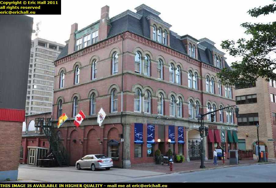 I did say that Saint John was one of the wealthiest cities in Atlantic Canada, and you can tell that by looking at some of the buildings around here.
This is the old city market, situated on Charlotte Street. and dates from 1876. It’s the umpteenth Market Hall in the city, and regular readers of this rubbish don’t need to be told what happened to the others.
The building deteriorated considerably after World War II but underwent a major renovation between 1987 and 1990.
 Churches are always a good indication of the wealth of any community, and no-one is going to be disappointed by this church. This is the Trinity Anglican Church in Germain Street and was founded by United Empire Loyalists who fled here in 1783.
This imposing pile dates from 1880, and you don’t REALLY need me to tell you what happened to its predecessor, do you?
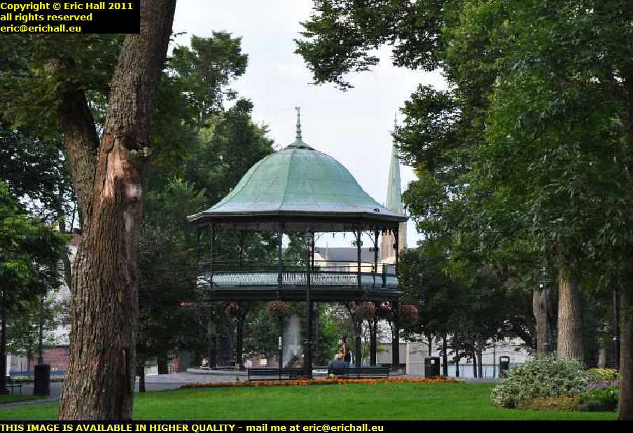 There’s a beautiful park right in the centre of the city – King’s Square, it’s called. And right in the middle is a bandstand, the King Edward VIII bandstand, dating from 1908.
It’s not very well-known, (so I shall publicise the fact) that I once made a bandstand. That’s right. I set fire to all of their chairs.
I’ll get my coat.
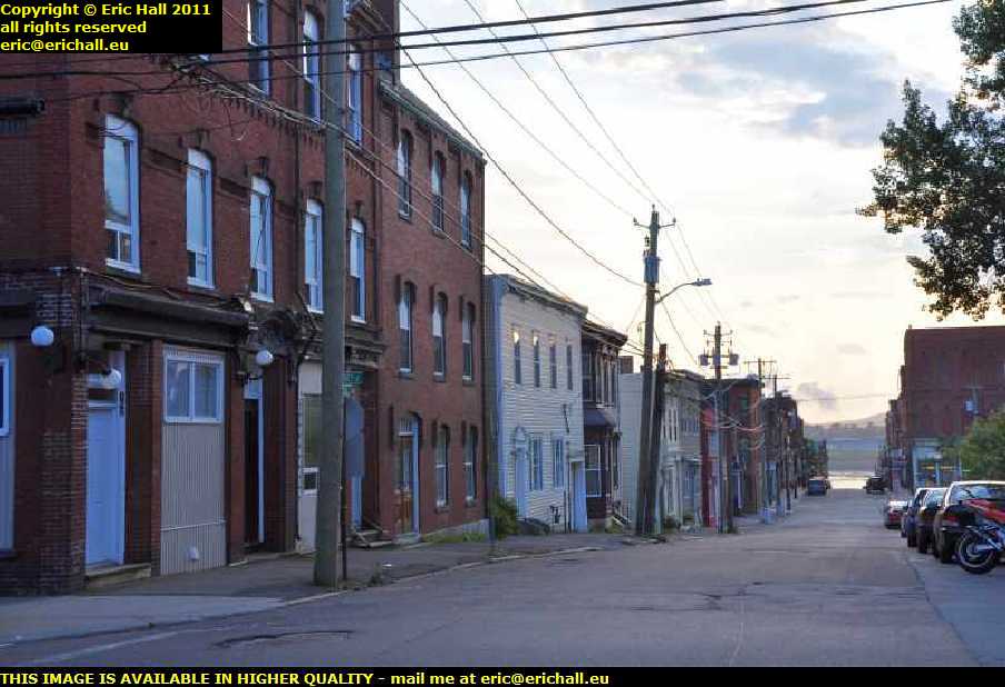 I said that there was plenty of evidence of former wealth in Saint John. And there is also plenty of evidence of current poverty too. This street here would not be out of place in any industrial city in the north of England.
If that’s not all, I stumbled upon a bingo hall which had a game actually in progress. The hall was pretty full too. Just how sad is that? It really did remind me of Stoke on Trent on a bad day.
And some ageing hippy has just come up to me. He was having a good look at my telephoto lens and, pointing to it, said “hi – you must be one of those long-distance photographers”.
“I’m from the UK” I replied. “Is that long enough?”
 Bravely battling against the lack of light, I rejoin my vehicle and head out of the town, continuing my journey to the north-east and leaving behind me a load of photographs that I must deal with some time.
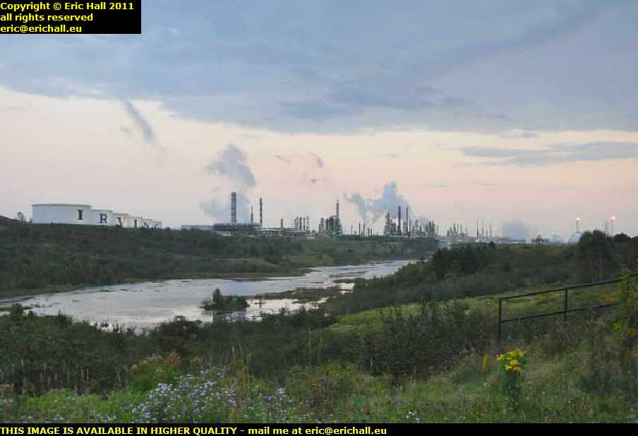
Just outside the town is the immense KC Irving oil refinery and LPG processing plant. It really does look like a desperate scar on the landscape, but as long as people want to drive around in cars, what do you expect?
A phrase involving omeletttes and eggs springs to mind.
And now it’s dark, I can’t see what I’m doing, but there’s a truck stop ahead. That’s going to be as good a place as any for me to lay down my weary head.