Tag Archives: fitting insulation in strider

Friday 25th September 2015 – WHAT A GOOD NIGHT’S SLEEP!

Having done everything that I needed to do last night, I crawled into my sleeping back and settled down to watch a film. But it wasn’t for long. After about 15 minutes, I switched off the laptop and that was the last thing that I remembered.

I must have had a good nine hours when I didn’t feel a thing. And when I awoke, it was reasonably warm inside the truck cap, there was no condensation at all on the roof and only a few minimal traces on the walls. It seems that this idea of putting the insulation on top of the roof of the truck cap is doing its job. I’m well-impressed with this. But I’ll need some more tape though. If the plastic sacks become torn or damaged, I have plenty to replace them but I’ve run out of tape to hold everything together.

I didn’t stop for breakfast though. There’s a sailing across to Labrador at 10:30 and I want to be on it if possible and so I hit the road.

sleeping in strider ford ranger newfoundland canada
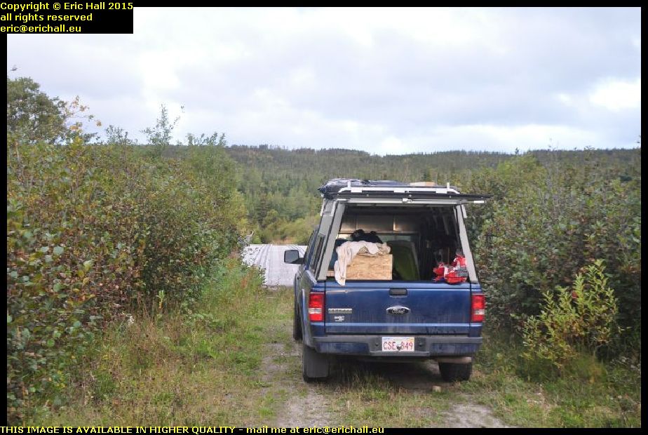
But I did take a minute or two out to take a photo of my spec for last night and Strider with his exterior insulation. You can see just what a good spec this is.

And now, a weird idea is running through my mind that if I could find a plastic sheet that is 6 feet by 4 feet, I could fit that over the top, hold it down with ratchet straps and that would make a very permanent arrangement while I’m on my travels. Something like a corrugated roofing sheet would be ideal for this.

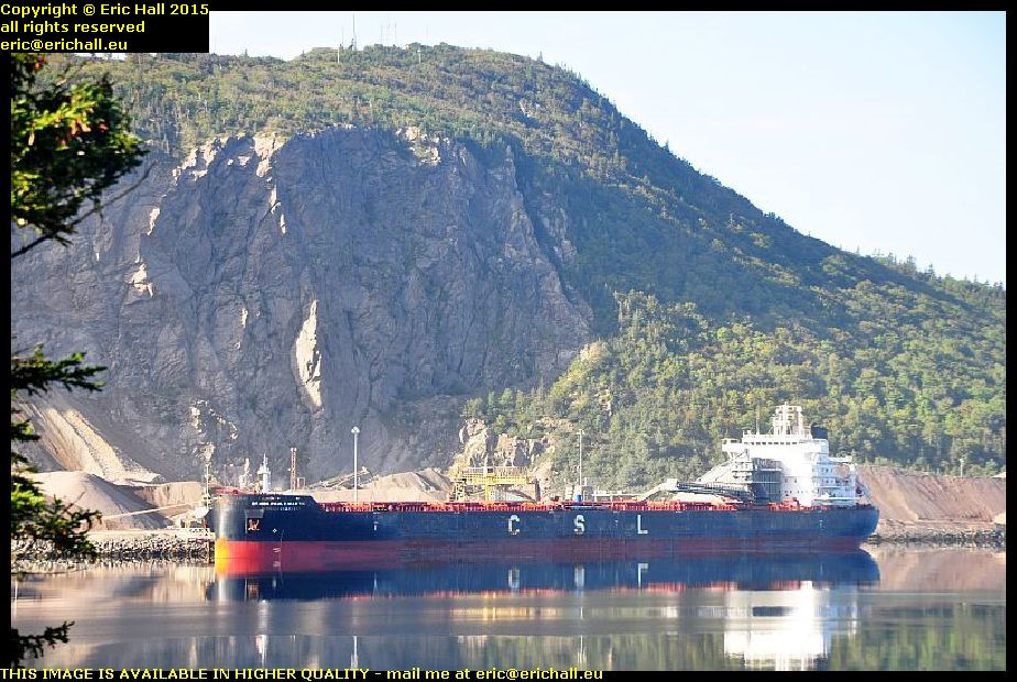
An hour on the road found me at St Barbe and there was an enormous queue waiting for tickets to sail. I was given ticket 16 – which meant that I would be the 16th casual voyager to be added after the reserved places are loaded. And to my surprise, with the senior discount to which I’m now entitled, a 90-minute crossing with Strider costs me all of just $18:58 – eat your hearts out, you European ferry travellers!

mv apollo st barbe newfoundland blanc sablon quebec labrador ferry canadaHaving fuelled up Strider (I keep telling you that out here you need to fuel up when you can) I lined up on the quayside watching the antics of the artics loading up the trailers, and then I was squeezed on board into a little corner of the ship.

And poor Apollo. As she steamed in, I couldn’t help noticing that she’s looking every day now of her almost 50 years and she can’t be long for this world now. The inside is pretty rough too, and I’d have taken a photo of what I meant, except that Bane of Britain here seems to have forgotten to bring his camera with him up into the lounge.

But now, after a heary breakfast of coffee, four rounds of toast and a plate of hash browns, I’m ready for anything. Including a couple of chats that I had had, one with a German guy in an ancient New-Brunswick-registered Dodge Caravan from Woodstock (the Caravan, not the German) with a spare wheel strapped to the top, and another older guy heading out to Goose Bay.

highway 138 lower north shore quebec canada
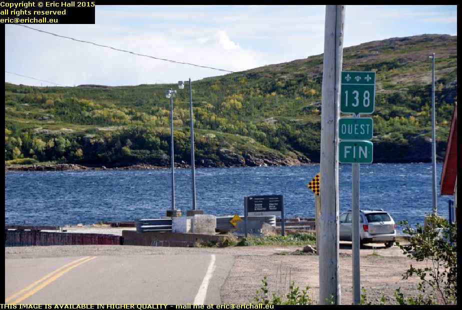
In May 2012 I’d done a tour of Quebec Highway 138 from Montreal all the way to the end at Natashquan where the road comes to a shuddering halt in the middle of nowhere.

It’s not actually the end of Highway 138, theoretically at least, because there’s part of the Quebec coast accessible from Blanc Sablon,and the road along there is also called Highway 138. I’d driven down here last year but there was that much fog and rain that we hardly saw a thing

highway 138 lower north shore quebec canada
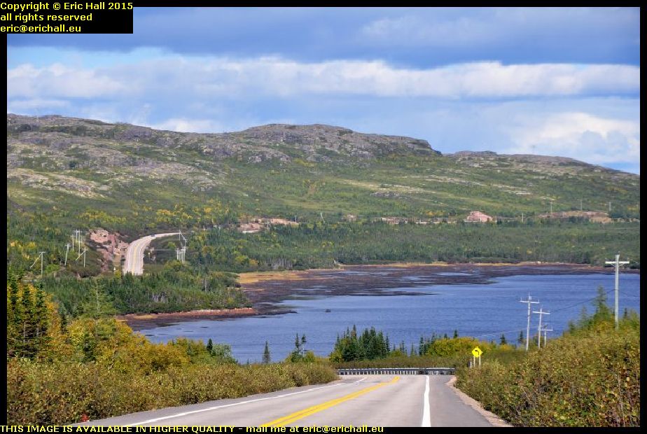
No such complaints today though. I was really lucky with the weather and couldn’t have wished for better. I’ve managed to retake all of the photographs that I took last year.

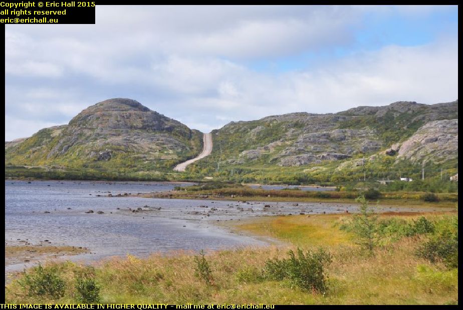
And you can see just how beautiful the road is. It doesn’t quite have the grandeur that the Trans Labrador Highway has, of course … "nothing can quite manage that" – ed … but it was a journey that I wanted to make, just to complete my Highway 138 adenture

end of highway 138 old fort bay vieux fort lower north shore quebec canada
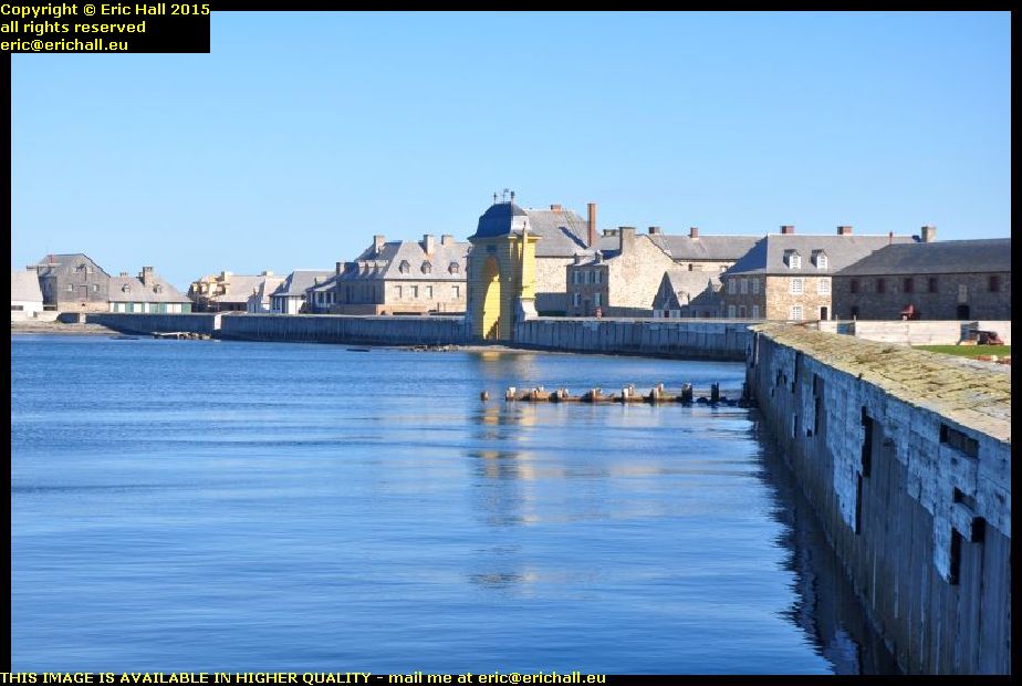
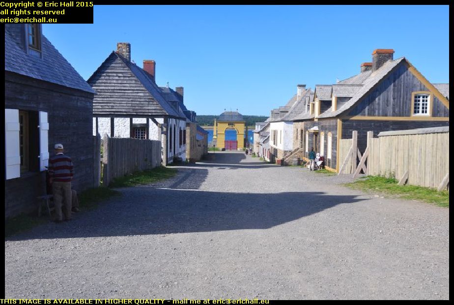
And so we arrive at Vieux Fort, known to the locals as Old Fort Bay because this is an Anglophone area, as I discovered a few years ago.

The Highway terminates at the harbour and here, right in front of us is an old quay. It’s closed off and marked “danger” so it’s clearly unused, but in view of its substantial construction, I wonder if the coastal boat that plies along the Lower North Shore used to call in here before the road through to here was opened.

old fort bay vieux fort lower north shore quebec canadaIt’s not quite the end of the Highway though. If the Highway ever is extended, which won’t be in the lifetime of anyone reading this rubbish, it’ll come round the head of the bay and head west.

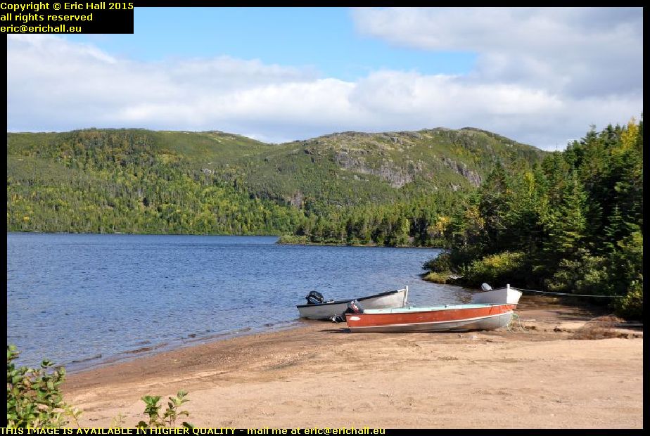
At the moment there’s a dirt highway that takes that road, and this eventually brings you down to this beautiful sheltered bay just here. When I arrive, a couple of fishermen … "fisherPERSONS" – ed … were launching a boat and setting off. This really IS the end of the road as far as I can tell, and it was a convenient place for me to stop for lunch.

middle bay lower north shore quebec canada
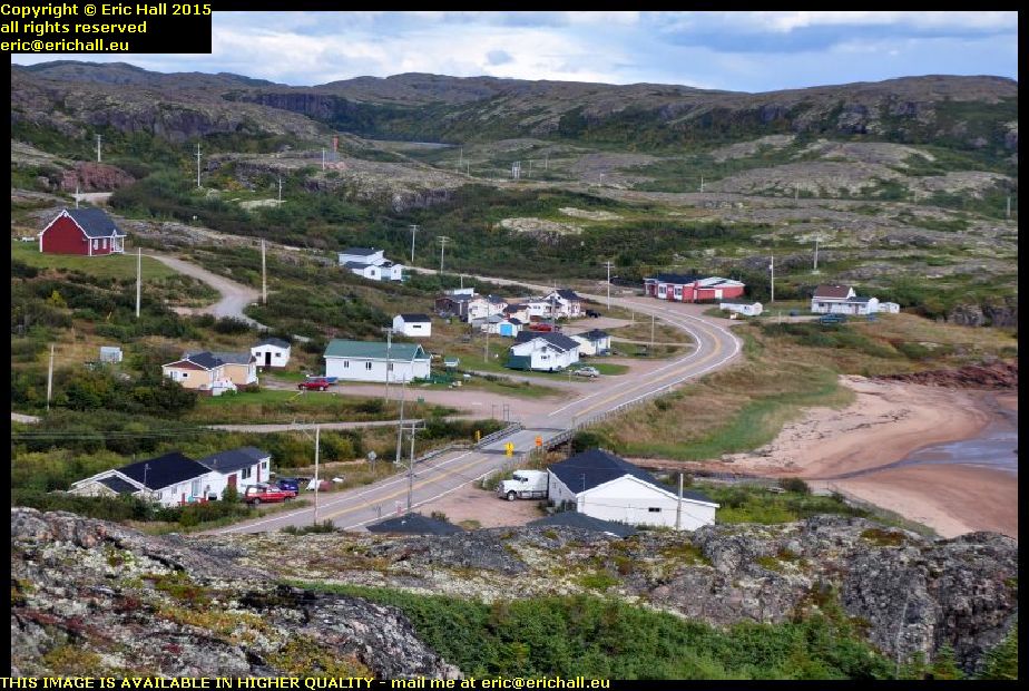
There are a few of the villages along the highway too and I took hundreds of photos of them. This is just one of them, Middle Bay.

This is said to be the site of a Basque whaling station back in the 16th Century. There were a couple of dozen along here and the most well-known example, Red Bay in Labrador has been excavated and there’s a museum there. However, I don’t know what, if anything, has been discovered here from that period

strider ford ranger labrador canada
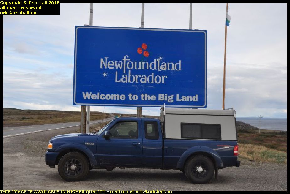
From here, I retraced my steps to Blanc Sablon and beyond towards L’Anse Aux Loups in Labrador.

We had to stop though, in order to take a photograph at the border just to prove that Strider was here. This is the border today, of course, but it might not be in the future because the mayor of Blanc Sablon has said that he would like to apply to the Canadian Government to secede from the Province of Quebec and join up with Labrador. Whether the Province of Quebec will agree to releasing some of its prisoners however remains to be seen.

jersey trail anse aux loups labrador canadaThere are many French names just here. Some of them relate to the exploration of Jacques Cartier, others to the French fishing boats that came along here in the 18th Century, but many others relate to inhabitants of the Channel Islands who colonised this area.

The old road along the coast prior to the construction of the new highway is called the Jersey Trail today, and there are all kinds of remnants and relics of the previous inhabitants along here. Excavations have taken place and many artefacts have been uncovered.

anse aux loups labrador canada
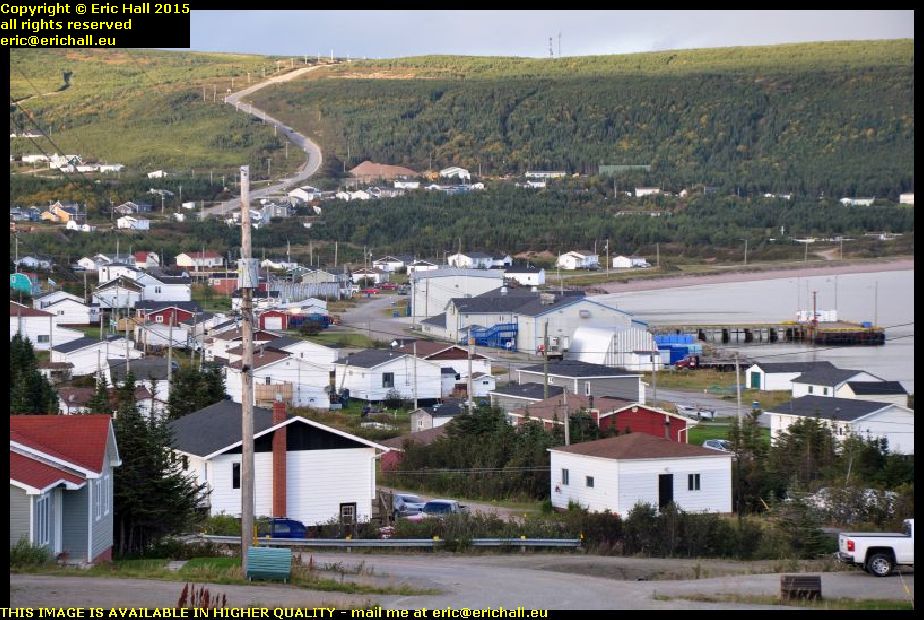
There are a dozen or so villages along here too. I missed out photographing them in 2010 because I was rushing for the ferry (I hadn’t realised that it ran on Newfoundland time, which is 90 minutes ahead of Quebec) and in 2014 I had the weather against me.

But never mind. Today, even though it was now going dark quite rapidly, I still had time to take all of the photos that I wanted to take.

labrador coastal drive deviation county cat pond canada
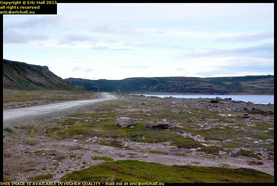
When I was here in 2010, the Labrador Coastal Drive followed the narrow valley of the Pinware River, but I did notice a considerable amount of roadworks in the area round by the County Cat Pond.

This is what they have been doing. The old road goes off to the right, but there’s a new road now going up the hill just there.

I can’t think why they have done it, though. The route along the Pinware River is beautiful, but this new route is all straight up and straight down. In 2014 I watched a huge lorry struggle up the hill in the rain and I bet he wasn’t amused.

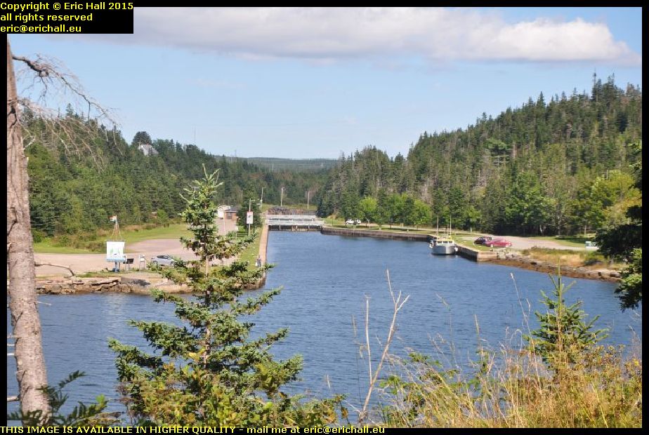
I had planned to stop at a Guest House in Red Bay for a wash and a change of clothes, but there was no-one there when I called, and so I’ll be spending another couple of nights sleeping along the road. I found a very basic rest area and even though it was early, it was freezing cold and so I went to bed. But not before putting the big insulated sunshield across the rear window of the truck cap and wrapping the rest around the head of my bed. I’ve a feeling that I’m going to need it tonight.

Wednesday 23rd September 2015 – I HAVE MADE A STARTLING DISCOVERY!

I woke up this morning to find no condensation on the roof of the truck cap. There was quite a bit down the sides, so clearly there was plenty about, but none on the roof.

What had happened was that in the confined and cramped circumstances yesterday, I’d put the pack of insulation outside on the roof of the truck cap instead of by the side of Strider as I would normally do. This seems to have had the effect of insulating the roof but from the outside.

And so what I’ve done is to go to a supermarket and bought a pile of giant-sized plastic bin bags. I’ll wrap the insulation up in those and stick them on the roof of the truck cap at night – I’ll be interested to see if this might solve the problem.

But apart from that, I’d had a reasonable night’s sleep last night even though I was on a truck stop and some of the trucks were idling away all night. even a train on the railway line across the Canso Strait didn’t disturb me all that much.

But next morning, I was surprised to find that the Tim Horton’s at Aulds Cove didn’t have a wifi connection. It’s the first that I’ve found that hasn’t had one. I had to decamp off onto Cape Breton Island and the Nova Scotia Tourist Board offices there

rt hon paul e martin aulds cove nova scotia canadaAnd I’m glad that I did, because when was the last time that we have had a “ship of the day”? Back in Montreal I reckon, and that was by default too.

This ship is the Rt Hon Paul E Martin, whoever he was when he was at home, if he ever was, anchored up at the huge quarry at Auld’s Cove. She’s a CSL (Canadian Shipping Lines) ship and has come here from Brayton Point, which is the site of a coal-fired power station on the coast of Massachusetts, USA, although she was seen in the Panama Canal a couple of weeks earlier.

canso canal st peters cape breton island nova scotia canadaIt’s been years since I’ve travelled up the southern shore of Cape Breton Isle – 2003 in fact – and so I reckoned that I would go up to Sydney that way, even though it’s the least interesting route.

I’d had a brief glimpse of the canal here when I passed by back then and so I reckoned that, seeing as how it was a nice day, I’d go and have a closer look.

atlantic ocean st peters canal cape breton island nova scotia canadaThat’s the Atlantic Ocean just there and just a couple of hundred yards away to my right is the Bras d’Or Lake which almost cuts Cape Breton Island in two. This little strip of land is all that prevents Cape Breton Island being split in two.

This area has always been a favourite portage site and the French had a fort around here – Fort Toulouse – that guarded the crossing

st peters canal breton island nova scotia canadaAt one time there was a rolling plank road that enabled sailors to drag their boats from one water to the other but in the 1850s the canal was built and this is what we have today, one of only two canals east of the St Lawrence that are still working.

You’ll notice that there are two lock gates at each end of the lock, and the gates are pointing in opposite directions. That’s because with the tides, the Atlantic Ocean can be either higher or lower than the Bras d’Or Lake and so the water flow needs to be controlled in either sense.

earthworks fort dorchester st peters cape breton isle nova scotia canadaThere’s nothing at all now left of Fort Toulouse but the British had a fort up here on a dominant eminence for a short while.

This was called Fort Dorchester and you can still see quite a few of the remains of earthworks up on the top. This appears to be part of an earthen bank that might have been part of the walls of the fort at one time.

louisbourg cape breton island nova scotia canadaAnother place that I had passed by back in 2003 was Louisbourg, the principal town and seaport of the French on Ile Royale – Cape Breton Island – in the 18th Century.

It’s quite an astonishing place, being effectively a fortified city in the middle of nowhere, and was a city over which the French and British fought on many occasions.

louisbourg cape breton island nova scotia canadaThe French engages in a triangular trade route between Nouvelle France, the French West Indies and France itself, and they needed a seaport somewhere in between to be a naval base, ship repair centre and trans-shipment port for the interior.

They chose Louisbourg to be the place, in view of the magnificent bay here, and so they build a fortified city.

louisbourg cape breton island nova scotia canadaAnd it needed to be fortified too. Its central position meant that it was miles away from anywhere else, and so miles away from where reinforcements might be obtained.

And with it straddling the British trade routes from British North America and Newfoundland, it was quite likely that in the event of war between Britain and France – a regular occurrence in the 18th Century, the British would want the fort neutralised.

louisbourg cape breton isle nova scotia canadaIt was captured on several occasions by the British and returned at the end of conflict, but finally the British captured it for keeps and it was abandoned, falling into ruin.

It’s been slowly rebuilt over the years and the result is quite spectacular. It’s just as it was back in its heyday and there are all kinds of 18th-century trades being undertaken here. I ended up having a lengthy chat with a couple of 18th-century boatbuilders who were building a caravel.

sydney louisbourg railway museum cape breton island nova scotia canadaLouisbourg is alwo well-known as the terminus of the Sydney-Louisbourg railway, and there’s a kind-of railway museum here.

I say “kind-of”, because no-one in their right minds would call it a real museum. While most “museums” in North America “preserve” their artefacts by slapping layer after layer of thick black paint over their exhibits, they can’t even be bothered to do that here.

sydney louisbourg railway museum cape breton island nova scotia canadaThe “exhibits” here are just rotting away and in a few more years there won’t be anything at all left.

This is beyond embarrassing and beyond shameful – it’s a total disgrace and how the administrators of the museum have the nerve to exhibit artefacts like this is totally beyond me. There’s nothing left for these artefacts except the scrapyard because they are way beyond any kind of preservation.

The administrators should be ashamed of themselves.

So having dealt with that rant, I went up to North Sydney, the Marine Atlantic terminal where I booked my passage on tonight’s sailing to Newfoundland. $155 too – it’s becoming more and more expensive. But then again they have a new ship and, this year, a new ferry terminal to pay for.

It’s the new “Highlander” upon which we are sailing, and it’s not sailing until 23:45 so that gives me plenty of time to organise some food. And in the terminal I have a very lengthy chat with an old guy who is also retired and is also off on his travels.

On board, we are stuck in the bowels of the ship, and I mean that too. There’s a hatch in the middle of the deck with a ramp that goes down another level with room for about 100 cars, and that’s where we end up – well below the water line. It’s a good job we don’t stay with our cars during the crossing. I’ll be a nervous wreck down here.

Monday 21st September 2015 – IT WAS COLD …

… last night in Strider. Firstly, the temperature had dropped outside during the night, and secondly, the aluminium sheeting provides nothing in the way of insulation – in fact quite the reverse. I’ll have to do something about that because the condensation was terrific too despite the rear window being ajar.

But as for the bed, it was indeed comfortable enough and once I did manage to drop off I was fine except for the noise from the lorries that awoke me every now and again as they went moving about the lorry park.

This morning I fitted my shelf up in the roof. It took ages to do as it had to be cut really fine and so I took four or five goes to cut it precisely to size, and then I screwed a front batten to it to stop the tins and everything sliding off. I’ll put the saucepan and the tin opener up there too so that they are to hand.

After a coffee and an internet at Tim Horton’s, I hit the road and headed to Moncton. First stop was the Salvation Army thrift shop where I picked up a book, a CD and a tin opener, seeing as how the one that I have doesn’t seem to want to do anything.

Second stop was not the second stop at all. Princess Autos is just opposite the Salvation Army thrift shop, but not any longer. It’s all closed down and they had the builders in. However the builders directed me there and although they didn’t have what I wanted, I ended up with a 19mm spanner (at last), a set of offset ring spanners and a big set of torx and torx-E drive sockets.

Value Village was a disappointment. I ended up with just a (rather expensive) book although it did produce a decent old saw and a tenon saw. The saw that I have is rather flaky and I need to do better. God second-hand tools are much better value than cheap new stuff, that’s for sure.

At Home Depot I bought a pile of insulation as well as a couple of sets of screwdriver bits for back home, and then I went off to have a look at the new music shop that has just opened across the car park.

And then I set off.

railway line across freeway dieppe moncton new brunswick canadaYou may remember a while ago that I wrote something about a railway line that crosses the big freeway at Dieppe (just outside Moncton) on the level and made a comment about the M25 in the UK.

So just so you know that I wasn’t pulling your leg about this, Strawberry Moose took a photo of the railway line as we passed over, so that you know that it’s there.

covered bridge tantramar marshes new brunswick usaOne of the things that I’ve been trying to do as I pass by here is to find a way across the Tantramar Marshes. There’s the freeway of course, but finding another road is not easy. This time however, with the aid of The Lady Who Lives In The Sat-Nav, whom I told to take the quickest way to Amherst without using the Freeway.

She found me some exciting roads, including passing over this delightful little covered bridge across one of the many drainage ditches that criss-cross the marshes.

The Tantramar Marshes have been described as “The Largest Hayfield In The World” and quite rightly so.

largest hayfield in the world tantramar marshes new brunswick canadaYou can see from this photo that I took from the ridge on the northern edge of the marsh that it lives up to its name. Especially at this time of year when the “rolos” are everywhere.

The marshes were originally drained by the first Acadian settlers here so that the hayfield could be created, and you can see everywhere the traces of the old drainage ditches running through the fields. You can also see traces of the old Acadian dykes and I took you to visit the remains one of them a couple of years ago.

wind turbines amherst nova scotia canadaMy route took me past the wind turbines across the border in Nova Scotia (there’s not a one in this area in New Brunswick) and down to the site of old Fort Beausejour. This is situated at the head of the Bay of Fundy where I would watch the sun set.

But as for this insulation, it’s no good. It’s far too thick, far too heavy and not flexible enough, so it would do for the roof. I’ll have a go at the sides tomorrow but I’m not hopeful and I can see all of this going in the bin even though it cost a lot of money.

I’ll have to think again about this.