I woke up this morning to find no condensation on the roof of the truck cap. There was quite a bit down the sides, so clearly there was plenty about, but none on the roof.
What had happened was that in the confined and cramped circumstances yesterday, I’d put the pack of insulation outside on the roof of the truck cap instead of by the side of Strider as I would normally do. This seems to have had the effect of insulating the roof but from the outside.
And so what I’ve done is to go to a supermarket and bought a pile of giant-sized plastic bin bags. I’ll wrap the insulation up in those and stick them on the roof of the truck cap at night – I’ll be interested to see if this might solve the problem.
But apart from that, I’d had a reasonable night’s sleep last night even though I was on a truck stop and some of the trucks were idling away all night. even a train on the railway line across the Canso Strait didn’t disturb me all that much.
But next morning, I was surprised to find that the Tim Horton’s at Aulds Cove didn’t have a wifi connection. It’s the first that I’ve found that hasn’t had one. I had to decamp off onto Cape Breton Island and the Nova Scotia Tourist Board offices there
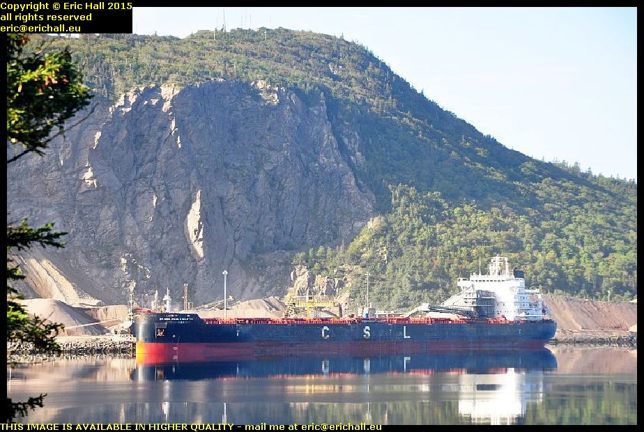 And I’m glad that I did, because when was the last time that we have had a “ship of the day”? Back in Montreal I reckon, and that was by default too.
This ship is the Rt Hon Paul E Martin, whoever he was when he was at home, if he ever was, anchored up at the huge quarry at Auld’s Cove. She’s a CSL (Canadian Shipping Lines) ship and has come here from Brayton Point, which is the site of a coal-fired power station on the coast of Massachusetts, USA, although she was seen in the Panama Canal a couple of weeks earlier.
 It’s been years since I’ve travelled up the southern shore of Cape Breton Isle – 2003 in fact – and so I reckoned that I would go up to Sydney that way, even though it’s the least interesting route.
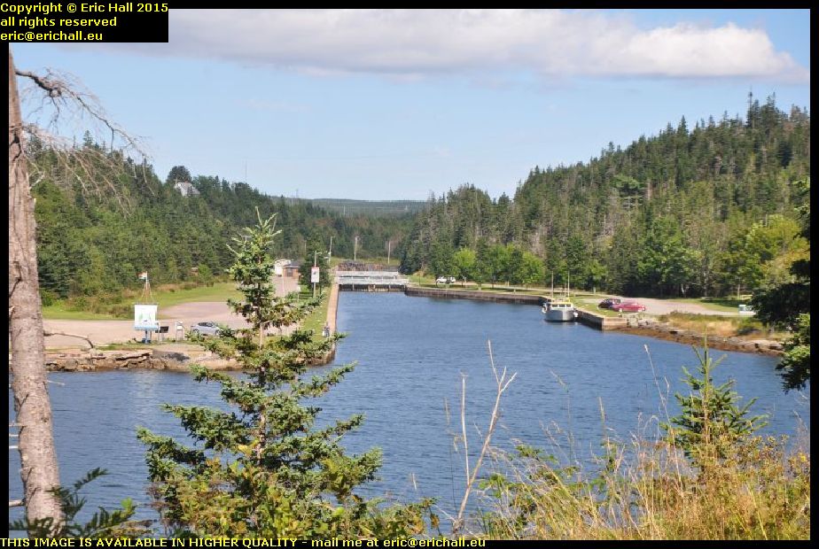
I’d had a brief glimpse of the canal here when I passed by back then and so I reckoned that, seeing as how it was a nice day, I’d go and have a closer look.
 That’s the Atlantic Ocean just there and just a couple of hundred yards away to my right is the Bras d’Or Lake which almost cuts Cape Breton Island in two. This little strip of land is all that prevents Cape Breton Island being split in two.
This area has always been a favourite portage site and the French had a fort around here – Fort Toulouse – that guarded the crossing
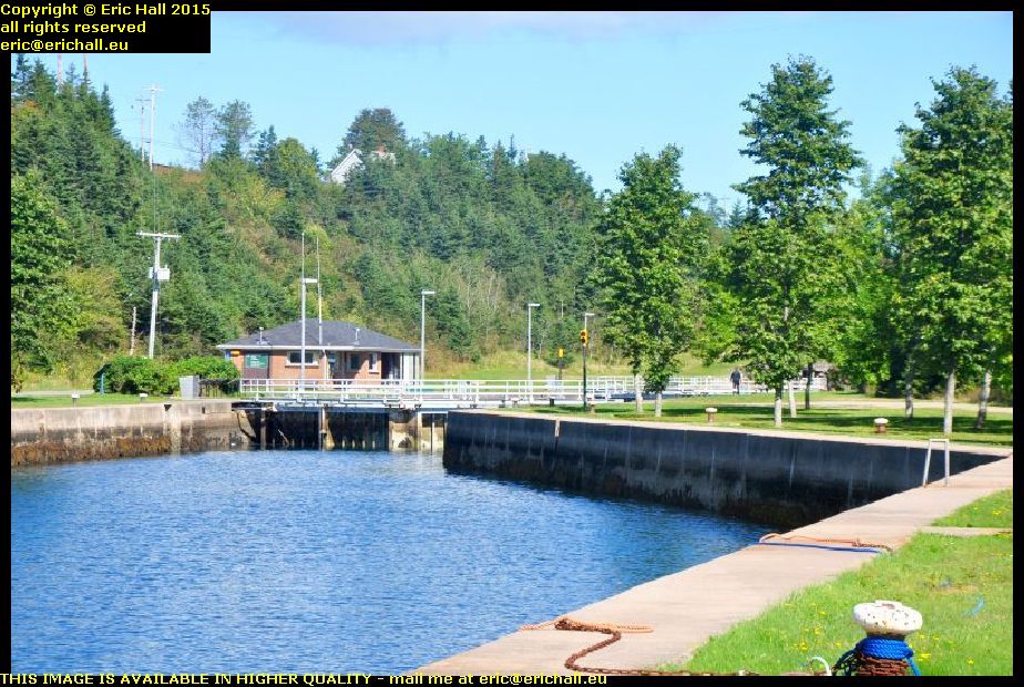 At one time there was a rolling plank road that enabled sailors to drag their boats from one water to the other but in the 1850s the canal was built and this is what we have today, one of only two canals east of the St Lawrence that are still working.
You’ll notice that there are two lock gates at each end of the lock, and the gates are pointing in opposite directions. That’s because with the tides, the Atlantic Ocean can be either higher or lower than the Bras d’Or Lake and so the water flow needs to be controlled in either sense.
 There’s nothing at all now left of Fort Toulouse but the British had a fort up here on a dominant eminence for a short while.
This was called Fort Dorchester and you can still see quite a few of the remains of earthworks up on the top. This appears to be part of an earthen bank that might have been part of the walls of the fort at one time.
 Another place that I had passed by back in 2003 was Louisbourg, the principal town and seaport of the French on Ile Royale – Cape Breton Island – in the 18th Century.
It’s quite an astonishing place, being effectively a fortified city in the middle of nowhere, and was a city over which the French and British fought on many occasions.
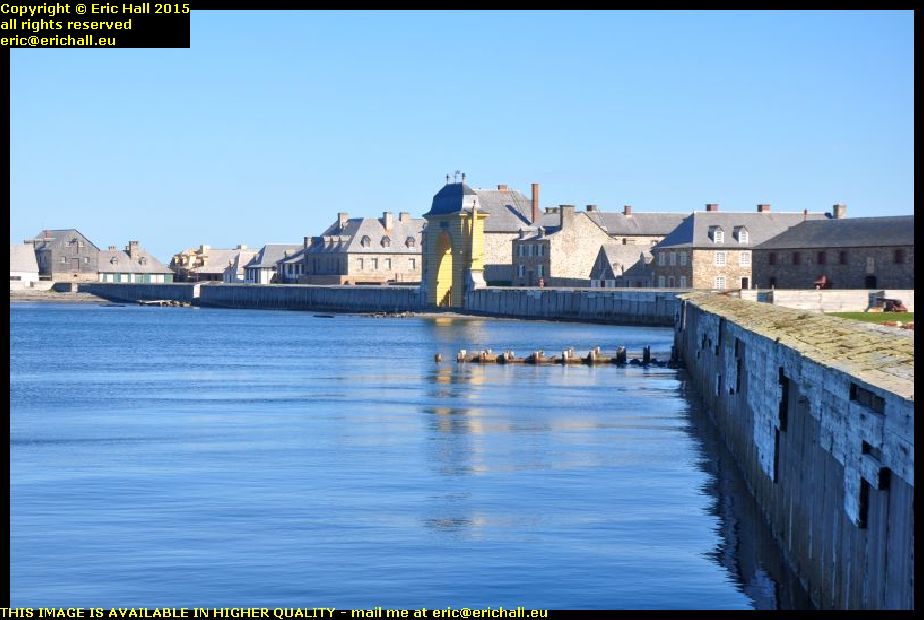 The French engages in a triangular trade route between Nouvelle France, the French West Indies and France itself, and they needed a seaport somewhere in between to be a naval base, ship repair centre and trans-shipment port for the interior.
They chose Louisbourg to be the place, in view of the magnificent bay here, and so they build a fortified city.
 And it needed to be fortified too. Its central position meant that it was miles away from anywhere else, and so miles away from where reinforcements might be obtained.
And with it straddling the British trade routes from British North America and Newfoundland, it was quite likely that in the event of war between Britain and France – a regular occurrence in the 18th Century, the British would want the fort neutralised.
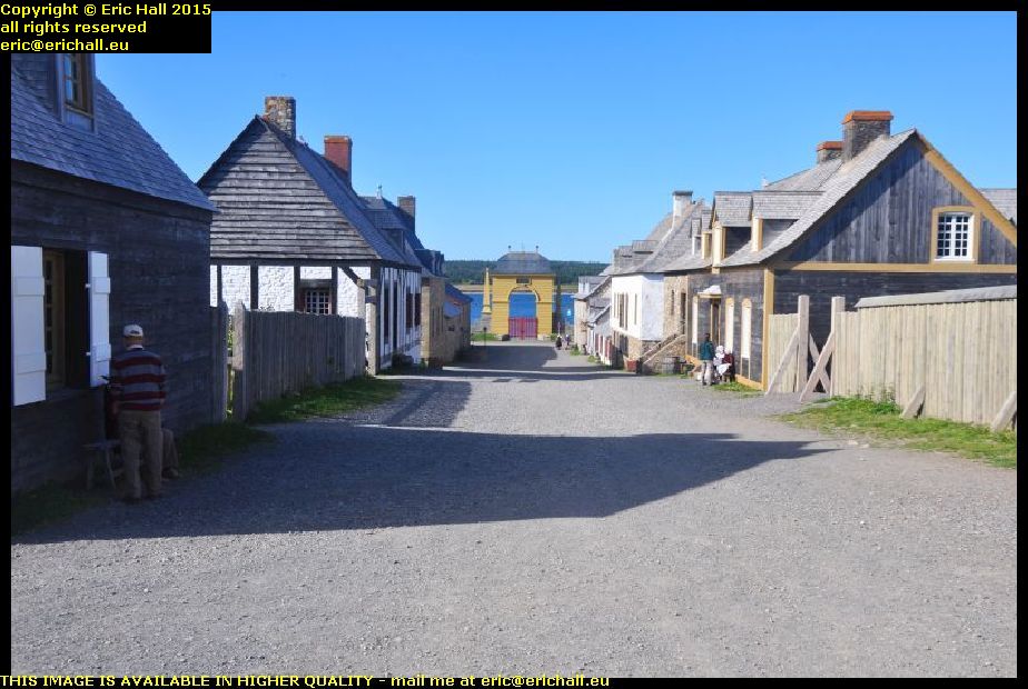 It was captured on several occasions by the British and returned at the end of conflict, but finally the British captured it for keeps and it was abandoned, falling into ruin.
It’s been slowly rebuilt over the years and the result is quite spectacular. It’s just as it was back in its heyday and there are all kinds of 18th-century trades being undertaken here. I ended up having a lengthy chat with a couple of 18th-century boatbuilders who were building a caravel.
 Louisbourg is alwo well-known as the terminus of the Sydney-Louisbourg railway, and there’s a kind-of railway museum here.
I say “kind-of”, because no-one in their right minds would call it a real museum. While most “museums” in North America “preserve” their artefacts by slapping layer after layer of thick black paint over their exhibits, they can’t even be bothered to do that here.
 The “exhibits” here are just rotting away and in a few more years there won’t be anything at all left.
This is beyond embarrassing and beyond shameful – it’s a total disgrace and how the administrators of the museum have the nerve to exhibit artefacts like this is totally beyond me. There’s nothing left for these artefacts except the scrapyard because they are way beyond any kind of preservation.
The administrators should be ashamed of themselves.
So having dealt with that rant, I went up to North Sydney, the Marine Atlantic terminal where I booked my passage on tonight’s sailing to Newfoundland. $155 too – it’s becoming more and more expensive. But then again they have a new ship and, this year, a new ferry terminal to pay for.
It’s the new “Highlander” upon which we are sailing, and it’s not sailing until 23:45 so that gives me plenty of time to organise some food. And in the terminal I have a very lengthy chat with an old guy who is also retired and is also off on his travels.
On board, we are stuck in the bowels of the ship, and I mean that too. There’s a hatch in the middle of the deck with a ramp that goes down another level with room for about 100 cars, and that’s where we end up – well below the water line. It’s a good job we don’t stay with our cars during the crossing. I’ll be a nervous wreck down here.