Tag Archives: canso strait

Wednesday 23rd September 2015 – I HAVE MADE A STARTLING DISCOVERY!

I woke up this morning to find no condensation on the roof of the truck cap. There was quite a bit down the sides, so clearly there was plenty about, but none on the roof.

What had happened was that in the confined and cramped circumstances yesterday, I’d put the pack of insulation outside on the roof of the truck cap instead of by the side of Strider as I would normally do. This seems to have had the effect of insulating the roof but from the outside.

And so what I’ve done is to go to a supermarket and bought a pile of giant-sized plastic bin bags. I’ll wrap the insulation up in those and stick them on the roof of the truck cap at night – I’ll be interested to see if this might solve the problem.

But apart from that, I’d had a reasonable night’s sleep last night even though I was on a truck stop and some of the trucks were idling away all night. even a train on the railway line across the Canso Strait didn’t disturb me all that much.

But next morning, I was surprised to find that the Tim Horton’s at Aulds Cove didn’t have a wifi connection. It’s the first that I’ve found that hasn’t had one. I had to decamp off onto Cape Breton Island and the Nova Scotia Tourist Board offices there
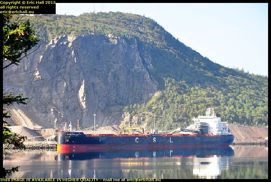
rt hon paul e martin aulds cove nova scotia canadaAnd I’m glad that I did, because when was the last time that we have had a “ship of the day”? Back in Montreal I reckon, and that was by default too.

This ship is the Rt Hon Paul E Martin, whoever he was when he was at home, if he ever was, anchored up at the huge quarry at Auld’s Cove. She’s a CSL (Canadian Shipping Lines) ship and has come here from Brayton Point, which is the site of a coal-fired power station on the coast of Massachusetts, USA, although she was seen in the Panama Canal a couple of weeks earlier.
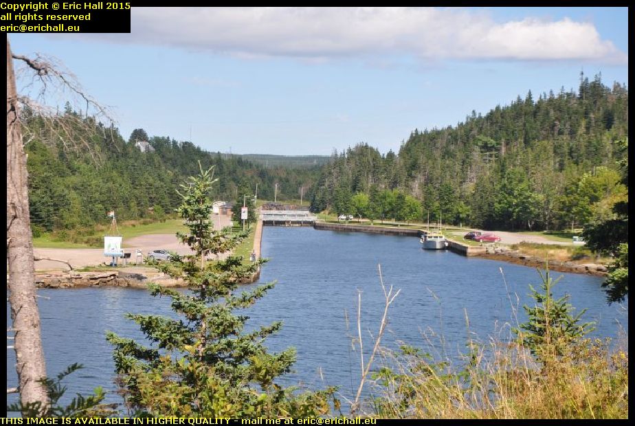
canso canal st peters cape breton island nova scotia canadaIt’s been years since I’ve travelled up the southern shore of Cape Breton Isle – 2003 in fact – and so I reckoned that I would go up to Sydney that way, even though it’s the least interesting route.

I’d had a brief glimpse of the canal here when I passed by back then and so I reckoned that, seeing as how it was a nice day, I’d go and have a closer look.

atlantic ocean st peters canal cape breton island nova scotia canadaThat’s the Atlantic Ocean just there and just a couple of hundred yards away to my right is the Bras d’Or Lake which almost cuts Cape Breton Island in two. This little strip of land is all that prevents Cape Breton Island being split in two.

This area has always been a favourite portage site and the French had a fort around here – Fort Toulouse – that guarded the crossing
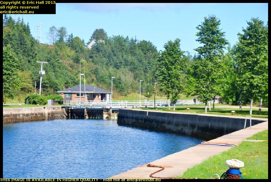
st peters canal breton island nova scotia canadaAt one time there was a rolling plank road that enabled sailors to drag their boats from one water to the other but in the 1850s the canal was built and this is what we have today, one of only two canals east of the St Lawrence that are still working.

You’ll notice that there are two lock gates at each end of the lock, and the gates are pointing in opposite directions. That’s because with the tides, the Atlantic Ocean can be either higher or lower than the Bras d’Or Lake and so the water flow needs to be controlled in either sense.

earthworks fort dorchester st peters cape breton isle nova scotia canadaThere’s nothing at all now left of Fort Toulouse but the British had a fort up here on a dominant eminence for a short while.

This was called Fort Dorchester and you can still see quite a few of the remains of earthworks up on the top. This appears to be part of an earthen bank that might have been part of the walls of the fort at one time.

louisbourg cape breton island nova scotia canadaAnother place that I had passed by back in 2003 was Louisbourg, the principal town and seaport of the French on Ile Royale – Cape Breton Island – in the 18th Century.

It’s quite an astonishing place, being effectively a fortified city in the middle of nowhere, and was a city over which the French and British fought on many occasions.
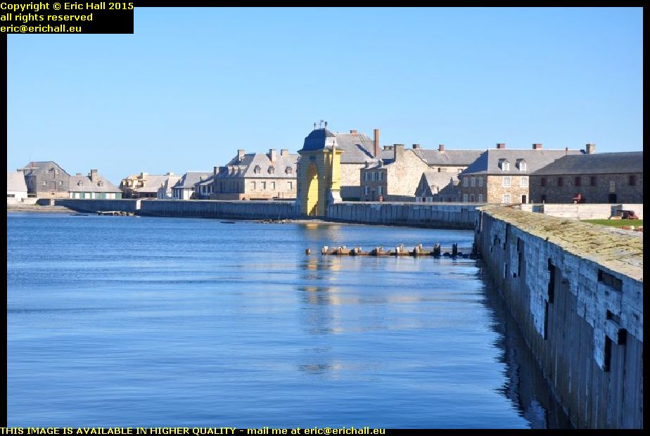
louisbourg cape breton island nova scotia canadaThe French engages in a triangular trade route between Nouvelle France, the French West Indies and France itself, and they needed a seaport somewhere in between to be a naval base, ship repair centre and trans-shipment port for the interior.

They chose Louisbourg to be the place, in view of the magnificent bay here, and so they build a fortified city.

louisbourg cape breton island nova scotia canadaAnd it needed to be fortified too. Its central position meant that it was miles away from anywhere else, and so miles away from where reinforcements might be obtained.

And with it straddling the British trade routes from British North America and Newfoundland, it was quite likely that in the event of war between Britain and France – a regular occurrence in the 18th Century, the British would want the fort neutralised.
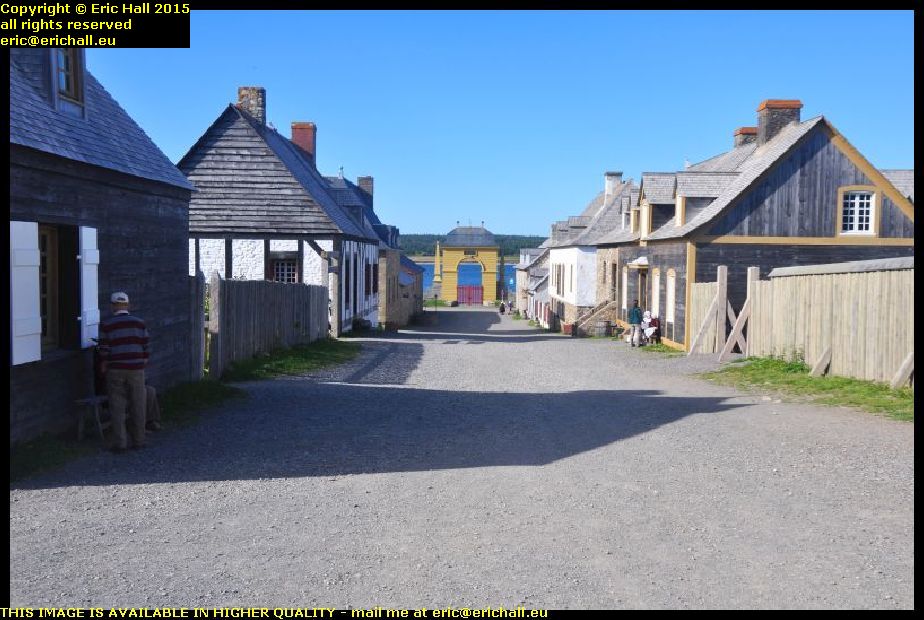
louisbourg cape breton isle nova scotia canadaIt was captured on several occasions by the British and returned at the end of conflict, but finally the British captured it for keeps and it was abandoned, falling into ruin.

It’s been slowly rebuilt over the years and the result is quite spectacular. It’s just as it was back in its heyday and there are all kinds of 18th-century trades being undertaken here. I ended up having a lengthy chat with a couple of 18th-century boatbuilders who were building a caravel.

sydney louisbourg railway museum cape breton island nova scotia canadaLouisbourg is alwo well-known as the terminus of the Sydney-Louisbourg railway, and there’s a kind-of railway museum here.

I say “kind-of”, because no-one in their right minds would call it a real museum. While most “museums” in North America “preserve” their artefacts by slapping layer after layer of thick black paint over their exhibits, they can’t even be bothered to do that here.

sydney louisbourg railway museum cape breton island nova scotia canadaThe “exhibits” here are just rotting away and in a few more years there won’t be anything at all left.

This is beyond embarrassing and beyond shameful – it’s a total disgrace and how the administrators of the museum have the nerve to exhibit artefacts like this is totally beyond me. There’s nothing left for these artefacts except the scrapyard because they are way beyond any kind of preservation.

The administrators should be ashamed of themselves.

So having dealt with that rant, I went up to North Sydney, the Marine Atlantic terminal where I booked my passage on tonight’s sailing to Newfoundland. $155 too – it’s becoming more and more expensive. But then again they have a new ship and, this year, a new ferry terminal to pay for.

It’s the new “Highlander” upon which we are sailing, and it’s not sailing until 23:45 so that gives me plenty of time to organise some food. And in the terminal I have a very lengthy chat with an old guy who is also retired and is also off on his travels.

On board, we are stuck in the bowels of the ship, and I mean that too. There’s a hatch in the middle of the deck with a ramp that goes down another level with room for about 100 cars, and that’s where we end up – well below the water line. It’s a good job we don’t stay with our cars during the crossing. I’ll be a nervous wreck down here.

Tuesday 16th September 2014 – I’VE REACHED THE SEASIDE.

evergreen motel antigonish nova scotia canadaThis motel where I found myself last night would have been really good value (apart from keeping on dropping the internet connection which annoyed me intensely when I was trying to work) but it was not at all the kind of place that I was looking for.

And I had a really bad night’s sleep too. That coffee that I had with Hannah did me no good at all.

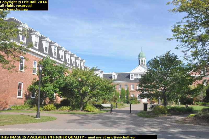
st francis xavier university antigonish nova scotia canadaSeeing as it was dark last night after I had left Hannah, I went off this morning for a little wander around the University campus to see what there was to see.

And it seems that apart from being at the most prestigious University in Canada, if not the entire English-speaking world, Hannah is also at probably the most beautiful one as well, because it really is nice and civilised here.

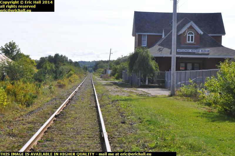
canadian national railway line antigonish nova scotia canadaThere’s a railway line here at Antigonish, which is a surprise as Canada really out-Beechinged Beeching when it came to decimating the railway network.

Judging by the rails it receives plenty of use, but the station doesn’t get any at all which is a tragedy for many people living around here. Canada really was ruthless when it came to gutting its passenger facilities. If it wasn’t for the fact that this is the main line for the oil that’s landed at Port Hawkesbury on Cape Breton Island, this line would have been long gone too.

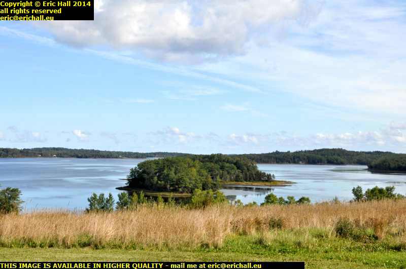
willimans point antigonish nova scotia canadaFrom here I wander off along the Nova Scotia coast because it certainly is beautiful around here. I have thousands of photos that I took and it’s hard to find just one that would do justice to the view.

This one is as good as any, taken from the end of the road down to Williams Point, just a few miles outside Antigonish. If you’re a fan of the outdoor life, then the coast of Nova Scotia is certainly the place to be.

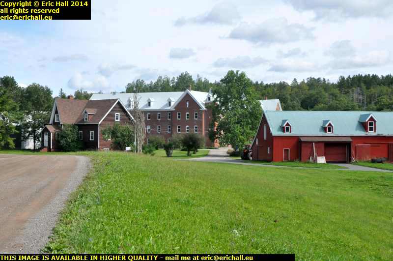
our lady of grace monastery nova scotia canadaThere’s a town called Monastery along the coast and it is so-called because there’s a monastery here. This is it, a couple of miles outside the town, and it’s called Our Lady of Grace.

It’s not very well-known but I once tried the monastic life, but I didn’t last too long. It was the monotonous diet that did it for me. There were only two monks who worked in the kitchen, the Chip Monk and the Fish Friar.

canso strait cape breton island nova scotia canadaThere’s the Canso Strait just down there at the bottom of the hill and Cape Breton Island is over there on the other side of the strait. That’s our destination for this afternoon and we’ll be there in 10 minutes with a bit of luck, God’s help and a bobby.

The south side of the island isn’t all that interesting apart from the old French fort at Louisbourg, I drove the central road in 2010 and so I’ll be going up along the north west coast.

site troy railway station abandoned railway line canso causeway inverness cape breton island nova scotia canadaWe mentioned the decimated Canadian railway network earlier, and this is my lunch stop at the site of the old Troy railway station.

There used to be a railway line that ran from the Canso Strait to Inverness as there used to be all coal mines out around there and the railway was used to haul away the coal. It opened in 1901 but passenger traffic ceased in 1959 and goods finally ceased in late 1980s although been tottering along on the edge of closure for years. Of course, the mines have all gone too. In fact I can’t think of any coal mine still operating on Cape Breton Island.

view cape breton island north coast cliffs nova scotia canadaComing out of the back end of Port Hood on the old gravel road over the headland, you’ll see why I’ve chosen this particular way round the island. The views from up here are really stunning looking north towards Inverness

And you are lucky that I took this photo. 5 seconds later and I was shrouded in dust from a school bus that roared past me like there as no tomorrow and it was like a Sahara dust storm.


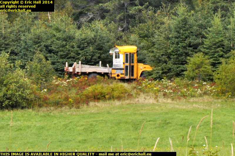
old redundant school bus transformed into pickup west mabou cape breton island nova scotia canadaOne of the “games” that we play on our travels is “101 uses for a redundant school bus”. School buses are only licensed for a certain number of years and so the countryside is littered with abandoned and redundant school buses. It’s interesting to see what people do with them.

Transforming them into pickups is certainly one of the best ideas that I’ve seen.

beach inverness cape breton island nova scotia canadaThe biggest town on this part of the coast is Inverness and it’s quite famous for its wonderful beach. This is what I’ve come here to see, and you can tell that they aren’t wrong about that.

And although it’s not by any means late (despite how dark it looks), my bad night has finally caught up with me. I’ve not been able to find a coffee place and I’m too tired to make one, so I’m going to crash out right here.

Friday 20th May 2011 – Today was a better day.

At least I was up at a reasonable time, for a change and had the usual couple of hours on the web pages. And although I didn’t advance far down the Canso Peninsula I managed to cover about 750 years and three continents, such is the controversy surrounding the alleged voyage of Sir Henry Sinclair to Chedabucto Bay sometime in the late 14th Century.

I carried on with Caliburn and he is now all reassembled and roadworthy, with a nice, clean and tidy cab and almost all the electrics working. You’ve no idea how much junk I took out, and how much I threw away either, but I didn’t find the SatNav, which is a pain. Mind you, a couple of quid, 5 Canadian cents and about 2 Euros made it worthwhile from that point of view. I would rather have the SatNav though.

We went for a run into Pionsat to draw some cash and to go to the Post Office to post Mike’s birthday present but blast it – it’s POETS Day isn’t it? And I missed the post.

Back here I didn’t manage to empty out the back of Caliburn as we had a torrential downpour – 14.5mm of rain fell and that’s a lot. Fed up with this blasted non-working water system, I dismantled it in the pouring rain and cleaned it all out. Now some kind of water is getting through but still nothing like enough and I’ll have to redesign it. I know a way to make it work.

But this weekend I’m really busy and so it won’t be until Monday that I can carry on.

Friday 22nd October 2010 – SO WE WERE ALL DISCHARGED …

caribou ferry north sydney cape breton Channel Port au Basques newfoundland labrador canada… from the “Caribou” … “He wasn’t discharged, he was expelled” – ed …  at 07:30. We weren’t torpedoed during the night after all. And the first thing that I did, after getting a coffee from Tim Horton’s, was to go to have a look around Sydney.

I’d been here in 2003 but with not being very well at the time I’d never really seen the place and so I resolved to rectify the matter.

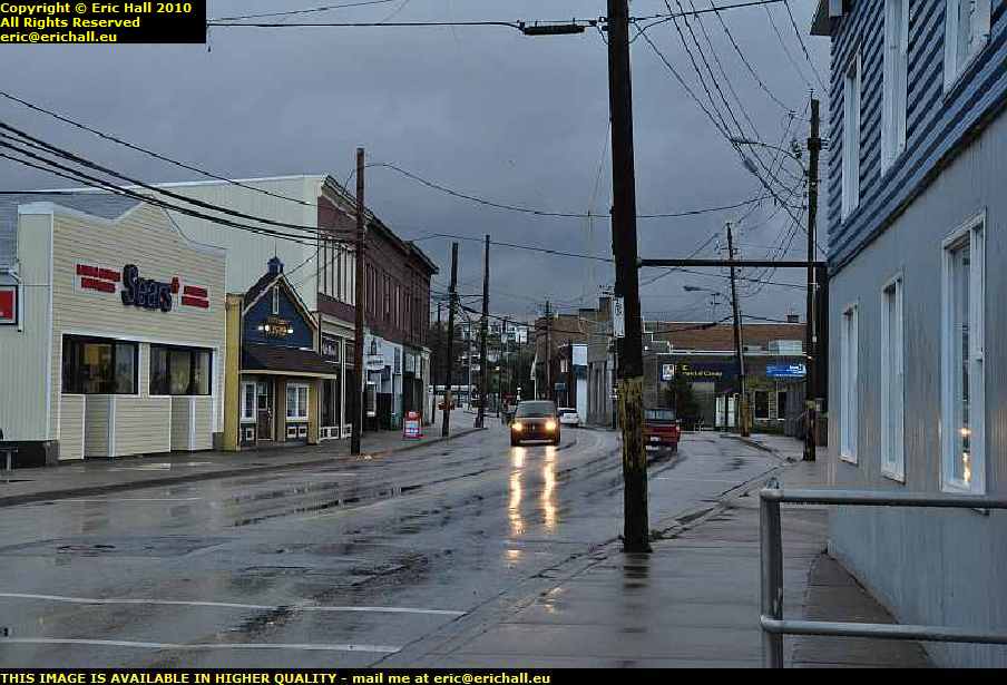
main street north sydney cape breton island nova scotia canadaSo here’s a photo of Main Street, just to prove that I was here. This is actually North Sydney, where the harbour is and I drove all around the harbour and I didn’t find a flaming Opera House or a blasted bridge anywhere.

Nothing for it but to head into Sydney itself, and that’s quite a hike away. And the road down to there has grown a roundabout. 10 years ago you could drive all around North America and not find a single one. Now they are all the rage and everyone wants one.

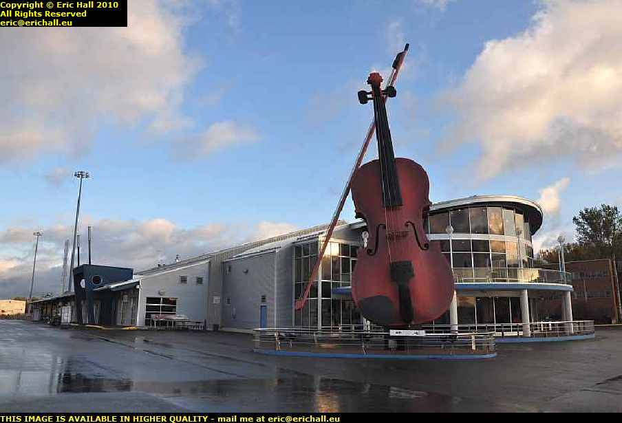
sydney opera house cape breton island nova scotia canadaThere may not be an Opera House here at Sydney but this is the next best thing to it.

Someone has certainly been on the fiddle here and I’ll probably find, if I were to go in, that it would be quite a vile inn. But there’s no chance of that at this time of morning.

But anyway, now you know that I’ve been here and seen it. That’s dealt with that outstanding issue.

seal island bridge cape breton island nova scotia canadaClimbing up Kelly’s Island, where in a space of 7kms the road climbs 240 metres, we can pull up at the viewpoint and take a good look at one of my favourite works of engineering, the Seal Island bridge.

It’s a shame that I have the early morning sun to deal with, but never mind. Lurking in the shade of a convenient pine tree, I can still manage something and the bridge still looks quite impressive regardless.

st anns lookout cape breton island nova scotia canadaOn the other side of Kelly’s Mountain there’s a lookout on the way down and I missed that completely in 2003. And it really is beautiful too.

There’s a ferry down there that goes across to the start of the Cabot Trail and I went that way in 2003. I’m going to go down there and cross over on the ferry and then do the Cabot Trail in the other direction.

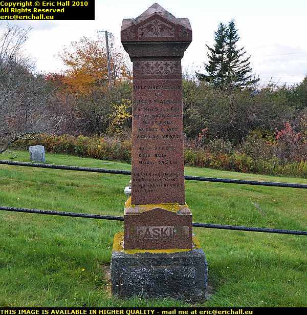
grave of giant macaskill englishtown cape breton island nova scotia canadaI had to take a little deviation to visit the cemetery at Englishtown. Here is the grave of Giant MacAskill. A normal-sized baby, during adolescence he just “grew and grew” and reached a height of 7’9″, a height that puts him well up in the ranks of the tallest men in history.

Born in Berneray in 1825 and christened Angus, he came here to Nova Scotia with his family in about 1831 and died in 1863.

estate of Alexander Graham Bell baddeck cape breton island nova scotia canadaBaddeck is said to be the birthplace of canadian aviation, with the flight of the “Silver Dart”, and it was also the home of Alexander Graham Bell.

There’s a museum here that is open for visits, but if you want to see the home of Bell, you can’t because it’s still occupied by his family and so is off limits to tourists. But out of pure interest, it’s over there on that headland where that tower is.

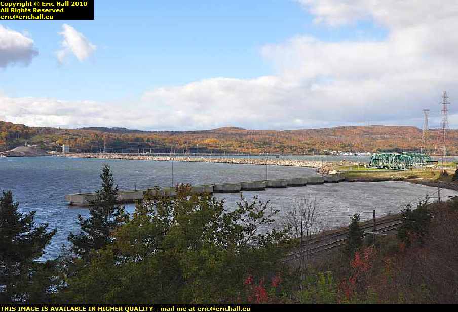
canso causeway cape breton isle nova scotia canadaCape Breton Isle was formerly an island as you might expect, but it’s been joined to the mainland of Canada by a causeway which carries a railway line and a road, as you can see down there.

There’s a canal through the causeway so that ships can still pass from one end of the Canso Strait to the other, and the bridge swivels out of the way whenever a ship needs to pass.

pleasant street nova scotia canadaI followed the western shore of the Canso Strait southwards for a while and it really was a beautiful drive, far too nice to ignore, and I must have taken hundreds of photos.

This is Pleasant Street, a very apt name I do say, but I forgot to record the name of the town in which it is situated. But the whole area was as beautiful this and I was having the right weather for sightseeing.

commercial cable company hazel hillAnd as well as beauty we were having plenty of history too.

All around here was a very important area 100 years ago, being the part of the North American continent nearest to Western Europe and several submarine trans-Atlantic telegraph cables came ashore here. This was the Hazel Hill terminal of the Commercial Cable Company and the story goes that the company built its offices and staff houses in brick in order to attract employees from urban areas to come and settle here

stormont country harbour ferry nova scotia canadaBut after my marathon drive today, I began to lose the light. Here on the Good Ship Ve … Stormont, Strawberry Moose took the helm with his assistants Seaman Staines and Roger the Cabin Boy while I worked out my next move.

According to the crew of the ferry, there’s a place down the road where they take in boarders  – “what do they tell them?” … ed – and that’s where I went.

bed and breakfast country harbour nova scotia canadaAnd if I could find more places like this on my route – nice friendly and cheerful proprietors, bed and breakfast in a comfortable room with use of cat and kitchen, for $45 cash, all of my troubles would be over.

>No internet though, but you can’t have everything I suppose.