Friday 22nd October 2010 – SO WE WERE ALL DISCHARGED …

caribou ferry north sydney cape breton Channel Port au Basques newfoundland labrador canada… from the “Caribou” … “He wasn’t discharged, he was expelled” – ed …  at 07:30. We weren’t torpedoed during the night after all. And the first thing that I did, after getting a coffee from Tim Horton’s, was to go to have a look around Sydney.

I’d been here in 2003 but with not being very well at the time I’d never really seen the place and so I resolved to rectify the matter.
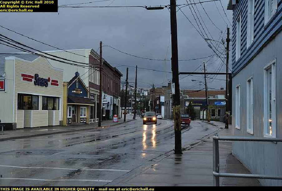
main street north sydney cape breton island nova scotia canadaSo here’s a photo of Main Street, just to prove that I was here. This is actually North Sydney, where the harbour is and I drove all around the harbour and I didn’t find a flaming Opera House or a blasted bridge anywhere.

Nothing for it but to head into Sydney itself, and that’s quite a hike away. And the road down to there has grown a roundabout. 10 years ago you could drive all around North America and not find a single one. Now they are all the rage and everyone wants one.
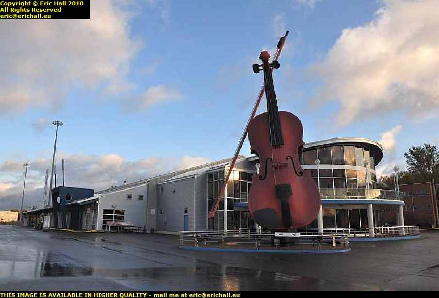
sydney opera house cape breton island nova scotia canadaThere may not be an Opera House here at Sydney but this is the next best thing to it.

Someone has certainly been on the fiddle here and I’ll probably find, if I were to go in, that it would be quite a vile inn. But there’s no chance of that at this time of morning.

But anyway, now you know that I’ve been here and seen it. That’s dealt with that outstanding issue.

seal island bridge cape breton island nova scotia canadaClimbing up Kelly’s Island, where in a space of 7kms the road climbs 240 metres, we can pull up at the viewpoint and take a good look at one of my favourite works of engineering, the Seal Island bridge.

It’s a shame that I have the early morning sun to deal with, but never mind. Lurking in the shade of a convenient pine tree, I can still manage something and the bridge still looks quite impressive regardless.

st anns lookout cape breton island nova scotia canadaOn the other side of Kelly’s Mountain there’s a lookout on the way down and I missed that completely in 2003. And it really is beautiful too.

There’s a ferry down there that goes across to the start of the Cabot Trail and I went that way in 2003. I’m going to go down there and cross over on the ferry and then do the Cabot Trail in the other direction.
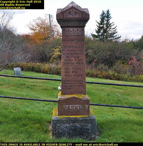
grave of giant macaskill englishtown cape breton island nova scotia canadaI had to take a little deviation to visit the cemetery at Englishtown. Here is the grave of Giant MacAskill. A normal-sized baby, during adolescence he just “grew and grew” and reached a height of 7’9″, a height that puts him well up in the ranks of the tallest men in history.

Born in Berneray in 1825 and christened Angus, he came here to Nova Scotia with his family in about 1831 and died in 1863.

estate of Alexander Graham Bell baddeck cape breton island nova scotia canadaBaddeck is said to be the birthplace of canadian aviation, with the flight of the “Silver Dart”, and it was also the home of Alexander Graham Bell.

There’s a museum here that is open for visits, but if you want to see the home of Bell, you can’t because it’s still occupied by his family and so is off limits to tourists. But out of pure interest, it’s over there on that headland where that tower is.
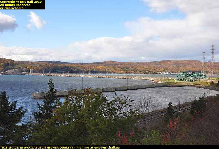
canso causeway cape breton isle nova scotia canadaCape Breton Isle was formerly an island as you might expect, but it’s been joined to the mainland of Canada by a causeway which carries a railway line and a road, as you can see down there.

There’s a canal through the causeway so that ships can still pass from one end of the Canso Strait to the other, and the bridge swivels out of the way whenever a ship needs to pass.

pleasant street nova scotia canadaI followed the western shore of the Canso Strait southwards for a while and it really was a beautiful drive, far too nice to ignore, and I must have taken hundreds of photos.

This is Pleasant Street, a very apt name I do say, but I forgot to record the name of the town in which it is situated. But the whole area was as beautiful this and I was having the right weather for sightseeing.

commercial cable company hazel hillAnd as well as beauty we were having plenty of history too.

All around here was a very important area 100 years ago, being the part of the North American continent nearest to Western Europe and several submarine trans-Atlantic telegraph cables came ashore here. This was the Hazel Hill terminal of the Commercial Cable Company and the story goes that the company built its offices and staff houses in brick in order to attract employees from urban areas to come and settle here

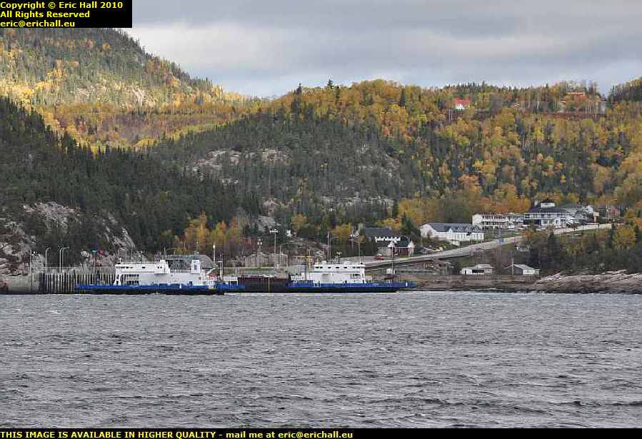
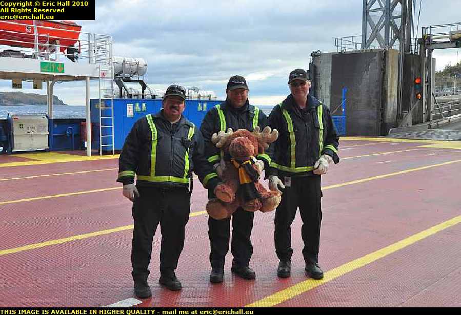
stormont country harbour ferry nova scotia canadaBut after my marathon drive today, I began to lose the light. Here on the Good Ship Ve … Stormont, Strawberry Moose took the helm with his assistants Seaman Staines and Roger the Cabin Boy while I worked out my next move.

According to the crew of the ferry, there’s a place down the road where they take in boarders  – “what do they tell them?” … ed – and that’s where I went.

bed and breakfast country harbour nova scotia canadaAnd if I could find more places like this on my route – nice friendly and cheerful proprietors, bed and breakfast in a comfortable room with use of cat and kitchen, for $45 cash, all of my troubles would be over.

>No internet though, but you can’t have everything I suppose.

Thursday 21st October 2010 – I KNOW THAT I SAID …

caribou car ferry channel port aux basques newfoundland north sydney cape breton island nova scotia canada… that I wouldn’t be blogging tonight but here I am in the harbour (well, the terminal, not actually in the harbour) of the ferry terminal at Channel Port Aux Basques with a few hours to go before I sail back to civilisation and I’ve discovered an internet hotspot.

And furthermore some very kind lady fellow passenger has shown me how to configure my computer to use it, so here I am

bed and breakfast corner brook newfoundland canadaLast night’s B&B was exciting. $50 a night for the room and breakfast. Breakfast was help-yourself, make it yourself, cook it yourself – just like last night’s meal where my stock of food was put to good account.

And although the room was advertised as “with private bath” I quickly learnt that what that meant was that when it was your turn to go in, you could have it to yourself without 20 people clambering in with you.

And that’s not as strange as it might appear either as all through breakfast different people kept on appearing – out of the attic, from tunnels in the ground, all kinds of places. It was a hobbit-hole to go with the best. But who’s complaining? $50 with breakfast and I could do with some more places like that on my travels.

typical newfoundland scenery canadaI wasn’t in a great rush to get to Channel Port Aux Basques as the ferry wasn’t until the late evening so I had a leisurely drive southwards.

The scenery along the road is typical of the western side of Newfoundland and in the early morning sunlight with a hanging cloud so typical of my own home in the Auvergne in France, I could be quite at home here.

abandoned American air base USAAF stephenville newfoundland canadaAlong the road I noticed a sign for the town of Stephenville and that rang a big bell with me. During World War II Britain mortgaged everything that it had in order to raise the cash to buy weapons from the USA and when the money ran out, they started selling off the land.

The US Air Force took over a large area of land here at Stephenville and built a huge air base, aimed primarily at refuelling the bombers that were always on patrol ready to attack the Soviet Union. It remained in service until guided missiles and rockets took over from bombers, whereupon it was abandoned.

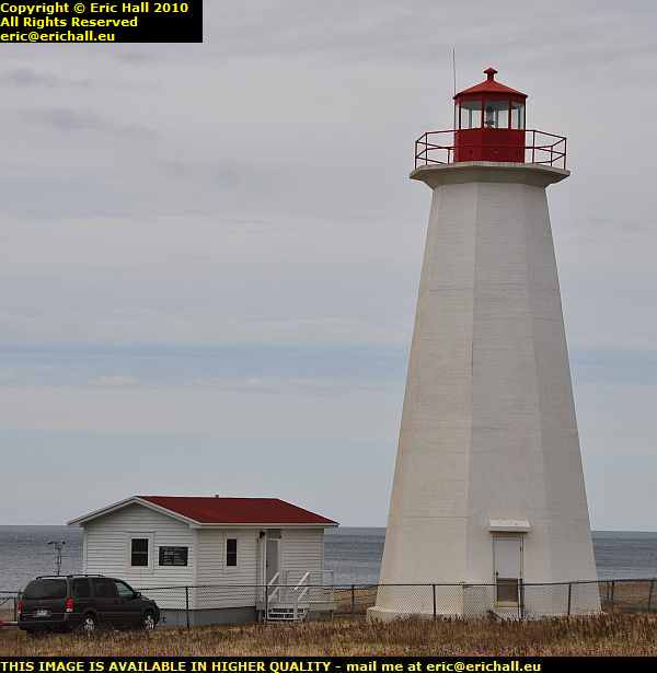
lighthouse cap anguille newfoundland canadaI stopped for lunch by the seaside in the shadow of the Cap Anguille lighthouse. We’re close to the entrance of the Strait of Belle Isle here, and this is the short cut out of the Gulf of St Lawrence and Western Europe.

The Strait is narrow and is quite often beset with icebergs, so navigation is not as straightforward as it might be. There are hundreds of wrecks littering the shoreline of the Strait as we know, hence all of the lighthouses along here to warn mariners of the dangers.

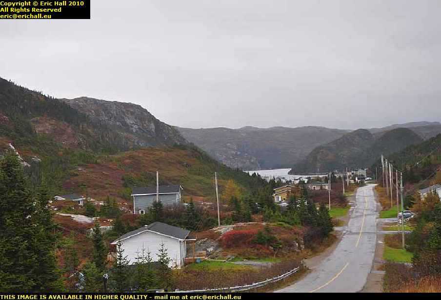
typical south western newfoundland scenery canadaWe’re back on the road and back in the typical Western Newfoundland scenery again. This is what the road looks like between Woodville and Codroy, at Bear Brook Cove not far out of Channel Port Aux Basques.

But now you’ll notice something else, and that is that the weather has closed right in. Rain is something that it’s impossible to avoid in Newfoundland and although I’ve done well this last couple of days, it’s finally caught up with me as I prepare to leave.

railway museum channel port aux basques newfoundland canadaAt the entrance to the town of Channel Port Aux Basques is a small railway museum exhibiting relics of the Newfoundland Railway. As a good way to pass the time in the middle of this torrential rainstorm I went over for a wander around to see what I could find about the history of the railway.

However, as you might expect, the museum was closed, and that was that.

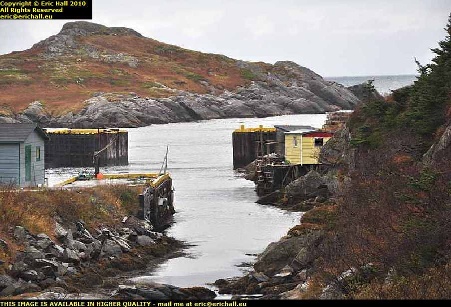
fox roost harbour newfoundland canadaI wasn’t going to hang around in the town and so instead, I went for a drive along the southern shore of Newfoundland. After a short drive, I found myself at the harbour at Fox Roost.

In fact, this is what most of the southern shore of Newfoundland looks like and had the weather been better, I would have been happy to spend much more time along here having a really good explore around.

newfoundland railway waggon body fox roost canadaAnd not only is the area famous for its beautiful scenery, it’s also famous for being littered with old waggon bodies from the Newfoundland railway.

The metal frames would be quite valuable for scrap but there would be no market for the bodies and they would make excellent garden sheds and storage units. In fact I could do with a few around here.

harbour le cou road newfoundland canadaThe road only goes so far down along the coast – you have to take a ferry the rest of the way – but right down as far as it is possible to go, there’s harbour le cou road – the road to neck harbour.

And the view from down at the end is just as stunning as the view from this end, but there is a limit to the number of photos that you can put on these pages. To see the rest, you need to go to this page.

By now, it’s going dark and I can see my ship in the distance heading towards port. I need to be heading back or I’ll miss it. And it’s not the Joseph and Clara Smallwood either – it’s the “Caribou”, and so when I went into the ticket office, I did say to the girl at the desk that I hope it doesn’t get torpedoed tonight in mid-channel. But that went clean over her head.

But here’s a thing.

There’s a cigarette lighter socket in the boot of Casey, and it only works when the ignition is switched on. I’ve wired a small inverter in there, one that I bought the other day, and I’ve wired the slow cooker into that. At lunchtime I threw in some water, a couple of handfuls of pasta, a small tin of veg, half a tin of beans – and a while later 1/3 of a tin of sauce into it and that’s been cooking away as I’ve been driving around.

While I wouldn’t say that it was boiling, it was certainly hot enough to eat. I reckon that meal cost me less than $1:00 and if I can keep this up, it’ll go some way to bringing the budget back under control.

strawberry moose casey chrysler PT cruiser caribou channel port aux basques newfoundland car ferry north sydney cape breton island nova scotia canadaEventually, we were allowed to board the ship and Strawberry Moose did well to park Casey correctly.

And having wined and dined, I’ve now found myself a nice comfortable reclining seat and I’m all set for a long voyage across the Gulf of St Lawrence, some of the most unpredictable waters in the world, submarine attacks notwithstanding.

Wednesday 20th October 2010 – I ALMOST FORGOT TO BLOG TONIGHT.

Yes, I was about to go to bed for an early night. I’m in Corner Brook for my last night in Newfoundland – a B&B in a private house at $50 for the night and they even let me use the kitchen to cook my tea from my supplies.

puncture casey chrysler pt cruiser canadian tires clarenville newfoundland canadaSo a cheap night tonight – but it needed to be, because this morning I had a nasty surprise. Casey had a flat tyre. 2000 miles down the worst roads in the world and not a thing, and a puncture on the Trans-Canada Highway. And so off to Canadian Tyres it had to be.

But it wasn’t all doom and gloom because they were having a sale of inverters – and I picked up a 75-watt and a 150-watt for just $19.98 for the pair.
And then, incredibly, at Walmart, a 40-watt slow cooker for just $9:99. So off to the dollar store for a pile of tins and so on and I now have all that I need to cook my meals in the car as I drive.

newfoundland railway ruins bridge joeys lookout gambo canadaWe’ve talked about the Newfoundland railway before and every so often I’d been encountering relics that looked very, very railway-like.

Here from my good spec up on Joey’s Lookout, whoever Joey might have been, near Gambo, I had this view and I don’t think that I’ve ever seen anything looking more like a railway line than this. It’s ironic in a sense that the railway, the 20th Century form of transport, has cut off access to the bay for boats, the previous method of transport around here

douglas dc3 dakota cockpit gander air museum newfoundland canadaAnother good stroke of fortune was that the Air Museum at Gander was open and while the girl in charge knew nothing about the missing artefacts she did know two authors of aviation books who are “friends” of the museum.

One of these men worked on the project for the replica flight of Alcock and Brown’s Vimy to celebrate the 75th anniversary. So if anyone knows anything about these objects one of these will.

hunter trapper selling rabbits by roadside gander newfoundland canadaOutside the museum was a fur trapper selling rabbits that he had trapped.

This took me by surprise. I thought that they only did things like that in the Last of the Mohicans but here he was – a genuine 21st Century trapper doing his stuff at the side of a main road in the middle of civilisation. If you were to read this in a novel you wouldn’t believe it.

newfoundland railway relics elmwood bridge canadaA little further on I can actually get in touch with the railway line.

This is a beautiful bow girder bridge across the river at Elmwood. And having been for a little walk along the line, I can tell you that it’s single-track and judging by the radii of some of the curves, narrow gauge too.

So now I know.

bed and breakfast guest house corner brook newfoundland canadaSo now it’s an early night in my guest house at Corner Brook.

There won’t be a posting tomorrow as I’m spending the night on this 7-hour crossing to Cape Breton Island where I’ll be picking up where I left off from my 2003 voyage.

And if I don’t blog the night after, it will be either because wherever I will be staying won’t have internet access, or else the ferry will have sunk. And don’t laugh about that either. On October 14th 1942 the Caribou, one of the predecessors of the ship I’ll be sailing on, was torpedoed by a U boat while crossing over the Gulf of St Lawrence.

And the ship I’ll be sailing on – it’s the first voyage since its rudder and steering gear have been repaired. So anything can happen – and it probably will, but I’ve got my Strawberry Moose to keep me warm.

Tuesday 19th October 2010 – THE BIG ISSUE …

… with fulfilling your lifetime’s ambition is “what do you do next?”

st john's harbour newfoundland canadaI reached St John’s today and had a good wander around. But I found hardly anything much to hold my interest,apart from a couple of things below.

The view of the harbour from up on the hill at the entrance to the harbour is impressive though and it showed you why this was such a key harbour during all of the events that took place on the north-eastern seaboard.

Last night I stayed in a little B&B that was excellent. The brother of the woman who ran it came round – he’s a teacher and we had a good chat about the aviation history of the area.

Now in a book that I once read, it stated that there was a little aviation museum that kept the bits of- the 5 attempts to cross the Atlantic in May 1919 – the undercarriage that fell off Hawker’s plane for example. But try as we might we could find nothing anywhere that looked like it might be anything.

But then this guy told me that a good while back a new museum had been built and all of the relics from a load of small museums were collected there, and there had also been a Transport Museum created.

And as my book was dated 1970 or something, long before the consolidation, he suggested I try those places.

transport museum newfoundland railway station st johns canadaAt the Transport Museum, one of my major assumptions was verified. Up in Central Newfoundland I’d seen traces of what looked like railway track bed – I would have staked my mortgage on it – and sure enough there had been a railway in Newfoundland and one of its tracks did go where I saw it.

So that was that. And a fascinating museum it was too – I spent ages there and learnt a lot but they had no trace of these aviation exhibits.

At the new museum, “unhelpful” is a word that I thought that I would never ever have to use in the English-speaking Maritimes, but unfortunately, here we are. The … errr …. young people on the reception desk knew nothing at all and wouldn’t be bothered to ring up to ask any elderly colleague to see what he or she might know.

But they did encourage me to visit the exhibition of a sculpture depicting the car-bombing of a street in Iraq – to see the “senseless destruction”.
“How appalling” I commented. “It’s a disgrace. It clearly made sense to the Freedom Fighter who detonated the bomb so I find your comments juvenile, offensive and patronising. When might there be an exhibition of some of the senseless American bombing of streets in Iraq?”

Yes, I was in a bad mood. I suppose these early aviation exhibits have been long swept into the obscurity of the distant past and probably won’t ever see the light of day again, which is a shame.

raynham morgan transatlantic flight attempt take off may 1919 pleasantville quidi vidi lake st johns newfoundland canadaI did however manage to track down what I reckon is the crash site of the “Raymor” – the aeroplane piloted by Raynham and Morgan. They took off from some land at Pleasantville, near Quidi Vidi Lake, and crashed at the end of the runway, heavily overloaded with fuel.

I once saw some photos of the aeroplane on the runway and I could identify the hills in the background, and I also saw a photo of the crash site, and I was also able to identify the hills in that location too – so I’m pretty sure that I’ve got it right.

It’s really the only place that it could be because everywhere else is either totally uneven terrain or the hills are too close.
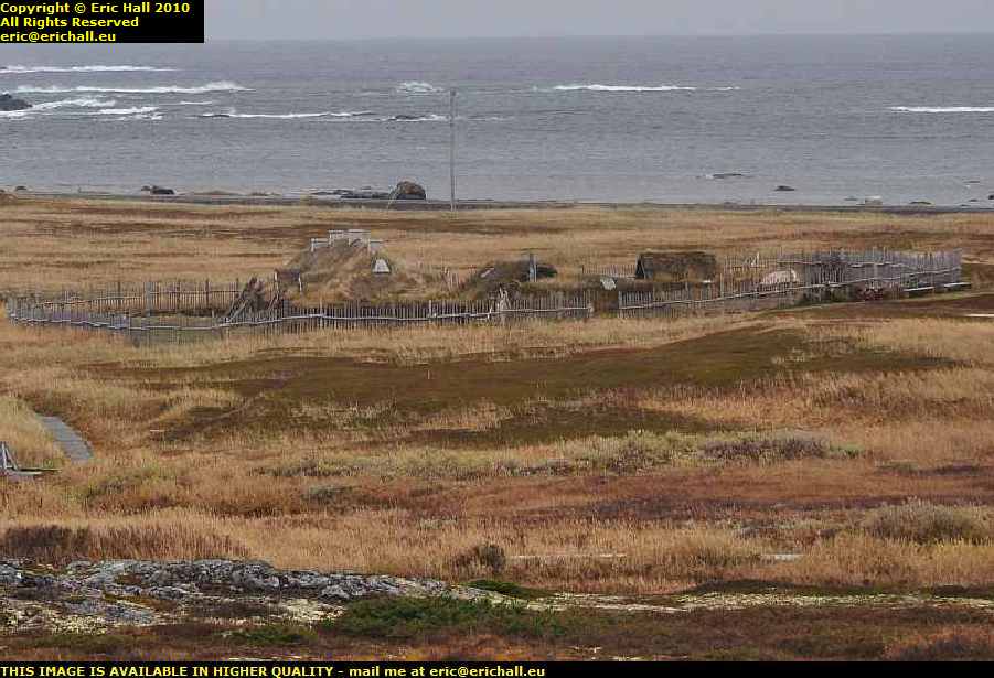
But it was still a hell of a place to try to take off with a new and untried aeroplane with an enormous load of fuel. Alcock and Brown, who had drawn to take off next from that field, immediately went around to look for another field rather than to try from there and in the end they used a field that had been allocated to another competitor but who had withdrawn. That, unfortunately, is now a big housing estate.

There were still a few other sites that I needed to track down, Hawker’s being the most important, but the light went and I needed to leave. I’ll have to come back again to Newfoundland, but I won’t be sorry. it really is a beautiful place even if the east coast does average something like … errr … 216 rainy days per year

strawberry moose cape spear newfoundland canadaSo now I’ve turned back and sad as it is to say it, I’m on my way home. I’ve reached the apogee of my voyage.

But I did see at St John’s, a sign that said “3940 kms to Paris”. And when I fuelled up just outside the city I noticed that since leaving Toronto not quite 3 weeks ago, I’ve driven far enough to have gone to Paris and come back, and still had mileage to spare.

Monday 18th October 2010 – "KEEP OUT! I AM WORKING CAPE RACE!"

marconi radio station cape race lighthouse newfoundland canadaIf ever 7 words changed the fate of so many people, it was “Keep Out, I am Working Cape Race”.

At the turn of the 20th Century Marconi perfected his radio  transmission system and it had the potential to overwhelm the cable line that had been laid across the Atlantic many years before.

Although he had managed to transmit directly across the Atlantic from shore to shore, it wasn’t as yet a practical proposition to do it consistently and so he set up a station at Cape Race – the nearest to Europe – and another one at Valentia in Ireland – the nearest to North America.

He then put his operators, whose wages his company paid for, on board ships, with the promise to the shipping lines that they would receive and transmit important navigation information between ships with the aim of making the oceans a safer place. And it is a fact that losses and deaths in the important shipping lanes declined significantly.

However, the sinking of the Titanic stunned the world and at the subsequent public enquiry Marconi gave his evidence that seemed to confirm the instructions that had been issued to his employees concerning the priority that “navigational” messages were to receive

But as the enquiry unfolded, it became clear that Marconi had been … errrr… economical with the truth. What was really happening was that Marconi was using the ships to bounce messages across the Atlantic by radio. And when the Titanic came into the range of the radio station at Cape Race the radio operator started to transmit a battery of Marconi’s commercial messages that lasted for three hours.

During this period, the Californian had become embedded in the ice and as the radio operator of the Californian knew that the Titanic was on the same track as his ship but an hour or so behind, he tried to send an urgent message to the Titanic to give it a warning.

It was then that the operator on the Titanic cut him off with his curt message, and the ice warning never made it to the Titanic‘s captain. The fate of the Titanic was thereby sealed.

At the subsequent public enquiry the Chairman asked the radio operator of the Californian “I’m sure you didn’t mean to listen but could you say what character of messages the Titanic was transmitting?”
The operator replied “I’m sure that these messages were of a private nature”.

trepassey bay newfoundland canadaNow this is Trepassey Bay, with the town of Trepassey in the background. Trepassey Bay is only an hour or so from Cape Race and the town played an important part in the history of aviation.

If you ask most Americans who was the first to fly the Atlantic they would reply “Charles Lindbergh”. But in fact much to their surprise and to the surprise of many others, at least 91 people (maybe 92 if a mysterious stowaway is included, and maybe even 94 if the mysterious fate of a pair of Portuguese aviators is ever unravelled. They disappeared on a flight across the South Atlantic and were never found, but a raft made from parts of their aircraft was discovered washed up on a remote part of the coast of Brazil) crossed the Atlantic before the Flying Fool.

Most British people would reply “Alcock and Brown” – but to the surprise of many people, that’s not correct either. What Alcock and Brown actually achieved was the TOP flight across the Atlantic.

There was an earlier trans-Atlantic flight by a US Navy Pilot by the name of Albert Read. However his flight was a little different. It was in a seaplane along a route marked by a line of US Navy ships, he made several stops on the way, had a break in the Azores before starting again for Lisbon, and the two other seaplanes that accompanied him failed to make the journey.

Nevertheless it is the first trans-Atlantic crossing no matter by what standards you measure his flight, and it has never ever received the credit that it deserves. And of course he set off from Trepassey Bay in Newfoundland.

commander read memorial plaque trepassey bay newfoundland canadaIf you hunt around the town you might, if you are lucky, eventually find a little plaque to commemorate Read’s efforts.

As for Amelia Earhart, the first woman to cross the Atlantic by air and who set off from here (and she did not pilot the aeroplane, no matter who insists that she did. In her memoirs she states that “Schultz did all the flying … I was just baggage, like a sack of potatoes”), and the Marquis of Pinedo, who was first to fly the Atlantic in both directions and who set off from here on the return trip, there’s nothing at all.

marconi radio station cape race lighthouse newfoundland canadaSo from Trepassey I went off to see Cape Race, seeing as I was here.

And I was lucky too. Although the place was closed up, someone had come by to collect the post and she allowed me to visit the museum. There are quite a few artefacts there from the time of the Titanic, and they were recovered on site.

When the Marconi station closed down, it was simply bulldozed into the earth with everything still inside. When the museum was proposed, the volunteers scavenged in the debris for the artefacts to exhibit.

seal bay bulls newfoundland canadaThis gentleman set the seal on my little trip, and gave me his seal of approval. Sitting there on his rock giving me a round of applause as I drove past him.

What with porcupines, moose and bear, and now seals coming along to mark my progezss, I’m having more than my fair share of wildlife. I’m disappointed that I haven’t seen Godzilla however.

merkur sierra xr4i tor cove bay bulls newfoundland canadaAnd despite what you might be thinking, this is NOT a Ford Sierra.

This is actually a Merkur Sierra – for the Sierra and the Scorpio were exported to North America under the Merkur trade name. The experiment didn’t last very long at all and you will be very lucky to be able to find one these days. I couldn’t believe my luck.

So now I’ve found a little Bed and Breakfast on the edge of St John’s, and I am immensely happy that I bought that cheap little GPS in Windsor a few weeks ago – it’s more-than paid for itself just with tracking down these obscure places.

Sunday 17th October 2010 – SUNDAY NIGHT FOUND ME IN ST. BRIDES

atlantica motel st brides newfoundland canadaAnd I bet you are wondering where this might be. It is in fact right down in the south-east of Newfoundland on the coast of Placentia Bay.

The motel was cold and damp at first, but then again I was the first visitor for 5 weeks and I did appear unexpectedly. But half an hour with the electric heater soon solved the problem.

And Argentia, and Placentia Bay is of some historical significance – it’s a huge deep bay on the south coast of Newfoundland and its historical claim to fame is that it was one of the assembly point of ships sailing from North America during World War II. They would arrive in the bay here and would be marshalled into their appropriate convoys – the Home Fast, the Home Slow, the Arctic Convoys and so on, be allocated a destroyer group to escort them on their voyage, and then they would be sent off into the cauldron that was the Battle of the Atlantic

plancentia bay argentia newfoundland canadaAnd not only that, an important wartime conference took place here between Churchill and Roosevelt in August 1941 – 5 months before the USA entered the war. The Atlantic Charter, as it became known, set out Churchill and Roosevelt’s vision for a postwar world.

And the one thing that rings any kind of bell about the Bay – the memoirs of Jack Broome or the biography of “Johnny” Walker for example, will be the mists and the fog and the persistent rain of this area. And do you know what? It’s absolutely pouring down – rain I don’t recall ever having seen before – and the fog is so thick you can cut it with a knife.

deer lake motel newfoundland canada And that is astonishing because for about 9/10ths of my journey across the south of Newfoundland from leaving my motel at Deer Lake until about Clarenville or whatever, the weather was absolutely gorgeous and I was in shirtsleeves.

The moment I crossed the final mountain range to the east coast, the change in the weather was dramatic.

gander airport newfoundland canadaI’ve also been to another historical site today – the airport at Gander. Before he became the officer in charge of Bomber Command, “Bomber” Harris was the chief of the Royal Air Force’s Purchasing Commission in the USA, charged with re-equipping Bomber Command with medium bombers after the Fairey Battles had been annihilated during the retreat to Dunkirk.

He bought a large amount of Lockheed Hudson bombers but hadn’t thought about how he would get them back to the UK.

A young BOAC pilot by the name of Donald Bennett, who had been seconded to his command, said “why don’t we fly them back?” and the Atlantic Ferry was born.

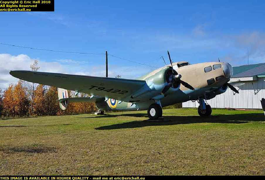
lockheed hudson bomber air museum gander newfoundland canadaBennett, officially a civilian who, in his BOAC days had flown passenger aircraft across the Atlantic in the 1930s, flew first one, from the USA to the civilian airfield at Gander where he refuelled.

On the night of 10th November 1940 as navigator, he led a squadron of Hudsons off for the 16-hour flight to Aldergrove in Northern Ireland, over 2000 miles across the Atlantic. Following the success of the flight, all kinds of planes subsequently flew from North America to Europe with the Atlantic Ferry, and the father of Liz (who reads this blog) was a navigator on some of the Halifaxes made in Canada that made the crossing.

war grave world war II military cemetery gander newfoundlandn those days, with primitive navigational aids and unknown climatic conditions the flights could be hazardous and many machines were lost.

Just outside Gander is a Commonwealth War Graves Cemetery with the remains of 100 aircrew who perished at Gander – either exhausted after the long flight from the USA to Gander and becoming disorientated in the fog, or else failing to leave the ground in the planes so heavily overloaded with petrol for the long flight across the Ocean.

But I saw something in the cemetery that absolutely disgusted me. A woman was there with a dog – off its lead – and it urinated on a grave.

The woman did nothing. I did something – I made the woman completely aware of what I thought about all of this and by the time I had finished she got back into her car with her dog and left the scene. It was a thoroughly shameful display.

car towing two trailers clarenville newfoundland canadaAnd so I finished my journey along the Trans Canada Highway down to the south-east of Newfoundland, admiring the scenery and the rather lax traffic laws that allow all kinds of bizarre combinations of vehicles and trailers to take to the road.

Long-gone are they days when this kind of thing would be tolerated in Europe, and if I could obtain a residence permit for Canada I’d be here like a shot.

Saturday 16th October 2010 – WE MADE IT TO L’ANSE AUX MEADOWS TODAY

l'anse aux meadows viking settlement norse newfoundland canadaThe view is spectacular and you can understand why the Norse chose this particular site.

There are two crescent-moon shaped bays, both well-sheltered, next to each other surrounded by cliffs to the prevailing northern side, and a low bank behind to stop the easterly winds. The boats could be brought right up to the village when weather conditions were right but a sandbank has intervened these days.

l'anse aux meadows viking settlement norse newfoundland canadaUnfortunately, the place was all closed up and locked, but having driven all of this way to get here, I was not going to be thwarted.

A visitor centre with a low roof miles from anywhere where there isn’t anyone about is not going to be a barrier to anyone who is sufficiently determined, and 10 minutes later we were in the park.

ruins viking norse remains l'anse aux meadows newfoundland canadaIt’s a little confusing at first – they have built some replicas of the Viking buildings, but these are some way from the remains of the original Viking ruins.

The remains of the original buildings are surprisingly open. They are not fenced off at all to anyone so you can wander around them.

bog iron l'anse aux meadows viking settlement norse newfoundland canadaThere are all kinds of traces of bog iron too just floating on the surface of the bog. The Norse travellers would have found this very useful to repair their ships.

But after that I had to clear off smartish-like because the heavens opened and I was soaked to the skin just walking back to the car. And I don’t have long here and I have a lot to do.

You may not think it but Newfoundland is huge, much bigger than it looks on a map and I have to travel from here, at the extreme north-east, down to the Marconi station at the extreme south-west, and its over 1300 kms, would you believe.

deer lake motel newfoundland canadaAnd so in a kind of minimalist mode I’ve made it this evening to Deer Lake where I can pick up the Trans-Canada Highway eastward.

The motel isn’t as cheap (by a long way) as I’d been hoping, but around here there are not so many choices. There was a cheap bed-and-breakfast but no-one answered when I knocked on the door. It made me wish that I had bought a mobile phone as well as a Sat-Nav.

beautiful scenery north west newfoundland canadaThe drive along the Viking Trail down from l’Anse aux Meadows to here was almost 500 kms, you know and we went through some wonderful scenery, because Northern Newfoundland really is beautiful.

There are some really nice mountains and massifs and had the weather been better and had I had more time, I could have taken hundreds of photos along here but I was in a rush.

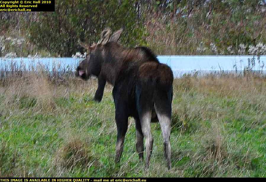
moose newfoundland canadaWe also saw some of Strawberry Moose‘s cousins. One was quite a good clear shot which came out blurred due to the darkness that was surrounding me.

As for the second – there were about 3 vehicles in a line – I was the middle one – and in the darkness and we were travelling at speed, suddenly the front car slammed on his brakes and screeched to a stop, and we saw four long legs in the headlight beam disappear into the forest. He had just had a close encounter with a moose. It was noticeable that for the remaining 30 kms to Deer Lake his speed dropped from over 100 kph down to about 70 kph.

Tomorrow I’m back on the highway and I want to do all of it to Saint Johns in one go. If I can find somewhere cheap to stay I’ll do 2 nights there, visit Cape Race and the Transatlantic Air Museum, and then head back to the south-western corner (Newfoundland is like a big triangle) to my ferry Thursday night.

Friday 15th October 2010 – THIS ALL STARTED AS AN ARGUMENT, YOU KNOW.

strait of belle isle newfoundland labrador canadaSomeone had said something about the first white child born in North America being Virginia Dare in 1587. I replied that that was nonsense as there is evidence in the Norse Sagas to show that at least one child was born to the Viking settlers in Vinland.

The counter argument to that was that Newfoundland is an island – to which led the next and most logical question “and Roanoke Island is what?”.

So then we degenerated into some other discussion that terminated with “well, you can’t see the mainland from Newfoundland”.

The distance across the Straits of Belle Isle is only 18 miles at its narrowest part – less than the English Channel between the UK and France – and so that statement sounded like absolute nonsense and so I was determined to go along and see for myself, and this is how all of this started. I’ve spent 5 years planning for this

mv bernier strait of belle isle labrador newfoundland canada And so here I am at sea level in Red Bay on the southern shore of Labrador and in the distance are the hills of Newfoundland way across the Strait of Belle Isle.
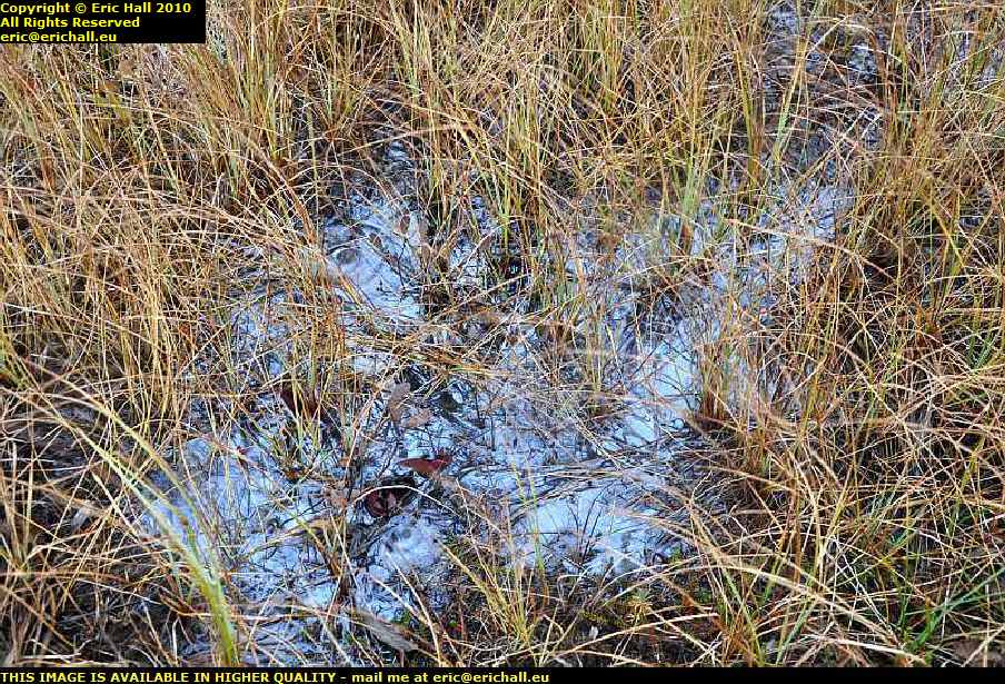
And if you don’t believe me, just click on the image and see for yourself.

The … errrr … ship on the right of the image is the MV Bernier, a collier delivering coal to the bay in 1966 that slipped from its moorings in a November gale and ran aground on the rocks.

basque whaler recovered from water red bay labrador canadaBut I had a most amazing stroke of good fortune at Red Bay.

Red Bay was the site of a Basque whaling station in the 16th Century (and there is strong evidence to suggest that it was operational long before then – maybe even before Columbus sailed the Atlantic). Not only are there the ruins of a whale-oil distillery, but 4 sunken galleons and several small whalers, one of which has been recovered and put on display

wreck mv bernier cemetery basque whaler graves red bay labrador canadaThey also rediscovered a cemetery containing the graves of basque whalers who had lost their lives jn the 16th Century, and this can be seen to the left of the Bernier.

Of course it is all closed up at this time of year but the Canadian Government has submitted it as a potential UNESCO World Heritage site and today there were some visitors from this being shown around. Of course, Yours Truly blagged his way onto the guided tour and was given the full VIP treatment.

It was truly remarkable

mary's harbour labrador canadaI forgot to take a photo of my hotel last night but this is the town in which is is situated – Mary’s Harbour.

This is a “new” town, being officially founded in the 1930s. Prior to that, everyone lived on an island called Battle Harbour but the settlement burnt down in 1930, so it was decided to create a new community for the inhabitants here on the mainland.

From here, it was to my startling discoveries at Red Bay.

point amour lighthouse strait of belle isle labrador newfoundland canadaAnd that wasn’t all either. Down the road at Point Amour is Canada’s second highest lighthouse.

It was of course closed when I got there but a lady was loading up her car and so she took some time out to explain things to me. She even told me where to go to see the remains of two ships stranded on the coast just down here.

shipwreck hms raleigh point amour strait of belle isle lighthouse labrador canadaSo off I went for a wander along the coast to see for myself.

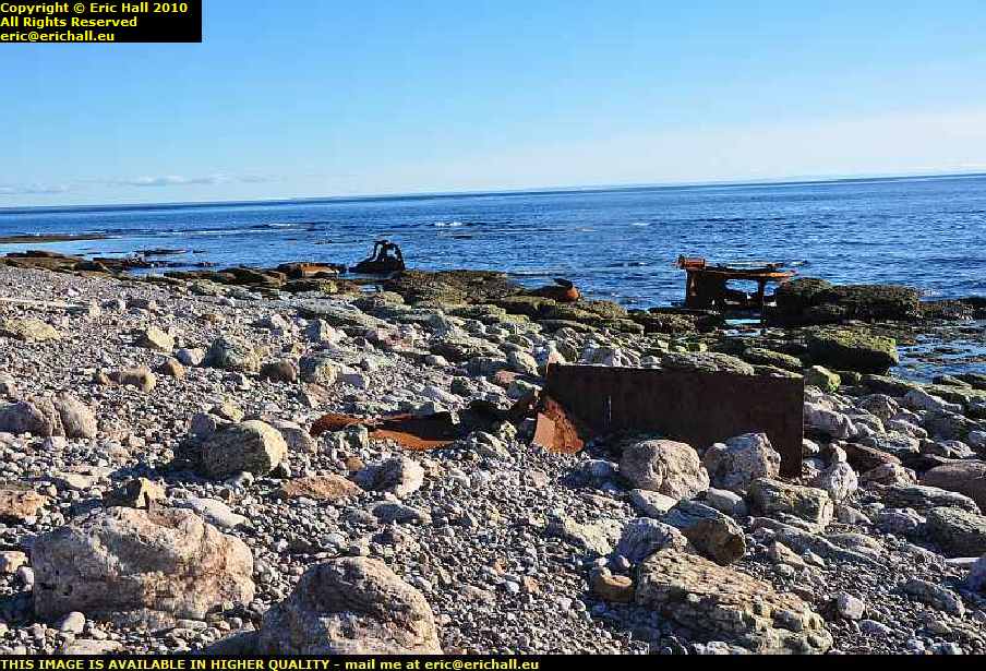
These are probably bits of HMS Raleigh, a British light cruiser that ran aground here in 1922, having swerved to avoid an iceberg in the Strait of Belle Isle. It was so well aground that it was impossible to move it and so they decided to dynamite it.

shipwreck hms raleigh point amour strait of belle isle lighthouse labrador canadaThey calculated precisely the amount of explosive that they needed to split the ship into manageable portions, but totally forgot to take into account the quantity of ammunition that remained on board.

Consequently, huge portions of the ship were hurled many hundreds of yards inland where they remain to this day.

But some of the remains that you see relate to HMS Lily, a British man-o-war that had gone aground 50 years earlier. However the remains are so mixed up due to the explosion that it’s hard to tell which is which.

mv apollo newfoundland labrador ferry strait of belle isle blanc sablon st barbe canadaSo that was my day really – and what a day it was.

And coming into Blanc Sablon there was a ferry moored in the harbour with steam up. Further enquiries revealed that it was the MV Apollo – the Newfoundland ferry, and it was leaving in half an hour so I had to get a move on if I wanted to catch it.

And so here I am in St Anthony, Newfoundland just 20 minutes away from L’Anse au Meadows and the Viking remains. Yes, I had a quick thrash through the dark right the way up Newfoundland to get here.

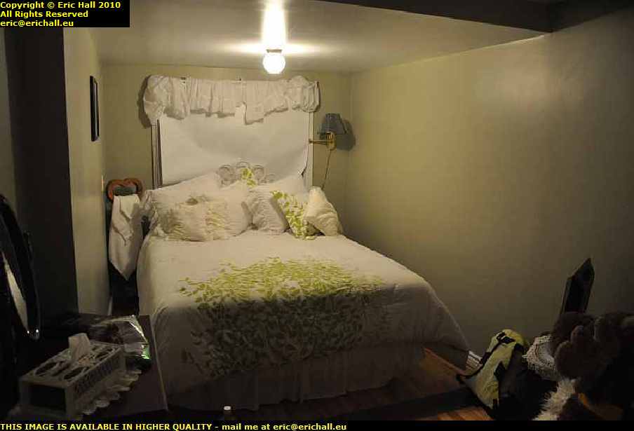
bed and breakfast st anthony newfoundland canadaBut what a cheesy place this B&B is – it’s furnished in the worst possible taste – all chintz and lace and nothing practical and all gone to ridiculous extremes.

It’s like something out of a bad 1920s novel and I can’t think what must have gone through the minds of the people who fitted this out. There are 7 pillows on the bed, for heaven’s sake, all laid out with military precision. One look at this place and the phrase “obsessive behaviour” sprang straight away to mind.

Still I’ll be gone tomorrow, I hope.

But that’s not definitive. There are some ominous rumblings in the distance. It seems that the ferry to Sydney, Cape Breton, may well have broken down. And the only other way off the island is back the way I came, and then to retrace my steps all the way over the Trans-Labrador Highway. And the weather has broken!

The road from Blanc-Sablon to some weirdly-named town beginning with N … "Natashquan" – ed … has not yet been built so I can’t get round to Sept Iles and then Baie-Comeau that way.

One other possibility is to have Casey shipped in a container by sea freight to wherever it is that Highway 138 begins – and when they told me how much that might cost (STARTING AT $400 – heaven alone knows what price it will finish at) I nearly fell through the floor.

But on reflection, if you think about it – the hotel at Labrador City, the one at Goose Bay, the one at Cartwright and the one at Mary’s Harbour came to almost twice that – and then there was the fuel and so on.

I shall have to look carefully into this. There’s a freighter leaving for there from Blanc Sablon next Friday.  

Thursday 14th October 2010 – WELL, STRAWBERRY MOOSE HAD A GOOD DAY TODAY.

strawberry moose family labrador coastal drive canadaOn the road between Port Hope Simpson and Mary’s Harbour we encountered some more of his cousins. This time it was mother and daughter.

And a short while later we encountered another juvenile. So he’s having fun anyway, meeting up with all of his family and he’s ever so excited about it all. Good old Strawberry Moose

wunderstrand norse viking visit site cartwright labrador canadaAs for me, I’ve done nothing like as much as I hoped. But then again, I’ve been distracted. For a start I couldn’t get out to see the Wunderstrand.

Although it’s just across the bay from Cartwright, it’s actually a 10-mile walk followed by a 10-minute kayak journey (you need to carry your kayak the 10 miles, by the way), or else it’s half an hour across the bay in a kayak (in a howling wind across freezing cold water) and of course regular readers of these columns know that you couldn’t get warm again. You know that it’s against the law to light a fire in a canoe – you cannot have your kayak and heat it.

wunderstrand norse viking visit site cartwright labrador canadaThere is however a certain spot to which you can drive and with a long telephoto lens and a little judicious crop and sharpen, you can make out the beach right away in the distance and see just how beautiful it all is.

Of course a photo isn’t the same as actually walking in the footsteps of Eirik the Red at the climax of his magnificent epic voyage to Vinland, but I suppose that it’s the best that I can do

pinsent's arm labrador canadaAnyway, back on the Labrador Coastal Drive (as this bit of the Trans-Labrador Highway is called) the next stop was the most delightfully-named Pinsent’s Arm, a small fishing village on the coast in a sheltered bay off the Atlantic. I always thought that the name was quite romantic.

I had to ask directions when I got to Charlottetown. I hailed a passing native (who picked up a handful of gravel and hailed me back)
“Excuse me – can you tell me where I can find Pinsent’s Arm?”
“Why yes alrighty” she burred (I just love the way they talk in Labrador). “It’s over there in that bucket”.

fishing boat pinsent's arm labrador canadaPinsent’s Arm has a population of 64 and they were all on the quayside waiting for me to arrive.

One of the fishing smacks that operates out of here had just put in to port.
“What do you catch here now that the cod has finished? Shrimp like out of Cartwright?” I enquired.
“Why no” he replied. “We get them thar whelks and scallops”.
But if they were whelks and scallops in those baskets they were unloading then I’m going to have my eyes tested as soon as I get back to Europe.

atlantic ocean pinsent's arm labrador canadaThe natives, obviously wishing to see the back of me, pointed out to me the way through the rubbish dump and local tip to the point where you can see the Atlantic through the cove.

This is quite impressive, and would have been even nicer had I been more lucky with the weather. But it could have been worse – it could have been snowing.

iceberg alley st lewis labrador canadaI also went off down Iceberg Alley for a visit to St Lewis – the farthest easternmost settlement on the mainland American continent.

And if ever I have the luck to be able to choose a place out here to settle it would be here. St Lewis is easily the prettiest place that I have ever visited on the North American continent.

It was settled in the earliest days of white exploration and then forgotten.

iceberg alley st lewis labrador canadaAnd when it was “rediscovered” in the 19th Century, the person who discovered it (I can’t remember his name just now) remarked on the “industry and divinity” of the inhabitants. I suppose that a couple of hundred years of isolation had had its advantages for the inhabitants.

But all of that changed after World War II

pinetree radar station st lewis labrador canadaIts more modern claim to fame, as everyone will tell you, is that it was a station on the DEW line – the Distant Early Warning radar system installed by the Americans on Canadian soil to track and then shoot down the atomically-armed Russian bombers so that the nuclear fallout would be in Canada and not in the USA.

But of course it wasn’t on the DEW line, despite how romantic the legend sounds, as you can tell from the antennae. It was actually a site on Pinetree – the forerunner of the DEW line but which operated on a much shorter-reach traditional radar system and with all the defects of a traditional system.

Once the Russians mastered the art of low-flying, Pinetree’s days were numbered.

alexis river port hope simpson labrador coastal drive canadaBut it’s unfair to single out places like St Lewis and Pinsent’s Arm for their beauty. The whole of this road – the Labrador Coastal Drive – is full of spectacular scenery.

This is, I think, Alexis River near Port Hope Simpson and if there is a more beautiful place to stop and eat my midday butty, I would really love to see it. In fact, the nice lay-by here would be an ideal place to stay for the night, if only I had a camper.

And after that, with me not being halfway around where I wanted to go, and having found some playmates for His Nibs, I’ve had to lay up for the night in Mary’s Harbour (spelt correctly – this is Canada not the USA).

Wednesday 13th October 2010 – I’VE SEEN A BEAR!

eagle plateau black bear trans labrador highway canadaYes, I really have!

Rupert sauntered across the road about 150 metres in front of me and then stopped by the side of the road waiting for me to ensure his immortality by recording his features in the camera.

But I’m ever so impressed by all of this, I really am. I think that all of the wildlife have been briefed to expect the arrival of the legendary Strawberry Moose and they are lying in wait.

united states air base happy valley goose bay labrador canadaSo this morning having left my extortionate and over-priced motel (but then again everything is extortionate and over-priced out here and when you work out the logistics of bringing the stuff up here it’s hardly any surprise – you just need to be prepared for the shock) I had a wander around to see the air base at Goose Bay

its well-known airfield from World War II when it was one of the wayside stations in the Atlantic Ferry but there wasn’t anything significant to observe. It’s all seen much better days and is pretty much derelict now.

labrador coastal drive canadaAnd so I headed off for part III of the route – the Labrador Coastal Drive.

This part of the road here towards L’Anse au Loup was finally opened earlier this year and it is this that has made my journey feasible. Prior to this, one had to go to the docks, stick one’s car into a container and wait for a ship for Cartwright.

labrador coastal drive canadaThe road was surprisingly good and I could keep up a good speed along it for the most part although there were a few bits that were thin.

But I did have a problem. Casey is doing about 9.5 litres to the 100 kms on good roads and much more on the rough stuff and so when I took it to be fuelled up, the guy put about 24 litres in, to account for the 300 from Churchill Falls yesterday.

I reckoned that the fuel consumption over that last bit must have been exceptional despite the roads and I was expecting Casey to need much more fuel than that.

But halfway round the route today I noticed that the gauge had dropped alarmingly. It seems that the guy didn’t fill it all the way to the top and it was about 8 litres (the length of the neck) short of fuel.

if ever I come this way again, which I really hope that I shall, I’ll have a 20-litre fuel can with me, and I’ll make sure that it’s full

casey chrysler pt cruiser labrador coastal drive canadaAnd Casey is now thoroughly filthy … "and as if you aren’t" – ed … as the weather conditions were pretty awful with the torrential rain that we were having every now and again.

And with another 750 kms to travel, despite what it says on the sign (and how the towns are spelt – clearly someone in the signwriting service around here has a sense of humour) his condition was not going to improve.

eagle plateau labrador coastal drive canadaBut I wouldn’t have missed this journey for the world, even if I didn’t have much luck with the weather. In good weather this journey would have been stunning and even in weather conditions that I was having, it was quite spectacular.

Anyway, these are only a selection of photos and a short resumé of the journey. To see more, you need to go to this page, start at the beginning, and read on until the end

Eventually, I arrived in Cartwright (after seeing my bear) on fumes, and also with a semi-flat tyre, not that this is any surprise. I’m surprised that it’s the only problem that I have had up to date, given what I’ve gone through this last few days. But now, another one has presented itself.

metis trail cartwright labrador canadaThere are two hotels in the town, and one of them is fully booked and the other one is closed for the season.

However, the owner of the fully-booked one rang up a friend of the owner of the second one and she came out from home to unlock a room for me, and gave me the key to the kitchen to help myself for cooking and for breakfast. It’s a good job that I had bought a few tins of beans and packets of spaghetti for emergencies such as this. I knew that they would.

But there’s about a year’s supply of beer in the kitchen – all kinds of things and I could have a field day in there if I were of that type.

metis trail cartwright labrador canadaHere at Cartwright, an old fishing port dating back to the 18th Century and one of these stops for the coastal ferry trade up the Labrador coast, the road is a new arrival.

Isolated and Remote Canada seems to have these really old and traditional kind of values, as the affair of the motel has provd and I shall always be grateful to them.

Tomorrow when I’ve fixed the tyre and fuelled up I’m going to look at the Norse Wunderstrand then drive back the 82 kms to the highway and go to the site of a historic early Pioneer village, Canada’s second-highest lighthouse, an early Basque whaling station and the Basque fishing boats from the 16th Century that have been salvaged.

Finally, it will be Blanc-Sablon where I may well spend the night ready to take the ferry to Newfoundland the next morning.

But the bear. I can’t get over that. What with the beaver … "it was a porcupine" – ed … on the first day, the moose on the second, the bear on the third – I’m going for the Loch Ness Monster tomorrow!

Tuesday 12th October 2010 – I’M IN GOOSE BAY THIS EVENING …

… the town, that is, not the bay itself, and I’m goosed.

This morning got off to a rather bad start. I was walking down a street somewhere in small-town America in a howling gale. I don’t remember who I was with, and we were watching this 8-storey brick-built rooming house which was swaying alarmingly in the wind. Suddenly the top four storeys were blown right off the building and crashed to the street with an almighty bang. The two of us dashed over to start to rescue the survivors and suddenly in the middle of all of this I sat bolt upright in my bed.

It’s been ages since I’ve had such a realistic dream as this.

So this morning I was up long before dawn and took piles of photos of Labrador City, only to find that I had the ISO on the wrong setting after last night’s photos, and I had forgotten to change it back. Hence, not a one came out, and was I upset?

motel labrador city canadaWell, not quite. It wasn’t quite light when I took the photo of my motel this morning so I managed to salvage that.

And I’m not going to say anything about the motel at all – I’ll wait for another occasion after I’ve recovered. I was expecting the prices out here to be different than in most other places – 500 kms of dirt road to bring stuff out here will be responsible for that – but I wasn’t prepared for this.

wabush iron ore mine quebec north shore labrador railway line canadaIf it wasn’t for the huge iron-ore mines out here, there wouldn’t be anything at all. But what we do have is, apart from the mine of course, a huge railway network for hauling away the output and that was one of the things that I had wanted to see.

Having grown up on The Land God Gave to Cain and similar books, to come out to Labrador to see the iron ore mines, the railway lines and the dams has been my main lifetime ambition ever since my childhood.
But back to the story of my drive over the trail. Today I drove about as far as yesterday, but the roads were a different thing altogether. Leaving Labrador City we had a paved road for all of about 50 kms and then that was about that.

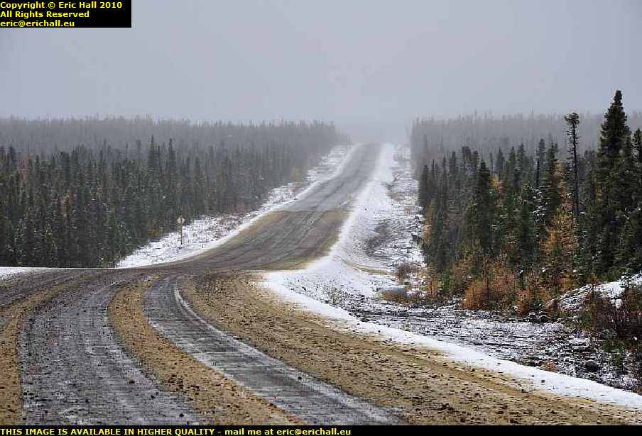
trans labrador highway canadaSeeing an enormous snowplough coming towards me with its front all thoroughly plastered with snow gave me a little inkling of what the weather was likely to be, and as we climbed up onto the Labrador Plateau it started to snow.

The more the road deteriorated, the more snow we had and it started to become quite an adventure. The higher I climbed brought me up into the clouds and it became a question of not even being able to see what the weather was doing, and that was probably the best idea.

But Casey, Strawberry and I pressed on relentlessly along the worst road that I have ever driven, deep into the wilderness.

male moose trans labrador highway canadaAnd Strawberry was well-rewarded because at a certain moment right up on top of the plateau with the wind whistling around from everywhere, one of his Canadian cousins slowly ambled across the road as if he owned it, which he probably did.

Strawberry was ever so excited as you can imagine and it brought me to a standstill for a good few minutes as the two of them exchanged pleasantries. Eventually cousin managed to manoeuvre himself into a good spot between a couple of trees where I could get a really good shot of him, and once he was sure that he had made his entry onto these pages, he made his excuses and left

road to fuel station churchill falls trans labrador highway canadaWe arrived at Churchill Falls and had a good hunt around to find the petrol station – it wasn’t easy to spot.

Churchill Falls is not on the main Trans Labrador Highway – it’s way off to one side and you need to drive down this road in order to find it. Fuel was $1.15 at Fermont but here it was $1.22 and that’s quite acceptable for where we are – after all there is no train hauling it up into the mountains just here and from the railhead it’s quite a way.

churchill falls trans labrador highway canadaThe falls though were a little disappointing, and for two reasons too. Firstly, at this time of the year it’s probably all frozen up high up in the mountains.

Secondly, the river has had part of its course diverted to feed the huge hydro-electric power station on the other side of town. But there isn’t too much to see – everything is inside a hollowed-out mountain, rather like Doctor Evil’s lair.

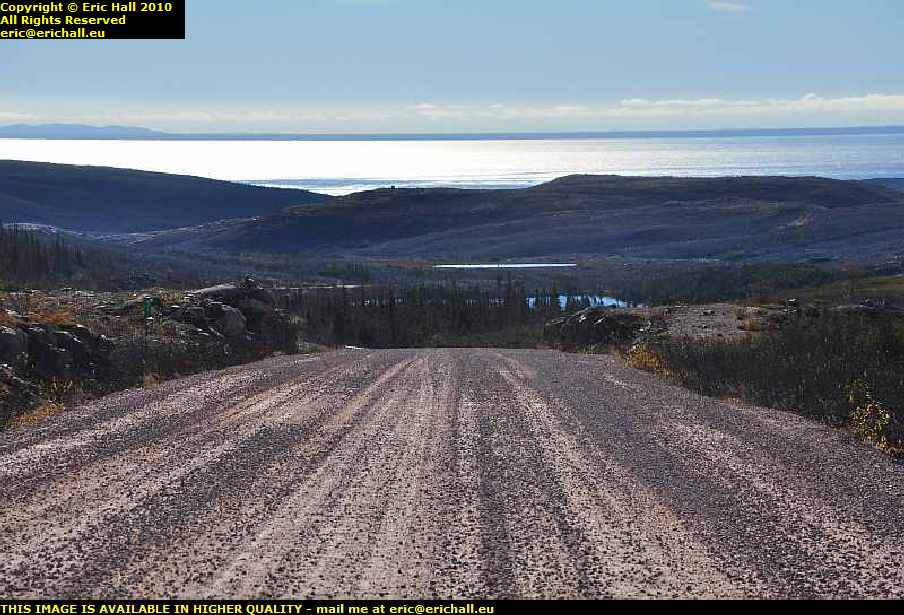
trans labrador highwy canadaAfter Churchill Falls as we climbed back out of the river valley onto the plateau the little bit of paved road immediately petered out and from then on I can safely say that I was on the worst road that I have ever driven in my life as you can tell from the photo.

One stretch of 122 kms took over 4 hours to drive, and I don’t hang about as you know

major road works trans labrador highway canadaAt another point we were held up by a construction team (there were about 20 teams working up here and they could have done with 200 I reckon) for 10 minutes while they dynamited a huge rock.

And then we were held up for another hour or so while they shovelled it up from off the road as they had miscalculated the amount of dynamite to use. It certainly was spectacular watching lumps of rock the size of giant pumpkins flying down the road just a hundred yards from where I was parked.

And by the time they had finished, quite a little queue had built up

trans labrador highway canadaBut the road really was awful – at times it was just like a sea of mud in places and I didn’t dare stop because I would never have started again.

After 3 hours of driving from Churchill Falls with just 87 kms on the clock it all became a little depressing. But eventually, after 122 kms we passed onto an area where the construction crews had finished and we could roll along at a much more relaxed 60 kph – even though the roads were nothing like anything that you would get anywhere else. Ruts and potholes, lakes of water, huge stones, these were all commonplace

former trace trans labrador highway canada.But that being the case, every so often you would catch a glimpse of the old road – the one that they used before they had the idea to make the Highway about 10 years ago.

Just imagine driving on that surface -you wouldn’t even manage 60 kilometres in a week on that. There just aren’t any words in the dictionary to describe that road

deciduous forest river valley trans labrador highway canadaBut all of a sudden, at exactly 191 kms from Churchill Falls there was a huge steep climb up over the mountains and Casey struggled up that, I can tell you, and as we dropped down the other side we found ourselves in a deciduous forest.

Yes, the deliniation of the climatic zone was as dramatic as that – you could draw a line to represent it. And as we drove through a steep-sided valley it was curious to note that in the valley floor and the north-facing slopes there were conifer trees, mosses and lichens yet on the south-facing slopes there were deciduous trees and grass. This kind of area is a real marginal climatic zone that’s for sure.

But who is this “we” that I’ve been talking about?

Ford F150 pontiac 7 seater MPV minivan trans labrador highway canadaWell, in fact long before Churchill Falls when I had stopped to take a photo of something I was passed by a Ford F150 pickup followed by a Pontiac 7-seater MPV. Half an hour later I caught up with them again, and then lost them as I stopped again to take another pic or so.

And we continued like this all the way over the Labrador Plateau and right until we hit the paved road a few miles from Goose Bay, when they piddled off into the sunset. It really was quite strange continually catching them up at roadworks and so on. We must have made quite a strange convoy along that road.

Now if last night’s hotel was the most expensive in which I have ever stayed, today’s is the second. And not by much either. I reckon that I could have stayed for a night with a lady of ill-repute in each of these places and still been ahead of the game. I shall be looking into this.

Anyway, these are only a selection of photos and a short resumé of the journey. To see more, you need to go to this page, start at the beginning, and read on until the end.

Monday 11th October 2010 – I’M IN LABRADOR CITY RIGHT NOW …

… in probably the most expensive hotel in which I’ve ever stayed in all my life, even when someone else was paying the bill. But that’s what everything is like around here. To give you an example, the petrol in Baie-Comeau is 108.4 cents per litre – at Manic 5 (the intermediate stop on Highway 389) just 213kms north, it was all of 132.4 cents. And a small mug of coffee cost me $1:50 instead ot the usual 50 cents.

highway 389 trans labrador highway canadaSo what I decided to do was that instead of spending three or four nights on the trail I’m going to do it in just two.

So today, I’ve driven 604 kms over some of the worst roads I’ve ever driven in the mud, rain and snow (it’s snowing outside) and a 12-hour day with 68 photos included, and here I am halfway round. And I’m exhausted too.

riviere manicouagan manic 5 dam hydro electric power station highway 389 trans labrador highway canadaBut the road is an adventure. The first 213 kms up to the immense barrage at the hydro-electric dam at Manic 5 (short for the Manicouagan River Dam no5) is a surfaced road and to drive this far was quite easy.

And the dam is certainly impressive too – it’s enormous and the photo can’t possibly do it any kind of justice.

highway 389 trans labrador highway quebec canadaAs for the rest of the road, it is as you find it.

Generally speaking it’s compacted dirt but in the weather we are having just now it’s mostly mud and there are places along the trail where lorries have sunk in. It’s slippery too in the wet and I’ve had Casey across the road a couple of times when I’ve not been concentrating.

gagnon ghost town highway 389 trans labrador highway quebec canadaFor a distance of several kilomtres through where the ghost town of Gagnon and its iron ore mine used to be, not only is the road surfaced but we even have a stretch of dual carriageway.

However, it’s not been maintained for probably 30 years since the mine closed and as a result it’s worse than parts of the dirt trail. And then once you cross the Cartier Railway line further along there just isn’t anything really – rail traffic has put paid to any pretext at keeping up the road and you have to pick your way between the potholes

tundra sub arctic scenery highway 389 trans labrador highway quebec canadaBut once you climb onto the Labrador Plateau you find yourself in the sub-arctic tundra. It’s totally wild up here, but beautiful and spell-binding

There are no grasses, just mosses and lichens and stunted fir trees.

And I’ve spent so much time up here admiring the view that I’ve lost the light and it’s snowing heavily again up there. I grope my way down in the dark and snow to the valley and Labrador City, and here, it’s teeming down with rain and there’s a biting wind.

Tomorrow I’m going to catch up on a couple of things I missed and then I’m going to do the second half – to Goose Bay.

A mere 520 kms.

Saturday 10th October 2010 – RIGHT NOW…

baie comeau quebec canada… I’m sitting in a dingy motel room in Baie Comeau, a town that was built in the 1930s to handle the timber and subsequently the paper trade relating to all of the forests and so on around here.

At that time it was effectively the farthest north-eastern town (as opposed to “settlement”, of which there were plenty) in Quebec. They hadn’t yet discovered the iron ore and aluminium that led to the creation of Sept-Iles further up the coast.

railway line steam locomotive baie comeau quebec canada>What’s interesting is that they have a rail link from here to Quebec City, would you believe?

There’s just about 10 kilometres of track on this side of the river to handle all of the paper traffic from the mill and then a rail ferry takes it across to Matane on the south shore of the St Lawrence from where it’s shipped by rail to Quebec City.

There’s quite a bit of sea traffic too. There are two huge freighters, of which this is one, anchored in the bay waiting to get in while a third one, the Australiaborg, owned by a Dutch shipping company, is currently being loaded at the dockside.

And of course there is the ferry over the St Lawrence to Matane. I’ve made a note of that for the return.

motel baie comeau quebec canadaAnd don’t think that I’m complaining about my motel room either because I’m not. I’m on the economy budget plan as you know and a room here has only cost me $49 so I’m happy with that.

And not only that, it’s on the main road and nicely positioned for tomorrow when I head off into the interior. The Labrador Trail, Highway 389, starts just about 1km from my door and I’ll be on that tomorrow.

Talking of railways, sometime tomorrow I’ll be encountering the railway line that runs from Sept Iles up to Labrador City and all of the iron and aluminium lines in the interior. It might mean nothing to you at the moment but if you have ever read The Land God Gave to Cain by Hammond Egges, then this is the line that they were building all throughout the story, so it has some kind of literary interest.

motel st simeon st lawrence river quebec canadaMy motel last night at St Simeon, despite being expensive, was quite comfortable and I was up and about quite early going for a little walk.

From here there’s a ferry across the St Lawrence that I sailed on in 2001, but I’m not going that way – I’m going much further along the river from here and then heading into the interior

felix antoine savard saguenay ferry st lawrence river quebec canadaBut I’m not to be denied my ferry trip.

Back in 2001 I passed over the Saguenay River on the ferry that crosses here and I took it again this year.

But when I arrived here in 2001 it was dark and in the morning it was freezing cold so I didn’t gat to hang around too much and photograph the scenery. One of the things I had always planned to do was to come back and photograph it properly in the daylight, and here I am today.

strawberry moose felix antoine savard saguenay ferry st lawrence river quebec canadaAnd Strawberry Moose had a good photo opportunity today. Master Bates, Seaman Staines and Roger the cabin Boy, the crew of the Felix-Antoine Savard, did the honours as His Nibs posed for the camera. Luckily the ferry was comparatively empty.

And as for the weather, it might be freezing but at least we have bright sunlight. It could quite easily be raining.

waterfall riviere sault aux moutons st lawrence river quebec canadaI’m really off the beaten track now though. As well as the St Lawrence River and the scenery, I’ve encountered my first serious waterfall.

I think that this is the Riviere Sault aux Moutons – the River Leap-Sheep ad if the sheep were leaping over that waterfall they must have been pretty good. We have a parking place and a sign, but that’s our lot. Had this been in civilisation, we would have had a fanfare and a marching band, together with coloured lights.

log flume forestville st lawrence river quebec canadaThere are several other ferries across the St Lawrence and I went to check them out. At Forestville, where there’s a ferry over to Rimouski, I was distracted by this.

Forestville was formerly an important logging town and to move the logs down to the river, they had a log flume. This was a wooden trough filled with water and they floated the logs down to the shore in it.

If you’ve ever been on the log flume ride at any adventure park, then you’ll be pleased to know that that attraction has been based upon this idea.

So here I am at Baie Comeau. I arrived at about 14:30 today so you are probably wondering why I didn’t press on. The fact is that the next motel once I hit the Labrador Highway is 213km away at Manic 5 and the route planner that I downloaded before I went says that it ought to take me all of 8 hours to do it.

It’s an unpaved dirt road with many bends apparently and with three long single-track bridges. I reckon that I ought to plan a full day to do that and if I do get ahead of myself I can drive on to Fermont, just another 250 or so kms further on.

There’s a few places to stop there as well.

Friday 9th October 2010 – TODAY WE CROSSED THE RUBI … ERRR ….. ST LAWRENCE

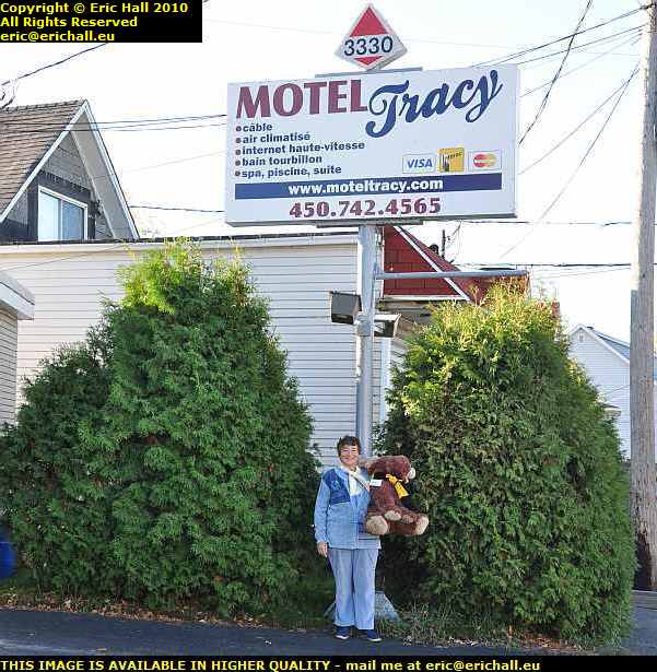
motel tracy quebec canadaThis morning quite early, we said goodbye to our host of the previous evening. And as you can see, Strawberry Moose was particularly sad to depart.

And what a nice motel that was – there was even a microwave oven in the room and that made me wish that I had some proper food on board. In fact, I’ll stock up with a few bits and pieces next time I pass by one of these supermarkets just in case I find another microwave in a motel room.

Tracy, where the motel might be found, is a small port on the south bank of the St Lawrence between Montreal and Quebec and you may remember that I had a good wander around there last night.

pont laviolette trois rivieres quebec canadaNext item of interest is this gorgeous bow-girder bridge, the Pont Laviolette that spans the St Lawrence on the outskirts of Trois Rivieres, which is on the other (north) bank of the river.

I had a good drive around to see if I could have a closer and better view of the bridge, but no such luck. However, I’ll be coming back this way and I’ll spend some time then to have a really good look around.

pont de quebec canadaAnd while we are on the subject of bridges, what do you think about this one?

This is the legendary Pont de Quebec, built at the turn of the 2Oth Century to carry the road and the railway across the St Lawrence to the city of Quebec. It’s been the subject of two major construction failures and cost more lives than the Tay Bridge disaster did, although it was never immortalised by William McGonagall.

You can read more about the Pont de Quebec on this page.

autumn colours deciduous trees quebec canadaThere’s no doubt about it though, the southern shore of the St Lawrence around by the city of Quebec is absolutely beautiful at this time of the year as the leaves are falling (and it’s funny that the further north-east I travel the more the trees have lost their leaves – it’s quite remarkable).

I chose this spot to stop and eat my butty, with the St Lawrence over my left shoulder and the city of Quebec across the river.

It was something of a late lunch because I went to the Walmart just up the road to buy another SD card – they had Kodak ones on special offer – 4GB for $10 but they had sold out. And in line with my resolution of this morning, I bought a tim opener, a mixing spoon and a microwave bowl to go with the pile of pasta in tomato sauce (4 for $5) and tins of beans (99 cents each) that I bought in a food supermarket across the road in case I find another motel with a microwave.

I have to be prepared.

After my lunch I crossed over into Quebec and had a drive around. Old Quebec is really beautiful but I didn’t stop as I’m running to a tight schedule. I hope I’ll be able to fit a day into my return journey to go for a wander round. It’s just like a late medaieval European city in places and has somehow managed to escape the developer’s bulldozer.

highway 138 stunning view city quebec cape tourmente canadaAfter that I headed north-east along the north shore of the St Lawrence and this is really where the beautiful part of Canada begins.

After maybe 15 miles you abruptly leave civilisation and go right into the mountains. It is just so spectacular, as you can see in this pic taken from halfway up Cap Tourmente. The St Lawrence is down there in the valley and Quebec is on the skyline.

highway 138 cap tourmente quebec canada>And this is what it is like – all up hill and down dale all the way along the coast, with the St Lawrence never more than a mile or two away.

Here, at the top of Cap Tourmente, you can see what I’ll be encountering. The mountains, the undulating road, the deciduous trees shedding their leaves, and the possibility of encountering a moose, if the one sitting beside me wasn’t enough to be going on with.

motel st simeon st lawrence river quebec canadaTonight I’m staying in St Simeon which is a ferry port across to Riviere du Loup on the southern shore where I crossed over last time I was up here. This is the view of the ferry terminal from my motel bedroom.

And what I don’t understand is that last time I struggled to find a motel and had to drive another 25 miles until I found one quite by chance.

motel st simeon st lawrence river quebec canadaJust now, I’ve passed 6 at Malbaie, a small town about 15 miles west of here and there’s 5 motels that I can see from my window just here. I really must have been asleep that evening.

But even now I’m not lucky. It’s quite expensive here and there is nothing – no coffee machine (although I’ve sorted that out) and no microwave either. And even worse, there’s nowhere around in the town where I can find a meal.

I’m really not having much luck, am I?

Tomorrow I’ll be driving the 4 hours up to Baie Comeau, going by the famous ferry at Tadoussac, which you will have seen from the last time I was here, and then it’s into the interior. 400-odd miles of dirt track through the interior of Quebec and then 600 or so miles through Labrador and out to the Atlantic Ocean.

Now that’s what I call the wilderness!

Thursday 8th October 2010 – A BIG RED BOX …

… has now appeared in the back of Casey (in case you are wondering, Casey is the name of the PT Cruiser – with a registration number of BBKC 458 it could hardly have been anything else now, could it?) and the big red box is full.

For having been to a Lowe’s yesterday afternoon and the huge Home Depot and Walmart that were right on the US-Canadian border at Covington (they must have heard me coming), I now have

  • 100 drywall pattresses (cost $22 the lot)
  • 25 wall-mounted pattresses
  • 20 white sockets – the standard colour
  • 10 ivory sockets
  • 10 red sockets (regular readers of these pages know that I’m heavily into colour-coding for different usages)
  • all of the fascia plates (they say that they are unbreakable – obviously they haven’t had me in there for a while)
  • about 50 3-pin plugs
  • a few extension leads and all kinds of other exciting American electrical stuff
  • one partridge
  • one pear tree

The reason for this of course is that when I do 12-volt DC electrical circuits running off solar panels and wind turbines in Europe I need to use plugs and sockets and the like that cannot be mistaken for anything else and which can handle high amperages.

There are no American fittings in Europe so no-one will mistake them, and as American current is 110 volts instead of 230 volts and so more susceptible to voltage drop, they use thicker cable to compensate – and the thicker cable will handle higher amperages.

So now I have a full stock on hand and I shall be shipping that back to Europe in due course and so when I get back I can get on with what I’m supposed to be doing – ie earning money to compensate for what I’m spending over here.

You’ve no idea how rampant inflation has been over here since I last visited. Petrol in the States for example costs $2.80 a gallon in most places, and as there are only 16 fluid ounces in an American pint instead of 20 in a European pint, an American gallon is just about 3.65 litres. And $2.80 a gallon is a far cry from 2005 when I was paying $1.45 and an even farther cry from 2001 when I was paying $1.10.

motel usa canada borderCheapest motel I’ve found so far has been $45 – last night, stranded in the wilderness miles from civilisation I paid a whopping $69, and that motel was nothing to write home about at all. It just happened to be the first one that I came across after looking for half an hour.

Gone are the days from 2002 when I paid $25 per night and in 2005 when I was stopping in a respectable chain of modern motels at $33 per night.

With millions of Americans out of work and rampant inflation such as I am noticing, no wonder there are thousands of people being turned out onto the streets. The States is nothing like the Shoppers’ Paradise it used to be.

But in Walmart I also bit the bullet and bought a new digital dictaphone. The Olympus that Rhys recommended wasn’t carried and they had a whole selection of different ones. not one of which did everything that I needed.

In the end I bought a Sony at $39 which does not have a direct connection to a computer (which is strange and disappointing – I’ll have to rig up a cable through the headphone and mike sockets and see what I can do about getting some speech recognition software) but it does have a “pause” facility (which puts the “record” on standby for an hour), 2gb of memory, a unidirectional microphone facility as well as the more normal omnidirectional mike – so if you switch it into unidirectional, it just picks up whatever is going directly into the mike and none of the background noise, a noise reduction facility that cuts out high-frequency interference.

All in all considering that there wasn’t much choice, I’m well-impressed with it and it’s doing the business.

sprite musketeer caravan usaMany years ago, driving through Canada, I saw what I was convinced was a Sprite Musketeer caravan althougb I didn’t stop to photograph it and I rather wish that I had.

But here on the side of the road in northern New York State about 8 miles from the Canadian border I come across a very sad Sprite Musketeer caravan that originally came from a company down in Oswego down the road according to the sticker on the chassis.

So there we are. They were definitely imported officially into North America.

police barrage escaped convict new york state usaA few miles further on, I’m caught in a police road block. There’s a prison not too far from here and one of the convicts, by the name of McCann, has made a bid for freedom.

The police have a quick glance inside Casey to see if he’s hiding under the seat or in the boot, but once they have satisfied themselves that he’s not in here, I can carry on with what I was doing.

exporail montreal quebec canadaI’m now in Canada, approaching the suburbs of Montreal, and this looks interesting.

It’s the old ALCO railway works, apparently, now transformed into Exporail, a railway mseum and it’s chock-full of railway engines and other relics. I’ve no time to look at it today, but this will be high on my list for the return journey.

montreal quebec canadaI’m on the southern shore of the St Lawrence River here and there across on the far shore is the city on Montreal.

I’m staying over here because there’s much less traffic and much less congestion. I don’t have the time to be caught up in the traffic today. Every hour that I waste on the road at the moment brings the snows of Labrador that much closer.

ethanol factory varennes quebec canadaI can still stop and take photos though if I’m quick. This is a huge ethanol plant on the edge of Montreal and the steam that’s pumping up from there is really impressive. It gives you an idea of the heat that the plant is generating.

Ethanol is becoming much more important as a renewable energy source and is slowly being added to petrol in an attempt to reduce the amount of fossil fuels that we consume. There will be more and more of these plants sprining up in the future.

nuclear power plant sorel tracy quebec canadaBut never mind new technology for the moment – here’s a bit of old technology to be going on with. On the outskirts of Sorel-Tracy I encounter a nuclear power station.

It’s something that has taken me completely by surprise because Canada, and Quebec in particular, must be up there amongst the top three countries in the world for producing hydro-electric power and so I would have thought that a nuclear power station, particularly one situated in between two major urban centres, would have been the last thing that they needed.

docks sorel tracy quebec canadaBut then Sorel-Tracy has a huge mineral-refining plant and so it must need all of the power. It must need all of the minerals too and there are some big ships in the docks being unloaded, as well as one or two awaiting their turn outside.

But I’ve found an impressive motel here – $60 Canadian it has to be said, but it has all mod cons including a microwave so tea has cost me less than $2 – a couple of tins from the supermarket next door.

If I’m spending all this money on motels I’m going to have to economise on the eating – no restaurants for me – and I can see me buying a $30 microwave for where a motel doesn’t have one if these prices keep up.

Of course, many of you know that the eastern part of Quebec, from roughly the centre of Montreal, is French-speaking and here in my shower room the taps are marked with C and F.
“Chaud and Froid” I hear you say.
“Rubbish” I retort. “It’s cold and freezing“.