Tag Archives: richelieu valley

Tuesday 8th September 2015 – WHAT AN ASTONISHING STORM!

It went very hot and humid late at night and then about 23:00 he wind got upand we had a howling gale for 20 minutes, and then the most tremendous thunderstorm for ages and ages – at least I know that my little tent it waterproof. I sat there for hours (probably 20 minutes in fact) wondering whether I should evacuate the tent but I’m not sure at all what happened because the next thing that I realised, it was the alarm going off at 06:00. Yes, the bed, even though it is too small for the tent, has made a world of difference.

But I couldn’t stay here lounging in my stinking pit all morning. This is the morning when I need to be moving on, so I have to pack everything away. And I’m pleased that I packed away everything yesterday so that today’s packing is a simple (well, relatively simple) half-hour’s job once I’d dealt with everything that needed dealing with on the internet.

Then a shower, followed by the laundry. There was a machine and a dryer available, both at $1:00 a go, and I could have put myself in there with the clothes. Everything took a while but it all came up clean and dry and you can’t argue with that. I just wish that I’d brought the washing from home.

And the result of my little stay at Goose’s Point campground? Covered with (harmless) whitefly and my spec wasn’t up to all that much. However, the internet connection was the fastest I’ve ever had in a public place and it was just $21:00 per night. I’d more-than had my money’s worth just here for sure.

samuel de champlain statue isle la motte vermont usaFirst job after leaving the campsite was to go down to the Isle la Motte, or la Motte Island or whatever it’s called. The woman I met the other day recommended it.

This place is important for several reasons, not the least of which being that it’s yet another place where Samuel de Champlain is said to have landed. And it might be true too, although if de Champlain landed at every site that is claimed for him, he would never have found the time to get back into his ship.
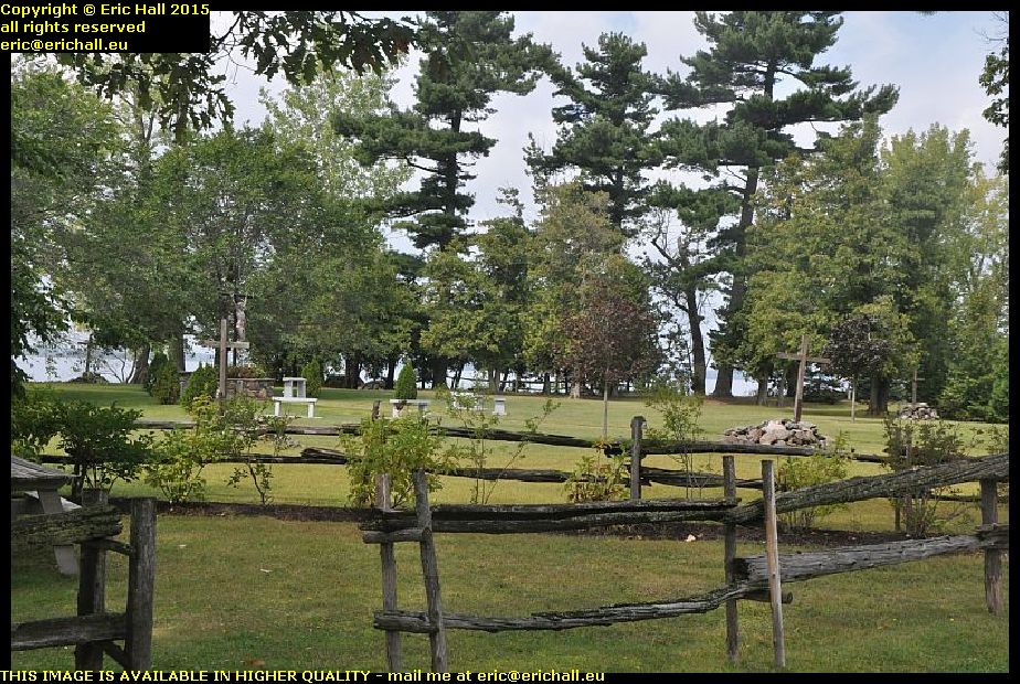
assumed site of fort sainte anne isle la motte vermont usaThe second claim to fame is that it was the site of one of the French forts – Fort Sainte Anne – that protected the Lake Champlain / Richelieu Valley supply route from attacks by the Iroquois. Built in 1665-66 by Pierre la Motte, it was garrisoned by about 300 soldiers (the first “European” settlement in what is now Vermont) and only lasted for three or four years before the French pulled back, destroying the fort as they left.

Nevertheless, a great many artefacts from this period have been unearthed by different archaeological squads over the years. It’s a shame that they haven’t rebuilt a replica of the fort around here.

But I have been told a story about the time that Hawkeye and Chingachgook came around here on a spying expedition for the British

“How many soldiers do you see in the fort?” asked Hawkeye.
Chingachgook lay down and put his ear to the ground. “About 300” he replied
“And how many cannon?”
Chingachgook lay down and put his ear to the ground again. “About 30”
“And how many horses?”
Chingachgook lay down and put his ear to the ground yet again. “About 60”
“And how many native allies?”
Chingachgook lay down and put his ear to the ground once more. “About 200”
“That’s incredible” said Hawkeye. “Can you tell all that by just lying down and listening to the ground?”
“Ohh no” replied Chingachgook. “If I lie down here like this and turn my head so that my ear is to the ground just like this, I can see right underneath the gates of the fort”.

In its short lifetime, the fort was aid to be an “exciting” place to be if you craved for contact with the native Americans.
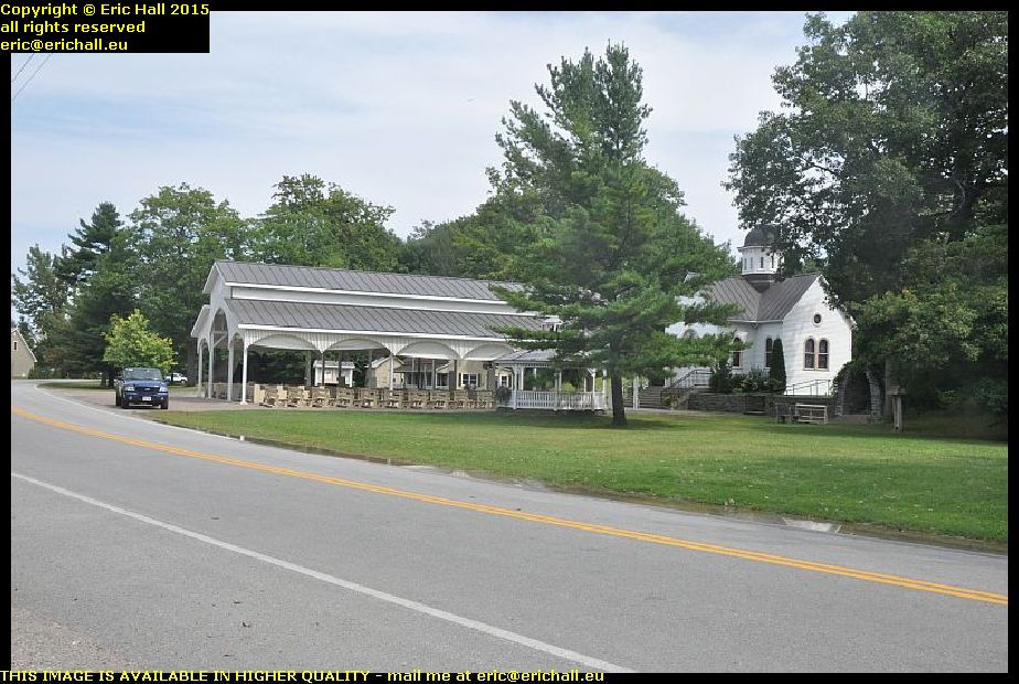
shrine of saint anne isle la motte vermont usaIts third claim to fame was that it was the site of the first mass said in this region – in May 1666 as the fort “opened for business” and a shrine to Saint Anne, mother of Mary and grandmother of Jesus, was dedicated.

Although the fort itself was abandoned, the shrine lived on and since then it’s become a place of pilgrimage for many people. There’s also a retreat here, where people can come to seek peace and quiet, and communicating with nature, although if the racket that I heard coming from the unsilenced hedge trimmer used by one of the gardeners was anything to go by, I would have done my communicating with a pickaxe handle.
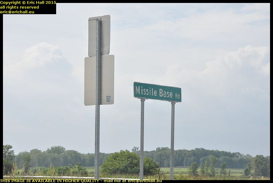
missile base road alburgh vermont usaI’d seen this sign a few times as I had been driving up and down the road between Alburgh and Rouses Point and so I had to take a photo of it, just to prove that the street did exist.

And sure enough, down at the end of the road were a few derelict nissen huts and a few bits and pieces of other stuff, but nothing exciting in the way of ordnance like an A4 rocket or something. The place was however sealed off with chains and padlocks and so a really good exploration was out of the question.

It wouldn’t normally bother me as you know, but bearing in mind the paranoia and fear that is gripping all Americans right now, I’d probably wake up in an orange jump-suit in Guantanamo Bay – if I ever were to wake up at all.
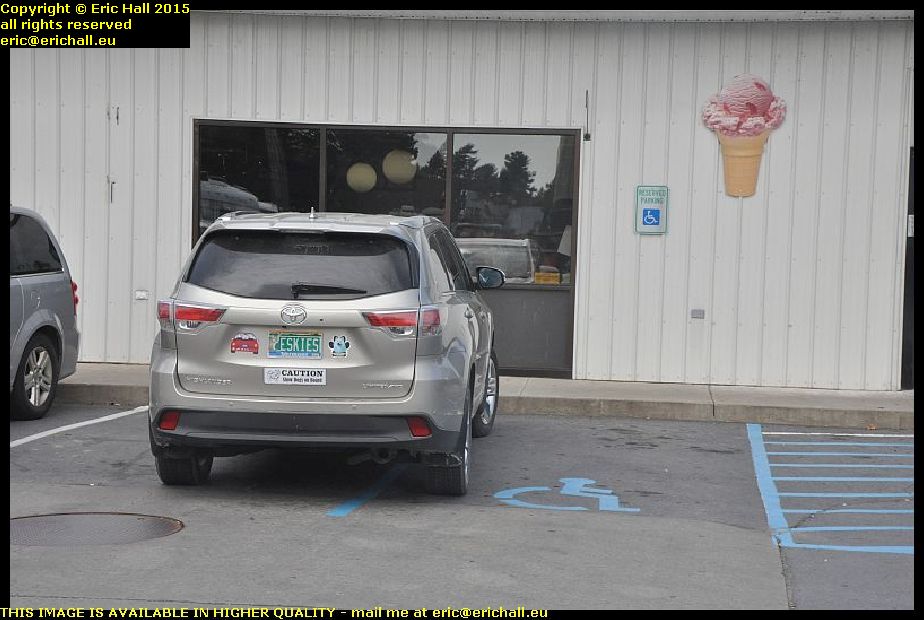
selfish bad parking rouses point new york state usaI went into Rouses Point after that to buy myself a coffee and something for lunch (yes, it was that time already) at the big petrol station in town.

And just to prove to many people that bad parking isn’t just confined to Liverpool, here’s some pretty shocking car parking in Rouses Point New York as Madam abandons (because on-one can say that this is parking) her vehicle across two parking spaces, one of which is a disabled bay. It’s hard to believe just how selfish and thoughtless some people are.

sail ferry lake champlain rouses point new york state alburgh vermont usaOver the road from the petrol station is another historic site, of which there are thousands all around this area.

This promontory where this derelict motel is situated is a former quay and over there where the lighthouse is is another quay. And this was apparently the route of a sail ferry that plied its trade across the head of Lake Champlain. I’m not sure how long it lasted but the first bridge across the head of the lake wasn’t, apparently, until the 1930s so I suppose that there had to be something going across here until then.

From here I retraced many of my steps from the other day and ended up in a town called Plattsburgh
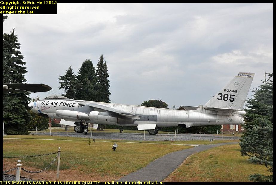
b47 bomber plattsburgh new york state usaAnd once again, it’s amazing the things that people leave lying by the side of the road isn’t it?

Never mind the FB1-11 that was parked up here, this is a B47 and to see this kind of thing parked up here must be something pretty exceptional. Where we are in fact seems to be at some old military complex with loads of decaying and abandoned barracks-type of buildings. apparently there was an Air Force base just outside town and the two planes here were of the type that flew out of it.
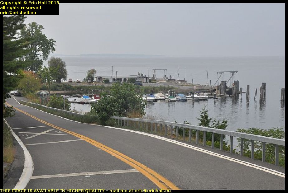
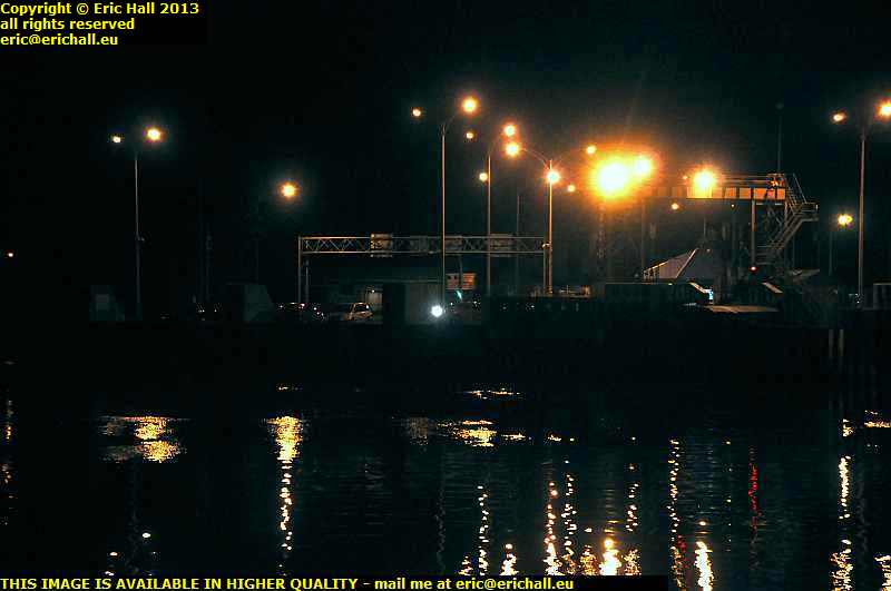
port kent ferry terminal lake champlain new york state usaAnd now, almost my final destination for today.

This is the harbour at Port Kent and why it’s important for our journey is that it’s the terminal of the only crossing of Lake Champlain that I have not yet taken. It’s another one of these places that was very important once the area calmed down in the late 18th Century, becoming a thriving port and holiday resort, because there are some nice beaches here.
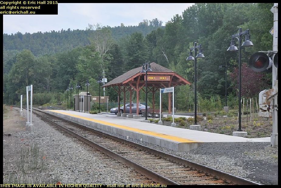
amtrack port kent railway station new york state usaBut the coming of the railway here (and, very much to my surprise, there is still an Amtrack railway station here and that just about beats everything) took away much of the river trade and the port declined in importance.

According to a very friendly old guy with whom I had a lengthy chat, there are three scheduled goods trains that pass by here every day, as well as the once-per-day passenger service between New York and Montreal.

And of course, I missed them all.

lake champlain beaches port kent new york state usaI’d also missed the ferry too. Only 4 per day and the one that I wanted was steaming (or dieseling) out of the bay as I arrived.

But never mind. It gave me a good opportunity to go for a good wander around and admire the local sights, including some of the famous local beaches. And they were quite nice too. But many of the hotels that used to be here no longer exist or else have been converted into private houses, such as those up there on the cliff behind.

Eventually, after a two-and-a-half-hour wait, the Good Ship Ve … err … Valtour came steaming back into harbour from its trip across to Burlington and we made oursleves ready to cross.

$30:00 to cross for a 45-minute sailing, which is starting to become excessive, but with just 7 cars, one motorcyle and a dozen foot passengers, they need the revenue. It’s a seasonal service too, that’s why it’s not very well advertised, but yet it sails right into the harbour in the centre of Burlington.
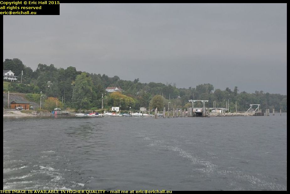
lake champlain ferry port kent new york state usaAs we sail out of Port Kent harbour, I have to tell you that it’s ironic really that we are on our way to Burlington, the largest city in Vermont and whose metropolitan area includes one-third of the State’s population, and the railway line there has long been pulled up. But you can still reach Burlington by rail, in the summer months at least, if first you take the train to the little station here and then take the ferry.

It did make me wonder if they synchronised the times of the trains to correspond with the ferries? Knowing how public transport works, I doubt it very much. But they could make quite an impression on Burlington’s public transport if they were to make an effort

strawberry moose strider ford ranger lake champlain ferry crossing new york state usa“Twas on the Good Ship Ve .. errr … Valtour”
“By God you should have seen us”
I know that I shouldn’t have let His Nibs near that bottle of rum.

Strawberry Moose and Strider are here enjoying the relaxing crossing, which was nothing like as rough as I was expecting, given the weather that we were experiencing. It had changed dramatically for the worse since this morning.
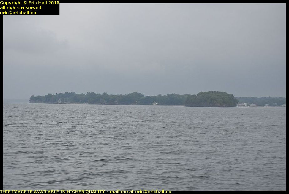
shore of vermont coast lake champlain usaWhile you enjoy the rapidly-deteriorating weather, I wandered off to check out the facilities on the boat.

And much to my surprise, there is actually a ship’s cafe on board – the first that I have encountered on a North American short sailing. But it’s down in the bowels of the ship and you have the disconcerting sight of watching the water splash against the portholes which are round about your eye level.

I don’t mind being below water level if I can’t actually see it, but this was getting to be a little too near the knuckle for me. I’d rather be out on deck in rough weather where I have a good chance of escaping if we turn turtle. What kind of wimp am I?

lake champlain burlington harbour vermont usaWe eventually make it over to Burlington in one piece, and I end up chatting to a guy and his wife who are doing a tour of the North-Eastern states on a Harley Davidson. I asked him what the fuel consumption was like, because I’d head the stories.
“Depressing” was his reply.

Anyway, they are planning to end up in Halifax and so we had quite a lengthy chat about the city which, as you know, is one of my favourite places in the whole of North America. I really hope that they enjoy it.
storm cloud lake champlain vermont usaHaving left the ship, I made my way out of town to the campsite at North Beach – and it really does have a beach too!

But I didn’t show you this cloud that was looming away in the distance as we were crossing the lake. It was in fact right over the campsite and we were having a torrential rainstorm and high winds there when I arrived. I quickly put up the tent (you’ve no idea how quickly I can do that when I’m being soaked to the skin) and crawled inside.

That’s all that I’m doing tonight!

Wednesday 3rd September 2014 – WELL, I HAD AN EXCITING DAY TODAY.

And here is the result of my visits to places of historic interest along the lower part of the valley of the River Richelieu

The Museum of Fort St Jean – closed since yesterday for renovation and to be moved into a new building

Fort Lennox on the Ile aux Noix – open Fridays, Saturdays and Sundays

The blockhouse at St Paul de l’Ile aux Noix – closed since yesterday

The museum at Lacolle – open at weekends only.

Yes, I’m not having much luck at all with the Canadian Tourist season, am I?

I had better luck at Bell Telephones in St Jean sur Richelieu. Someone who actually knew what he was talking about had me conected in five minutes – at a price, mind you (we are talking about Bell Telephones of course) but I’m now connected. I’ve had to have a new number – it’s 740 6186 but the area code remains the same as before.

So off to the Fort St Jean and found that it was closed, but a helpful woman military person allowed me to wander around the barracks and to take photos, as long as I didn’t go inside any buildings.

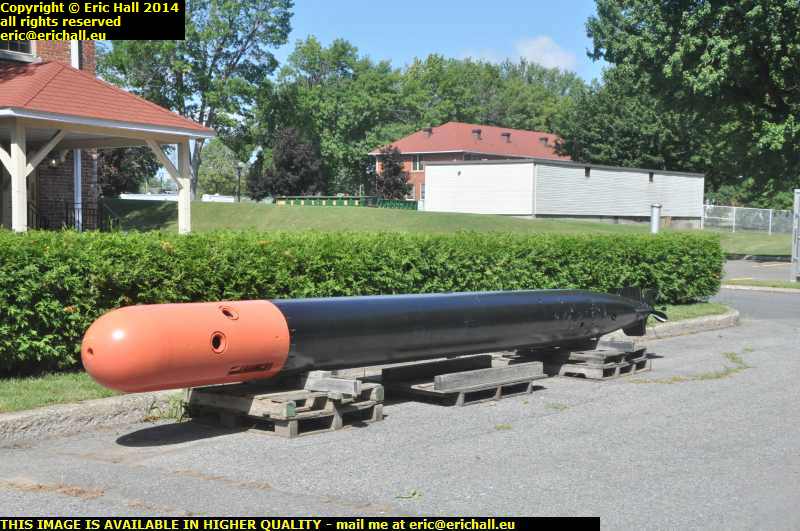
world war II anti U boat homing torpedo fort st jean River Richelieu valley quebec canadaThere are lots of old military equipment there so I was in my element for a good hour or so. This is an anti-U-boat homing torpedo from World War II. It’s the type that was launched either from the air or from a ship.

It’s certainly quite an interesting artefact to see, especially as I’ve been spending a lot of time wading my way through Clay Blair’s rather polemic and viciously anti-British submarine book just recently.
There were lots of other stuff there – tanks and aeroplanes and so on – so I didn’t have a totally wasted morning.

anchor fury perry somerset island fort st jeanRiver Richelieu valley quebec canadaProbably the most important thing in the fort, at least from my point of view, were these anchors. They were discovered in Fury Bay on Somerset Island, which is in the High Arctic.

They are said to come from the ship – the Fury of William Parry (he after whom Parry Sound in the High Arctic is named) which was crushed in the ice one winter in the early 19th Century during one of his explorations to pass through the North-West passage.

fort lennox ile au noix River Richelieu valley quebec canadaSo at Fort Lennox I was disappointed. Not just by the fact that the fort was closed to visitors but the fact that the fort was situated on an island and there was no possible access to the island for even a wander around outside the fort.

There was someone from Parks Canada on site and so I bent his ear about the desperate tourism facilities on offer here. If you come here during the summer season you can’t find a campsite or a motel because they are full. If you come here outside the summer season you can’t find a campsite or a motel because they are closed.

You just can’t win.

Blockhouse st paul de l'ile aux noix River Richelieu valley quebec canadaThe blockhouse at the River Lacolle was also closed. It was part of the border fortifications controlling the access up the Richelieu valley and was built in 1778 after the American incursions of 1776.

Its claim to fame was that in March 1814 it held out against 4000 American soldiers bent on invading Canada, and in November 1838 it was the site of the last stand of the “Patriots”.

It’s the only blockhouse left in Quebec now, but regular readers of this rubbish will remember that we encountered one in Edmundston in New Brunswick a few years ago.

From there I went on to the town of Lacolle and with the museum closed, visited the site of the enigmatic “Battle of Lacolle Bridge”. Here in thick fog on 20th November 1812 the American forces prepared to attack the British forces but someone accidentally discharged a firearm.

This caused the Americans to start shooting, and ended up inflicting heavy casualties upon their own troops. This caused them to retreat in disarray without embarrassing the defenders at all.

d'antan magasin general hemmingford River Richelieu valley quebec canadaAt Hemmingford I encountered the “d’Antan magasin General”- a shop that was set out in the style of a shop of 100-odd years ago.

I had an interesting chat with the proprietor of the shop – I kept her away from her jam-bottling and sauce-making. We put the world to rights for a good half an hour and I ended up with a handful of traditional sweets and a cup of coffee so I’m not complaining and I’ll come back here again if ever I get the chance.

We then drove on for our usual confrontation with the American border farces down the road. I’m sure that there’s no real reason for them to be so … err … difficult with cross-border tourists and they would make tourists feel much more welcome if they would be a little less confrontational and a little more friendly. After all, it’s tourists like me that keep them in employment and if they chased everyone away from crossing the border they would all be out of a job.

I fuelled up just across the border and then set off down Highway 87 through the Adirondacks and the beautiful smell of fresh pine until I came across a welcome rest area where I’m settling down for the night.
l

Tuesday 2nd September 2014 – AFTER A REALLY GOOD NIGHT’S SLEEP …

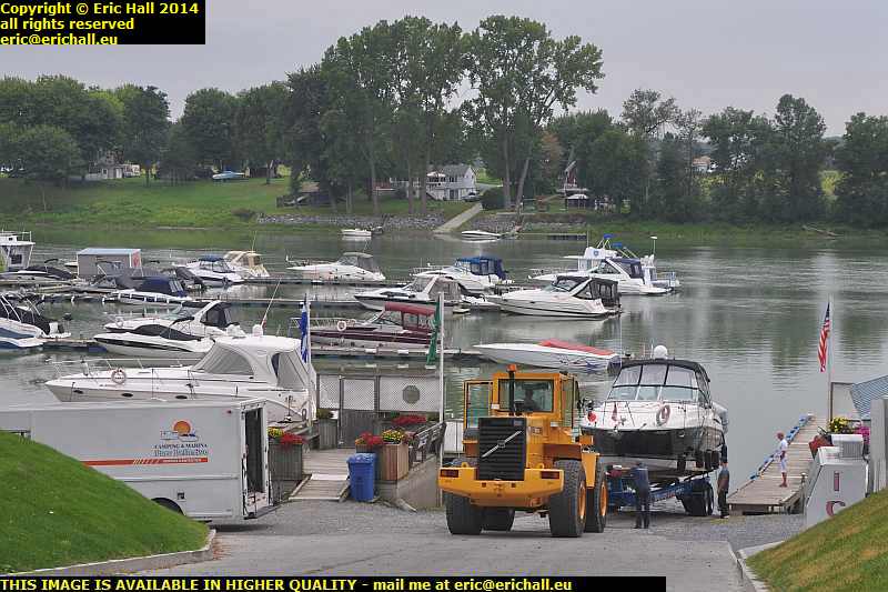
volvo tractor winching boat from river richelieu valley quebec canadaI went for a walk around the campsite and was treated to this sight here. Someone is having a boat recovered from the marina here on the Richelieu River, and the campsite here has this huge Volvo tractor and trailer unit to perform tasks like this.

Something of a monster, I don’t suppose that recovering the Queen Mary would have been beyond its power. Still, watching it with this boat was a good way to start off the morning.

From here, I set off down the road to the locks at St Ours. The Richelieu Valley (heading north) connects up with the Hudson valley (heading south) forming something of an easy route between Montreal and New York. We came up the Hudson last year, you may remember, and you’ll recall that it was the scene of several bloody encounters between the British, the French, the Americans and the natives in the 17th and early 18th Centuries.

locks st ours canal river richelieu valley quebec canadaOnce peace (of a sort) had finally descended on the valley it was decided to construct a canal to facilitate water transport around several of the rapids along the way.

These are the locks on the river at the town of St Ours. The original lock is the one that has been filled in, on the left of the photo. The new one, built in the 1930s is larger and was built to correspond with the size of the locks down in the Hudson Valley.

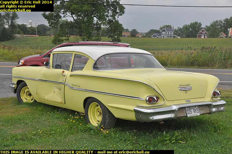
for sale chevrolet delray river richelieu valley quebec canadaThis car is a 1958 Chevrolet Delray, and it’s for sale if you are interested. A mere $9,000 (or near offer) and it’s yours, but only if you are prepared for a lot of work because, leaving aside the question of the accident damage for the moment, it isn’t in very good condition.

$9,000 will be only the start of your expenditure to put this car back on the road, which is a shame.

Mind you, I’ve seen cars up for sale in much worse condition than this, although not at this kind of price.

Next town along the road is that of St Denis Sur Richelieu. This was the home of Louis-Joseph Papineau, leader of the 1837 rebellion against – not the Anglais as all of the signs round here insist – but the Britanniques (and it says something for the Quebecois extremists and their attitudes that they can’t even get that correct).

Everywhere you go, there are plaques saying things like “Papineau bought a loaf of bread from a boulangerie situated on this spot” and “this is the spot where Papineau scrathed his nose”.

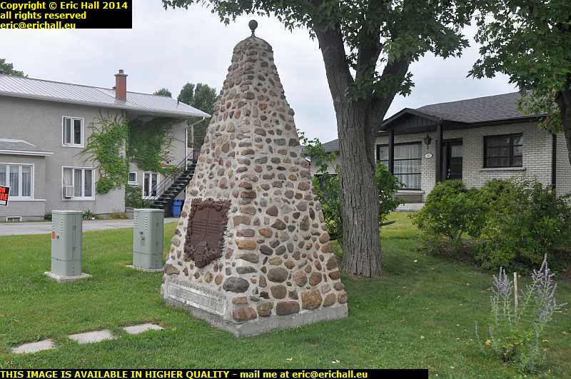
st denis sur richelieu river richelieu valley quebec canadaThis is not one of those – this is the spot where in November 1837 a group of “patriots” repelled an attack by 500 regular (British, not English) troops.

What the plaque doesn’t tell you is that 10 days later the regular troops returned to St Denis and burned down the town, there being no opposition as the “patriots” had all run away and hidden across the border in the USA, just down the road from here.

There is however another little plaque hidden away somewhere that does mention in small letters that the American forces on Independence visited the town in 1776 and shot some innocent civilian bystanders in cold blood, so any idea that that the Quebecois have nothing but a total and utter depraved and warped fixation about the nasty and horrible Anglais (and not Britannique) is totally false.

almond milk vegan ice cream river richelieu valley quebec canadaNow this is an interesting find, isn’t it?

It’s a pot of ice cream but made, not with cows’ milk but with almond milk. The packaging proudly proclaims that it’s a non-dairy dessert and this is confirmed by the list of ingredients, and it came from a mainstream supermarket, the IGA, too.

Europe, and especially France, is a hundred years behind the times when it comes to items like this. Being a vegan, an addition of something like this to my regular diet would have me in paradise.

And it was gorgeous too.

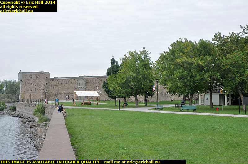
fort de chambly river richelieu valley quebec canadaChambly is the next town down the line and at the head of the little lake here is a stone fort of the 18th Century – the fourth fort to be built on the site.

It’s purpose is to control the access to the rapids here on the River Richelieu, a portage where people would have to get out of their canoes and carry them overland to a smoother section of water.

The tourist season at the fort seems to last for another few weeks yet and so I was quite optimistic about visiting it, but I arrived on a Tuesday and you don’t need me to tell you what day it is that the fort has its Day of Rest.

river richelieu valley quebec canada


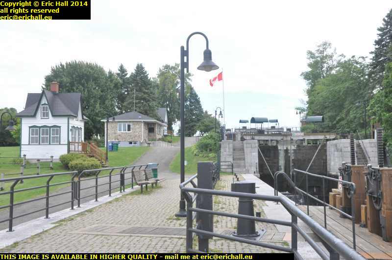
locks canal chambly river richelieu valley quebec canadaIn the 19th Century the portage became a thing of the past when, as part of the navigational improvements, the Chambly Canal was built to by-pass the rapids and ease navigation between Montreal and New York.

These are the locks that lift the boats up to the level of the ground behind the rapids, and the canal carries the traffic along to rejoin the river further back.

So now I’m off to find a campsite for the evening. It’s threatening rain and it’s not very optimistic.

Monday 1st Sepember 2014 – NEW TOY

Now that I’m back in bass-playing mood again, I can’t do with 7 weeks deprivation while I’m in North America so I’ve been scouring the second-hand and junk shops in a desultory fashion while I’ve been wandering around in Montreal.

squier fender jaguar bass montreal quebec canadaAnd this is what I discovered. It’s a Squier Jaguar bass guitar – a short-scale model (which means that you can play it in a confined space like a Dodge Grand Caravan).

Made by Fender (ptah!) so they say, the world’s leading manufacturer of bass guitars, but that’s only so that people can say that they own a Fender, it’s cheap and basic. Probably about $250 worth of guitar.

But it’s surprisingly easy to play and has a very smooth action, something that took me by surprise, and so I had a good session with it in this pawn shop in the rue Queen Mary. $169 they wanted for it, but after a long and complicated negotiation that went on for a couple of days, we agreed on $100 with the case thrown in so I’m quite satisfied with that.

dodge grand caravan montreal quebec canadaTalking of Dodge Grand Caravans, this is this year’s beast. 4 weeks old and with 3200 kms on the clock. The fools. It’ll have a little bit more than that on the clock when it comes back.

It’s so new that it still has this lovely new-car smell. But I wonder what smell it ill have after I’ve been sleeping in it for 7 weeks.

I’m back on the road now, and this was a photo taken at my lunch stop, the Parc St Laurent at Repentigny.

msc maria laura st lawrence river st ignace sorel-tracy quebec canadaIt’s not taken me long to find a ferry though, has it?

This is the crossing between St Ignace and Sorel-Tracy and the passage is delayed while the huge container ship MSC Maria-Laura comes sailing past. She’s an old Panama-registered ship of 42500 tonnes, dating from 1988 and looks every day of her age, and is on her way to Montreal via a whole series of North American ports.

alcyone st lawrence river st ignace sorel-tracy  quebec canadaIn fact it was my lucky day for ships at St Ignace – there must have been half a dozen streaming in a line up the St Lawrence.

This is the Alcyone, built in 2002 and wearing the colours of the Canadian Steamship Lines but now Greek-owned. She’s come upriver on her way in from Chile via the Panama Canal. She’s a bulk carrier of 50,000 tonnes.

campsite st ours river richelieu quebec canadaSo now I’m at my camp site. It’s the Parc Bellerive on the River Richelieu near St Ours. This is where I’ll be staying the night. And quite a pleasant night it is too.

It’s a little noisy here fortunately, as it is on most camp sites, but I’m going to have another early night and they can all do as they like.

Friday 4th October 2013 – HERE AS PROMISED …

lake champlain bridge new york vermont usa… is a photo of the view from my “bedroom” window from last night. It is of course the new Champlain Bridge across the lake of that name between New York and Vermont, and it’s pretty spectacular too, especially when I remember that I have a tripod in the Dodge and so I can use a long exposure.

I can’t think of many better sights to see as I settle down for the night, apart from the lighthouse from the beginning of May 2012, but that of course was something special.

Last night though, there was no-one on duty at the camp site, which was not unexpected, and neither was the note “if there’s no-one on duty when you arrive, find a vacant space and check in at 08:00”. What was however unexpected was that when I got fed up of waiting and hit the road, it was 09:44 and there was still no-one about.

I also had an encounter with yet another dissident today. The USA seems to be crawling with them but, as I have said before, they only seem comfortable expressing their dissent with foreigners such as Yours Truly. It really is just like the old Soviet Union back in the USA just now. I was not joking.

derelict restored railway locomotive ALCO RS18 Lake Champlain Moriah Railroad Port Henry New York USAI don’t travel far, though. Just to Port Henry where I encounter what is rather laughingly called a “preserved locomotive”. Port Henry was formerly a steel town, due to the fact that there was an iron ore mine in the interior, and between the port and the mine ran a railway line, the Lake Champlain and Moriah Railroad. It all closed down in the 70s but some of the rolling stock has been “preserved” and a redundant ALCO RS18 was donatrd by the Canadian Pacific.

Why I’m treating the “restoration” with total derision is because it consisted simply if walloping a few buckets of thick black paint all over everywhere just like the “Big Boy” in Cheyenne, Wyoming, and the result is just the same. Red streaks of rust everywhere where the paint has been worn away, and the rust trailing down all over the rest of the equipment giving it all an air of total dereliction, which is exactly what it is.

lake champlain ferry new york vermont usaHere’s no surprise. Yours truly is on a ferry. It’s always a bad idea for me to go near a ferry, because every time I see one it makes me cross. This is one of the ones across Lake Champlain between New York State and Vermont that was not done away with when the Champlain Bridge was opened and you may well be surprised to learn that after more than 5 weeks on the North American continent, this is the first ferry that I have taken.

Not like me at all, you might think, but then I have had many preoccupations this year and have not been my own master as far as things like that go.

rouse's point new york usaThe Vermont side of Lake Champlain brought me over a series of bridges back into New York and a small one-horse town called Rouse’s Point.

Students of Civil War might well be forgiven that Rouse’s Point was the largest town in the whole of the Union States, given the number of enlistments from there in the latter stages of the Civil War. The statistics are certainly impressive. However, that is only a small part of a very long story. Rouse’s Point is the town closest to the Canadian Border for Quebeckers, and in the latter stages of the war, the Union paid quite a substantial bounty to civilians who joined up to bolster the army for Grant’s Overland Campaign in Virginia in 1864 and 1865.

Thousands joined up from Rouse’s Point but probably not even one-tenth were actually from the town. All of the rest were Canadians from Québec who discreetly crossed the border into the town, signed up, did their training, received their bounty, and then promptly deserted. And there is considerable evidence to suggest that the same person enlisted in three or even more
regiments in order to receive three or more bounties. The enrolment books of many a New York, Vermont and Maine regiment have an entry “Rouse’s Point Bounty Jumper” against a name.

st lawrence ferry sorel st ignace quebec canadaFrom Rouse’s Point it’s a mere cockstride back into Canada and along the Richelieu Valley to Sorel on the St Lawrence. And here the second ferry of the day (and second of the holiday) takes me across the river to the north bank and the town of St Ignace.

Onto the Highway at the back of the town and off to the Service Area near Lavaltrie. I spent my first night “on the road” here, and it’s fitting that i’ll be spending my last night here, because it really is my last night in North America for 2013 and that thought fills me with total sadness.

Sunday 29th September 2013 – THE BRITISH ARE COMING! THE BRITISH ARE COMING!

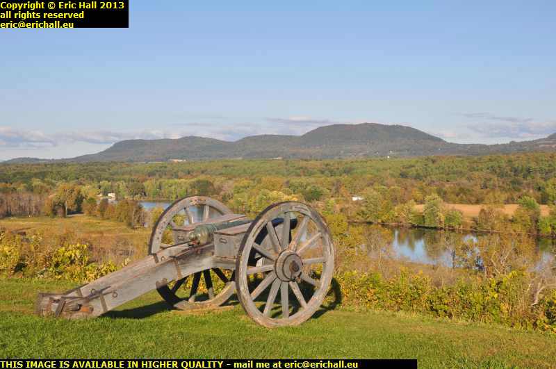
strawberry Moose Roy the Ranger neilson's farm saratoga battlefield new york USANo reason to be alarmed, though. Strawberry Moose and his faithfful artillery crew, namely Roy the Ranger, have manned … "personned" – ed … the guns and are ready to repel all boarders – and a few day pupils too by the sound of things.

I’m deep in the Hudson Valley near a town called Schuylerville and while that name might mean nothing to most people, it used to be called Saratoga and that might mean a whole lot more because the battle here, in October 1777, put the writing on the wall for the British occupation of what is now the United States of America.

artillery hudson river saratoga battlefield new york USAFor four months of the year the St Lawrence is frozen over and the only way to send supplies to Montreal and Lower Canada is up the Hudson Valley, over the portages around the various lakes and then down the River Richelieu to Montreal.

At Saratoga there’s a bluff overlooking the Hudson River and whoever controls this bluff controls all of the upper Hudson Valley – a fact perfectly well realised by the rebels, and only belatedly by the Imperial power who had failed to stock up with supplies. The rebels made it here first and as winter started to draw on, the Imperial forces realised that they needed to move them off the bluff in order to restock themselves for the winter.

So on October 7th, 1777, the Imperial forces attacked and after a fierce fight, were pushed backwards off the bluff and right into the arms of rebel reinforcements, and that was that. This was the first nail in the coffin of Imerial domination of the 13 colonies.

So that was how I spent my afternoon, and a beautiful afternoon it was too and no mistake. So much so that I ran completely out of time. luckily though, although the visit cost me all of $5:00, the Tourist Information service gave me a campsite list and so I was able to find the campsite that I missed in the dark last night – must remember to finish earlier in the daytime.

Regular readers of this rubbish will recall my preoccupation with roundabouts in North America. When I fist started travelling here, finding a roundabout was a major achievement. Nowadays, though, it’s the “in thing” for towns to have roundabouts, almost a status symbol, for here at Malta on Highway 9, they have two in quick succession.

road accident malta highway 9 roundabout truck overturnHowever, it’s all very well having roundabouts here, but it’s another thing completely about drivers knowing how to use them, as this truck driver has discovered, and he has come to a sticky end as he tries to turn off Highway 9 to go up to Interstate 89 and Montreal.

On a neagtive camber like this with a high centre of gravity like that, a dead stop at the “Give Way” sign and a slow and careful drive around would have been much more appropriate than showing off the handling capabilities of his rig. At least the cab hasn’t gone over, so he’s not hurt, except in the pride department, and also in the wallet I bet, because there were several of New York’s finest in attendance.

Why I was down here was for the huge Home Depot that I encountered last night. There was a sale on and so I stocked up with cheap tools – not rubbish but heavily-discounted stuff including a Ryobi all-in bit collection, the type that sells for about €35 in Brico Depot but here reduced to just $6:00. I can do all sorts of things with that.

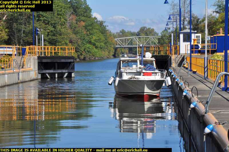
lock 4 champlain canal new york usaMy route is going to take me along the side of the Champlain Canal – the 19th Century water route between the Hudson and the St Lawrence. While much of it has been abandoned to due navigational improvements on the Hudson, there are still several locks along the route that are used.

This is lock 4 and I watched it being used by a pleasure boat, sadly the only type of traffic along here these days with commerical freight long-gone.

Ironically though, I’ve had lengthy (and I do mean lengthy) chats with 3 people today and they have all featured one thing in common – the scepticism of their Government’s foreign and militarist policies. All three of them have been as cynical as I am about all of this.

There’s an undercurrent of dissent running through the USA and people seem to be only able to express their discontent to foreigners. It really is just like the Soviet Union in the 1970s here, only that the authorities use ridicule and ostracism as a punishment instead of imprisonment. And believe me, ridicule and ostracism are far more devastating a punishment.

But yes, 50 years of fighting Communism, and now they have installed the worst aspects of it here in their own country? There’s something fishy here, and I’m not talking about the contents of Baldrick’s apple crumble.