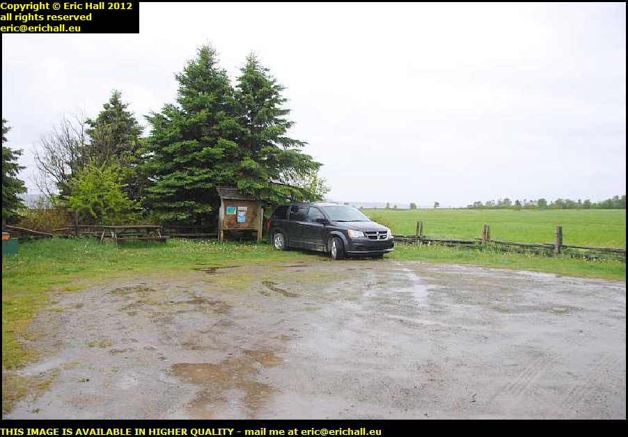
 I’ll remember this spot again, that’s for sure. I’m at the parking for the Sentier des Roitelets right by the Riviere des Vases on the shore of the St Lawrence River.
Hidden in here behind the hedge I was out like a light and didn’t feel a thing until the dawn.Even the rainstorm didn’t awaken me. And this is the first time since we’ve had rain – on the way to Harrington Harbour several weeks ago, I reckon.
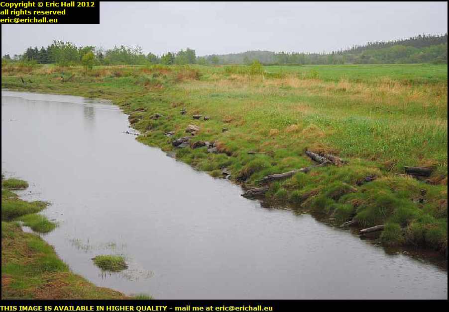 Do you see the remains of a wooden quay just here?
This area was comparatively well-populated 100 years ago. The eel-grass that grows along here has a special quality that makes it spring back into shape after it has been compressed by a weight and so was in great demand for car seats.
Families lived here and harvested the grass, and ships used to come from Detroit to pick it up and take it to the car factories. But a change in manufacturing technique rendered it obsolete when a substitute was found and by 1934 the industry had collapsed and everyone had moved away.
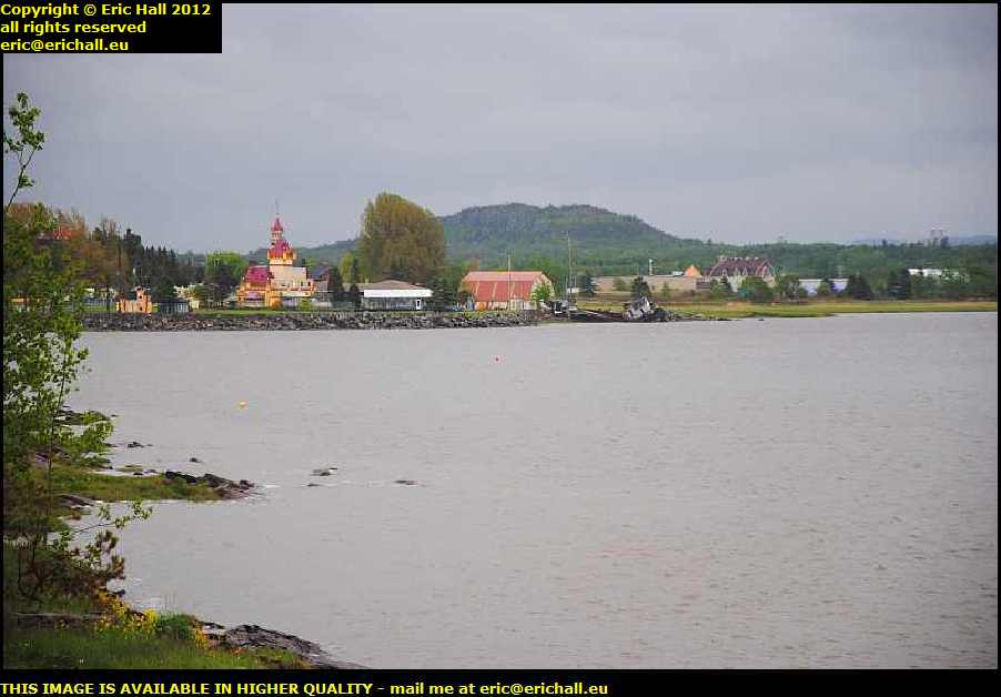 I’d been out to look at the ferry terminal at Riviere du Loup (where I’d landed on my first trip over here) and on the way back into town, I encountered this building.
It’s the Noel au Chateau, a bit of the “Neuschwanstein Castle” transported to the wilds of Canada, built in 1971 and now used as an exhibition centre and a small amusement park out here. It’s certainly different.
 I’d been through here before on my first trip but I didn’t stop to photograph the town. Now’s the time to put that right.
This is the Church of St Patrice, the building of which started in 1855 but due to a lack of funds, wasn’t completed until 1883. The church then almost immediately caught fire and burnt down, just like everything else in Eastern Canada.
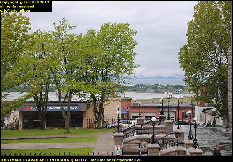 from up here on the steps of the church there’s a splendid view of the harbour. It’s a shame that there isn’t a ship coming in or going out, to add something to the photograph.
But over there on the far shore is the Noel au Chateau, where I had been just now.
Beyond there is the Charlevoix but there’s little chance of seeing that today with the low cloud that’s hovering over the St Lawrence.
 That building just there is the headquarters of the Riviere du Loup Catholic Youth Labour Organisation, but its claim to fame dates from a good while before then.
In fact, between 1928 and 1931 it was the office of the United States Consulate. And that, of course, begs the question “how substantial was the United States presence in this area if it necessitated the presence of the United States Consulate?”
 The road that runs along the southern shore of the St Lawrence, Highway 132, is called the Route des Navigateurs, the “Road of the Navigators”.
Whilst it’s nothing like as attractive as Highway 138 on the north shore, it does have its moments here and there such as just here with the beautiful cliffs in the background. If it takes me through places like this, I shan’t be complaining too much.
 There’s another difference between the southern shore and the northern shore, and that’s related to the land use.
Whilst the northern shore is rocky and concentrates mostly on forestry products and tourism, the flood plain here on the southern shore is very fertile and there’s a considerable amount of agriculture here. You can tell just how much by the number of silos that you can see in this photograph.
 This is the original site of the town of Kamouraska, settled between 1696 and 1791.
During that period, it was the civil and religious centre of the south shore of the St Lawrence east of Riviere-Ouelle. There were two churches here, and there were over 1300 burials in the cemetery. No individual graves seem to be recorded but there are these commemorative tablets listing the inhabitants of the cemetery grouped by family name.
Apart from several anonymes, we have a few tablets for Innu, Malicetes and so on, as well as un homme noir nommé Pierre – “a black man called Pierre”.
 This is the church of the town of Riviere-Ouelle.
This small town of about 1,000 inhabitants is a very sad relic of what was at one time the most important town on this part of the southern shore of the St Lawrence. 150-odd years ago there were over 4,000 inhabitants.
 Thanks to the railway line that was here, it was a vibrant port on the St Lawrence and the terminus of an important ferry that called at several places on the north shore.
It does have a modern claim to fame in that there’s a bar laitiere, an ice cream parlour, on the edge of town that serves the most delicious vegan ice cream that I have ever tasted, although not today in this weather.
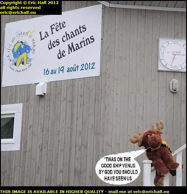 One thing for which the town of Saint-Jean-Port-Joli is famous is for the annual Festival of Sea Shanties.
It goes without saying that Strawberry Moose fancies himself as an entrant after his antics in the baggage hold of the aeroplane on the way over.
This is something that takes place every August and so he was quite keen to know my travel plans for late summer this year.
And when I informed him that it might be a possibility, he spent a happy half-an-hour practising while I wandered off to take a few photographs of the area.
 Whilst you admire the church, which dates from 1779 and is famous for its collection of sculptures, let me tell you that Saint-Jean-Port-Joli is one of the oldest settlements on this part of the St Lawrence.
It dates from about 1677, although you won’t find much dating to before 1759 as the village was burned by General Wolfe’s Fraser Highlanders during the invasion of 1759
 These days it’s a very important tourist destination with the Sea Shanty Fesitval of course, and also the marina and an annual symposium of wood sculpture. In fact, several wood sculptors have chosen the town as their home venue
It also has a windmill. All seigneurs were obliged to provide a corn mill for their habitants and whilst many were water powered, some were powered by the wind. This one, one of the few surviving windmills, won’t be doing all that much until they cut down the tree that is in front of it, shading it from the wind.
 My road takes me into the town of Levis and whilst I’m stopped on the old quayside overlooking the St Lawrence River and the city of Quebec to eat my butty, this beauty goes steaming past my parking space, steaming underneath the skyscrapers.
I’ve seen a couple of ships on the river, but this one is my candidate for today’s “Ship of the Day”, even if she is badly in need of a good coat or two of paint.
 There’s another candidate for “Ship of the Day” right out there down the river.
I have a good view of it steaming – or rather, dieseling – towards me, and that’s because I’m right in the middle of the river. I’m on the ferry that goes across the St Lawrence from Sorel-Tracy to St Ignace. I saw this on my way out and this was the way that I decided to come back. I hadn’t crossed over here before.
From here I drove back down the Chemin du Roy to Repentigny where I have a motel organised for tonight. This is a road that I know very well and I’ve travelled along it dozens of times. You can read all about my adventures along here over the years by following this link but you need to go backwards if you know what I mean.
Back at the motel I washed and cleaned all of the crockery and cutlery and made sure that everything else was clean. And then I packed it away ready to put it into store tomorrow.
I don’t want to go home
 … that I wasn’t planning on going over to the Charlevoix. I pulled into Riviere-du-Loup just in time to see the ferry to St Simeon steaming out of the harbour.