… “Monday 2nd December” for the title of today’s posting. Not an error, as you might think, but a Freudian slip because it is winter here today. Black skies, lashing down of rain, hurricane force winds (trees uprooted and all that kind of thing in Montreal) – so much so that it wasn’t until 16:30 or thereabouts that I took to the road, all heaters in the Dodge blazing away.
 It wasn’t like that at first though. Dawn came early to my little spec on the bluff above the Riviere Ste Anne and it looked as if it might be a lovely day – and I know that the dawn came early because I sa it, having somehow managed to park in the middle of a moquito nest and having been bitten to pieces during the night. I didn’t even cook a meal for fear of disturbing them.
Anyway, as the morning drew on, the day clouded over and as I was fuelling uo the Dodge, the heavens opened and that was that. I found a convenient motorway service area and parked up. With a coffee and an internet connection, I attacked a pile of paperwork and read a book.
By about 16:30 the weather improved a little in the sense that it stopped raining and we just had occasional showers. I hit the road and went off to the village of Deschambault.
This was an important stage on the Chemin du Roy and although the village has altered considerably over the last 275 years, it is said that much of the traces of the original 1734 road are still said to be there if you know where to look.
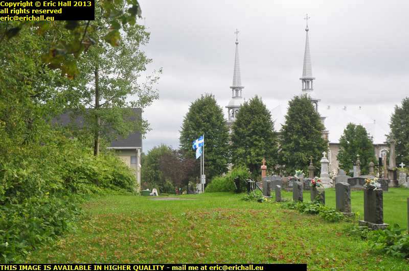 Judging by the alignment of the church and the presbytery, and the site of the old fort that Champlain had built against the Iroquois (you can see part of the wall as the boundary wall of the cemetery) I reckon that this might be a good-enough bet.
It continues along the headland from here to the new road, but about 400 metres behind me is a sudden stop. Coastal erosion, particularly along the clay cliffs, was always a serious problem and one of the main reasons for some serious alignment of the road.
Another place on the route is a town called Portneuf, about 10kms further along. Someone shored up a river bank and this led to dramatic changes in the action of the river and created a fine port for the goélettes, the little ships that plied up and down the St Lawrence, of which you can see long-since abandoned here. Gradually, the port was expanded until there is now a quay that stretches more than one kilometre into the St Lawrence, and even the biggest ships can tie up here, although not that they ever do these days.
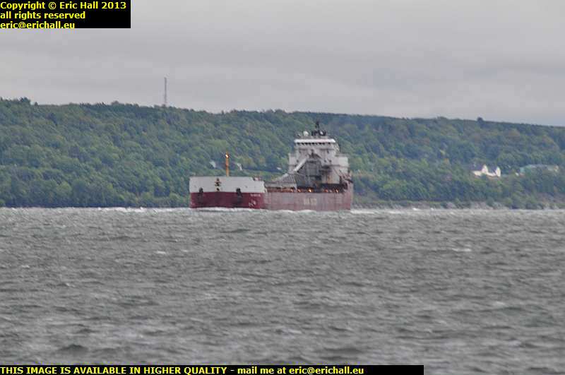 The quay is actually situated right at the apex of one of the sharpest meanders in the whole of the river and there are some delightful optical illusions with a long-range telephoto lens as you capture photos of ships such as the Canadian Shipping Line’s Atlantic Erie fighting the current and the meander and having to make a hard-over turn to port to round the headland without colliding with the quay.
And look at the waves – you can see what I mean about the howling wind and the storm that we were having.
Dusk came pretty quickly after this, which was no surprise, and so finding myself back on Highway 40 I retraced my steps to the Motorway Service Area to batten down the hatches for tonight. I’m not going to be doing anything else.