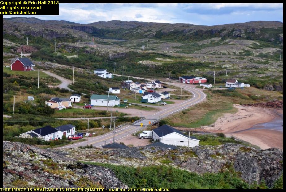
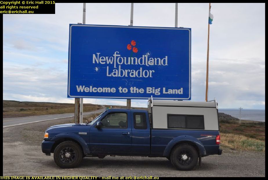
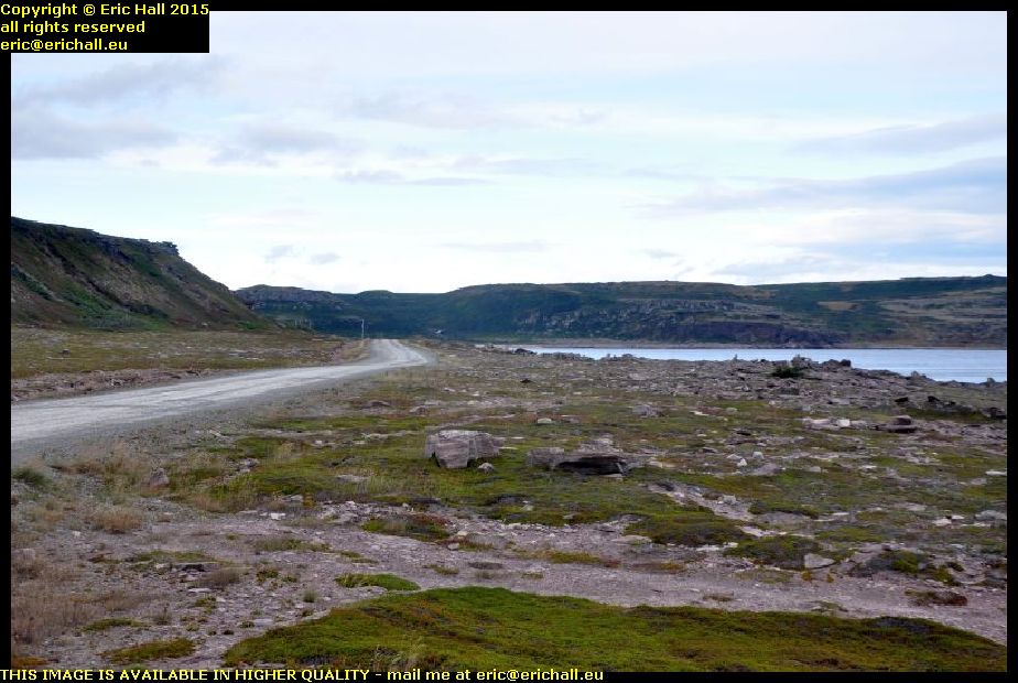
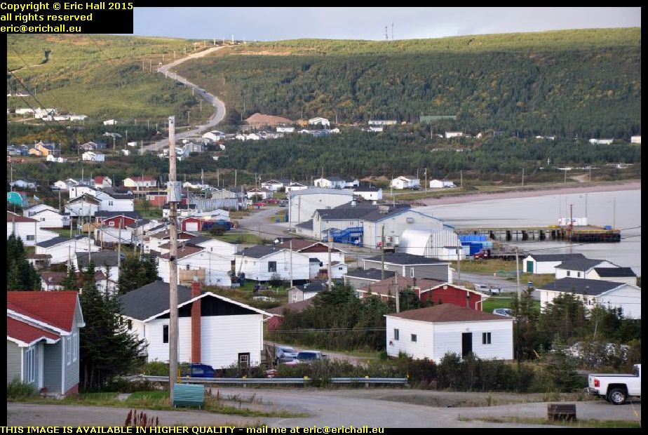
Category Archives: Eric Hall

Sunday 4th October 2015 – I DUNNO …

… what I had eaten last night, but I had an appalling night where I didn’t sleep a wink due to the most violent indigestion. I can now tell you all about my digestive tract such as where it is and how long it takes for something to work its way through it, because I could feel it on its travels for every inch of the way.

And so feeling like death warmed up, I eventually hit the road and headed east

mv camilla desgagnés harbour matane st lawrence river highway 132 quebec canadaAfter a brief drive I ended up in the town of Matane and went for a good prowl around the harbour.

I was very impressed, and also very lucky to see this ship in the harbour. She’s the Camilla Desgagnés, a heavy-icebreaking cargo ship and she has several claims to fame. Perhaps the most important is that, depending upon which book you read or who you talk to, she was either the first or the second modern commercial ship to navigate the North-West Passage and holds the rather unique honour of being the only “eastern” supply ship to service and provision communities on the “western” side of the Passage.

Secondly, she’s an unlucky ship and has suffered a couple of major incidents. In 1993, she was abandoned in mid-Atlantic after her engines failed, right in the path of an approaching hurricane. Furthermore, a couple of years later, she was abandoned once more after her engines caught fire

mv ctma voyageur harbour matane st lawrence river highway 132 quebec canadaAlso in the harbour, and I was very tempted to go over and see about negotiating my way on board her, was the CTMA Voyageur.

She’s the ship that provides the supply and provisioning service to the Iles de la Madeleine, off the coast of Prince Edward Island, and there’s room on board for a few motor vehicles. However, she was all loaded up and they were just shunting a couple of trailers on, ready to depart. And not only that, it’s a good way out to the Madeleines and I didn’t know when I would be likely to be able to make my way back.

mv camille marcoux harbour matane st lawrence river highway 132 quebec canadaAlso in the harbour moored next to the CTMA Voyageur was the Camille Marcoux. However, we all know about her because we have sailed upon her a couple of times – once in November 2010 and again in September 2014. She’s the ship that runs the ferry route between Matane and Godbout on the northern shore of the St Lawrence.

Our trip in 2010 was quite noteworthy, as I’m sure you remember, because we had tickets for the ferry to Baie Comeau from here but Bane of Britain somehow contrived to park himself in the wrong ferry queue.

I was feeling a little better by now and so I went for a coffee and something to eat at Tim Horton’s and to use the internet there. I managed to pick up my order without throwing it all over the floor this time, and I was there for about three hours because I was really finding it difficult to move.

river matane gaspesie highway 195 quebec canadaMatane is effectively the gateway over to the southern shore of the Gaspé Peninsula and there is a pass through the Appalachian Mountains at the headwaters of the Matane and Matapedia Rivers.

Out of Matane, you follow Highway 195 up along the valley of the Matane River and the scenery here is really beautiful even if the light is quite depressing for photography purposes. You could take hundreds of photos of the scenery here and still not do the area any justice.

covered bridge river matane gaspesie highway 195 quebec canadaThe higher up into the mountains we go, the more impressive the scenery becomes.

And it’s not just the natural scenery either but the man-made scenery too because we encounter several covered bridges across the river. The longest covered bridge in the world is in Hartland, New Brunswick, but Quebec has very much more than its fair share of them, as far as pure numbers are concerned. And those that are left (because hundreds have disappeared) are very-well maintained.

headwaters watershed matapedia river matane gaspesie highway 195 quebec canadaAt the headwaters of the River Matane we start to climb up and over the watershed into the drainage basin of the Matapedia River.

This road is another thoroughly impressive road with some really impressive scenery, and it bounces you up and down everywhere as you climb steeply into the Appalachians. And then, just as steeply, it drops you down into the valley of the Matapedia River, where we rejoin Highway 132 at Amqui.

And it was along here that I decided that I couldn’t go on any more. Around the bend, a motel appeared offering rooms with cuisinettes for just $49:95 plus taxes. Furnished like something out of the 1950s, nevertheless I’ve stayed in far worse places than this for far more money too.

I booked myself in, found my room, went inside and, still feeling like death warmed up and with it only being 16:45, I promptly crashed out and that was that.

Saturday 3rd October 2015 – START AS YOU MEAN TO GO ON.

I decided this morning that I would have a proper breakfast (of sorts) and so I called into the local Tim Hortons for coffee and bagels. And then promptly dropped the whole lot on the floor, followed by the laptop.

Still, at least it amused the patrons of the establishment.

I was up early after my rather late night last night and did a pile of paperwork in something of a vain attempt to catch up and then hit the road for Rimouski and breakfast. At least they gave me some more bagels and coffee. And someone with whom I was chatting confirmed that the serving wench there asked me 7 times if I really didn’t want butter on them.

I’d never had a proper look at Rimouski before and so I had a little drive around. It’s a typical seaside town with beaches, plenty of motels and amusements – just the place to come for a fortnight if only the river were warmer, because the St Lawrence is a really cold river.

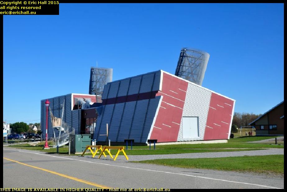
onondaga submarine maritime museum rimouski st lawrence river quebec canadaBut I was here at Rimouski for other reasons. As Austin Powers once famously said to Basil Exposition, “what’s long, hard and full of seamen?”.

There’s a small maritime museum here at Rimouski and the pride of place goes to the old Canadian submarine Onondaga. I’ve always said that you would never ever get me into a submarine, and at the price that they wanted for a visit, nothing was ever likely to change.

maritime museum rimouski st lawrence river quebec canadaThere’s quite a little complex of buildings here and the old port facilities when this area was a major port for all of the coast-hopper ferries that started from here.

Much of this traffic has been replaced by road now and what is left departs from the quayside in the town and so this area is redundant. But there are quite a few maritime souvenirs left to visit and it’s a nice place to walk around and to eat your butties

empress of ireland pavilion maritime museum rimouski st lawrence river quebec canadaBut it was the new pavilion that I had come here to see – or, rather, it was the contents of the new pavilion.

On the evening of 28th May 1914 the Canadian Pacific transatlantic liner Empress of Ireland set out from Quebec on her way to Liverpool. She stopped off at Rimouski to drop off her river pilot and then set off full ahead for Liverpool.

buoy sinking empress of ireland st luce st lawrence river quebec canadaJust a couple of kilometres out of Rimouski she sighted the collier Storstad and then each ship became enveloped in a fog bank.

What happened after that has never been adequately explained, but it’s suspected that some of the portholes were open and the collision rolled the ship so that the water poured in.

The net result was that the liner took the Storstad full-on in the beam and sank within 14 minutes, taking 1012 passengers with her. And they all lie right underneath where that white buoy lies.

It’s the greatest marine tragedy every to hit Canada and one of the largest losses of life of any marine accident in peacetime. Remember that the Titanic lost 1507 passengers, but she was 4 times as big, and this disaster took place right within sight of shore.

Quite a lot of the ship has been salvaged since her wreck was rediscovered in the early 1960s. Some of it is displayed in the museum (and this was what I came to see). Very much more of it is held in private hands, which is a shame.

But what is even more disgraceful in my opinion, even though I know for a fact that many others, including the museum staff, disagree with me, is that much of it, including one of the massive brass propeller screws, has been sold for scrap. $5,300 the salvors were paid for the propeller and that just goes to show that some people have absolutely no sense of history.

In fact the looting of the wreck became so blatant (there was talk that one team was planning to use dynamite on the hull to make an easier entry into the bowels of the ship) that the authorities “nationalised” the wreck and placed it out of bounds to salvors, although private divers can visit it.

And hence the buoy – to moor your ship and to display the “statutory notice” about looting.

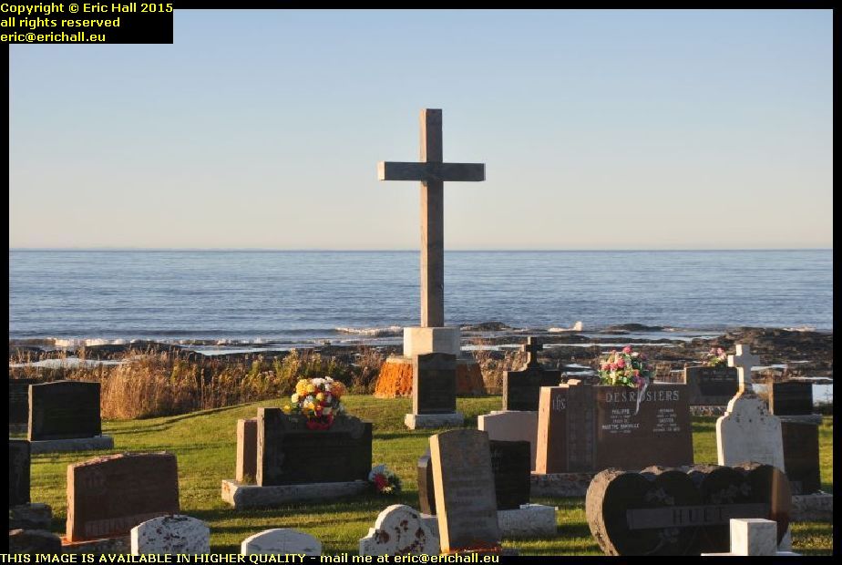
empress of ireland memorial cross st luce st lawrence river quebec canadaThe disaster took place just off the headland of St Luce and there’s a modern Celtic cross on the headland there that clearly relates to the disaster.

In the cemetery however is a concrete and stone cross dated 1920 looking out over the headland to the sea. There’s no plaque to say to what it relates but the date and its position would seem to be significant as being an early memorial to the disaster.

It’s hard to understand how it was that the notion of the earth being flat persisted as long as it did amongst the powerful classes.

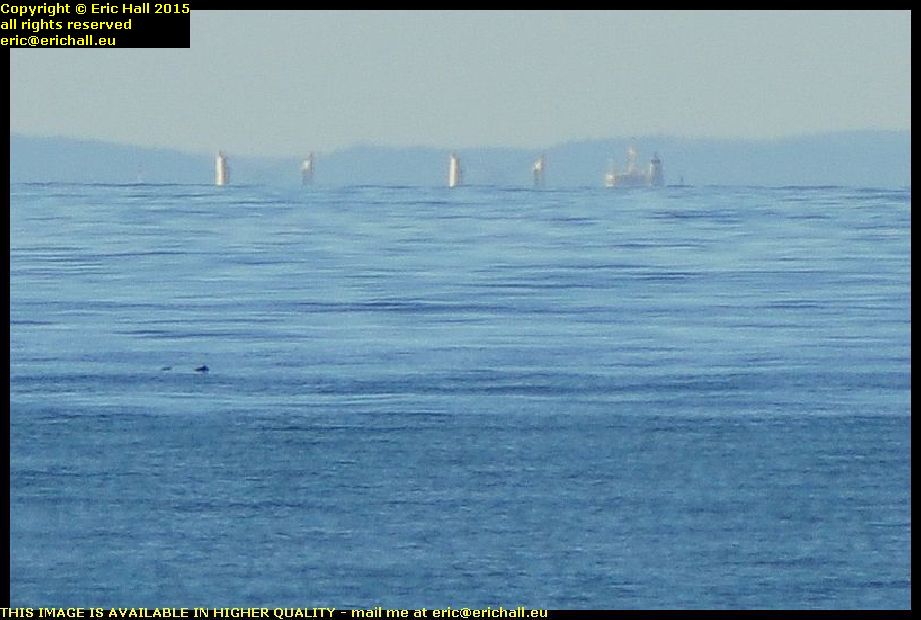
superstructure of ship st lawrence river quebec canadaWhile I was sweeping the horizon looking to see what I could see, I noticed a few peculiar shapes and so I photographed them with the telephoto lens at its fullest extent and enlarged the image to see what I could see.

It turns out that it’s the superstructure of a ship, way across the other side of the St Lawrence. The ship is at such a long distance away that the hull has been lost due to the curvature of the earth.

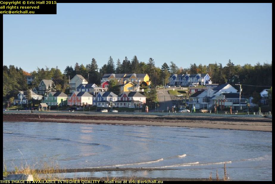
st luce st lawrence river quebec canadaAs for the town of St Luce, it’s another seaside resort but much smaller than Rimouski. It’s quite a quaint little place, another small town where I would be quite happy to pass a week or two relaxing in the peace and quiet.

But the shore of the St Lawrence is really beautiful around here with all of the beaches. It’s a shame though that it’s on the south shore and so it doesn’t catch the sun as much as the north shore. And the north shore is a good 5° colder so it’s not as pleasant for sunbathing.

sunset st lawrence river ste flavie quebec canadaI’ve had a couple of really exciting and involved chats with a couple of people today and we’ve really put the world to rights.

However, it’s made the time pass really quickly and as a result the sun is disappearing rapidly. We’re having a glorious sunset but none of this is helping me find a place to stay.

And while I’m dithering, the temperature has dropped rapidly too and it’s freezing. But I’ve found a type of chalet motel place with cooking facilities and while it’s a little more than I would be happy paying, it’s got absolutely everything and I can cook myself a really hot meal. And so I’m saving there too.

And talking to the proprietor’s wife, she’s a vegan too and gives me a huge bowl of home-made vegan vegetable soup. And that’s the most delicious thing that I’ve eaten for ages.

Friday 2nd October 2015 – AT THE FERRY TERMINAL AT LES ESCOUMINS …

Our hero “can I have a ticket for the next crossing to Trois Pistoles?”
Serving Wench “sorry, we don’t do that here any more. You have to contact the terminal at Trois Pistoles”
OH – “how do I do that?”
SW – “you have to ‘phone them with your credit card number” (gives OH the brochure with the phone number°
Ferry Terminal at Trois Pistoles “Our office is open 7 days a week from 09:00 to 16:00 (it’s now 13:40 by the way) but we are not able to take your call. Please contact us by internet”
OH “the phone isn’t working. I have to contact them by internet”
SW “okay”
OH “do you have the internet here?”
SW ‘yes we do”
OH “well, can we do this here by internet”
SW “sorry – we aren’t allowed to do this for customers”
OH “well, can I do it on my behalf then?”
SW “sorry but customers aren’t allowed to use our internet connection”
OH “well is there public internet access then here in the terminal?”
SW “no there isn’t”
And so Our Hero tracks down an internet connection in a local salle de quilles (bowling alley) and makes the reservation himself far, far quicker than it took to enter into discussion with the Serving Wench.

Whatever is the world coming to? As I have said before … "and before and before and before" – ed … the legendary North American customer service is going rapidly down the tubes.

But anyway, last night I did have an excellent night’s sleep. Just what the doctor ordered. Although I did have to heave myself out of my stinking pit on one occasion.

I was also on my travels again too. To Stoke on Trent, in fact, and back to the house of someone whom I used to know up until about 2008. It’s been 7 years or so since we last had any contact and so when we were in his living room waiting for Godot or whoever it was, I asked what new videotapes he had to watch.
“We just watch the same videotapes over and over again” he replied.
There’s quite a probable reason why this person has appeared just now. On my social network account I have noticed quite recently that both his wife and his daughter have been having a look around at my doings, although they weren’t around last night. Not that it bothers me of course – I’m pleased to have the visitors but it has been puzzling me for a couple of days. I didn’t realise that I was that popular

dawn pointe aux outardes st lawrence river highway 138 quebec canadaThere was not a drop of condensation anywhere at all inside Strider this morning and I didn’t think that it was that cold.

But it was cold enough to freeze the butane can again and I had to roll it around in my hands for five minutes before there was enough pressure to make a good-enough heat to boil the water for my morning coffee. And then I could sit quietly and admire the sunrise – what I could see of it anyway through the rainclouds – with my breakfast.

outardes one hydro electric generating plant st lawrence river highway 138 quebec canadaAnd I found the old power station at Outardes One too, as you can see. And it wasn’t easy to find either.

I drove around the town for a while but I couldn’t see anything, but in the middle of a housing estate I saw a sign indicating a “Footpath to the Old Quay”. Now I knew that the quay was at the mouth of the river and that the old power station was on the river close to its mouth so that seemed like a good plan.

outardes one hydro electric generating plant st lawrence river highway 138 quebec canadaThe path was a very steep drop down about 300 steps and then when we reached the bottom, the path to the old quay went to the right but there was another path that led off to the left and so I tried down there.

A couple of false starts led me up a few garden paths but I eventually arrived at the building. It was all locked up and the doors and window welded closed. But peering through the windows I could see that all of the turbines had been removed.

outardes one hydro electric generating plant st lawrence river highway 138 quebec canadaIt’s possible to walk all around the outside of the premises though, and you can see how the water arrived here. It’s not a waterfall or a tunnel bored through the rock, but a couple of conduits on the surface and covered in concrete.

The water goes through the turbines in the building and then out of the building into the river that passes by below.

Going back was much easier than it might have been. Obviously they didn’t bring (or take away) the power station material via the steps and so I had a good nosey around and eventually found an old asphalt path that might have been a roadway. This took me up to the main highway but there was a gate and fence that was all closed up and padlocked.

That’s not inhibited me before as you know, and it was no great inconvenience. And then a nice long walk on a reasonable surface took me back to Strider.

I bought my SatNav in 2010 and every time I’ve come up Highway 138 The Lady Who Lives In The SatNav leads me up the garden path at Portneuf and dumps me at a steel barrier down the end of a dead end.

derelict abandoned dismantled bridge portneuf st lawrence river highway 138 quebec canadaThe town has been by-passed with a modern road and a modern bridge further upstream, but I was curious to see what was at the end of the dead end in Portneuf and so I backtracked on the SatNav route.

This took me through a campsite and up to the river and here I am. The steel barrier is up at the top of the hill over there. presumably there was a ferry and later a bridge across here, I should think.

This was a good place to relax and I had a crash out for half an hour, which was hardly a surprise.

strawberry flavoured soya drink canadaI also took the opportunity to arrange my shopping from yesterday, and I can show you this that I bought.

I’m a vegan, in case you haven’t guessed, and like all vegans, I have issues about Vitamin B12 which is very difficult to find in vegan foods. But this strawberry-flavoured soya drink contains 16 essential nutrients, including a good healthy dose of B12, and so I wish now that I had bought a week’s supply, especially at $2:59.

l'heritage st lawrence ferry les escoumins trois pistoles quebec canadaThen we had all of the nonsense at Les Escoumins but I eventually made it to the quayside, such as it is, for the ferry.

L’Heritage, the ferry that takes us across the St Lawrence, finally pulled in. It was looking very sad in 2011 and it’s looking even worse today. She was built in 1973 and looks every day – in fact every minute – of her age.

But anyway, once Noah and his menagerie and Julius Caesar and his soldiers had disembarked, we could load ourselves up.

l'heritage st lawrence ferry les escoumins trois pistoles quebec canadaThe crossing was quite rough – although it wasn’t really. We had plenty of wind to be sure and it was cold, but there was no reason why the ship should have been swaying around as much as she was. Presumably it’s because of her flat-bottomed design but I don’t remember swaying around like this last time.

I had a couple of rounds of toast on board and that took me up to landing time.

It was dark too and I wasn’t going to find a place to doss down in these conditions. I found a cheap motel on the edge of Trois Pistoles and I’ll stay here for tonight.

Thursday 1st October 2010 – I’VE HAD A DAY TODAY …

… where I don’t seem to have accomplished very much at all – at least, as far as distance goes.

But there’s a reason for that – namely that after my week or so out there in the wilderness I’ve had a lot of sorting out to do. And we started off by having yet another red-hot shower. And how much I enjoyed that too!

But working my way through all of the paperwork I was disturbed at 09:40 and again at 09:50 by the cleaners who wanted to attend to the room, even though check-out time was 10:30.

After the second time I gave up and decamped to Tim Horton’s, stopping along the way for a very lengthy chat with a young guy in charge of sales in a caravan place. They are agents for Palomino slide-in truck campers (called caravan autoporté in French) and as that company makes exactly the camper that I want (the collapsible 600 model) it’s always useful to chat to the agents. Who knows what second-hand model might come their way.

Working at Tim Horton’s seemed to take ages and it was, would you believe, 14:00 when I hit the road again. First stop was to the supermarket to stock up on food seeing that I have none left – at least, of bread and salad stuff. Fuel was next and I had a long chat with the woman whom I know who runs the little Ultramar service station opposite the supermarket. I’ve called there every time that I’ve gone past there because I’m sure that she remembers me and we have had some interesting chats.

Third port of call was at Pointe Lebel where I stopped to eat my butty. I’m not buying hummus now, no matter how much I like it. I have a load of vegan cheese that needs to be eaten as it’s been hanging around since last year and it won’t last another year.

From there I went off to look for Outardes One.

There are several big rivers that run down to the St Lawrence, and they are all dammed for the generation of hydro-electric power. We’ve done the Manicouagan and seen some of the dams there, and we’ve seen some on the Outardes too, but Outardes One, the very first one that is close to the shore of the St Lawrence has long been abandoned and is very difficult to find. I’m determined that this year I’ll track it down.

pointe aux outardes sunset matane st lawrence river highway 138 quebec canadaI passed by quite a few places that I’d seen before and before long I ended up at the Pointe aux Outardes.

There are a few houses down here today but formerly this was the site of a reasonably important settlement. The church has long gone but there’s still the old cemetery here and a parking place for the little country park down at the end where there’s an incredible view across the St Lawrence to the town of Matane

pointe aux outardes sunset matane st lawrence river highway 138 quebec canadathe river isn’t particularly wide here, it’s not very deep and it’s a long way down from its mouth. And so it’s very hard to imagine that during World War II two German submarines, believed to be-69 and U-132 – were operating in the river around here and not only sank a couple of ships, made a successful getaway too.

There’s a couple of ferries across to Matane too. One, from Godbout, we’ve sailed on a couple of times but the other, from Baie Comeau itself, i’ve not yet taken but I’m saving that delight for another time. I’m planning to head west upriver.

pointe aux outardes sunset matane st lawrence river highway 138 quebec canadaBut it’s a beautiful evening and as the sun sets down in the west, I’ve decided that I’m going to stay here the night. There’s just the odd car pulling in to turn round and I don’t think that that will disturb me too much, and with the little breeze that is rocking Strider I should be quite comfortable tonight.

And it ends up being a late night too. Well after 23:00 in fact. I seem to have been carried away with one or two things that I was doing on the laptop and I didn’t intend to end up this late before retiring. I hope that I have a good night’s sleep to make up for it. And then tomorrow I’ll be ready to continue the hunt for Outardes One.

Wednesday 30th September 2015 – DRIVING THE TRANS-LABRADOR HIGHWAY …

overturned lorry road accident trans labrador highway 389 quebec canada… is not for everyone, that’s for sure. We mentioned yesterday, strangely enough and by pure coincidence, the subject of road accidents along the highway and the subject of lorries driven carelessly cropped up in the conversation.

Now of course I have no evidence and make no suggestion that this lorry was being driven carelessly but this is what can happen when it all goes horribly wrong. You’ll notice the route sinueuse sign of course – the road is like this for about 15 kilometres – and this is suggestive

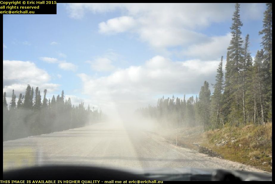
mud road trans labrador highway 389 quebec canadaWe’ve seen some pretty good stretches of the highway of course, but there are also some sections that are thoroughly dreadful. This section is about 40 miles of mud. When the weather is really dry, like today, it’s a pile of dust after dust after dust.

But I’ve been here in the wet winter weather too, and it’s nothing but a sea of mud up to the axles. You mustn’t stop moving forward because if you were to stop, you wouldn’t be able to set off again.

This is what you need to contend with up here.

But let’s go back to last night.

And it was bound to happen. After several nights of really good sleep I had a nuit blanche last night. Mind you, I must have gone to sleep at some time because I was off on my travels again. I was driving a bus with passengers and I needed to leave the bus urgently at a certain moment. However, one of the passengers, who bore a very strong resemblance to Didier from FC Pionsat St Hilaire was having an attack of catalepsy right at the top of the stairs and I couldn’t go past him.

But what with a howling wolf that started up at about midnight, followed by a searing attack of cramp in my leg that went on for hours, and then some other species of sub-arctic mammal trying to claw its way into the back of Strider to, presumably, cuddle up next to me in bed, all of that put paid to any idea that I had of having a decent comfortable sleep.

overnight parking spot sleeping in strider sub arctic tundra trans labrador highway 389 quebec canadaAnd it was cold too. All of Strider was iced up outside and inside (although not on the roof – there’s no condensation on there again so this insulation idea is working in spades).

I wasn’t uncomfortably cold like this but what was uncomfortable was that the little butane gas cylinders had frozen up. I had to roll one round and round in my hands for 20 minutes before it was warm enough to light up and I could have a very welcome coffee

hanging cloud trans labrador highway 389 quebec canadaThe weather wasn’t very good at first though. Just to prove that hanging clouds are not a phenomenon unique to the Auvergne, here’s a fine example in Northern Quebec.

You can’t see anything very much and vehicles here don’t have rear fog lights and so you can’t tell that they are there until they come looming up out of the gloom like this one. But luckily it didn’t last too long and we could put our feet down.

I stopped for a really long while in Gagnon.

We’ve been here a few times before and so most of you will know that it’s a ghost town. There’s a huge iron ore mine up here and the purpose of the town was to house the workers. The mine was exhausted and so the people moved away and the houses dismantled.

abandoned roads gagnon ghost town trans labrador highway 389 quebec canadaThere’s almost nothing (read on, MacDuff!) here now to remind you that at one time it was a thriving metropolis but it’s interesting to drive around some of the old abandoned streets even though the forest has reclaimed it all.

And this is one of the reasons why I bought Strider – so that we could go for a wander off around roads like this without any worries about what hire companies might have to say about it.

abandoned cemetery gagnon ghost town trans labrador highway 389 quebec canadaThere’s only one thing more sad than an abandoned and deserted ghost town, and that’s an abandoned and deserted cemetery in an abandoned and deserted ghost town.

If you read anything that has ever been written about the town, you’ll note that every single author writes that the only remains in the town are the drops on the kerbs of the pavements in the main street, where the houses used to be, and the airstrip that we have all seen before.

But that’s because one person drove through here without stopping and without going for a good prowl around, and wrote down what he observed in a brief moment, and everyone else (many of whom haven’t even been to the place) who have written about the place have repeated his comments parrot-fashion.

There is not (to date) a single mention of the cemetery. It’s being totally ignored and as far as I can tell, I’m the first person ever to photograph it and write about it.

graves in unconsecrated ground cemetery gagnon ghost town trans labrador highway 389 quebec canadaThe cemetery is in two parts. There’s the actual cemetery proper, and then these graves, on the northern side of the cemetery.

Not one of these wooden crosses (there are one or two proper headstones in here) bears a name but interestingly, the angels on them seem to have at one time been coloured either blue or pink – perhaps to indicate male or female graves

grave plaques cemetery gagnon ghost town trans labrador highway 389 quebec canadaThere’s a panel with a series of grave plaques showing who is in here and when they died. It seems that the cemetery (and probably the town) was in operation between 1961 and 1982

Many of the people interred here have their given names listed as anonyme. This implies to me at least that these people are young children who have died before being christened – hence the unidentified crosses in what might be unconsecrated ground and also the blue and pink angels.

abandoned exhausted iron ore mine gagnon ghost town trans labrador highway 138 quebec canadaAn exhausted and abandoned iron ore mine, I said. I’d had brief look at it before but with Strider, I could boldly go where no man has gone before for probably 30 years – good old Strider.

To give you an idea of scale, that little track right down there is wide enough for two vehicles to pass and we’ve driven all the way along from there, past the gigantic mine holes and the mile after mile of mine tailings to perch upon this rocky crag

abandoned exhausted iron ore mine gagnon ghost town trans labrador highway 138 quebec canadaRight down there in the distance (zoom lenses are good) is an abandoned Chevrolet pickup and a pile of industrial wheels and tyres, but there aren’t very many physical relics of the mine left.

The Chevrolet is more modern than that but I have included it in here to give you an idea of the scale of everything, because the site of the mine is immense. It covers quite a few square miles of ground.

iron ore mine gagnon ghost town trans labrador highway 138 quebec canadaYou can’t see it clearly in this photo but there is a reason why the rock in the centre of this photo is important.

Before I came here, I wouldn’t have known a piece of iron ore from any other piece of rock but there is no mistaking this one. In the bright sunlight it was glistening and sparkling and was visible from quite a distance away.

In fact, the whole area was glistening and sparkling where the crushed stone had released grains of iron. It didn’t occur to me at the time to pass over here with a magnet and to see what might happen.

concrete retaining wall abandoned exhausted iron ore mine gagnon ghost town trans labrador highway 389 quebec canadaWhile you admire (if that is the right word to use) the only real vestige that remains of the giant mine workings that were here, let me just conclude my story of the iron ore mine by saying that it’s just nothing but a huge environmental disaster.

The rape of the countryside here has been encouraged by the Canadian Government due to it being “out of sight, out of mind”. No-one (except intrepid, adventurous … "and self-effacing" – ed … explorers and so most people are totally unaware of what is happening in the darkest depths of their country.

There’s been no attempt been made to clean up the site and restore it to its previous condition. It’s been left as a huge open wound – a symbol of man’s greed. I shudder to think what might happen up in the high Arctic, which is even more inaccessible to people like me.

If the Canadian Government can’t make the big companies clean up their act here, then there is no hope at all for the High Arctic, is there? It’s shameful.

And it’s not just that either.

Look at those graves. These are, presumably, children. But they have no names, no plaques, no nothing. But they do have parents. Why don’t the parents look after their babies, long-dead though they might be? The cemetery is abandoned too and so are its inmates.

People are even prepared to forget their “loved” ones and leave them lying cold and stiff in this inhospitable environment as they move on elsewhere in the search for material wealth.

This just sums up modern Canada if you ask me. They should all be thoroughly ashamed of themselves.

lunch stop lake manicouagan trans labrador highway 389 quebec canadaLeaving behind yet another really good rant, we head off to Lake Manicouagan and our lunch stop.

This is a beautiful place to stop and the view is really astonishing, but I didn’t have much time to enjoy it. I was eating my lunch and reading a good book and the next thing that I remember, it was 14:41.

Yes, crashed out again, and it’s hardly surprising seeing what a night that I had had last night.

refuge des prospecteurs trans labrador highway 389 quebec canadaI went on down the road to the Refuge des Prospecteurs after my little doze.

This is the nearest thing that you will find out here to a holiday camp. There are chalets (this is a photo of just part of it) and activities going on here. Walking trails, sailing, fishing and all that kind of thing. I reckon that it must be a great place to come and spend a relaxing week and I shall be looking to check it out some time or other.

lake manicouagan trans labrador highway 389 quebec canadaI’m more interested in the lake, though. Lake Manicouagan is an artificial lake formed by the barrage of the hydro-electric dam at Manic 5. It’s a circular lake with several big islands in the centre, some of which are nature reserves and strictly out of bounds to visitors.

What is really interesting is that the depression that is now the lake is said to be a crater formed by the impact many thousands of years ago of a meteorite, and that must have been something really impressive. It makes me wonder about all of the iron ore around here – is this part of the fall-out from the meteorite?

road works trans labrador highway 389 quebec canadaBack on the road again in the beautiful weather and the lovely autumn colours, and the roadworks are still continuing.

They are currently demolishing an overhanging rock using a hydraulic breaker, and as I drove past, a huge lump fell off it and bounced across the road right in front of me. I almost ended up with a new vehicle out of this.

I stopped at Vallant for another coffee. This was formerly a ghost town but has dramatically sprung back to life just recently. Two years ago in fact, according to the woman who served me. Everything was abandoned but the fuel station is back up and working, so is the cafe and shop, and there are these residential trailers everywhere.

There are a few major construction projects going on in the vicinity and even though it’s not exactly central, Vallant seemed to be the best place to create a workers’ village seeing as all of the infrastructure was already in place

As the evening wore on, I arrived in Baie Comeau and my journey around the wilderness is finished. As is customary, I found a motel here (but not the one I always used to use – we had a disagreement) and while it’s basic, so is the price. But I need a good wash, a shower, a change of clothes and to sort out everything – and for all of that I need the space.

In 2 weeks time I’ll be going home. I’m amazed how quickly time has gone, and I’m rather sad about that. But apart from my night at North-West River (and that was for special circumstances), I’ve fulfilled my ambition of spending every night on the Trans-Labrador Highway sleeping out in the wilderness. It wasn’t too difficult either, although insulation and a ply lining on the truck cap would have helped and a small electric heater of some kind would have been luxury – I’m sure that I could invent something out of s100 watts of halogen light bulbs.

In fact, I’ll do it again too, but I do need to sort out the truck cap.

Tuesday 29th September 2015 – THAT WAS A NICE …

… night too. despite the rainstorm that we had, and despite having to leave my stinking pit twice due to reasons that any man of my age will know, and despite me having a neighbour arrive at some point, I was really comfortable in my little bed. So much so that I was awake and out of the bed long before the alarm went off.

And it was warm (well, comparatively warm), to such an extent that I stood outside Strider, lowered down the tailgate and made myself a coffee in the open air. And it was here that I engaged my neighbour in conversation.

He and his wife were from Newfoundland and had a 1999 Chevy pick-up with a camper back. They’d come round from Baie Comeau and were telling me about the road. We discussed fuel consumption too, and he dismayed me by saying that he could do from Goose Bay to Blanc Sablon on just one tank of fuel. Mind you, it cheered me up to a certain degree when he said that he had a 135-litre tank. That compares to Strider’s 70 litres or something. And how I wish I had that size of fuel tank. But of course I will settle for an improved fuel consumption.

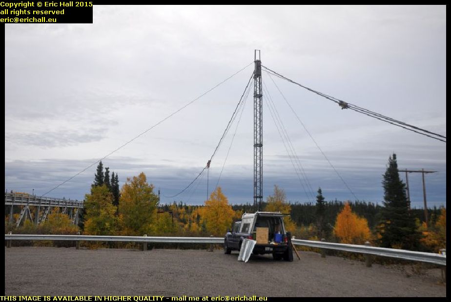
strider cable car remains churchill falls rest area trans labrador highway canadaHe knows the area here quite well and he drew my attention to the structure under which Strider was parked.

According to him, these are the remains of a cable car. Before the highway – and the bridge – were built, they still needed to pass stuff over the river to whatever settlement was over on the other side and to start the construction of the plant and cabins that formed the basis of the town of Churchill Falls.

if what he says is true, then it can’t be true about the cable car at North West River being the only one in Labrador. But we shall see what they mean by all of this.

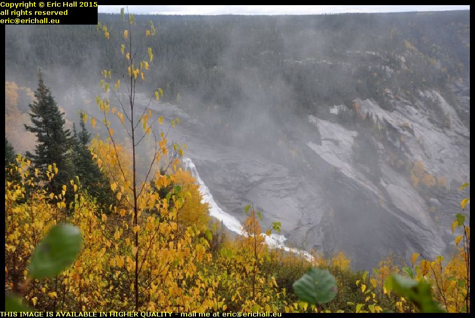
churchill falls river gorge trans labrador highway canadaAnother thing that he knew was the footpath that led to the best view possible of the falls, although it’s not possible to see the falls in all their glory – the best views are just inaccessible.

It’s quite a hike, although not a difficult one, but it’s well-worth the effort. I was pleased to reach the end pf the path because there’s a splendid view of the gorge itself from there. I’ve never seen a view quite like this – the Grand Canyon excepted, of course Apparently, I’m 240 feet up just here, according to the Neighbour from Newfoundland.

waterfall churchill falls trans labrador highway canadaHe was right about the view of the falls not being spectacular. The falls themselves are spectacular, of course, but you just can’t reach the immediate vicinity of them, or found a spec directly opposite to take a good photo.

In any case, the falls themselves aren’t anything like as spectacular as they used to be. They really were impressive back years ago but the river was diverted to provided the drop for the hydro-electric power plant and so only a small fraction of the water falls over the waterfalls today.

crashed pick up trans labrador highway canadaMy neighbour also told me of a crashed vehicle that was lying on its roof further on down the road.

And so I kept my eyes peeled, and I found this one here. It’s not on its roof of course but it hasn’t half been knocked about. This gives you yet another clue about the state of the road around here. As for the yellow tape that’s around it, that’s Police marking tape. It shows that the Police have inspected the vehicle, and that it’s sealed off to warn people not to enter.

crazy quebec lorries overtaking me trans labrador highway canadaBut it’s not by any means the state of the road that’s responsible for may of the accidents – it’s the state of the drivers.

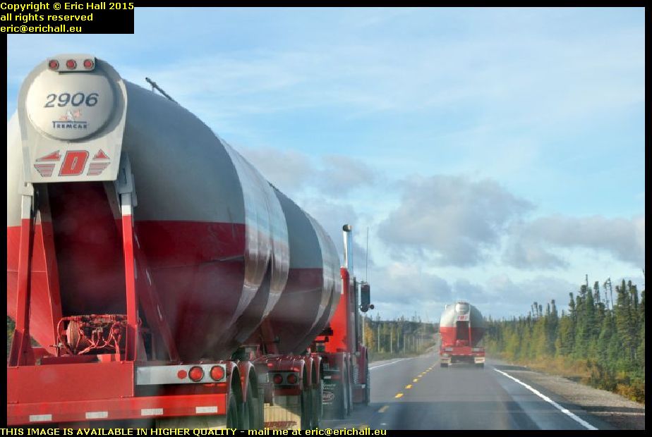
The speed limit along the Trans-Labrador Highway is 80 kph and I have the speed limiter on Strider set at just 80 kph. But everything on the Highway is going past me like I’m standing still, including these two lorries. And these aren’t just simple artics either, these are two of those road-trains pulling two trailers and these road trains are notoriously unstable at the best of times on the best of roads.

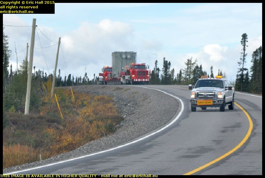
double load twin tractor units trans labrador highway canadaAnd talking of unusual loads on the road (although road trains aren’t by any means unusual) how about this one? We started off with a police car in front flagging down the traffic and telling us to move right off the edge of the road. And then this came along.

This is some kind of huge electrical unit, and it has two lorries in charge of it. There’s one pulling it, and the one behind it is pushing it along. The purpose of the pick-up in front is to clear the road because with the configuration that this unit has, it can’t even take a bend like this and keep on its own side of the road. It took up most of the road.

cottages near labrador city trans labrador highway canadaI’ve been noticing, as I’m sure that I have already told you, that there’s some kind of urbanisation taking place along the Trans-Labrador Highway. This is the lake that we’ve all seen before, about 40 kms out of Labrador City, when we came by here on previous occasions.

There was a cottage there previously, but now we seem to have a couple of other cottage down by the lakeshore. And this is the kind of place where I would like to live, with this really gorgeous backdrop and a really beaautiful view of the lake in front.

iron ore mine wabush trans labrador highway canadaLast year when we were in Wabush, we heard all kinds of sories about the iron ore mine closing down and how people were going to desert the town in droves.

I made a diversion into the town to see what was going on in here, and as you can see, the buildings of the iron ore mine are still there standing. And furthermore, I didn’t see anything that suggested to me that people were deserting in droves. There were no more houses up for sale or to let than you would expect to see anywhere else.

But of course, that’s not to say that things won’t be different in another year’s time.

I stopped off at Tim Horton’s for the internet and a coffee, and then I went on to Fermont, in Quebec, for fuel as it’s the last station before the Northern Quebec wilderness.

I also went to look in the “boomerang”. We saw a photo of it last year – it’s the big, high, long building that has a huge shopping gallery on the ground floor and a pile of apartments up above. I’ve never been in there before (except to sound out the hotel in 2010) and so I was curious to see what it was like.

It’s certainly a labyrinth on the ground floor, but what surprised me was that a good proportion – probably 30% or 40% – of the shops were closed down and empty. At least the Co-op food store was open, which is more than can be said for the one in Labrador City which seems to have closed down since last year.

mont wright trans labrador highway 138 quebec canadaThe road out of Fermont into the Wilderness goes past Mont Wright and the Arcelor Mittal iron mine, what is said to be the largest iron ore mine in the world, and it’s the reason for the town of Fermont being built – to house the workers. Mont Wright was once a mountain, but so much iron ore has been extracted that it’s fast becoming a hole in the ground.

The mine tailings stretch for miles, and from here up on a ridge at the back you can see some of the workings. And I do mean “some” because they also stretch for miles. It’s really impressive from that point of view, but we saw last year what has happened at Gagnon, another huge iron ore mine. When that was exhausted, it was simply abandoned and is now an environmental disaster.

trans labrador highway 138 quebec canadaAnd now, from the beautiful morning that we had today, we have now descended into a dreadful and miserably wet evening up here.

We’re having wind, fog and squalls of rain and although you can’t see it, we are back on the dirt road. And a miserable wet and muddy dirt road it is too, with very little sign (if anything) of any improvement to match the major work that has taken place on the Labrador side of the border.

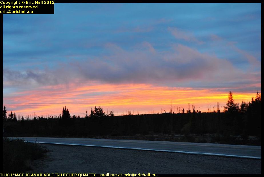
beautiful sunset red sky sub arctic tundra trans labrador highway 138 quebec canadaI’ve found a place to park for tonight. It’s in a lay-by and I’ve dug myself in in behind one of the emergency telephones, with a lorry to keep me company through the night – although he didn’t stay for long.

And the weather seems at last to be improving. There’s a beautiful red sky right now, and so that might promise well for the morning (at least I hope so) but it’s cold, so I’m going to snuggle myself down in my sleeping bag and keep warm like that.

Monday 28th September 2015 – WHAT A GOOD NIGHT …

wood cottage north west river labrador canada… that was last night in Wood Cottage. I had had a good shower and shave, done a machine-load of washing, had a nice tea (rice and vegetables seasoned with a packet of dried onion soup), spent some time on the internet, and then flat-out upstairs in a nice heated bedroom.

And you can tell how good a sleep I had had, for I was on my travels again. I’d been playing for a Welsh Premier League football team in a European competition and we were so unprepared that we had been playing for just 18 minutes and we were already 3-0 down. And then there was a call on the public address system for the stadium electrician, and so Terry had to leave the field to go to deal with the issue and so we were down to 10 men already.

But that did bring back memories of a match at Pionsat. We were in mid-game and the siren at the fire station sounded, so two of the players ran from the field (they were volunteer firemen) and went down to the station. And they came back later when the emergency was over and rejoined the game.

sheshatshiu north west river labrador canadaAnd while you admire the view of the Innu community’s settlement at Sheshatshiu across the river, let me tell you about the internet here at North West River.

North West River is a small settlement, the farthest north that it is possible to go by road in Labrador (and then only since about 1982), and across the river is a First Nation settlement. An outpost of civilisation it most certainly is, and yet the internet speed here is a good ten (and I do mean 10) times faster than the speed that I have at home.

I said that North West River has only been connected to the national highway system since about 1982 when the road bridge was built. Prior to that, we had the coastal boat that called here once a week.

old chairlift north west river labrador canadaBut North West River is actually on the north side of the river, and civilisation (in the name of Goose Bay and Happy Valley) is on the south. To cross the river to civilisation, you had your canoe in the summer and your ice-skates in winter but in the very early 1960s a cable-car from the UK was installed here and this was luxury!

When the bridge was opened, the chair lift became redundant. The town bought it for the symbolic dollar and it’s here on display on the site from which it used to operate.

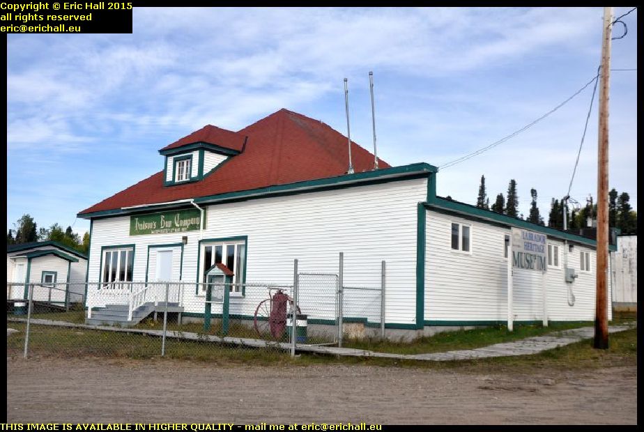
north west river labrador canadaThe site is next-door to the Labrador Heritage Museum, and that’s my next port of call.

The museum is situated in the old Hudsons Bay Trading Post and part of the exhibition is a fully-restored store inside, complete with many period products. The museum is officially closed as it’s now out of season but I’ve managed to blag my way in for a private tour. It wasn’t the Trading Post that interested me (although it did) but there was quite an exhibition about the boats that plied the coast here but also a big exhibition of artefacts from the Leonidas Hubbard and Mina Hubbard expeditions, including photos that Dillon Wallace had taken on his travels with Leonidas.

And I was right about the Labrador flag. The blue is the sea, the green is the forest and the white is the snow.

former airstrip north west river labrador canadaI spent a good couple of hours in the museum and then I went off for another wander around the town.

I’d noticed on an old map that I had seen that by the side of the dirt track out to the north, there was an airstrip indicated. It’s no longer used since the town has a road connection with the airport at Goose Bay, but I still thought it might be an interesting thing to try to find.

And here we are. This is the airstrip – now built-on in places and with some light industry in what I imagine would have been the airstrip building

north west river labrador canadaThat wasn’t all the excitement out here either.

I’d seen some people way out in the distance looking as if they were working in a field, and so I walked right over there to talk to them. They are indeed working in the field, pulling up their crop of potatoes, and here’s the evidence. They reckon that this is a bad year for their spuds but I’d be happy with a crop like this.

They told me that carrots, cabbages, lettuce and a few other crops are grown here but people keep them near to their houses as they need quite a lot of tending. Potatoes don’t need much tending at all and so they can grow them out in what passes around here for fields. I reckon that it’s just sand but at least that will warm up quickly once the sun comes out, as anyone who has sat on a beach will tell you.

From here, I went for a drive around the Innu settlement at Sheshatshiu but I won’t be posting any photos of it here. In fact, I didn’t take any at all.

There’s a reason for that. Sheshatshiu is an artificial settlement built under the extremely controversial Government plan of regrouping all of the outlying Innu settlements into larger centres of population with a concentration of services. But unfortunately it’s destroyed the lifestyle of the Innu and given them nothing to replace it. Just like the settlement out at the Davis Inlet, Sheshatshiu is a hotbed of despair, destitution, alcoholism and drug abuse, and you can see the hopelessness everywhere.

This is something that I’ve seen in other First Nation and Native American settlements – the hopelessness.I would have thought that Europeans would have learnt to leave the native communities alone and let their way of life evolve at their own pace.

By Europeans, by the way, I mean people of European origin, whether or not they are 10th Generation Canadians.

northern ranger goose bay labrador canadaTalking of First Nation settlements, there is about half a dozen of them further up the northern Labrador coast (and that’s a lot less that there used to be before the Government’s controversial compulsory resettlement policy) and the only access that they have is by sea.

The Northern Ranger is the ship that carries out the service and calls at each of the settlements, making the tour once a week. And here she is, at the quayside in Goose Bay loading up for – I imagine – Cartwright and the enigmatically-named Black Tickle.

goose bay airport labrador canadaThere was a great deal of activity at the Goose Bay airport too. A couple of helicopters were taking off and landing, there was a whole stream of light aircraft coming in to land, and there was a cargo plane over there at the terminal.

It’s all go since Valard began all of the work on the hydro plant at the Muskrat Falls – it’s brought piles of changes to the area, but it’s still a far cry from the days when this was an important port-of-call on the Atlantic Ferry in World War II and subsequently a major NATO base during the Cold War.

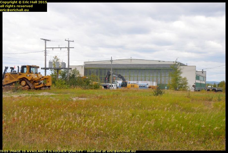
goose bay airport hangar labrador canadaI came here in 2010 and the place really was derelict in those days but now it’s being tidied up a bit.

The hangars were in a desperate state in those days but now they seem to be in use for light industry. And talking of Valard and the construction works here, in one of the hangars is a company that specialises in buying, selling and repairing heavy plant and machinery. And I bet that there’s a great deal of that needing repair too, seeing the amount of work that they do and the conditions in which they are doing it.

churchill river muskrat falls trans labrador highway canadaI fuelled up Strider again (you need to fuel up at every opportunity out here) and set off for Labrador City after that.

And while you can no longer go to visit the Muskrat Falls due to all of the construction, the construction work has opened up some astonishing vistas that were no longer visible previously. This is one of them – you wouldn’t have seen this a few years ago. And it’s not the only one either. There are plenty of them and the whole scenery is changing.

cabin shack house trans labrador highway canadaIt’s not only the Muskrat Falls that is undergoing major construction work. I’ve been noticing dozens and dozens of new cabins and homes springing up all along the Trans Labrador Highway that were certainly not there previously.

Some of them are quite banal as you might expect, but one or two of them have been built by people with a sense of the unusual and the eccentric. This home has quite fascinated me and I could quite happily live in a house like this – especially the tower bit. I love that.

beautiful autumn scenery trans labrador highway canadaOne thing that I do like about Labrador at this time of the year is the beautiful autumn colours.

The northern side of the valley catches the sun and is quite sheltered from the wind and so there are plenty of deciduous trees that grow up there. And here, there’s a spectacular view of a deciduous forest and as the colours change for the autumn, they are magnificent. I could sit and look at these colours for ever.
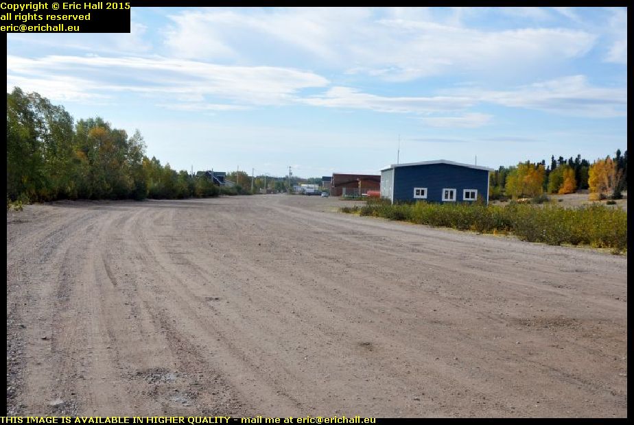
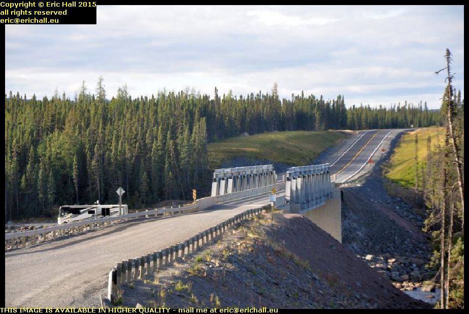
old section of trans labrador highway canadaWhen I came by up here in 2010 the road was thoroughly dreadful and it took hours to cover just 150 kilometres. Today though, it’s all different and we have a really modern and quick black-top highway so that we can cover the ground as fast as we like (subject to the 80 kph speed limit of course).

Just here, you can see a sample of the old road along which we used to have to travel and you won’t be surprised that it took so long to cover the ground. However, I am glad that I did the route when it was still a challenge and a struggle. It’s nothing like that now of course.

By economising on the performance of Strider, I’m managing to stretch out the fuel consumption a little. And so I didn’t call at Churchill Falls to fuel up. Strider won’t do the 550 kilometres to Labrador City of course, but I still have 40 litres in cans in the back. And so I’m heading to the sheltered little rest area by the Churchill Falls to spend the night

churchill falls airport trans labrador highway canadaBut talking of Valard and construction and the like, this is Churchill Falls airport and it never ever looked like this.

There’s been a considerable amount of rebuilding and expansion that’s gone on here this last year or so, and you can see who are the major customers here, judging by the amount of Valard vehicles parked in the car park.

And Valard vehicles are everywhere – at one point a stream of 5 Valard pick-ups passed me in the opposite direction and at almost every track off into the forest there are one or two parked up.

Now, I’m on the rest area. I’ve put my 20 litres of fuel in and I’ve settled down in the back of Strider, listening to the pouring rain beating down upon the insulation on the roof. I’m going to crawl into my sleeping bag in a minute and watch a film. And if I fall asleep during the film, then ask me if I care.

Sunday 27th September 2015 – I’M LOOKING FORWARD TO THIS.

Tonight, I’ll be sleeping in a real bed, in a real room, with full central heating too.

And what’s more, I’ve just stood for half an hour under a nice hot shower and I’ve changed my clothes and had a shave too. I even look human now, and you know how difficult that can be.

So how did all of this arise? The answer is that it’s a very long story.

overnight camping place eagle plateau labrador coastal drive canadaThis morning, I awoke to a torrential downpour of rain and the black sacks with the insulation in were sopping wet (although the insulation itself was dry).

And we had a small amount of condensation inside the truck cap, but considering how wet it was outside and the fact that I’d been cooking inside last night, I’m not surprised by this. The small amount of condensation was quite acceptable.

snowstorm eagle plateau labrador coastal drive canadaI hadn’t gone 5 kilometres when the metalled road ended. And while I was on the dirt road, the heavens opened and we were drenched in snow. It had been warmer in my little bolt-hole, but it wasn’t like that just here. This looked quite ominous for the rest of the journey. I wasn’t very optimistic.

Anyway, the dirt road only lasted for 15 kms or so and then we were back on the metalled road again. And I do have to say that in the dirt bit, there were men and machines, including an asphalt layer, all lined up. It looked as if today’s task (had the weather been better) would be to finish the gap.

And hats off to Strider too. I’ve been moaning about his excessive fuel consumption too (and to be fair, it is excessive) and I’d loaded up with 40 litres of extra fuel just in case I needed it. But we pulled in to the Ultramar petrol station in Happy Valley with the gauge just going into the final quarter. Not even the orange warning light, never mind having to refuel.

But I do have to say that the benefits of the new road are readily apparent. Whereas in 2010 when I was here, the difference between a litre of fuel here and a litre of fuel in a more-populated area was $0:34. Today, the difference is just $0:06. That says a lot.

old car happy valley goose bay labrador canadaAfter a coffee and an internet session at Tim Horton’s, I went for a good wander around.

First stop was to see what was happening with my old car – the one that I saw last year. It’s still here, looking definitely the worse for wear and it doesn’t look as if it is going to last for too long if no-one gives it any attention.
It really is sad

happy valley goose bay labrador canadaI went as far eastward as it was possible to go by road, and then went off for a wander into the bush to see what I could see in there.

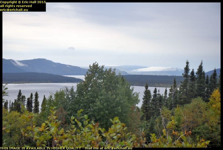
This is the bay of Goose Bay, at the head of the Hamilton Inlet, and there’s a lovely sand bar just here in the bay. The beaches really are nice in Labrador. And in the background are the mountains over which I’ve driven this last couple of days.

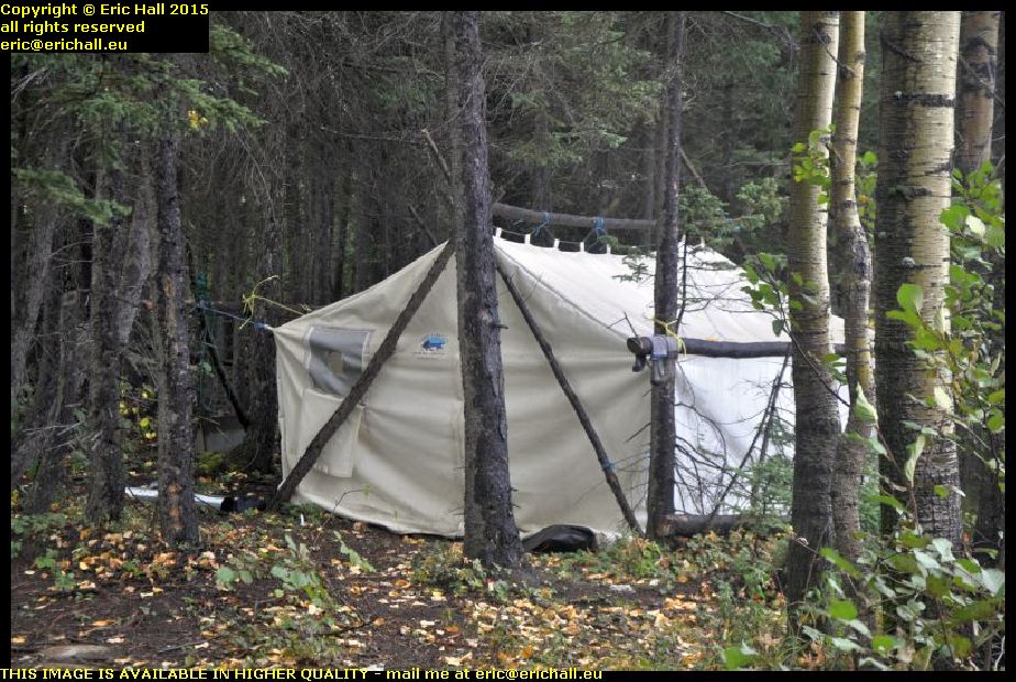
first nation encampment happy valley goose bay labrador canadaThis wasn’t all that there was to see either. There’s also a tent here in the woods.

There’s a really big Innu community around here and there are casual encampments all over the place. Although the First Nation people have adopted more modern building materials (I saw a hut made of OSB draped with a tarpaulin) the traditional itinerant lifestyle is quite important – and quite right too.

There was nothing doing at the quayside at Goose Bay and so I went on to North West River for a good look around. North West River is the farthest north town in Labrador that is possible to reach by road.

I was here late one evening last year and so this time I intended to have a better look around, even though the weather was dreadful.

And this is where our story begins.

I found a museum – the Labrador Interpretation Centre – and much to my surprise, it was open. That doesn’t happen very often.

I spent hours there chatting to the very friendly woman in charge, and we talked quite a lot about the interaction between the First Nation people and the Europeans.

“It’s a shame that the other museum in the town has closed for the season” she said. That has everything that you would like to see, including all of the papers from Mina and Leonidas Hubbard” … "he set out from here to explore the interior of Labrador 100 years ago and died of starvation – his wife set out 2 years later and completed his work" – ed …
“I’d love to see that” I said. “What a tragedy that it’s closed”.
And so after another long chat, I wandered off to look at the museum, and she came hurrying after me “I’ve spoken to the curator on the phone. If you can be there at 09:00 he’ll let you in for a private showing”.
Well, badger me!
“I don’t suppose that you know anywhere where I can stay for the night?” I said rather optimistically. My last night around here had cost me a King’s ransom, and that was 5 years ago.
She wandered off and came back again 5 minutes later.
“The B&B is full unfortunately, you won’t want to pay $115 at the motel here, but there’s a room free, with communal facilities including washing machine, in the old Grenfell Building. That’s $45 a night”.
Do bears have picnics in the wood?

north west river hamilton inlet sunday hill north west river labrador canadaShe said that the best views around here were from the top of Sunday Hill, and so Strider and I went off-roading up the mountain.

It was worth the effort because the view from here was stunning as you can see. And it would have been even better had the weather been kinder to me. It was a really excellent place to eat my butties.

And hats off once more to Strider because he made short work of our little excursion up the mountain, even in just 2-wheel drive. If only I could seriously improve his fuel consumption!

So here I am. In Wood Cottage, or Woods Cottage as I’ve seen it sometimes described. Built in the 1920s, it was first the boarding house for schoolkids at the High School who had come from the outlying settlements, and was later an Old People’s Home. I’m warm and comfortable, I’ve had a hot shower, a nice mug of coffee and all of my washing is now in the tumble drier. I’m going to make some food in a minute and then I’ll be off to a nice comfortable bed.

You just watch the house burn down!

Saturday 26th September 2015 – BRRRRR – THAT WAS COLD!

interior labrador coastal drive sleeping in strider early morning canadaHere I am at 06:30, just before dawn. The alarm went off at 06:00 and again at 06:15 and it was so cold that I wasn’t going to hang about.You can see the ice all over the truck cap and the pile of snow that is on the side of the road that fell off the insulation when I moved it. I froze in the 5 minutes that I was outside.

Mind you, inside the truck cap there was no condensation or ice on the roof, and only a little on the sides. That insulation and the sun visor seem to have done their job and I’m pleased with that.

In fact, I had a good night’s sleep all in all and the lorry that pulled up alongside me at 03:00 didn’t really disturb me too much at all.

sunrise labrador coastal drive canadaNow I can see why it is that ancient man worshipped the sun. I’d been on the road for half an hour in the freezing cold when suddenly the sun put in an appearance over the horizon.

This sunrise was one of the most magnificent sights that I have ever seen and you’ve no idea how warm this made me feel and just how welcome it was. It made me feel so much better.

major highway improvements labrador coastal drive canadaAnd so we pushed on – or, rather, pushed off – through old familiar territory that you have seen many times before and so I’m not going to bore you with photos.

Nevertheless, I will show you some which might be of significance here, such as the amount of roadworks going on up here. If you read my earlier notes, you’ll recall me saying how bad the road was back in those days. Now, while it’s not quite a black-top highway,it soon will be, given all of this work.

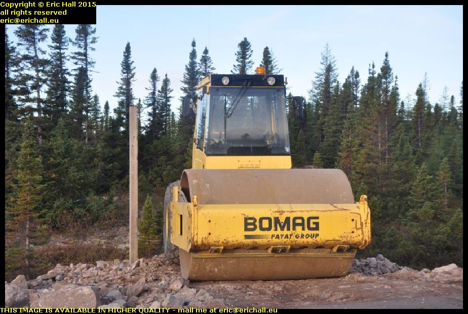
compactor major highway improvements labrador coastal drive canadaThis view is reinforced by the amount of construction equipment up here.

In 2010 we drove 1800kms of some of the worst roads in the world and I counted just a handful of compactors. Here, in this two-mile length of roadworks, there were two of them. You can see that they really mean business out here.

And while that’s bad news for me and any other adventurer, it has to be good news for the inhabitants.

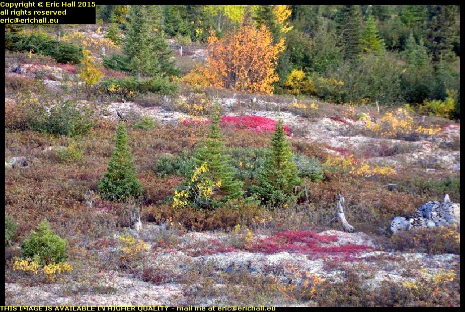
sub-arctic vegetation labrador coastal drive canadaAnd while I once famously said that the only time that you would ever see a photo of a flower on my pages would be if there were to be an old car parked upon it, I couldn’t resist a photo of these plants.

I don’t know what they are – add the names into the comments if you do know the answer – but they are very symbolic of the sub-arctic vegetation that you encounter up here because this is really a part of the tundra out here.

strider ford ranger labrador 813 kilometres coastal drive canadaWe always stop and take a photo at this spot whenever we are in the area. It’s far from being the most isolated spot along the trail, but it’s quite symbolic as being the first place where Labrador City appears on the road signs.

Before 2010, the road turned right just behind me and went down to Cartwright (well, it still does of course) but this road that we are taking didn’t exist. If you wanted to go west from here, you would have to go east down to Cartwright and wait for one of the weekly coastal boats that went up to Goose Bay, and then drive from there over to Labrador City.

abandoned car labrador coastal drive canadaThis is one of the things against which you have to guard yourself along the trail.

You can see that he has a flat tyre and by the look of things, he’s driven quite a way on it, because the tyre is off the rim. Why he hasn’t put the spare on, I really don’t know (and it’s none of my business anyway) but if you do have to abandon your vehicle to go and seek help, you should take your tyre with you. It won’t be fixed while it’s still on the vehicle.

And about 100kms further on, I found a loaded trailer with the same issues

lunch stop labrador coastal drive canadaThere’s a photo of me and a Dodge Grand Caravan stopped here for lunch last year in brilliant sunshine and I remember saying how I would love to stay here and settle down.

Today, though, we have lunch in a snowstorm, although you can’t see the snow very clearly. It’s not looking too good out there along the Eagle Plateau but at least this year I have the right kind of vehicle to make the trip.

gravel road labrador coastal drive canadaFurthermore, further along the Labrador Coastal Drive they are gravelling the road – and doing it seriously too. There’s tons of stuff being spread out here.

With the compactors that I’ve seen, I wonder if they are preparing this for tarmac? They were building an asphalt plant when I was here last year and it wouldn’t surprise me in the least if we are going to end up with a black-top highway.

gravel road labrador coastal drive canadaBut this gravel is impossible. everywhere there are clouds of dust and stones being thrown up and Strider’s windscreen has taken a few heavy knocks.

And not only that, Strider is rear-wheel drive when he’s not in 4×4 mode, and the rear end is quite light. I don’t have much grip on the gravel and when I try to swerve to avoid a pot-hole, Strider goes everywhere across the road and we’ll be doing pirouettes soon.

But Strider is definitely the right vehicle to do this trip. Even in rear-wheel drive, his high ground clearance, larger non-standard wheels and heavy off-road tyres has meant that I’ve done all of this road with the cruise control set at 70kph and we haven’t missed a beat. Whenever the road has been rough, Strider has taken it all in his … errr … Stride.

Contrast that with the Dodge Grand Caravan and its rubbish tyres, and Casey, the PT Cruiser with his town tyres and low ground clearance. We really struggled on parts of this road.

I just wish that Strider had a tank that was 20 litres bigger, or that I could do something about his miserable fuel consumption.

paved highway rest area labrador coastal drive canadaYes, and here we are, folks.

I’m listening to Counting Crows and “Pave Paradise, Put Up A Parking Lot” – and right at that very moment, look what we have here. The highway is paved at this point and there is a parking lot by the side.

How depressing is that? The end of my adventures along this road are in site and in about 5 years time, the whole of the route will be just another black-top highway.

But anyway, this is where I’m stopping for the night. It’s not as cold as last night anyway and I do have to say that it’s a comfortable spec. I even cook a meal inside Strider’s truck cap and the condensation is minimal with the insulation on the roof, even though the windows aren’t open that much.

But it’s cramped in here and this truck cap is not going to work in the long term – that I have realised.

I really do have to think of a Plan B.

Friday 25th September 2015 – WHAT A GOOD NIGHT’S SLEEP!

Having done everything that I needed to do last night, I crawled into my sleeping back and settled down to watch a film. But it wasn’t for long. After about 15 minutes, I switched off the laptop and that was the last thing that I remembered.

I must have had a good nine hours when I didn’t feel a thing. And when I awoke, it was reasonably warm inside the truck cap, there was no condensation at all on the roof and only a few minimal traces on the walls. It seems that this idea of putting the insulation on top of the roof of the truck cap is doing its job. I’m well-impressed with this. But I’ll need some more tape though. If the plastic sacks become torn or damaged, I have plenty to replace them but I’ve run out of tape to hold everything together.

I didn’t stop for breakfast though. There’s a sailing across to Labrador at 10:30 and I want to be on it if possible and so I hit the road.

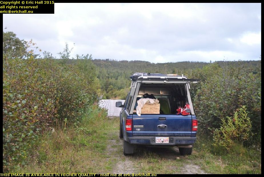
sleeping in strider ford ranger newfoundland canadaBut I did take a minute or two out to take a photo of my spec for last night and Strider with his exterior insulation. You can see just what a good spec this is.

And now, a weird idea is running through my mind that if I could find a plastic sheet that is 6 feet by 4 feet, I could fit that over the top, hold it down with ratchet straps and that would make a very permanent arrangement while I’m on my travels. Something like a corrugated roofing sheet would be ideal for this.

An hour on the road found me at St Barbe and there was an enormous queue waiting for tickets to sail. I was given ticket 16 – which meant that I would be the 16th casual voyager to be added after the reserved places are loaded. And to my surprise, with the senior discount to which I’m now entitled, a 90-minute crossing with Strider costs me all of just $18:58 – eat your hearts out, you European ferry travellers!

mv apollo st barbe newfoundland blanc sablon quebec labrador ferry canadaHaving fuelled up Strider (I keep telling you that out here you need to fuel up when you can) I lined up on the quayside watching the antics of the artics loading up the trailers, and then I was squeezed on board into a little corner of the ship.

And poor Apollo. As she steamed in, I couldn’t help noticing that she’s looking every day now of her almost 50 years and she can’t be long for this world now. The inside is pretty rough too, and I’d have taken a photo of what I meant, except that Bane of Britain here seems to have forgotten to bring his camera with him up into the lounge.

But now, after a heary breakfast of coffee, four rounds of toast and a plate of hash browns, I’m ready for anything. Including a couple of chats that I had had, one with a German guy in an ancient New-Brunswick-registered Dodge Caravan from Woodstock (the Caravan, not the German) with a spare wheel strapped to the top, and another older guy heading out to Goose Bay.

highway 138 lower north shore quebec canadaIn May 2012 I’d done a tour of Quebec Highway 138 from Montreal all the way to the end at Natashquan where the road comes to a shuddering halt in the middle of nowhere.

It’s not actually the end of Highway 138, theoretically at least, because there’s part of the Quebec coast accessible from Blanc Sablon,and the road along there is also called Highway 138. I’d driven down here last year but there was that much fog and rain that we hardly saw a thing

highway 138 lower north shore quebec canadaNo such complaints today though. I was really lucky with the weather and couldn’t have wished for better. I’ve managed to retake all of the photographs that I took last year.

And you can see just how beautiful the road is. It doesn’t quite have the grandeur that the Trans Labrador Highway has, of course … "nothing can quite manage that" – ed … but it was a journey that I wanted to make, just to complete my Highway 138 adenture

end of highway 138 old fort bay vieux fort lower north shore quebec canadaAnd so we arrive at Vieux Fort, known to the locals as Old Fort Bay because this is an Anglophone area, as I discovered a few years ago.

The Highway terminates at the harbour and here, right in front of us is an old quay. It’s closed off and marked “danger” so it’s clearly unused, but in view of its substantial construction, I wonder if the coastal boat that plies along the Lower North Shore used to call in here before the road through to here was opened.

old fort bay vieux fort lower north shore quebec canadaIt’s not quite the end of the Highway though. If the Highway ever is extended, which won’t be in the lifetime of anyone reading this rubbish, it’ll come round the head of the bay and head west.

At the moment there’s a dirt highway that takes that road, and this eventually brings you down to this beautiful sheltered bay just here. When I arrive, a couple of fishermen … "fisherPERSONS" – ed … were launching a boat and setting off. This really IS the end of the road as far as I can tell, and it was a convenient place for me to stop for lunch.

middle bay lower north shore quebec canadaThere are a few of the villages along the highway too and I took hundreds of photos of them. This is just one of them, Middle Bay.

This is said to be the site of a Basque whaling station back in the 16th Century. There were a couple of dozen along here and the most well-known example, Red Bay in Labrador has been excavated and there’s a museum there. However, I don’t know what, if anything, has been discovered here from that period

strider ford ranger labrador canadaFrom here, I retraced my steps to Blanc Sablon and beyond towards L’Anse Aux Loups in Labrador.

We had to stop though, in order to take a photograph at the border just to prove that Strider was here. This is the border today, of course, but it might not be in the future because the mayor of Blanc Sablon has said that he would like to apply to the Canadian Government to secede from the Province of Quebec and join up with Labrador. Whether the Province of Quebec will agree to releasing some of its prisoners however remains to be seen.

jersey trail anse aux loups labrador canadaThere are many French names just here. Some of them relate to the exploration of Jacques Cartier, others to the French fishing boats that came along here in the 18th Century, but many others relate to inhabitants of the Channel Islands who colonised this area.

The old road along the coast prior to the construction of the new highway is called the Jersey Trail today, and there are all kinds of remnants and relics of the previous inhabitants along here. Excavations have taken place and many artefacts have been uncovered.

anse aux loups labrador canadaThere are a dozen or so villages along here too. I missed out photographing them in 2010 because I was rushing for the ferry (I hadn’t realised that it ran on Newfoundland time, which is 90 minutes ahead of Quebec) and in 2014 I had the weather against me.

But never mind. Today, even though it was now going dark quite rapidly, I still had time to take all of the photos that I wanted to take.

labrador coastal drive deviation county cat pond canadaWhen I was here in 2010, the Labrador Coastal Drive followed the narrow valley of the Pinware River, but I did notice a considerable amount of roadworks in the area round by the County Cat Pond.

This is what they have been doing. The old road goes off to the right, but there’s a new road now going up the hill just there.

I can’t think why they have done it, though. The route along the Pinware River is beautiful, but this new route is all straight up and straight down. In 2014 I watched a huge lorry struggle up the hill in the rain and I bet he wasn’t amused.

I had planned to stop at a Guest House in Red Bay for a wash and a change of clothes, but there was no-one there when I called, and so I’ll be spending another couple of nights sleeping along the road. I found a very basic rest area and even though it was early, it was freezing cold and so I went to bed. But not before putting the big insulated sunshield across the rear window of the truck cap and wrapping the rest around the head of my bed. I’ve a feeling that I’m going to need it tonight.

Thursday 24th September 2015 – I MUST BE GETTING OLD

It used to be the case that I could sleep anywhere at any time. At one time I was even found asleep leaning up against a wall in a garage. But just recently, as you know, I’ve been having some sleeping issues, but none such as I had last night on the ship out to Newfoundland.

With some of the nicest reclining seats that I’ve ever sat on, I just couldn’t drop off to sleep. And when I did, I was awake 10 minutes later with aches and pains everywhere. And this went on throughout the night until we docked at Channel Port Aux Basques.

We had a very long wait there too before we could unload. I did mention that we were parked right in the bowels of the ship, and so we had to wait until everyone else was out and gone before we could be liberated.

I went for a coffee and some biscuits at Tim Horton’s so that I could use their internet without any pangs of conscience, and then went over the road to Canadian Tire for a big roll of waterproof duck tape, the reason for which I shall mention in a moment.

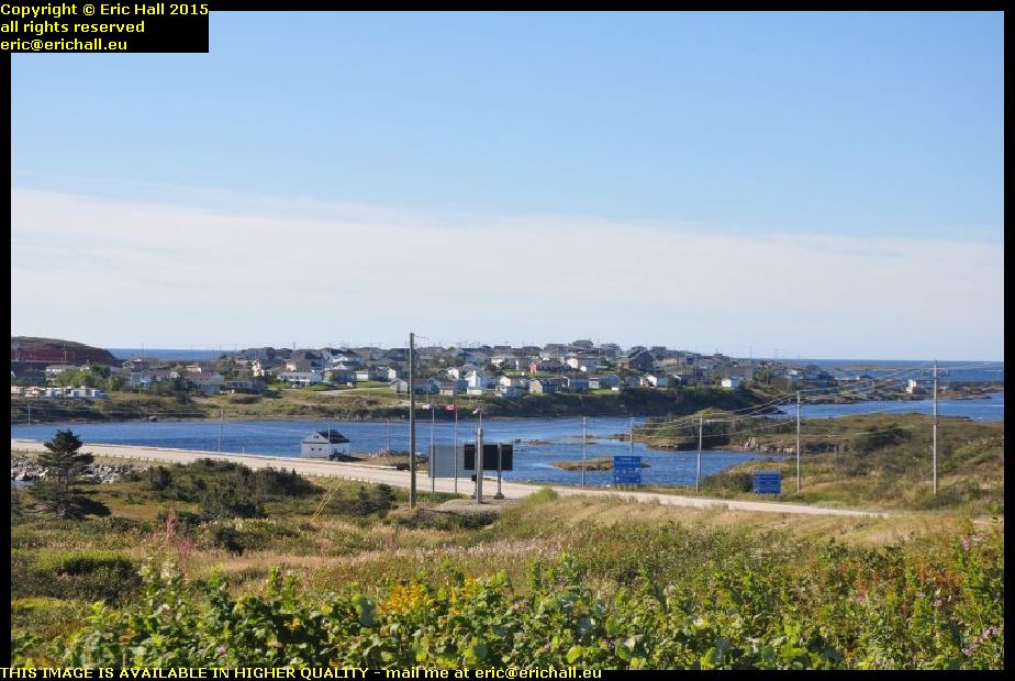
channel port aux basques newfoundland canadaYou’ve seen plenty of photos of the ship and of the town – Channel Port aux Basques – in the past, but I bet that you have never seen it from this angle before.

I’m a mile or two outside the town here at the Newfoundland and Labrador Tourist Information Office where I stopped to search Strider for the charger for the mobile phone, and there’s a good view of the town across the bay from here. I couldn’t resist taking a photo to add to the archives.

typical southern newfoundland scenery canada. In the past, whenever I’ve driven out of – or into – Channel Port Aux Basques, I’ve always followed the coast. But today, I’ve driven due north along the Trans Canada Highway and seen parts of the island that I haven’t seen before.

The eastern part of the island has all of the accessible coastline, but the western part has the mountains and the lakes and here, only a handful of miles outside the town, we start entering some really beautiful country. This photo is just typical of the scenery on the southwestern side of the island.

newfoundland railway bridge coopers brook canadaNewfoundland once had a very important railway network – one of the longest narrow-gauge systems in the world. But it struggled along, suffering from chronic under-investment and lack of modernisation despite having one of the most beautiful routes of any railway network ever.

However, as I’ve told you before, it was yet another victim of the ruthless decimation of Canada’s railway network and while very little of the equipment remains, the railway line itself is almost complete and you will see loads of bridges such as this one on your travels.

trans canada highway climbing up into newfoundland mountainsIt’s not long before we start to climb into the mountains of Newfoundland, and the Trans-Canada Highway makes some stunning ascents and descents as we continue northwards.

Here’s one of the most exciting climbs as you can see, a few miles south of the turning for Stephenville. The flattest route is indeed via Stephenville but that puts dozens of miles onto the route and so we take the short cut.

At Deer Lake I stop for fuel again. I fuelled up at Channel Port aux Basques but that’s not enough to reach the Labrador ferry at St Barbe (the short range of Strider is depressing me) and so the Big Irvings at Deer Lake comes up with more fuel and also enables me to fill up one of my big containers. There’s 20 litres in that and once I’m across in Labrador I’ll put 20 litres into the other container. I hope that that will be enough to enable me to do this 418 kms between Port Hope Simpson and Goose Bay.
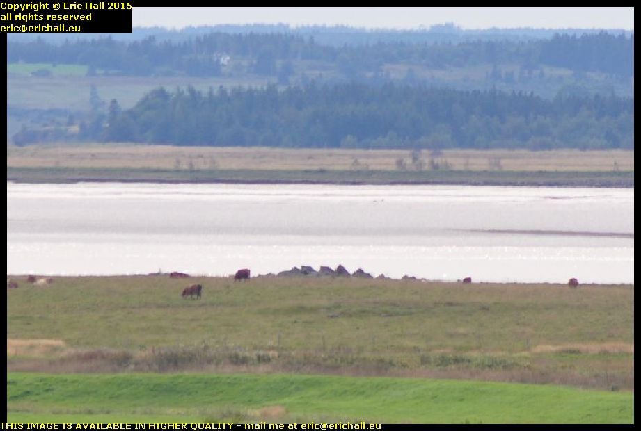
gros morne national park newfoundland canadaDeer Lake is the entrance to the Gros Morne National Park and if you think that the road has been beautiful to here, then you ain’t seen nuffink yet. Gros Morne really is spectacular.
This is one of the lakes here, nestling into the foot of what looks like a glaciated valley, and once more, this is just one of a thousand photos that I could have taken of the area. I’ve been here a few times now and I never tire of it. One day I’ll come here and stay for a week, and maybe I will, seeing as I now have transport of my own.
st pauls newfoundland canadaAs I was walking by St Pauls, I was seized by this beautiful view. I had to turn off the highway to see it and found myself on a little dockside.

There’s a big inlet here and the harbour is on the inside of the inlet, sheltered from the wind by the embankment for the beautiful metal girder bridge that spans the inlet. This is a typical Newfoundand photograph, isn’t it? The water, the fishing boats, the little harbour and the mountains away in the background.

18:00 is my usual time to start to look for a suitable place to stay (unless something astonishing presents itself beforehand) and tonight, at about 18:30, I’ve found an abandoned cut-off that leads down to a dismantled bridge. The house here seems to be abandoned so the hedges are all overgrown and as it’s a downhill slope to the bridge I’m pretty sheltered. Of the six sheets of insulation, I’ve put two each into a huge bin liner, fitted another bin liner over the open end and sealed them up with the duck tape.

The three packets that I’ve made, I’ve put them on the roof weighted down with the wood.

We’ll see what that is like through the night as far as the condensation issue goes, but the roof does feel much warmer than the sides of the truck cap already.

Wednesday 23rd September 2015 – I HAVE MADE A STARTLING DISCOVERY!

I woke up this morning to find no condensation on the roof of the truck cap. There was quite a bit down the sides, so clearly there was plenty about, but none on the roof.

What had happened was that in the confined and cramped circumstances yesterday, I’d put the pack of insulation outside on the roof of the truck cap instead of by the side of Strider as I would normally do. This seems to have had the effect of insulating the roof but from the outside.

And so what I’ve done is to go to a supermarket and bought a pile of giant-sized plastic bin bags. I’ll wrap the insulation up in those and stick them on the roof of the truck cap at night – I’ll be interested to see if this might solve the problem.

But apart from that, I’d had a reasonable night’s sleep last night even though I was on a truck stop and some of the trucks were idling away all night. even a train on the railway line across the Canso Strait didn’t disturb me all that much.

But next morning, I was surprised to find that the Tim Horton’s at Aulds Cove didn’t have a wifi connection. It’s the first that I’ve found that hasn’t had one. I had to decamp off onto Cape Breton Island and the Nova Scotia Tourist Board offices there

rt hon paul e martin aulds cove nova scotia canadaAnd I’m glad that I did, because when was the last time that we have had a “ship of the day”? Back in Montreal I reckon, and that was by default too.

This ship is the Rt Hon Paul E Martin, whoever he was when he was at home, if he ever was, anchored up at the huge quarry at Auld’s Cove. She’s a CSL (Canadian Shipping Lines) ship and has come here from Brayton Point, which is the site of a coal-fired power station on the coast of Massachusetts, USA, although she was seen in the Panama Canal a couple of weeks earlier.

canso canal st peters cape breton island nova scotia canadaIt’s been years since I’ve travelled up the southern shore of Cape Breton Isle – 2003 in fact – and so I reckoned that I would go up to Sydney that way, even though it’s the least interesting route.

I’d had a brief glimpse of the canal here when I passed by back then and so I reckoned that, seeing as how it was a nice day, I’d go and have a closer look.

atlantic ocean st peters canal cape breton island nova scotia canadaThat’s the Atlantic Ocean just there and just a couple of hundred yards away to my right is the Bras d’Or Lake which almost cuts Cape Breton Island in two. This little strip of land is all that prevents Cape Breton Island being split in two.

This area has always been a favourite portage site and the French had a fort around here – Fort Toulouse – that guarded the crossing

st peters canal breton island nova scotia canadaAt one time there was a rolling plank road that enabled sailors to drag their boats from one water to the other but in the 1850s the canal was built and this is what we have today, one of only two canals east of the St Lawrence that are still working.

You’ll notice that there are two lock gates at each end of the lock, and the gates are pointing in opposite directions. That’s because with the tides, the Atlantic Ocean can be either higher or lower than the Bras d’Or Lake and so the water flow needs to be controlled in either sense.

earthworks fort dorchester st peters cape breton isle nova scotia canadaThere’s nothing at all now left of Fort Toulouse but the British had a fort up here on a dominant eminence for a short while.

This was called Fort Dorchester and you can still see quite a few of the remains of earthworks up on the top. This appears to be part of an earthen bank that might have been part of the walls of the fort at one time.

louisbourg cape breton island nova scotia canadaAnother place that I had passed by back in 2003 was Louisbourg, the principal town and seaport of the French on Ile Royale – Cape Breton Island – in the 18th Century.

It’s quite an astonishing place, being effectively a fortified city in the middle of nowhere, and was a city over which the French and British fought on many occasions.

louisbourg cape breton island nova scotia canadaThe French engages in a triangular trade route between Nouvelle France, the French West Indies and France itself, and they needed a seaport somewhere in between to be a naval base, ship repair centre and trans-shipment port for the interior.

They chose Louisbourg to be the place, in view of the magnificent bay here, and so they build a fortified city.

louisbourg cape breton island nova scotia canadaAnd it needed to be fortified too. Its central position meant that it was miles away from anywhere else, and so miles away from where reinforcements might be obtained.

And with it straddling the British trade routes from British North America and Newfoundland, it was quite likely that in the event of war between Britain and France – a regular occurrence in the 18th Century, the British would want the fort neutralised.

louisbourg cape breton isle nova scotia canadaIt was captured on several occasions by the British and returned at the end of conflict, but finally the British captured it for keeps and it was abandoned, falling into ruin.

It’s been slowly rebuilt over the years and the result is quite spectacular. It’s just as it was back in its heyday and there are all kinds of 18th-century trades being undertaken here. I ended up having a lengthy chat with a couple of 18th-century boatbuilders who were building a caravel.

sydney louisbourg railway museum cape breton island nova scotia canadaLouisbourg is alwo well-known as the terminus of the Sydney-Louisbourg railway, and there’s a kind-of railway museum here.

I say “kind-of”, because no-one in their right minds would call it a real museum. While most “museums” in North America “preserve” their artefacts by slapping layer after layer of thick black paint over their exhibits, they can’t even be bothered to do that here.

sydney louisbourg railway museum cape breton island nova scotia canadaThe “exhibits” here are just rotting away and in a few more years there won’t be anything at all left.

This is beyond embarrassing and beyond shameful – it’s a total disgrace and how the administrators of the museum have the nerve to exhibit artefacts like this is totally beyond me. There’s nothing left for these artefacts except the scrapyard because they are way beyond any kind of preservation.

The administrators should be ashamed of themselves.

So having dealt with that rant, I went up to North Sydney, the Marine Atlantic terminal where I booked my passage on tonight’s sailing to Newfoundland. $155 too – it’s becoming more and more expensive. But then again they have a new ship and, this year, a new ferry terminal to pay for.

It’s the new “Highlander” upon which we are sailing, and it’s not sailing until 23:45 so that gives me plenty of time to organise some food. And in the terminal I have a very lengthy chat with an old guy who is also retired and is also off on his travels.

On board, we are stuck in the bowels of the ship, and I mean that too. There’s a hatch in the middle of the deck with a ramp that goes down another level with room for about 100 cars, and that’s where we end up – well below the water line. It’s a good job we don’t stay with our cars during the crossing. I’ll be a nervous wreck down here.

Tuesday 22nd September 2015 – HERE IN THE NICE AND QUIET …

canadian national railway locomotives fort beausejour new brunswick canada … isolation of my litle spec on the edge of the marshes I was having the best night’s sleep that I had had for quite some time.

However, as I have said before, one of the things that you need to do when you arrive somewhere to stay for the night in North America is to check the immediate area for railway lines, and I forgot to do that yesterday, didn’t I?

This isn’t the train that woke me up of course, but it is one that is very much like it, shuddering, clanking and blowing just about 100 yards away from my quiet little spec

bay of fundy fort beausejour new brunswick canadaWhen I did finally heave myself out of my stinking pit this morning, this is the beautiful view that greeted me. I’m shrouded in a fog rolling in off the head of the Bay of Fundy, something that many Ancient Mariners would tell you all about.

I’m shrouded in condensation too inside the truck cap – or at least, the truck cap is. I’m going to have to do something about this in the long term because as the weather cools down even more, the condensation will become worse and worse

I’ve had a little play around inside the back of Strider too and I’ve made piles of extra room. I can actually move around in there now, as well as unfold my chair and sit down. What with that and my little fold-up table, I’m really comfortable in there now. Next trick is going to be a solar panel on the roof and a battery inside so that I can run some lights in there and a little inverter to power a couple of things like my slow cooker.

I still have a couple of plans about the bed too and I shall put them into practice given a nice afternoon and a quiet spot in which to work.

bay of fundy fort beausejour new brunswick canadaThat’s Strider way down there, in the spot where I parked for the night. And beyond it is the head of the Bay of Fundy. I’m actually standing on the ramparts of Fort Beausejour and you can see why the French chose this site for the building of their fort.

We’re on the southern shore of the narrowest part of the isthmus of Chignecto, on the edge of the Tantramar Marshes – and you may remember if you were with us on our voyage in October 2010 we went to Fort Gaspereaux, on the northern shore of the isthmus.

fort beausejour new brunswick canadaFort Beausejour was built in 1750 under the orders of the French Governor the Marquis de la Jonquière, and with these two forts, the French could bottle up the isthmus.

Nothing could pass by here without the French knowing about it and so quite naturally they became prime targets for the British Army during the mid-18th Century. The British under Robert Monckton laid seige to Fort Beausejour in June 1755 and it fell after 13 days. Fort Gaspereaux fell a couple of days later and that was the end of French rule in Acadia.

fort beausejour new brunswick viewed from site of fort lawrence nova scotia canadaThe British had built a fort – Fort Lawrence – in Nova Scotia across the marshes from Fort Beausejour in order to put pressure on the French fort.

The fort didn’t last very long – the British preferred to occupy Fort Beausejour once they had captured it – and so there is nothing left of Fort Lawrence. But the site is well-known in the area and so I went for a wander over there for a look. And while there is nothing of the fort left to see, there’s a splendid view across the marshes to Fort Beausejour

fort beausejour new brunswick viewed from nova scotia tourist information board offices canadaBut that’s not the best view of Fort Beausejour by any means. From the offices of the Nova Scotia Tourist Board’s information office, the view of the fort is even more spectacular. You can see its five-star pointed design and it earthen walls quite clearly from here with a good telephoto lens.

In fact, such is the dominance of the site where I am standing over the surrounding area that I’m surprised that the British hadn’t occupied and fortified this point instead. I know that this is the point that I would have chosen.

chignecto ship railway nova scotiak canadaFrom up here on this eminence, there’s another good view – this time of an object that is just as spectacular as the fort, even though it’s much less well-known.

Right in the centre of the image, surrounded by cows, is the dock that was intended to the the entrance to the Chignecto Ship Railway and had this been built, it would have been a really impressive structure.

As I said, this is the narrowest part of the isthmus and if ships could find a way across it, they would save hundred of miles and several days, as well as avoid many of the risks of shipwreck, as they sailed between the Gulf of St Lawrence and the eastern seaboard of North America.

chignecto ship railway nova scotia canadaThe plan was for the ships to sail into the dock, to be raised up by a hydraulic ramp and loaded onto railway wagons, and then transported by train across the isthmus to the other side – to the dock near Tidnish that we visited in October 2010.

Unfortunately the works on the southern side of the isthmus are on private property and not able to be visited, but what we are looking at here are the earthworks that would have carried the track bed of the railway, which were completed for several miles.

Why this all went wrong was that the same technology that enabled the construction of the engineering works of the railway also enabled shipbuilders to build bigger and bigger ships – and so the railway quickly became clear that the railway would be inadequate for the task, and funds could not be raised to rebuild it to larger dimensions.

trans canada highway nova scotia canadaAfter lunch I set off down the Trans-Canada Highway through the mountains towards Antigonish. Hannah is at St F-X University there and I hadn’t seen much of her while I’ve been over here so I went to visst her.

We went out for a meal and a chat for a couple of hours, and then I hit the road again. There’s a big Irvings truck stop down at the Canso Strait and while I’m not a big fan of truck stops these days for sleeping purposes, it’s the nest place that I can think of to settle down for the night.

At least all of the facilities are there.

Monday 21st September 2015 – IT WAS COLD …

… last night in Strider. Firstly, the temperature had dropped outside during the night, and secondly, the aluminium sheeting provides nothing in the way of insulation – in fact quite the reverse. I’ll have to do something about that because the condensation was terrific too despite the rear window being ajar.

But as for the bed, it was indeed comfortable enough and once I did manage to drop off I was fine except for the noise from the lorries that awoke me every now and again as they went moving about the lorry park.

This morning I fitted my shelf up in the roof. It took ages to do as it had to be cut really fine and so I took four or five goes to cut it precisely to size, and then I screwed a front batten to it to stop the tins and everything sliding off. I’ll put the saucepan and the tin opener up there too so that they are to hand.

After a coffee and an internet at Tim Horton’s, I hit the road and headed to Moncton. First stop was the Salvation Army thrift shop where I picked up a book, a CD and a tin opener, seeing as how the one that I have doesn’t seem to want to do anything.

Second stop was not the second stop at all. Princess Autos is just opposite the Salvation Army thrift shop, but not any longer. It’s all closed down and they had the builders in. However the builders directed me there and although they didn’t have what I wanted, I ended up with a 19mm spanner (at last), a set of offset ring spanners and a big set of torx and torx-E drive sockets.

Value Village was a disappointment. I ended up with just a (rather expensive) book although it did produce a decent old saw and a tenon saw. The saw that I have is rather flaky and I need to do better. God second-hand tools are much better value than cheap new stuff, that’s for sure.

At Home Depot I bought a pile of insulation as well as a couple of sets of screwdriver bits for back home, and then I went off to have a look at the new music shop that has just opened across the car park.

And then I set off.

railway line across freeway dieppe moncton new brunswick canadaYou may remember a while ago that I wrote something about a railway line that crosses the big freeway at Dieppe (just outside Moncton) on the level and made a comment about the M25 in the UK.

So just so you know that I wasn’t pulling your leg about this, Strawberry Moose took a photo of the railway line as we passed over, so that you know that it’s there.

covered bridge tantramar marshes new brunswick usaOne of the things that I’ve been trying to do as I pass by here is to find a way across the Tantramar Marshes. There’s the freeway of course, but finding another road is not easy. This time however, with the aid of The Lady Who Lives In The Sat-Nav, whom I told to take the quickest way to Amherst without using the Freeway.

She found me some exciting roads, including passing over this delightful little covered bridge across one of the many drainage ditches that criss-cross the marshes.

The Tantramar Marshes have been described as “The Largest Hayfield In The World” and quite rightly so.

largest hayfield in the world tantramar marshes new brunswick canadaYou can see from this photo that I took from the ridge on the northern edge of the marsh that it lives up to its name. Especially at this time of year when the “rolos” are everywhere.

The marshes were originally drained by the first Acadian settlers here so that the hayfield could be created, and you can see everywhere the traces of the old drainage ditches running through the fields. You can also see traces of the old Acadian dykes and I took you to visit the remains one of them a couple of years ago.

wind turbines amherst nova scotia canadaMy route took me past the wind turbines across the border in Nova Scotia (there’s not a one in this area in New Brunswick) and down to the site of old Fort Beausejour. This is situated at the head of the Bay of Fundy where I would watch the sun set.

But as for this insulation, it’s no good. It’s far too thick, far too heavy and not flexible enough, so it would do for the roof. I’ll have a go at the sides tomorrow but I’m not hopeful and I can see all of this going in the bin even though it cost a lot of money.

I’ll have to think again about this.

Sunday 20th September 2015 – YOU MAY REMEMBER …

… the other day when I told you that I thought that it had rained during the night?

Well, there was absolutely no mistake this morning. There I was, busily taking down the tent, and the heavens opened. I was drenched.

I was intending to leave the tent out to dry out the condensation but I’ve had to forget that. It’ll be soaked even worse and so I just flung it into the back of Strider.

I had almost 200 photographs to edit too, and that wasn’t possible as I had nowhere to sit comfortably. I went off to the shower room and had a really good soak, changed my undies, and had a shave instead. No breakfast though – I heaved everything else into the back of Strider and headed off to Tim Horton’s for coffee and a comfortable seat.

All of these photos took hours to edit. My camera, which has been quite flaky since I dropped it in Quebec in May 2012, is now teetering on the edge of whatever it teeters on and the photos are getting worse and worse. A new camera is in order when I return home if I can’t find anything over here. I can’t go on like this. But I do need a really decent lens – something like a 28-85mm lens that drops down to f2.8 or beyond for this kind of work. I can’t keep going on the equipment that I have.

But the net result of this was that I had to move on. Not that I actually had to, but Tim Horton’s is very good to me when I’m on the road, what with washing facilities in the disabled loos and with the free internet, so I don’t want to abuse the facilities.

I found another Tim Hortons quite a way down the road and so I had another coffee and finished everything off, and that took me to 17:30, there was that much of it to do. And what I hadn’t realised was that when I finished, I was the only person in the place except for the staff who were hanging around waiting. It seems that the place was to close at 17:00 so that renovations could start, and I’d been holding up the work.

I hit the road after that, and Strider and I ended up on the big Irvings truckstop on the outskirts of Moncton. Tonight is the first night that I am to spend sleeping in Strider and so I needed to organise myself.

It took ages to clear everything out and I even cooked some simple food for tea. And that little table that I bought the other day is perfect for that. I did however spill all of my pasta all over the floor and that will need all cleaning out now.

The bed is just the right length and it’s reasonably comfortable too although I want to do better. But the truckstop is the wrong place for me to have spent the night – at least where I was. Lorries were coming and going throughout the night and it took me ages to get off to sleep.

I must do better tomorrow.