Tag Archives: napoleonic war

Saturday 7th July 2018 – ONE OF THESE DAYS …

… I’ll have a decent night.

But it wasn’t last night, that’s for sure. With all of the excitement following Belgium’s unexpected victory over Brazil there was chaos in the streets and enough noise to awaken the dead.

And so despite everything and all of my best intentions, it was hours before I managed to go off to sleep.

It was another morning too where I was awake long before the alarm went off. When I finally glanced at the time it was 05:47 and I was hoping for something rather better than that.

There had still been time to go on my travels though. Back driving a taxi and I’d been given a list of the regular clients which I was sure that I had memorised, and so I tore it up. And immediately there was a call over the radio “go to Nantwich and pick up so-and-so”. And I couldn’t remember where he or she lived. My notes were too badly torn to be able to be pieced together so I asked on the radio, but I couldn’t understand the reply which was rather garbled.
A little later I was in Eritrea (don’t ask me why) – an Eritrea that looked like nothing that I had ever seen of it. There was a military patrol walking down a road floating up observation balloons, many of which had fallen to earth and were littering the side of the road. Suddenly the patrol withdrew, leaving me isolated right out in front, a rather nervous place to be. Eventually I found a tourist guide who was selling tickets on a steam train ride. he was negotiating with someone and they agreed on a price of $50:00. The only thing that I could see in the brochure for a steam ride was at $130:00 so I asked about it. He replied that I needed to go to the railway station and book it there. He mentioned 13:30 but I didn’t understand if that was the time of departure or the time of return, and it was all so confusing.

So crawling out of bed I had my medication (now that I have some) but I still didn’t feel like any breakfast so I had a shower instead and cracked on with my paperwork.

The cleaner wanted to come in here at 11:00 but I told her to wait for a while as I was expecting a visitor.

And sure enough, just when I reckoned that I ought to go outside, I opened my door to see Alison pulling into the car park. Bang on cue.

welkenraedt july juillet 2018Our first port of call was about 30 kms down the road in Welkenraedt.

Despite only having a population on 9,000 or so, it’s probably one of the most famous small towns in Belgium and it’s one that I’ve been dying to visit ever since I first came to Oostende over 45years ago

And for one of the strangest reasons too, because it’s not your usual run-of-the-mill tourist venue.

Back in the 1970s at the railway station in Oostende there would alwas be a train waiting to meet the ferries, and they would always be going to Welkenraedt.

It aroused my curiosity so I did a little research and found that it was a small town in the north of the Ardennes that didn’t look as if it had any significance at all, so I was puzzled as to why all of these trains would want to come here.
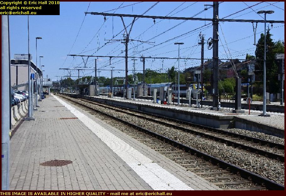
railway station welkenraedt belgium july juillet 2018And when you look at the station, it’s a big, modern station that has plenty of facilities and it is all out of proportion to the size of the town

A little bit of research back in those days soon cleared up the question.

Welkenraedt is the closest railway station to the border between Germany and Belgium – in Germany until 1919 and in Belgium afterwards.

And when the railways were electrified, the German voltage system was different from that in Belgium until comparatively modern times. And until the Schengen agreement, there was a frontier post at the station.

So while the passengers were having their passports controlled, the train would be changing engines and then going on to Aachen or Cologne or maybe further still.

Welkenraedt is officially a German-speaking town but when it was transferred to Belgium by the Treaty of Versailles, the SNCB, the Belgian railway company, opened a locomotive depot here and transferred in a large number of French-speaking railway workers.

They flooded the town to such an extent that you will struggle to find German spoken here today. We saw a couple of signs in German but that was about that.

We went off to find something to eat as Alison was hungry, and I forced down a helping of overcooked chips. I’m clearly feeling better after my crisis of Thursday and Friday.
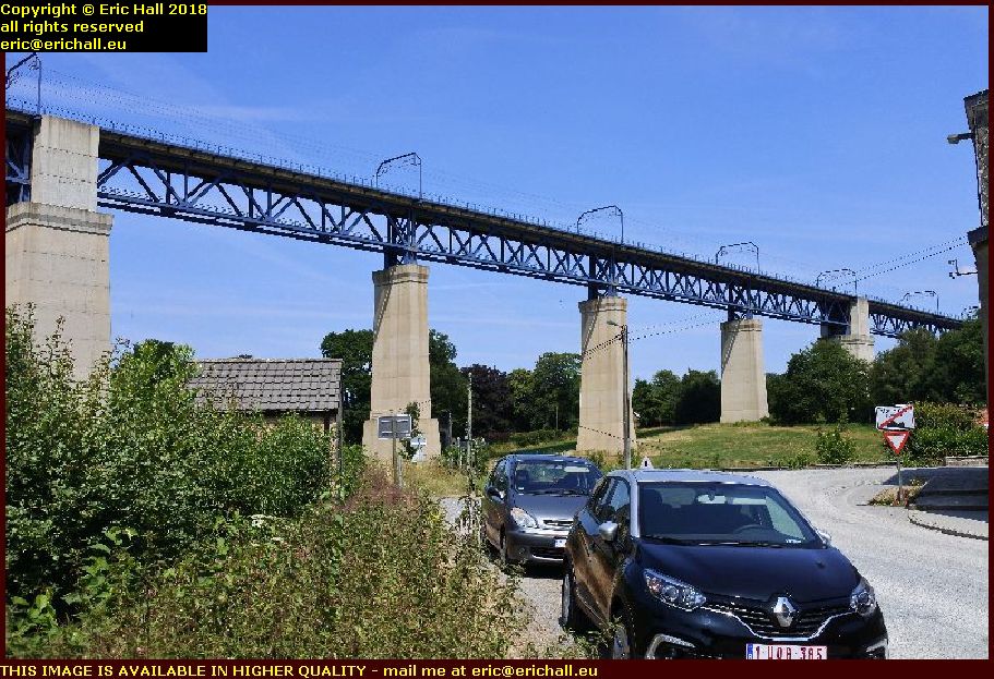
viaduc de moresnet july juillet 2018But you can’t cometo this region without going down the road to Moresnet.

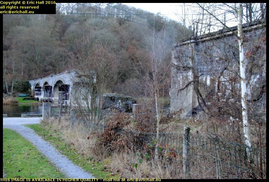
For several reasons really, not the first of which is this absolutely gorgeous railway viaduct.

It’s not quite on a par with the Tracel de Cap Rouge of course, that’s rather exceptional, but it’s by far the best that you are likely to find around this part of Europe.

viaduc de moresnet july juillet 2018According to the information that I have found, it was built during the period 1915-1916. The pillars are fine examples of reinforced concrete of that period.

It’s just over 1100 metres long and at its highest, it’s about 60 metres above the velley of the River Gueule

That tells us a couple of things

  1. There may well have been something here prior to that period that was demolished at the start of World War I
  2. It escaped demolition during the fighting of World War II


viaduc de moresnet july juillet 2018Knowing my usual luck, we would ordinarily have had to wait for about three weeks to see a train pass over the viaduct, and then we would have missed it because we had gone for a coffee.

But that’s not the case here. This is the main railway line that runs between Aachen and Antwerpen, one of Europe’s busiest ports.

We’d hardly pulled into the village before a freight train went rattling by just above our heads.
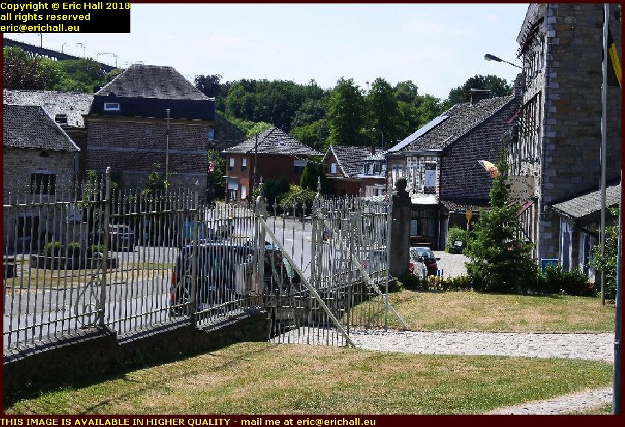
moresnet belgium july juillet 2018So while you admire the village of Moresnet and Alison and I have gone for a coffee with the friendly young girl who runs the village café, let me tell you a little story.

At the end of the Napoleonic Wars the Treaty of the Limits in 1816 redefined the border between the Low Countries (because Belgium didn’t exist at that time) and the Kingdom of Prussia.

For various reasons, they couldn’t agree with what to do with the commune of Moresnet and so they planned to divide it between them.

moresnet belgium july juillet 2018Unfortunately, any logical dividing line ran right through a very important and valuable quarry and they couldn’t agree where the line should go so that each country would have half the value.

Eventually, they agreed that the quarry and a surrounding piece of land would be a neutral zone administered jointly by one official from the Low Countries (Belgium after 1830) and the Kingdom of Prussia (the German Empire after 1871).

And so you had Moresnet, Neu-Moresenet (the German bit) and Moresnet Neutre.

In 1914 Germany took all of it, so at the Treaty of Versailles Belgium was awarded all of it, so in 1940 Germany took it all back and in 1945 Belgium regained all of it.

There has been quite a lot of excitement in such a sleepy little Belgian village

But our conversation with the serving wench was quite exciting. being practically right on one of Belgium’s linguistic borders, our conversation drifted between French and German with hardly a pause.

Belgium is a fascinating country.

And if that’s not enough to be going on with, just up the road some time round about 1750 a miracle involving Mary the Mother of Jesus is said to have taken place
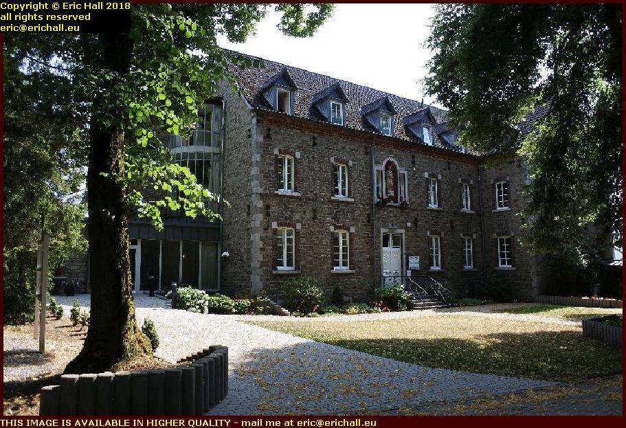
franciscan friars moresnet chapelle july juillet 2018Pilgrims came to visit the site so a small chapel was built, followed by all of the usual facilities for the visitors, and the village of Moresnet-Chapelle developed.

A group of Franciscan Friars (and seeing as this is Belgium, they were probably chip monks) were sent from Aachen in 1875 to provide spiritual comfort to the visitors.

As a result, some substantial development took place.
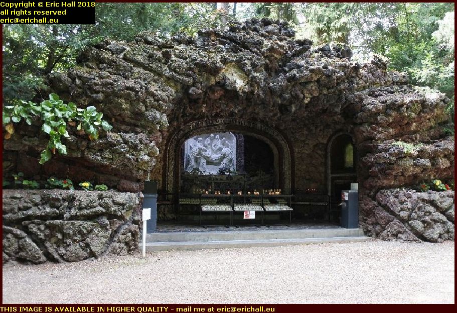
chemin de la croix moresnet chapelle belgium july juillet 2018Regular readers of this rubbish will recall that we’ve talked on several occasions about the Chemin de la Croix – 14 stages of Jesus on his way to his crucifixion, death and subsequent resurrection.

We’ve also been to see a a magnificent example of this at Cap de la Madeleine in Quebec.

In 1895 they decided that they would emulate it (the filthy beasts) right here.

chemin de la croix moresnet chapelle belgium july juillet 2018In 1895 German benefactor provided some cash to purchase the land around the chapel and they set to work.

The work was completed in 1904 and today there are 14 grottoes made of puzzolane, each featuring one of the stages of the Chemin de la Croix.

The aim is to visit each one, purchase a candle to light in each (which must bring in a fortune) and say a prayer at each one, in order to be absolved of your sins.

Of course, I don’t need to, for regular readers of this rubbish in one of its previous guises will recall that I was granted absolution by the Pope, having passed through all of the Holy Doors in Rome during the Period of Grace in 2000.

I choose my friends carefully as you know.
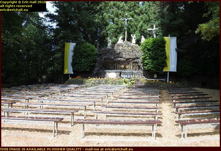
chemin de la croix moresnet chapelle belgium july juillet 2018The twelfth station, the Calvaire or Calvary, featuring the crucifiction, is always a good ‘un and there’s no exception here.

In fact, it was so popular at one time that they have installed benches here and occasionally hold open-air church services here.

But clearly not masses, because the place is pretty-much deserted today.

And I shan’t bore you all by repeating the story that a Frenchman delightfully told me, that they asked for a famous sculptor from each country to send in their impressions of how the Calvary should look, and the Belgian sculptor sent in a drawing of John Wayne on his horse.

Final stop (for now, anyway) on our day out was just a couple of miles up the road.
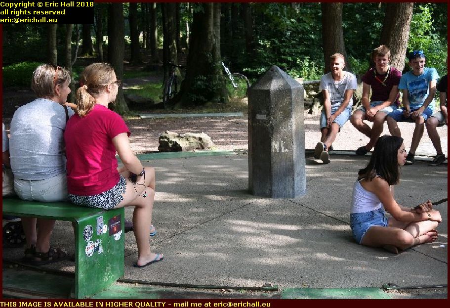
driehoek netherlands germany belgium july juillet 2018Here we have the Driehoek – or “Three Corners” – where the countries of the Netherlands, Belgium and Germany meet.

And when we had Moresnet-Neutre, it was a Vierhoek because that area had a bit of it too.

The girl in red is sitting half in the Netherlands and half in Germany, and the girl on the floor is half in the Netherlands and half in Belgium.
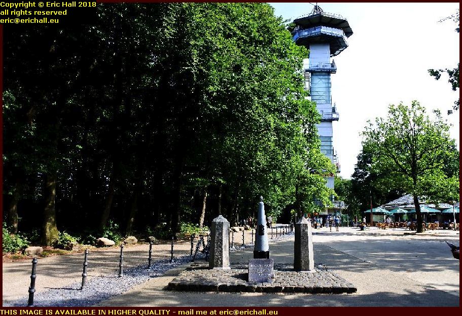
vaalserberg netherlands july juillet 2018Not only that, the highest point in the Netherlands – the Vaalserberg – is only 100 metres or so from the border and so we had to pay that a visit too.

It’s all of 322.4 metres above sea level, or 1,058 feet for those of you still dealing in real money.

And in the background you can see an observation platform. Apart from the fact that it cost real money to go up there to the top, the number of steps that I saw was enough to put me off the idea.

So having been driven up the Vaal(serberg) our next stop was across in our third country of the day – Germany. And those silly Brits who voted to leave the EU just don’t understand the advantages of having Breakfast in Brussels, Lunch in Luxembourg, Tea in Turin, Supper in Sampdoria and Bed in Bari.

Aachen in fact was where we went, where Alison wanted to take me to a café that she had found. And even though we arrived 12 minutes before the advertised closing time of 18:00, they refused to serve us.

Consequently we nipped to Mullers for some of my white coconut chocolate, and then to the cat café that we had visited a while ago.

The cooking smelt delicious so Alison had some thick soup and I had hummus with raw vegetables and bread.

It’s not far back to Liège from Aachen, even though you pass through three countries to get there. and I was in time to see Russia defeated by Croatia. And I could tell by the way that the first Russian limped up to take his penalty, head bowed to the ground, that he was going to miss it.

Tomorrow I am on the move, and so an early night – if my neighbours let me. They are being just a little rowdy, but then you can’t win a coconut every time, can you?

Saturday 14th April 2018 – I HAD A REALLY …

… nice day out today, and when I finish editing the photos (because there are more than just a few) I’ll be posting them up on here so that you can see what I mean.

We started off by having had a really good sleep for once, although there wasn’t that much of it with having not gone to bed until about 01:30. And that rather set the scene for the day, I’m afraid.

But I was still up early enough, had the usual morning ritual and followed all of that with a shower and a scrub of the undies. The heater in this room has a coat-hanger above it and so anything that I wash will dry in half a day and I need to take full advantage while I’m on the road.

There was plenty to do (like catch up with last night’s blog entry and go in search of some toilet paper) until Alison came on line and told me that she was leaving home, and at the appropriate moment I wandered down to the end of the street to meet her.

Just for a change it was the E40 that we fahrn’d fahrn’d farn’d down nd crossed into Germany there, leaving the autobahn at the next exit and heading, not north to Aachen, but southwards.

Despite having issues with the SatNav, that had different ideas that I had about where we needed to go, we eventually found our destination – Auf Aderich 33, 52156 Monschau. And hereby hangs a tail.

The Dukes of Brabant controlled several small German-speaking Provinces around Eupen and Malmédy which had been incorporated into the Austrian Netherlands. But after the territorial reorganisations following the Napoleonic Wars, their Germanic heritage meant that they were incorporated into the Kingdom of Prussia.

Following the end of World War I at the Treaty of Versailles these small territories were given to Belgium as part of the War reparations.

But there was a slight problem. Due to the mountainous relief of the country here, the only rail connection that these provinces had with the rest of Belgium was via Germany. And the solution was found – that the railway line itself, known as the Vennbahn – would be ceded to Belgium too.

This produced several anomalies, in that several parts of Germany were now isolated from Germany proper by the now-Belgian railway line and despite several subsequent territorial reorganisations, this left five “enclaves” (and, historically, one “counter-enclave”) still isolated from Germany and surrounded completely by Belgium.

The railway line is no longer in existence (it’s a cycle path) but the enclaves are. And these range from town-sized enclaves down in size to just one house and garden. And here we are at the smallest enclave of them all – Auf Aderich.

And this is what we came to see – the smallest of the German enclaves into Belgian territory.

From here we headed on down the hill into Monschau.

This is a very pretty old town situated along the banks of the River Rur as it flows through a cleft in the rocks. Being situated on a fast-flowing river near to a plateau noted for its sheep, the town was famous for its many mills and cloth-weaving.

Not unnaturally, it became quite a rich town and there are dozens, if not hundreds of magnificent buildings here, built of local stone or wattle-and-daub that leave no(one in any doubt about how rich the town was in those days.

In fact, it was so rich that it was regularly looted and pillaged by all kinds of different invading armies during the turbulent years of the second millennium.

We had a coffee and went for a good wander around. Alison, who had been here on many occasions, showed me the sights.

But none of these sights was as exciting as the second-hand shop in the town that had a “dobro” guitar – the acoustic guitar with a built-in resonance speaker that was very popular with blues musicians in the 1920s and still makes an appearance today (we’ve seen many at the Harvest Jazz and Blues Festival).

I would have bought it at a heartbeat, until I noticed “made in China” stamped on the neck. So it’s not an original 1920s guitar at all but a cheap Chinese import, of no interest really to me.

We ended up back in Aachen and our favourite restaurant for a meal and a wander around – not to mention a visit to the Muller supermarket where they sell that beautiful white vegan chocolate with coconut flakes.

By the time we returned home it was too late to go to the football, which was probably just as well because I was exhausted. I sat here and vegetated for a while and then went for a walk around the block.

And then, an early night. A good sleep will do me good as I’m moving on tomorrow. Man In A Suitcase is hitting the road.

Monday 28th November 2016 – I WAS RIGHT …

delhaize closed monday bohan belgium october octobre 2016… when I said the other day that I would probably find the Delhaize at Bohan closed if I were to come here today.

Well – I was half-right anyway. Had I come here this morning I would have found it open. But I didn’t – I didn’t arrive here until this afternoon and by then the supermarket here was well-closed.

It wasn’t much of a guess though really, was it? Knowing how things pan out when I’m involved, you should have had the mortgage on it.

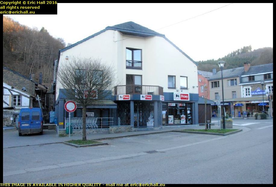
delhaize bohan belgium october octobre 2016It wouldn’t be so bad if it were an out-of-town retail outlet but here it is, in pride of place right in the town centre, on a site that’s been used for retail purposes for maybe at least 90 years if an old postcard that I saw had anything to do with it.

But as luck would have it, and quite surprisingly if you are a regular reader of this rubbish, there was a boulangerie open up the side street to the right,and I was able to grab a loaf of bread.

I’d had yet another bad night – this one probably the worst that I’d had so far. and I was awake long before the alarm went off. I’d been travelling too – round Labrador as it happens and I’d been promoting some complicated and difficult projects that I found very hard to explain.

First down for breakfast, even before the staff yet again, and then back to my room and carrying on with my work on Labrador and the Happy Valley-Goose Bay web pages that I’m writing. And I’m stuck. I’ve forgotten the name of a ship that I saw in the harbour and I can’t identify it from the photo. All I know is that it’s the Woodwards oil tanker that takes the fuel out to the outports and isolated islands in the Labrador Sea.

After my butties I set off to Bohan. And it was cold too – the ice warning was going off which was no surprise as the temperature had dropped well below zero during the night and there had been frost everywhere this morning. I sorted out the woolly hat to go on my woolly head.

riviere semois pont cassé bohan belgium october octobre 2016There was a really good reason for wanting to go to Bohan, because it’s another place that has a lot that I would find interesting.

Amongst them is what is called the Pont Cassé – the broken bridge. And if you really need to know who it was who broke it, the answer was that it was the French Army. They blew it up on 11th May 1940 in order to prevent the German Army and its tanks from using it to cross over the river

riviere semois pont cassé bohan belgium october octobre 2016And when they blew it up, they did a really good job of it too.

It was “repaired”, if that’s the right word, with a temporary wooden structure but during the German retreat they set it alight on 6th September 1944 and it burnt down.

And after the war, the decision was made in 1947 not to replace it.

rivere semois pont cassé bohan belgium october octobre 2016It’s possible to walk onto the bridge these days – it’s not fenced off – and so I did.

And you can tell from this photograph exactly what kind of bridge it is can’t you? It’s a railway bridge of course if you need to be told, and more than that, it’s another tacot or “rattletrap” – one of the
chemins de fer vicinaux or local tramway-type railways that littered Belgium just as well as they littered France and which we had near us in Marcillat en Combraille.

riviere semois pont cassé bohan belgium october octobre 2016And talking of my home area in the Combrailles, if you think that the railway line from Pionsat to Gouttieres with its 9 years of existence was quite ephemeral, you haven’t seen anything yet.

This railway line had a lifespan of just about 5 years. It was opened on 5th May 1935 and came to a rather sudden end on 11th May 1940 as I mentioned just now when the French army blew up the bridge.

chemin de fer vicinal bohan belgium october octobre 2016But even that pales into insignificance when we talk about the extension of the line.

Just over there is the railway station. The line came to a full stop over there in 1935 but the decision had been taken to extend the line into France. Just down beyond the railway station is the French border and beyond there is the town of Sorendal.

This was the terminus of the Ardennes tacot – the metre-gauge rural railway network of the French, and on 17th October 1938 an extension was built to join them together.

chemin de fer vicinal gare bohan belgium october octobre 2016While we admire the back of the railway station and what might be a signal cabin to control a set of points that might have worked a siding that looks as if it might have gone to the left just there, I’ll tell you an even more tragic story about the line.

And that is that despite only being opened in October 1938, the French closed the border at the outbreak of war and this part of the line didn’t even manage a whole year of working.


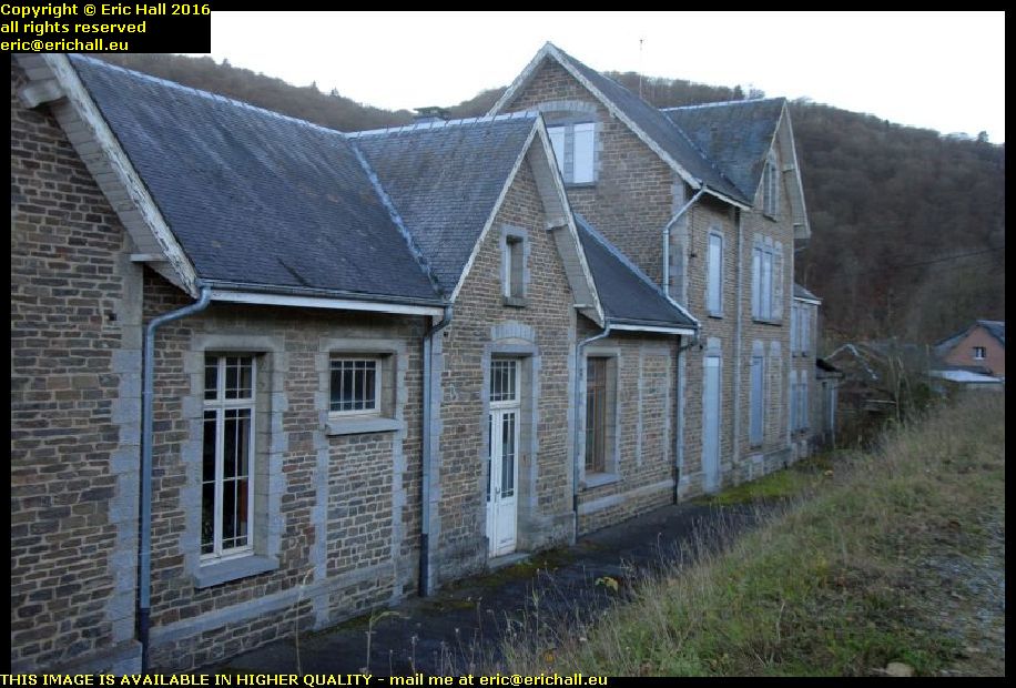
chemin de fer vicinal gare bohan belgium october octobre 2016There wasn’t any doubt in my mind that this was the old railway station. There wasn’t anything carved on the stone or any old sign that might have given me a clue – it just looks exactly as anyone might expect.

Thoroughly magnificent and thoroughly over-the-top, which was a feature of these rural railway stations. No wonder that the lines didn’t last all that long with this kind of expense.

chemin de fer vicinal gare bohan belgium october octobre 2016This is the line-side of the station – the roadway today is the track-bed and there is a pile of waste-land in front of the building that might easily have been the platform.

It looks as if it’s derelict now – all closed down and with damp rising up the stone walls. But it was at one time a garage and then later became a dwelling-house. But there’s no land with it unfortunately, and it’s far too big for me, as well as needing far too much work.

pont cassé chemin defervicinal bohan belgium october octobre 2016But before we leave the Pont Cassé, all 90 metres of it, let me just explain to you why it took until 1935 for the railway line to reach here.

It actually reached Membre in 1913, construction from Gedinne having begun in 1909. But then we had the war of course and afterwards, we had to wait for the Belgian economy to restart. And then we had the decision as to how actually to reach here because it’s a horrendous civil engineering problem.

In the end, they dug a tunnel through the rock, a tunnel of 22O metres in length and which was one of the marvels of Belgian engineering. Unfortunately, the portal at this end is on private property and overgrown so it’s not accessible.

road bridge bohan belgium october octobre 2016While we are on the subject of bridges, this is the road bridge over the Semois.

Of course, it’s not the original. There’s no need for me to tell you what happened to that – and on the same day that the Pont Cassé went up too. They didn’t do things by halves.

We had another temporary type of bridge subsequently, so I was told, but this one here is built of concrete and dates from 1957

maison de marichau bohan belgium october octobre 2016So back in the town again, I went to have a look at one of the oldest houses in the town.

It’s called the Maison de Marichau and it’s said to be one of the very few remaining examples of traditional Ardennais architecture that’s remaining.

Although in dreadful condition, it was classed as an ancient monument in May 1973 and is currently undergoing renovation – and not before time either if you ask me.

bohan belgium october octobre 2016Not a lot seems to be known about the history of Bohan.

It first seems to be mentioned as a fief of Orchimont, where we were the other afternoon, in 1205 when the Lord Of Orchimont, Badouin passed it over to his younger brother Rigaud.

However, you only have to examine its situation here on an easy crossing of the Semois with several valleys feeding in from all points of the compass to consider that it must have been quite an important ford here, and subsequently a settlement, for hundreds of years prior to that.

river semois bohan belgium october octobre 2016
The river here by the way looks as if it has all the air of a natural border or frontier, and that was indeed the case in the early Middle Ages.

Long before the emergence of national states here in north-western Europe, it was the church, with its various bishoprics, that divided up the country amongst themselves, and when we were in Bouillon the other day we noted that the Bishops of Liège managed to hang on to their independent provinces until as late as 1795.

river semois bohan belgium october octobre 2016
But the River Semois was the frontier between the Bishops of Liege and the Bishop of Reims. The southern side of the river was part of the Bishopric of Reims and in 1190 came under the control of the Abbey Church of Mézières, where it surprisingly stayed until 1802 when it passed into the hands of the Bishops of Namur.

All of this makes me so surprised to have seen nothing mentioned whatever about a fortress. Obviously the Lord of the Manor would have to live somewhere impressive and in view of the town’s strategic importance right on some kind of border I would have expected the town to have been fortified and some kind of fortress built.

river semois bohan belgium october octobre 2016
In fact we are told that by 1287 it had become the seat of a feudal nobility and villages on both sides of the river depended upon it. But if there had been fortifications and a fortress here, mention of them has escaped me.

Bohan is next in the news in 1559 when the territory is willed to the two daughters of Gerlache de Bohan. And in 1605 it passes into the hands of one Jan Baptiste van den Bosch. He’s of the family “du Bois de Fiennes” and Lord of Drogenbos in the Province of Brabant, and it stays more-or-less in the hands of his family until maybe 200 or so years ago.

river semois bohan belgium october octobre 2016
And this is probably the reason why it’s part of Belgium and not, as you might expect, part of France, even though the Semois would make a wonderful natural boundary.

I said “more-or-less” just now because we all know that this area is the “cockpit of Europe”, with marauding armies passing back and forth through here continually even as late as 1944.

We’ve seen how the French went on the rampage all around here in 1635, recaptured by the Spanish in 1652, the French again in 1657 and finally back to the Spanish by the Treaty of Rijswijk in 1697. And then we had the Wars of the Spanish Succession, the Wars of the Austrian Succession, the Napoleonic Wars and so on.

river semois bohan belgium october octobre 2016
But by 1830 and Belgian independence, things had settled down and there were 130 houses counted here. Forestry products were important, as was agriculture, especially as the area seems to have a microclimate that makes it a couple of degrees warmer than one would expect here. There are excellent alluvial soils due to regular periodic flooding of the river and it’s sheltered from the winds.

There was also quite a substantial cottage industry here, making nails.

tobacco drying shed river semois bohan belgium october octobre 2016But surprisingly, 100 or so years ago, this area was quite famous for tobacco growing and all around us are open barn-like buildings that were actually the drying sheds for the leaves.

It seems that in 1876 someone brought some tobacco plants back from Kentucky and to everyone’s surprise, they flourished here and grew like wildfire. But all of that has been abandoned now – not that I would know a tobacco plant if I were to see one.

eglise st leger church bohan belgium october octobre 2016As for the church, this was built in 1760 and seems to be dedicated to St Leger. Its construction was financed one-third by the commune, one-third by the Lord of the Manor and one-third by the Monks of the Abbey of Laval Dieu in Monthermé.

It’s certainly not the first church on this site. There’s a reference in a will of 1235 in which a “Clarisse de Gedinne” leaves a sum of money for the “repair” of the church at Bohan, and a ducument of 1190 seems to imply a church here too. We don’t know what that one looks like, or why it was replaced.

This church is built of stone brought from a quarry at Don-le-Mesnil, near Charleville-Mézières.

Its tower is 30 metres high and formerly contained two bells. The larger one, cast in 1860, was taken away by the Germans in 1943 to be melted down. It was replaced in 1949 and a third bell was added in that year too. The second bell is apparently called Marie and was cast in 1839 and repaired in 1909.

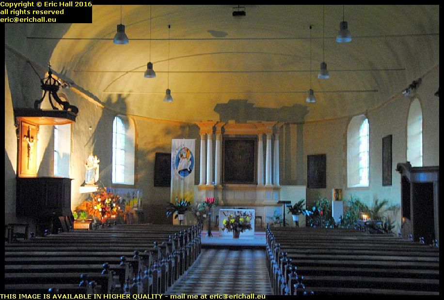
eglise st leger church bohan belgium october octobre 2016The interior is quite basic. We have the typical paintings of the “Chemin de la Croix” which date apparently from the very early 20th Century and the painter is unkown. There’s the principal altars and two side altars are also present, one dedicated to Mary and the other to Joseph.

There are several statues too, including ones of St Antony of Padua, St. Theresa and St Hubert, and several paintings that are signed “Renon Letellier de Charleville, 1827”, as well as a painting of Mary that seems to be older than that.

calvaire bohan belgium october octobre 2016As well as the church, there are a couple of other places of religious significance in the town.

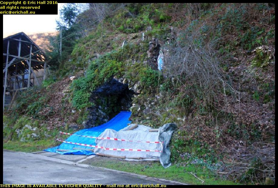
This is a calvaire, a calvary, and seems to be dedicated to Mary as far as I can tell. I think that that’s a statue of her over there in her grotto. It must be some kind of spring too because I could see water cascading out under the road opposite this spot and discharging into the river.

I wonder if that is what is covered up by the tarpaulin.

And this does remind me of the story that I heard about the Quebecois painter who was asked to paint a picture of the Calvary. He came back with a drawing of John Wayne and several United States troopers on their horses.

As for the wooden construction on the left of the photo, I wonder if that’s an old tobacco-drying shed.

marriage stone bohan belgium october octobre 2016Here by the side of the river we have a very peculiar couple of stones. They are called the “Marriage Stones” because some kind of weird ritual is performed here by newly-weds after the church service.

The purpose of this ritual is apparently to symbolise the difficulties that married couples face during their life together. And I suppose that seeing as this is Belgium, the greatest difficulty that they might encounter is to deal with this ritual in the pouring rain.

hotel bohan belgium october octobre 2016There’s a hotel over there, the white building down at the end of the road. And I missed out on an opportunity there because it advertises long stays with breakfast for just €30:00 per night, which would have done me just fine.

I decided to make a note of that for future reference, which I duly did. But would you believe that Brain of Britain forgot to make a note of the name of the place.

Ahh well! I suppose that I shall have to carry out some further research.

And now I’m done. I had a coffee and went off home for my butty and another early night.

After all, I’m off in the morning.

You can stay here and read all of this – all … errr … 2554 words of it.

Tuesday 1st July 2014 – THERE’S ONE THING ABOUT MOUNTAIN AIR …

… and that I was out like a light at 22:00. Didn’t feel a thing at all. And I slept until about 06:30. And I was busy too during the night. I can’t remember where I was (it might have been Electricity Street in Crewe) but I was working for some organisation that was doing something with the public and while our office still stayed in the same place, our job of interacting with the public meant that we had to go to the local shopping precinct that was 25 minutes away on a tram.

We needed a girl to come with us and we asked one of them but she was proving to be difficult. She said that she couldn’t possibly be ready for a 09:00 start as she didn’t arrive at the office until 08:30. I explained about the 25 minute tram ride and how not only were your travelling expenses reimbursed but so was your travelling time, but she was still being difficult about it.

hotel post trafoi alto adige south tyrol ItalySo wide awake, bright-eyed and bushy-tailed I went down to breakfast. And on leaving I was presented with the bill for my evening meal, room and breakfast.

For my three-star hotel etc, it came to a total of €60 and so I’ll be stopping here again, that’s for sure. I don’t think that I’ve ever before slept in such comfort at such a price, and made so welcome too.

stelvio pass alto adige south tyrol italyLeaving the hotel, I set out to assail the Stelvio Pass, all 2700-odd metres of it. I’ve never been up it before and so I didn’t know what to expect, and I wasn’t disappointed.

From Trafoi the road zig-zagged up to the summit via a series of hairpin bends. I don’t know how many there were, but I lost count at about 47 and there were still plenty to go.

stelvio pass alto adige south tyrol italyThe road itself dates from just after the Napoleonic War when Austria had possession of some territory south of the Pass and needed a road to connect with it. Although there have been many improvements to the road since those days, the actual trace of the road is still the same and that’s something that is quite astonishing.

Mind you, it’s not easy to see how else they could do it.

bus stelvio pass alto adige south tyrol italyNo vehicle longer than 10 metres is permitted on the road and I can’t say that I’m surprised.

This bus here was having quite a struggle upthe hill, not just against the hairpin bends but also against the traffic coming down the hill that, for the most part, refused to give the driver the room to manoeuvre.

caliburn snow 1st july stelvio pass alto adige south tyrol italyThere was plenty of snow at the top of the pass and again, I’m not surprised by that either. We’re at 2700-odd metres of altitude here as I said before, and you may remember that it was snowing in the Tyrol the day before yesterday at half of this altitude.

As an aside, this was once the border between Italy and the Austrian Empire after the reunification of Italy in the 1860s and in World War I there was actually fighting up here at the pass.

Still, Caliburn enjoyed a good wander around in the snow.It’s been a good few weeks since he’s been in it. But who would have expected to have seen him up to his axles in snow on the 1st of July?

Down the hill from the Stelvio Pass there’s a fork in the road and turning right, I’m in Switzerland. Much to my surprise, there’s no border controls here (Switzerland isn’t, of course, in the EU). I suppose they think that if you’ve made the climb all the way up the Stelvio then you deserve the right of entry.

caliburn train under the mountains fluela pass switzerlandIt’s all downhill from here until you need to climb up and over the Fluela Pass to Davos and Klosters. And so what am I doing in a train then? It looks like the Channel Tunnel train but I’m a long way from there.

The simple answer to this is that the Fluela is a pretty desperate road. It takes about 60 or so kilometres and no end of climbing and descending through a series of hairpin bends. However, there’s a 19-kilometre rail tunnel where, for a not-insignificant price, you can make the journey for about a tenth of the time.

It’s a straight road from there to Liechstenstein and the drive there was much easier than finding a hotel. The first hotel that I tried wanted CHF199 for a night and they can forget that. Then there was a whole series of hotels that were closed. Then we had one that was full (no surprise, that) and he referred me to another two – both of which were closed.

gasthof zum deutsches rhein bendern liechtensteinI gave up on the idea of staying for a night in Leichtenstein and headed for the Swiss border. And there, just on the Liechtenstein side of the border I found a hotel. Quite basic but B&B is only CHF70 per night.

And so I’m staying here maybe two nights and tomorrow I’ll go for a bus ride into Vaduz. There’s a bus depot right across the road from here.