I was wide awake at about 06:30 this morning, having had another one of the best night’s sleeps that I’ve had for a while. However, leaving my stinking pit was quite another story and it was probably a good hour or so later that I heaved myself out, to make myself a coffee and to finish off the notes from yesterday.
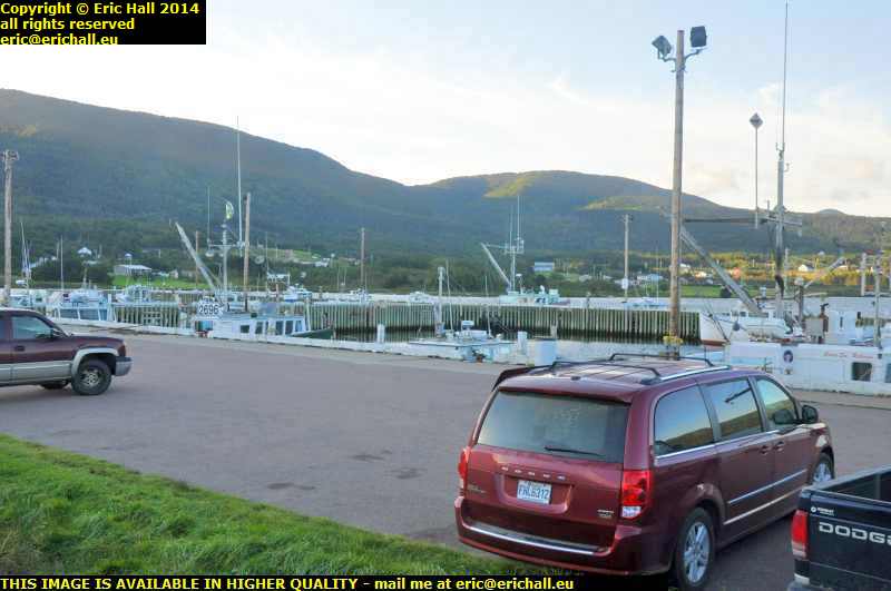
Now that my notes are up-to-date and having taken a couple of photos of my overnight spec, the harbour at St Lawrence and this is another good find with which I am very impressed, I can head for the hills. Or rather, the coast, for my days in the mountains are over for the moment.
 Further down ther road there’s a sign here for Dingwall, so Strawberry Moose and Yours Truly decide to go down there to see if Ross County is playing.
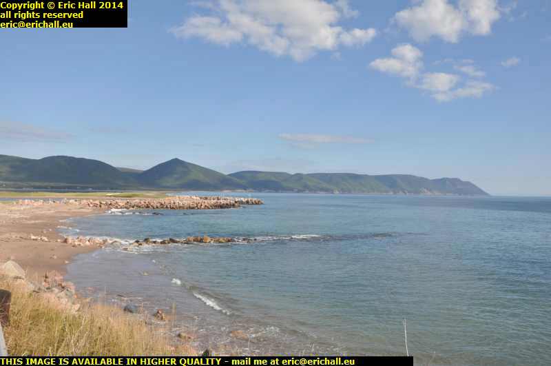
In fact the team doesn’t seem to be at home but here’s the view from the end of the road and it’s magnificent as usual. Just like most places along the coast here at the nothern end of Cape Breton Island.
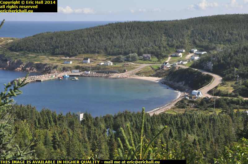 I find the Coastal Loop a little later, and this takes me to White Point.
There’s a camper just gone past me down there that’s from the same company as the one with which I was playing leap-frog along the Trans Canada Highway on Monday. It isn’t the same one though, because when I arrived at the bottom of the hill I had quite a lengthy chat with the couple. They were from the UK and they’ve been on a long exploratory voyage on trains planes and campers all over Canada and were on their way back from Newfoundland.
And the weather, out of the wind, is absolutely gorgeous. The sun is beating down and there’s a perfect blue sky. What more could any man desire? Apart from Jenny Agutter and Kate Bush of course, to sooth my fevered brow.
 That’s the view from Lakies Head whoever Lakie was when he was at home, if he ever was. And at this scenic turn-off (why don’t they ever have scenic turn-ons? It’s much more appropriate) there was a Park Ranger standing behind a sign saying “chat to me”. And so I did. As if I ever need any invitation …
And just a few hundred yards further on from here I was overwhelmed by the smell of damp seaweed. I haven’t smelt it quite as strong as I have just here so I don’t know what’s going on about that.
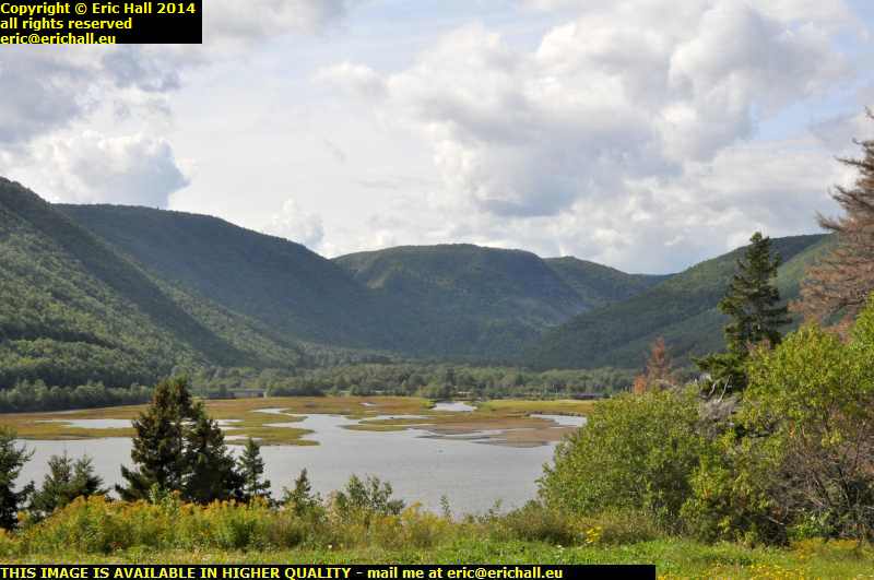 At Ingonish Harbour, not the harbour at Ingonish, that’s somewhere completely different, we’re back at the mouth of the Aspy Fault, the faultline that links up with the Great Glen in Scotland.
Here’s probably the best view of the fault line, the cleft between the mountains that stretches right into the interior of Cape Breton Island and maybe even far beyond. It’s quite astonishing that this fault line stretches all the way to Scotland and that these two land masses might even have been connected in the dawn of time.
Many years ago I read an ancient travel book which described inter alia someone’s nightmare drive over the desperate road over Cape Smoky. While it’s certainly exciting, I wouldn’t say that it was terrifying, but these days, the road around the Cape is hacked out of the cliff face.
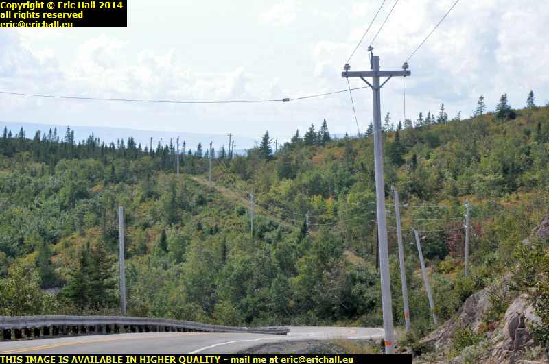 Here, where the modern road is about to swing round to the left to descend one of the steepest parts of the trail, a section that has been hacked out of the cliff, we can see what may well have been the old road straight ahead continuing to climb into the mountains.
The descent on the new road is stiff, as I said, and if this is climbing away from here, then the descent on the other side must have been phenomenal, at least twice as steep as the modern road. It’s hardly surprising therefore that people became so worked up whenever the road over Cape Smoky was mentioned
 If you want to see what the modern descent is like, we can travel maybe half a mile to a pull-in and if we peer through the haze that’s rolling in off the sea, you might be able to see it.
It just goes down and down and down and down and down and down and down and down, all the way to sea level right down there.
From the bottom of the hill I’m caught in a whole series of road works all the way to Sydney. One after the other and it takes hours to arrive in the town. At the shipping company offices I do the necessary and then go for a wander around to stock up with supplies.
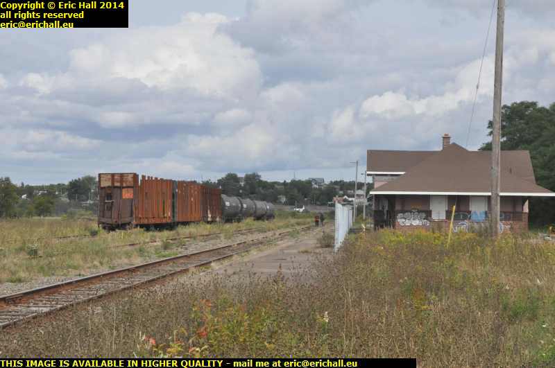 But here’s a sad legacy of the railway here at the port. Many years ago there was a rail ferry over to Newfoundland from here but the entire railway system in Newfoundland was demolished in this ruthless Canadian Government anti-rail programme – there’s not an inch of Government track left in the province – and the rilway network here is abandoned too.
Here’s a very sad-looking former railway station at North Sydney and the rails from beyond here down to the port have been lifted.
So now I’ve had a leisurely evening and I’m taking my place in the queue at the port for the next stage of my journey.